|
|
|
|


This page is sponsored by the East Texas Genealogical Society
|
|
|
|
This page is sponsored by the East Texas Genealogical Society
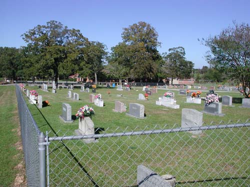
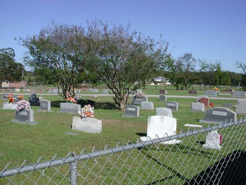
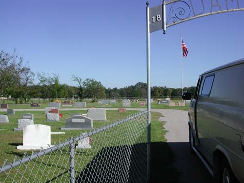
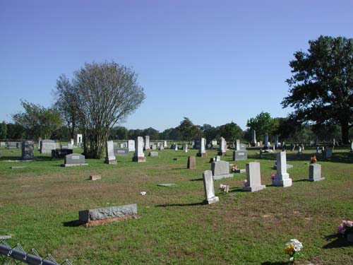
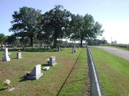
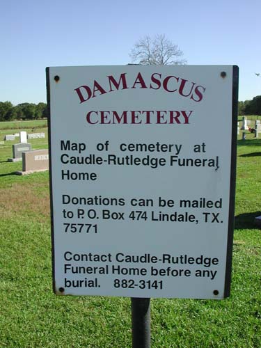
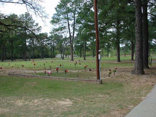
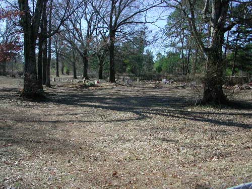
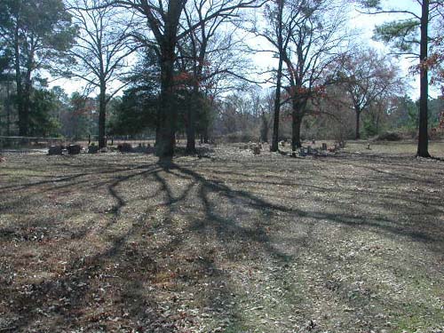
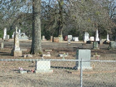
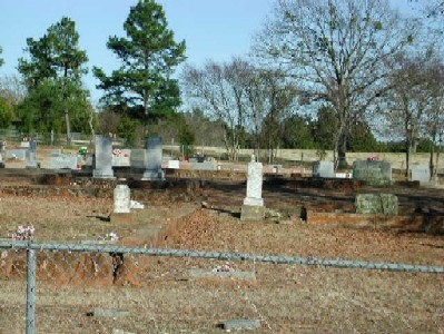
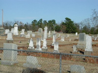
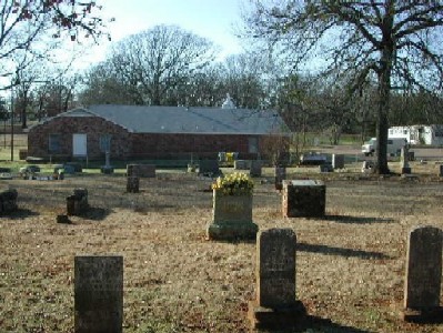
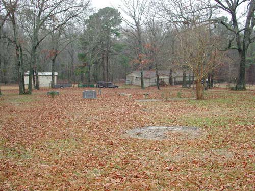
Damascus Cemetery
NW-02
Latitude: N 32:30:47.5
Longitude: W 095:21:24.8
From Lindale, go east on East Hubbard Street (FM16) for 2.6 miles to the
intersection with CR4104. Bear right on CR4104 and continue for 0.4 miles to the
intersection with CR4105. Turn right (south) onto CR4105. Proceed 0.3 miles to
the cemetery which is on the left (east) side of the road. The address of the
cemetery is 17052 CR4105, Lindale, Texas.
Located on land deeded to Damascus Baptist Church by Amy Wells in ______. This
cemetery was established in 1882.
by
Lawrence E. Oliver
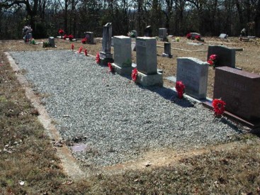
| Cemetery Gate |
Cemetery extreme left view |
Cemetery left view |
|
Cemetery left center view |
Cemetery right center view |
Cemetery right view |
|
Cemetery extreme right view |
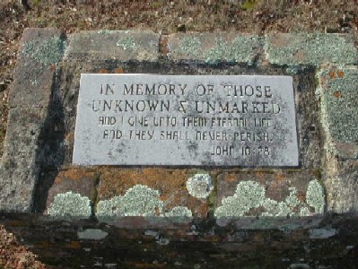
Info sign 1 | Info sign 2 |
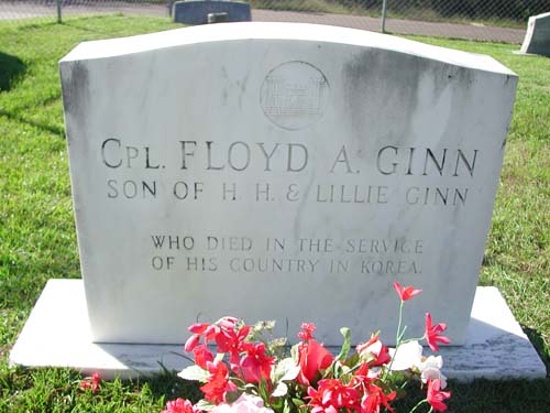
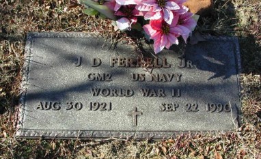
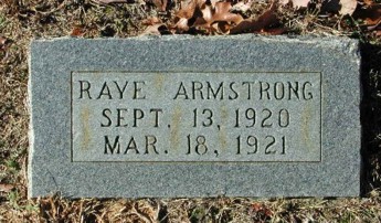
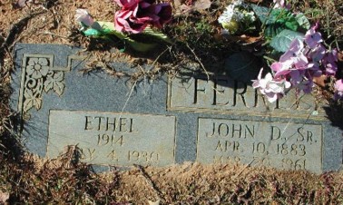
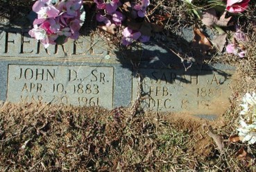
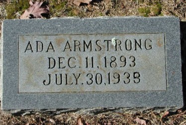
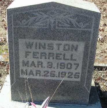
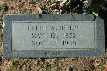
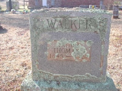
| Headstone Cpl Floyd A Ginn Son of H. H. & Lillie Ginn Who died in the service of his country in Korea |
Footstone Floyd Arthur Ginn Texas Cpl 65 Engr C Bn 25 Inf Div World War II Korea Oct 21 1925-Sept 14 1950 |
Dean
Baptist Cemetery
Dean Community, TX
SW-08
Latitude: N 32:18:53.3
Longitude: W 095:24:28.8
From Tyler, take SSW Loop323 to the intersection of Hwy364-SPUR. Travel west,
then northwest, on Hwy 364-SPUR to the intersection of Hwy206 and turn left
(southwest), follow to Dean road and turn left (southeast). This cemetery is on
the left side (east side) of the road behind and directly north of the Dean
Baptist Church.
Located on land bought by Major John Dean in 1863. He sold one acre
for a graveyard to the trustees of Dean Baptist Church in 1894.
| No pictures are available yet. |
Dover
Cemetery
NW-19
Latitude: N 32:29:11.9
Longitude: W 095:31:27.3
Take State Hwy 110 north from Tyler, Texas, until you come to US Hwy 20. This
cemetery is located 100 yards north of intersection of US20 and Hwy110 and is on
the west side of the road.
W. P. Allen deeded four acres to Dover Baptist Church in 1866.
by
Lawrence E. Oliver
| No pictures are available yet. |
East
Texas Chest Hospital Cemetery
NE-30
by
.
| No pictures are available yet. |
Ebenezer
Cemetery
Arp, TX
SE-31
Latitude: N 32:12:30.1
Longitude: W 095:04:12.1
This cemetery is located south of Arp city limits off Hwy 135. Turn east on
CR2110 and proceed about 1 mile. The cemetery is on the north side of road.
There is a African-American section of this cemetery located to the east side of
the main Ebenezer Cemetery - shares a common fence between.
The oldest burial found is, Nancy Arnold Tombstone reads (Nancy mother of G. M. Arnold b. 4-1776 - d. 4-30-1856)
Marker on rear gate indicates that Ebenezer Cemetery was dedicated to Solomon
Lanham who deeded the land in 1852.
Edwards/Emmanuel Cemetery
NE-38
by
.
| No pictures are available yet. |
Elkins
Cemetery
SE-22
Latitude: N 32:13:08.3
Longitude: W 095:05:46.5
This cemetery is located southwest of Arp, Texas. Take FM135 southwest from
Arp to the intersection with FM345. Take FM345 west about two miles. The
cemetery is on a dirt road in a pasture, about one-quarter mile north of FM345.
It is enclosed within a chainlink fence.
Bronze plate on gate: "This fence donated by Mrs. Bonnie Wilson
Runnion in memory of her parents Mamie and Jasper Wilson."
| Click to Enter Cemetery |
Erwin Cemetery
(African-American)
NW-37
by
.
| No pictures are available yet. |
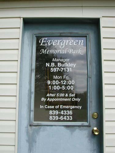
Evergreen
Memorial Park Cemetery
(African American)
Tyler, TX
NW-38
Latitude: N 32:23:25.0
Longitude: W 095:18:51.2
This cemetery is within the city limits of Tyler, Texas. It is on
West-NorthWest Loop 323. It is about 2 miles east of the intersection of Loop
323 and US Hwy 69, on the north side of the road.
by
Lawrence E. Oliver
Fairview Cemetery
(African-American)
AKA "Nebo Cemetery (A.A.)"
NW-46
by
.
| No pictures are available yet. |
Faith Mission Memorial
Park Cemetery
(African-American)
SE-65
by
.
| No pictures are available yet. |
Fitzgerald Cemetery
SW-05
by
.
| No pictures are available yet. |
Flewellen Cemetery
(African-American)
NW-23
by
.
| No pictures are available yet. |
Flewellen-Tweatt Cemetery
NW-05
by
.
| No pictures are available yet. |
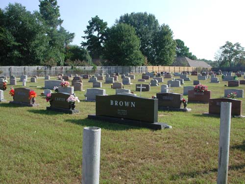
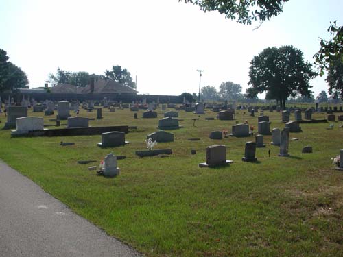
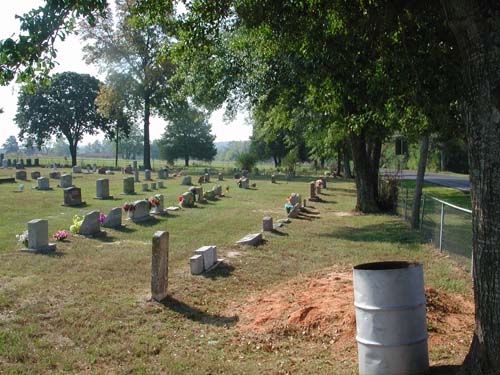
Flint Cemetery
SW-24
Latitude: N 32:11:58.1
Longitude: W 095:20:52.3
USGS GNIS Coordinates: Latitude: 321157N Longitude: 0952048W
This cemetery is located approximately 2/10 of a mile South of the 4-way stop in
Flint Community on FM2493 South of Loop323 in Tyler, Texas. It is on the east
side of the road.
S. E. and Mollie L. Oglesby sold one acre to W. C.
Henderson, E. Campbell, and P. A. Pagett, as trustees for a cemetery in 1900.
by
Lawrence E. Oliver
| Main cemetery entrance | View left | View center left |
| View center | View center right | View right |
|
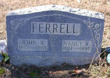
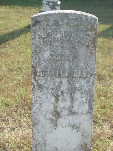
A.M. McFarland Co. I, 10th Ind. Cav., USA |
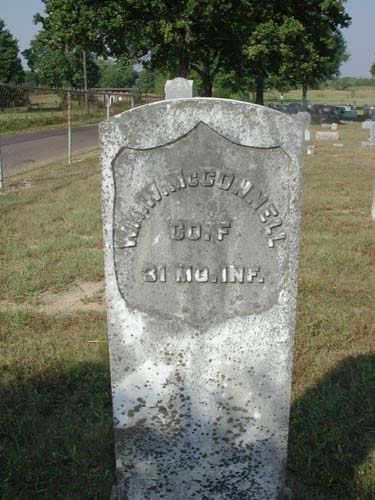
Wm. W. McConnell Co. F, 31 Mo. Inf., USA |
Friendship Cemetery
NE-25
by
.
| No pictures are available yet. |
Gabriel Cemetery
(African-American)
AKA "Warren Chapel Cemetery"
USGS GNIS Coordinates: Latitude: 322308N Longitude: 0950332W
NE-47
by
.
| No pictures are available yet. |
Galena Cemetery
NW-39
USGS GNIS Coordinates: Latitude: 322932N Longitude: 0953459W
by
.
| No pictures are available yet. |
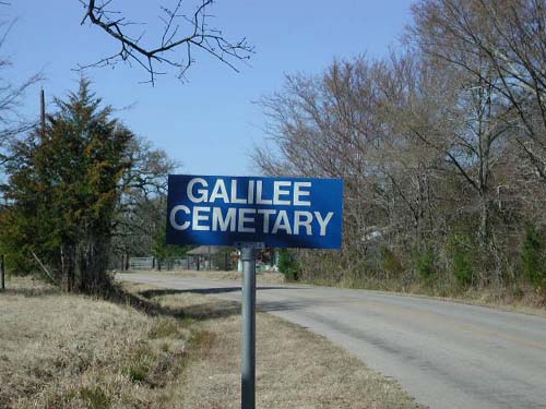
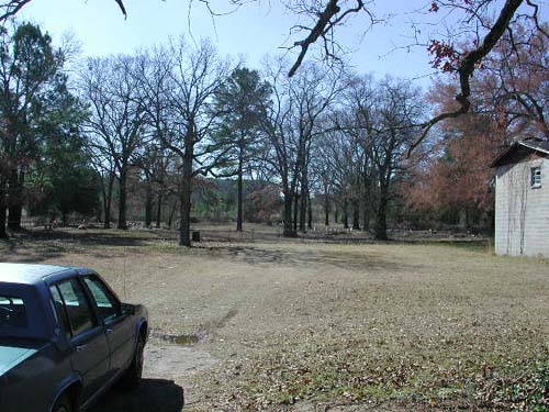
Galilee
Cemetery
(African-American)
Galilee Community, TX
SW-06
Latitude: N 32:15:55.5
Longitude: W 095:26:01.9
This cemetery is southwest of Tyler, Texas. Take Hwy155 southwest from Tyler
to the intersection with CR1113 (located approximately at the city limits). Take
CR1113 southwest until it intersects with CR1131. On the southwest corner of
this intersection is the cemetery. This cemetery is located directly across road
from Galilee Baptist Church.
by
Lawrence E. Oliver
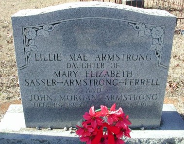
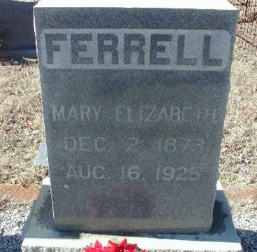
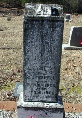
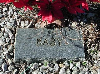
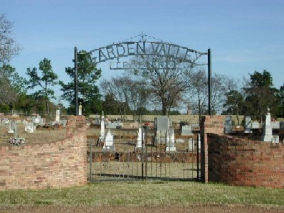
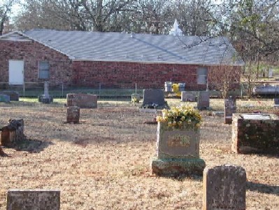
Garden
Valley Cemetery
Garden Valley Community, TX
NW-14
Latitude: N 32:15:55.5
Longitude: W 095:32:19.9
From Tyler, Texas, take State Hwy110 northwest until you pass over US Hwy20.
Continue on Hwy110 until you come to FM1253 and turn right. Continue to
intersection with FM16 and turn right. You are in the Garden Valley Community.
Within half of a mile, on the left is CR442. At that intersection is the Garden
Valley Baptist Church - the cemetery is behind the church.
Located on land bought by James L. Davidson in 1851.
by
Lawrence E. Oliver
|
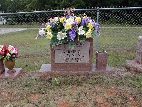
Narnie Florence Gabriel Downing June 21, 1915-Jan 22, 2002 "Forever With The Lord" |
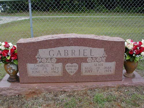
Charles Wade & Alma Jane Reeves Gabriel Nov 29, 1877-June 15, 1962 & Aug 19, 1888-July 7, 1973 |
William (Joe) & Dorothy F. Gabriel May 14, 1917-June 10, 1990 & Dec 5, 1920- |
|
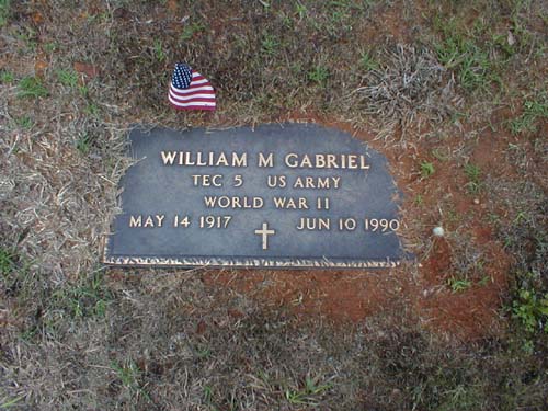
William (Joe) Gabriel Military Marker World War II May 14 1917-Jun 10 1990 |
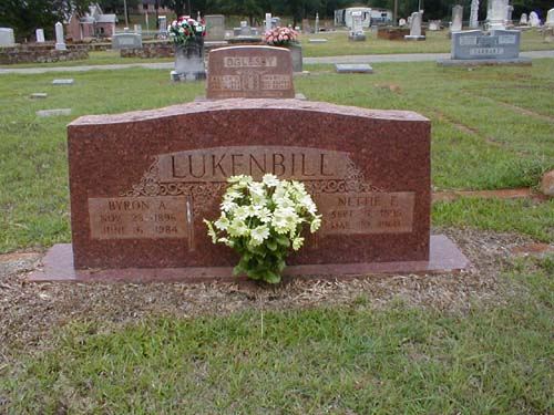
Byron A. & Nettie Frances Lukenbill Nov 23, 1896-June 6, 1984 Sept 5, 1895-Mar 10, 1960 |
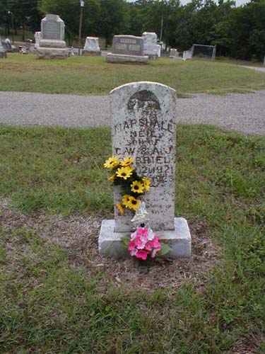
Marshall Neil Gabriel July 2 1921-May 16 1923 "Child of Charles Wade and Alma Jane Reeves Gabriel" |
|
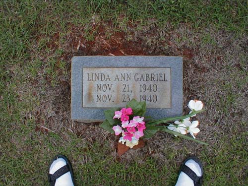
Linda Ann Gabriel Nov. 21, 1940-Nov.23, 1940 "Daughter of Robert Alonzo (Duck) and Mattie Pearl Cook Gabriel" |
Garrett Cemetery
(African-American)
SW-15
by
.
| No pictures are available yet. |
| No pictures are available yet. |
Gimble Cemetery
AKA "Breese Cemetery"
(Destroyed Cemetery)
NW-44
by
.
| No pictures are available yet. |
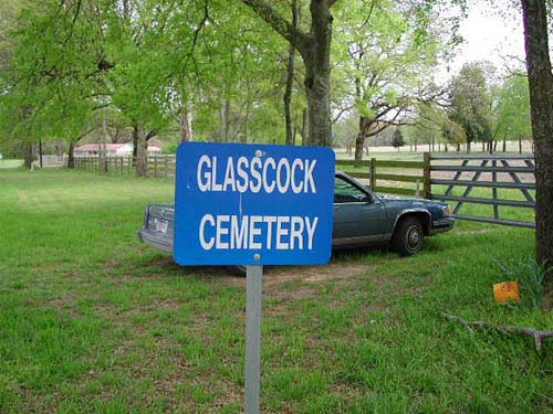
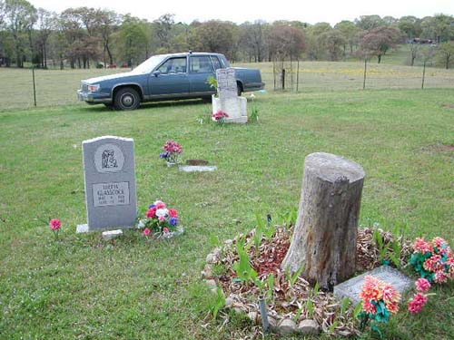
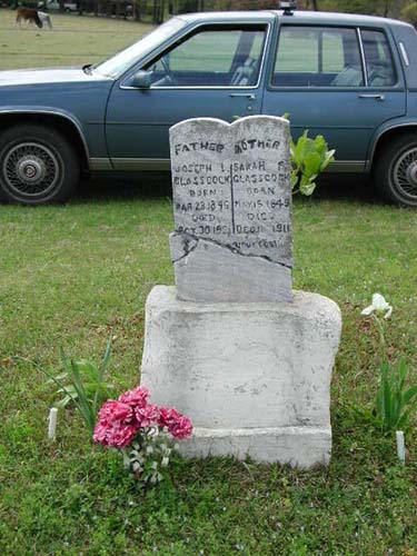
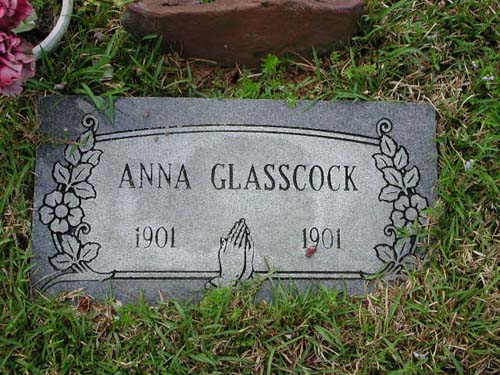
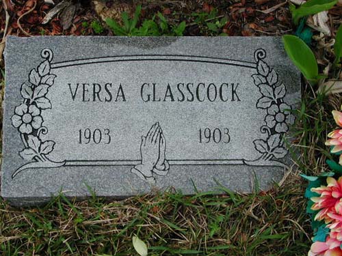
Glasscock
Cemetery
NW-55
Latitude: N 32:29:48.7
Longitude: W 095:23:17.8
This cemetery is located about 1.5 miles SW of Lindale on CR431. It is
accessed through a farm gate at the cemetery road sign. The access lane is
approximately 150 yards long.
by
Lawrence E. Oliver
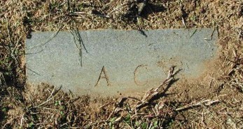
(close-up view) |
||
(full view) |
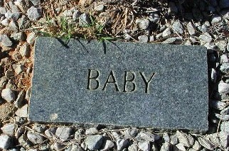
1901 - 1901 |
May 9, 1901 - June 15, 1901 |
1903 - 1903 |
~ |
Goodman Cemetery
(African-American)
NE-50
USGS GNIS Coordinates: Latitude: 322413N Longitude: 0945920W
by
.
| No pictures are available yet. |
| No pictures are available yet. |
Goss Cemetery
(African-American)
SW-13
by
.
| No pictures are available yet. |
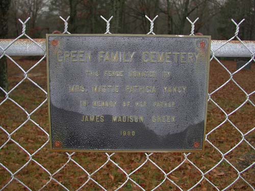
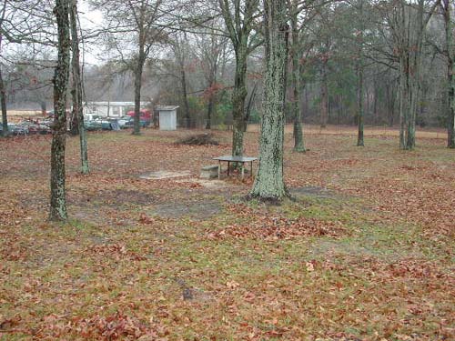
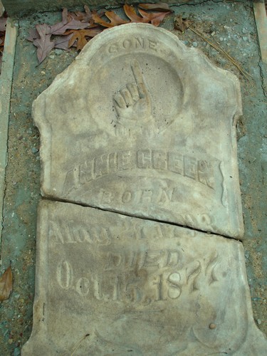
Green
Family Cemetery
SE-08
Latitude: N 32:15:12.1
Longitude: W 095:14:58.7
This cemetery is located on Rhone Quarter Road (FM2964) south of the Tyler City
Limits. The cemetery is on the west side of the road near the intersection with
CR2167. It is just west of Whitehouse, Texas and is entirely surrounded by a
chain link fence.
Bronze plate on chain link fence: "Green Family Cemetery. This fence donated
by Mrs. Mattie Patricia Yancy in memory of her father James Madison Green.
1980."
by
Lawrence E. Oliver
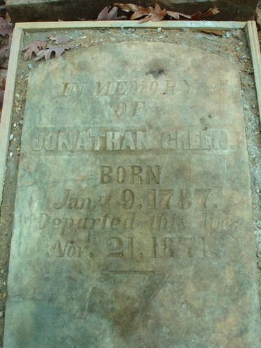
Green-Ellison Cemetery
Smith County, TX
SE-66
Latitude: N 32:14:11.3
Longitude: W 095:05:54.4
From FM 345 in Omen, take CR 230 north 1.0 miles, turn right onto private gravel
road, travel east 0.4 miles, then turn left (north) up the hill along unpaved
pipeline right-of-way. Graves are at top of hill (about 120-150 yards), on the
right side, about 15 yards into the woods. Cemetery is on private property and
not accessible to the public.
**There may be several graves which are unmarked.**
by
ssk - Sam & Sherry Kidd
|
Overview of Graves (ssk) |
||
|
Annie Green (ssk) |
Jonathan Green (ssk) |
William Ellison (ssk) |
| Cemetery Listings: Main Page |
| Cemetery Listings: A - C |
| Cemetery Listings: D - G |
| Cemetery Listings: H - K |
| Cemetery Listings: L - M |
| Cemetery Listings: N - R |
| Cemetery Listings: S |
| Cemetery Listings: T - Z |
![]()
![]()
Copyright ©
2005 - 2009
East Texas Genealogical Society and the Individual Contributors