Texas Digital Map Library
State Map Coordinator
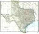 The following maps of Texas and the surrounding
territories are online in the United States Digital Map Library, and are
available for you to download.
The following maps of Texas and the surrounding
territories are online in the United States Digital Map Library, and are
available for you to download.
If you would like to be part of the Digital Map Library team and/or make contributions, please e-mail me, Rebecca Maloney. Your contributions are both needed and appreciated!
Texas State Maps- Texas 1820 -1836 Texas Map, Atlas of American History (1943). Drawn under the supervision of Carlos E. Castañeda, Published by Charles Scribner's Sons(222kb)
- Texas 1844
| Crowley Census Map |
Texas City Maps
- .
Miscellaneous Maps
U.S. DIGITAL MAP LIBRARY INDEX
Joy Fisher
Coordinator
Rebecca Maloney
Special Projects Representative


Copyright © 1999- USGenWeb Archives Project