
Erie County Pennsylvania Township Maps
|
This is a clickable image map of townships and boroughs in Erie County Pennsylvania. A text list of the township maps is shown below. The township images are cropped from a 1/50,000 USGS Geological Survey Map of Erie County dated 1977; based on 1/24,000 maps dated 1954 through 1968. The adjacent counties shown on the image map are links to their USGS maps. County Genealogy Sites: Link to Pennsylvania county USGenWeb sites at the bottom of the Pennsylvania Map Index page. |
List of Erie County Township Maps
The list below shows boroughs and villages within each township; however, some townships may be combined in one map. To search for cemeteries, villages and other features visit the USGS GNIS site. Check here for information on how to order US Geological Survey Maps of Pennsylvania counties.
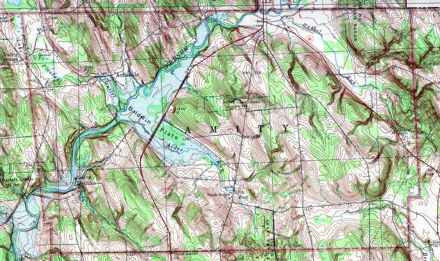
- Amity, Arbuckle
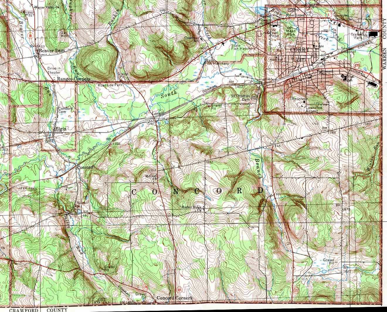
- Concord, Concord, Concord Corners, Elgin, Lovell
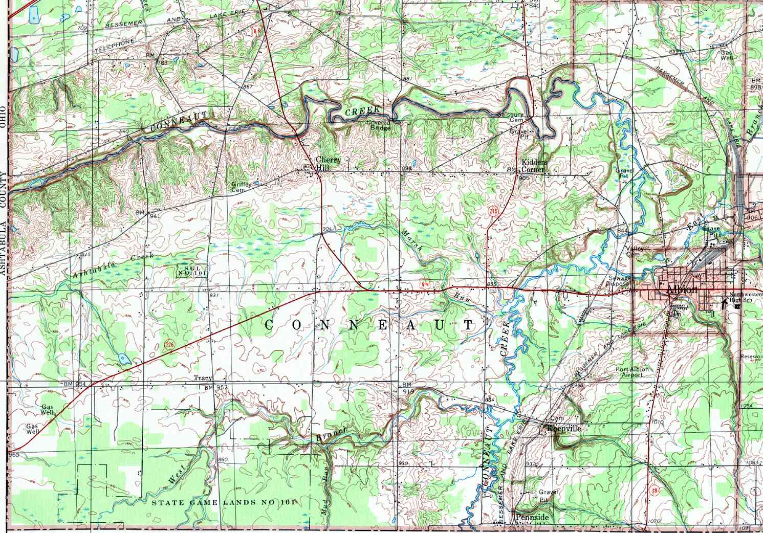
- Conneaut, Albion, Cherry Hill, Keepville, Kidders Corner, Pennside
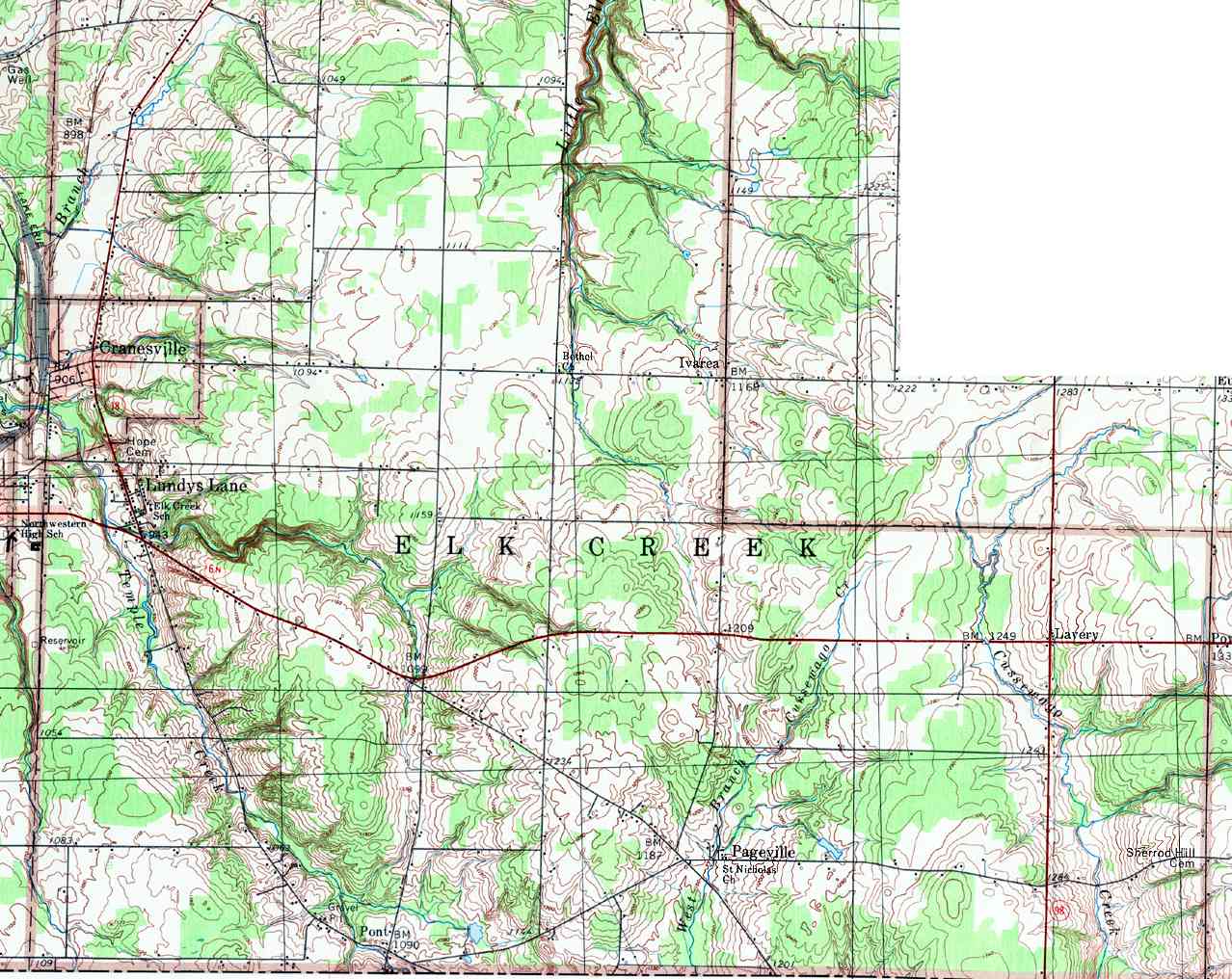
- Elk Creek, Cranesville, Ivarea, Lavery, Lundys Lane, Pageville, Pont
- Erie, Belle Valley, Chestnut Hill, Erie, Glenwood, Kearsage, Lawrence Park, Wesleyville
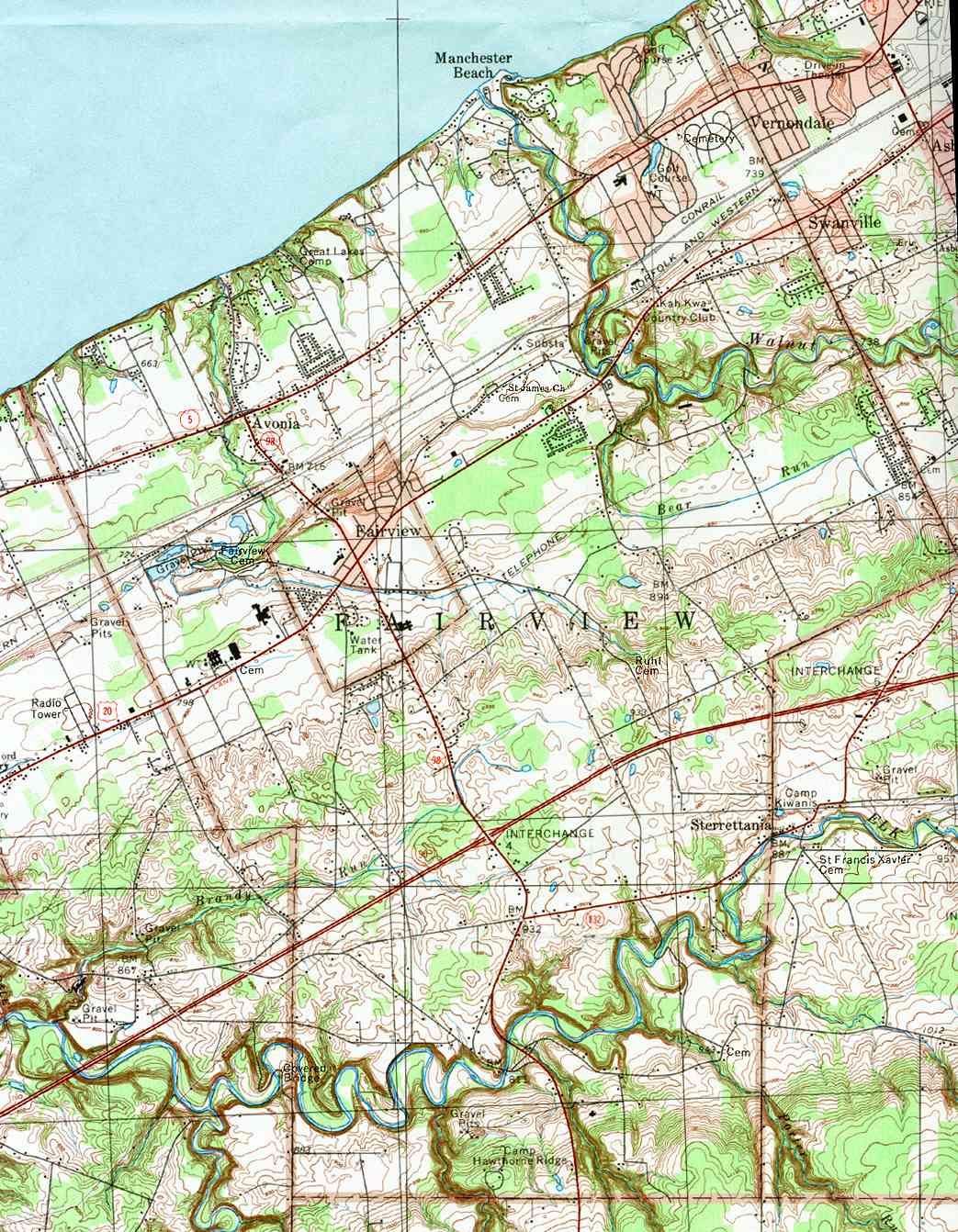
- Fairview, Avonia, Fairview, Manchester Beach
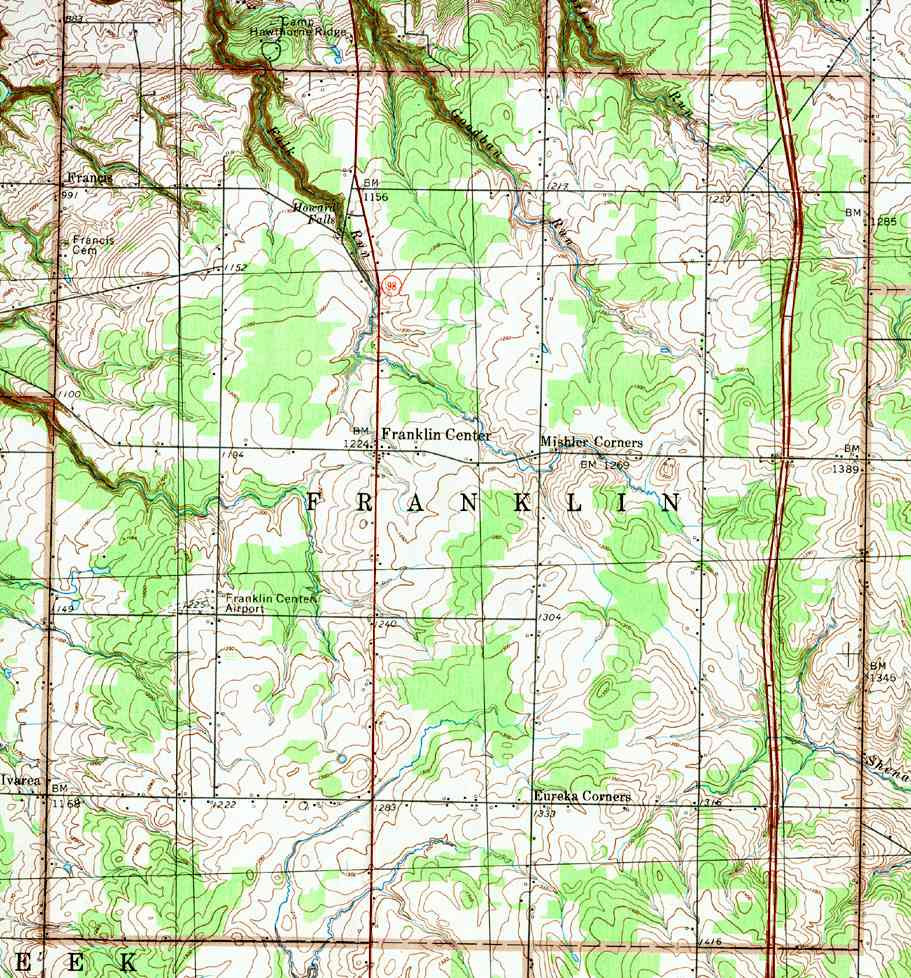
- Franklin, Eureka Corners, Francis, Franklin Center, Mishler Corners
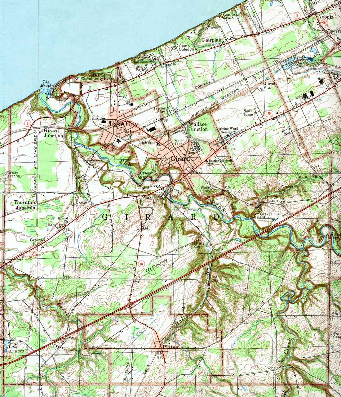
- Girard, Fairplain, Girard, Girard Junction, Lake City, Thornton Junction, Wallace Junction
- Greene, Bellview Heights, Bogus Corners, Hammett, Kuhl, Pleasant Hill, Sampson, Weeds Corners, West Greene
- Greenfield, Ashton Corners, Colts Station, Hornby, Little Hope
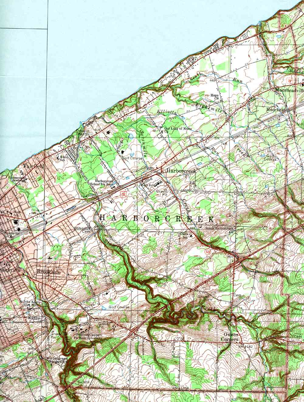
- Harborcreek, Brookside, Fairfield, Harborcreek, Moorhead, Moorheadville, Owens Corners
- Le Boeuf, Indian Head, Mill Village, New Ireland
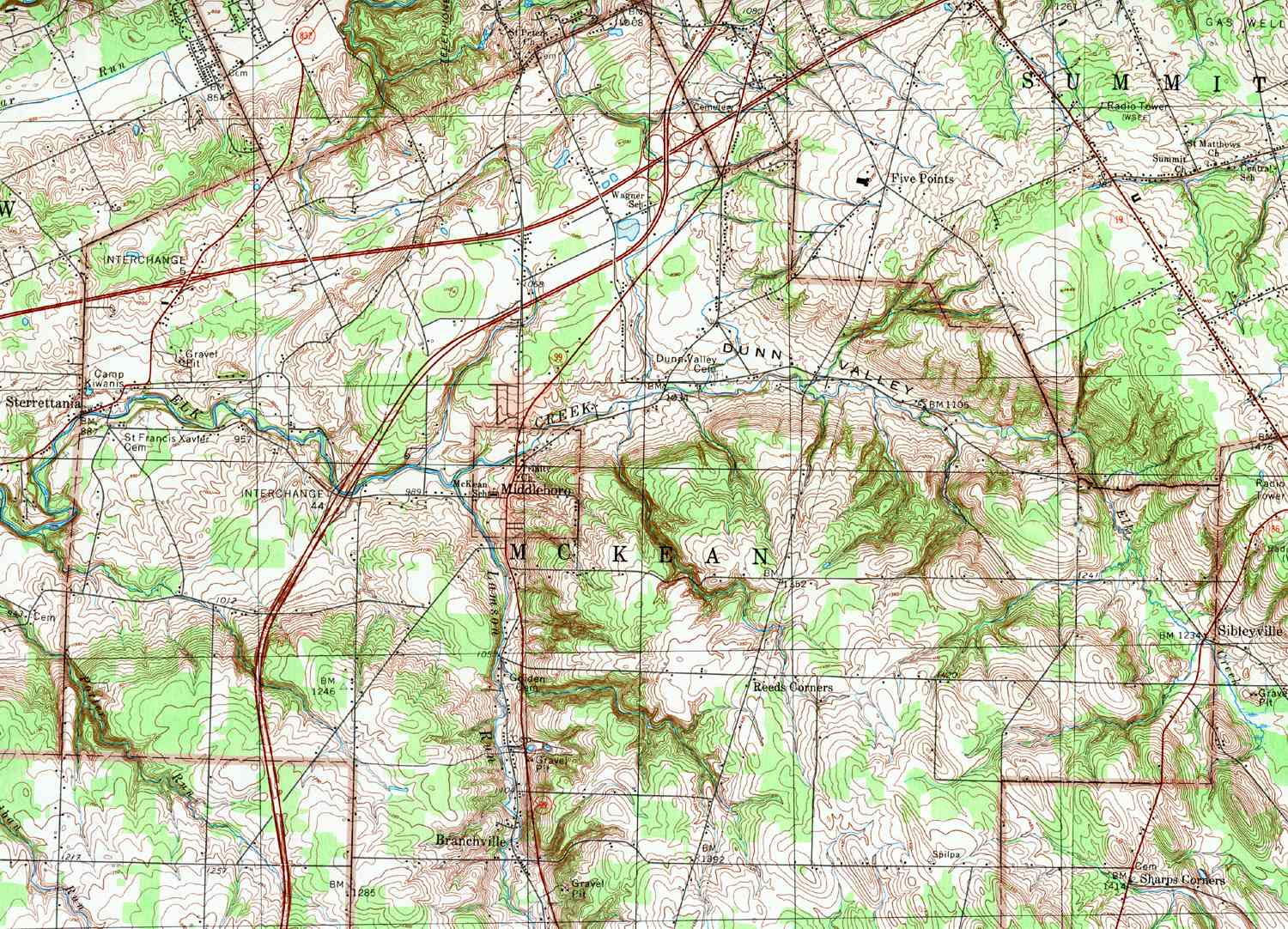
- McKean, Branchville, McKean (Middleboro), Reeds Corners
- Millcreek (West), Asbury, Charter Oaks, Englehurst, Glenruadh, Highland Park, Lakewood, Swanville, Vernondale, Waldameer Park, Westminster, West Millcreek
- Millcreek (East), With Erie
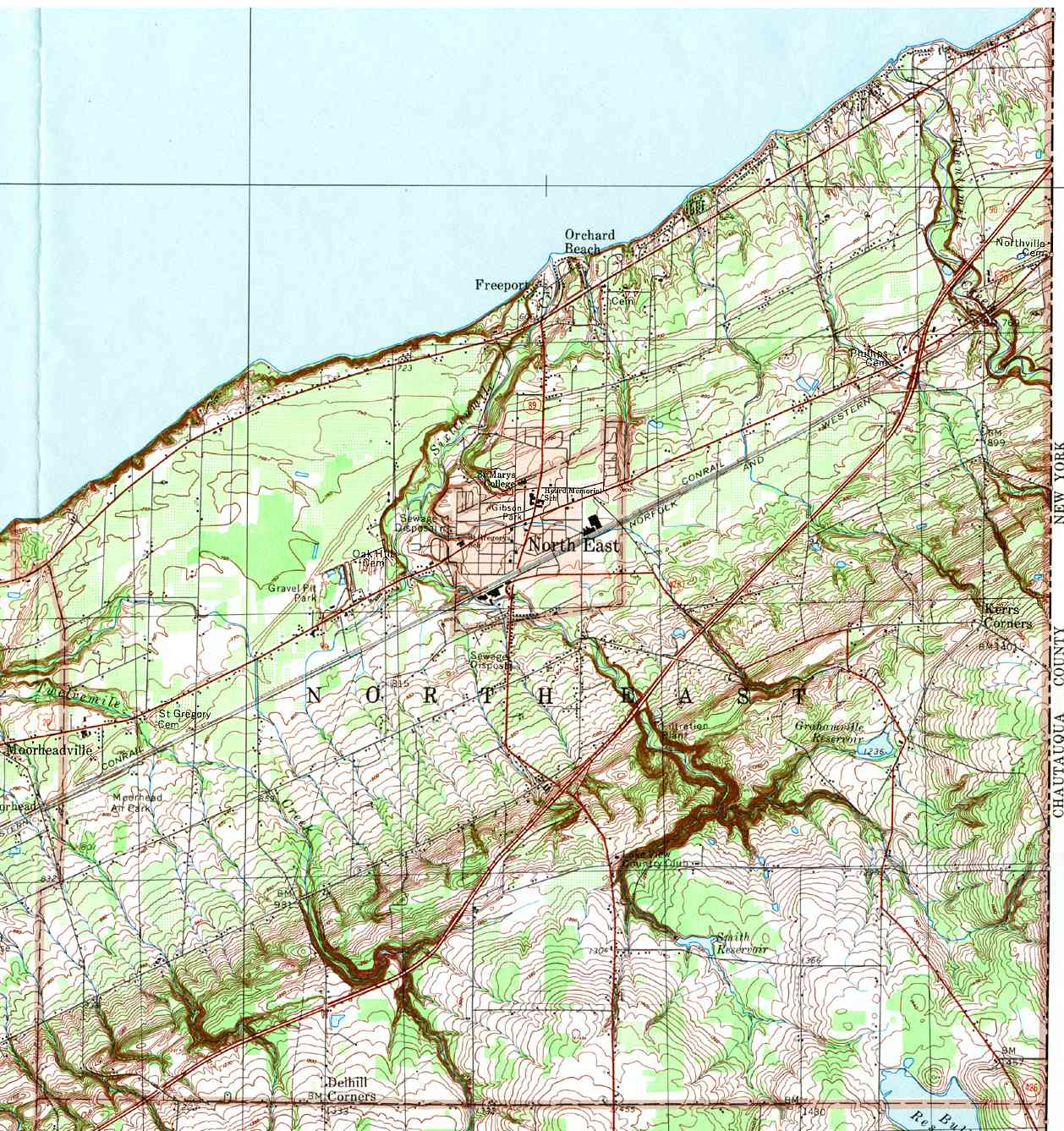
- North East, Delhill Corners, Freeport, Kerrs Corners, Orchard Beach, North East
- Springfield, Crayton, East Springfield, North Springfield, West Springfield
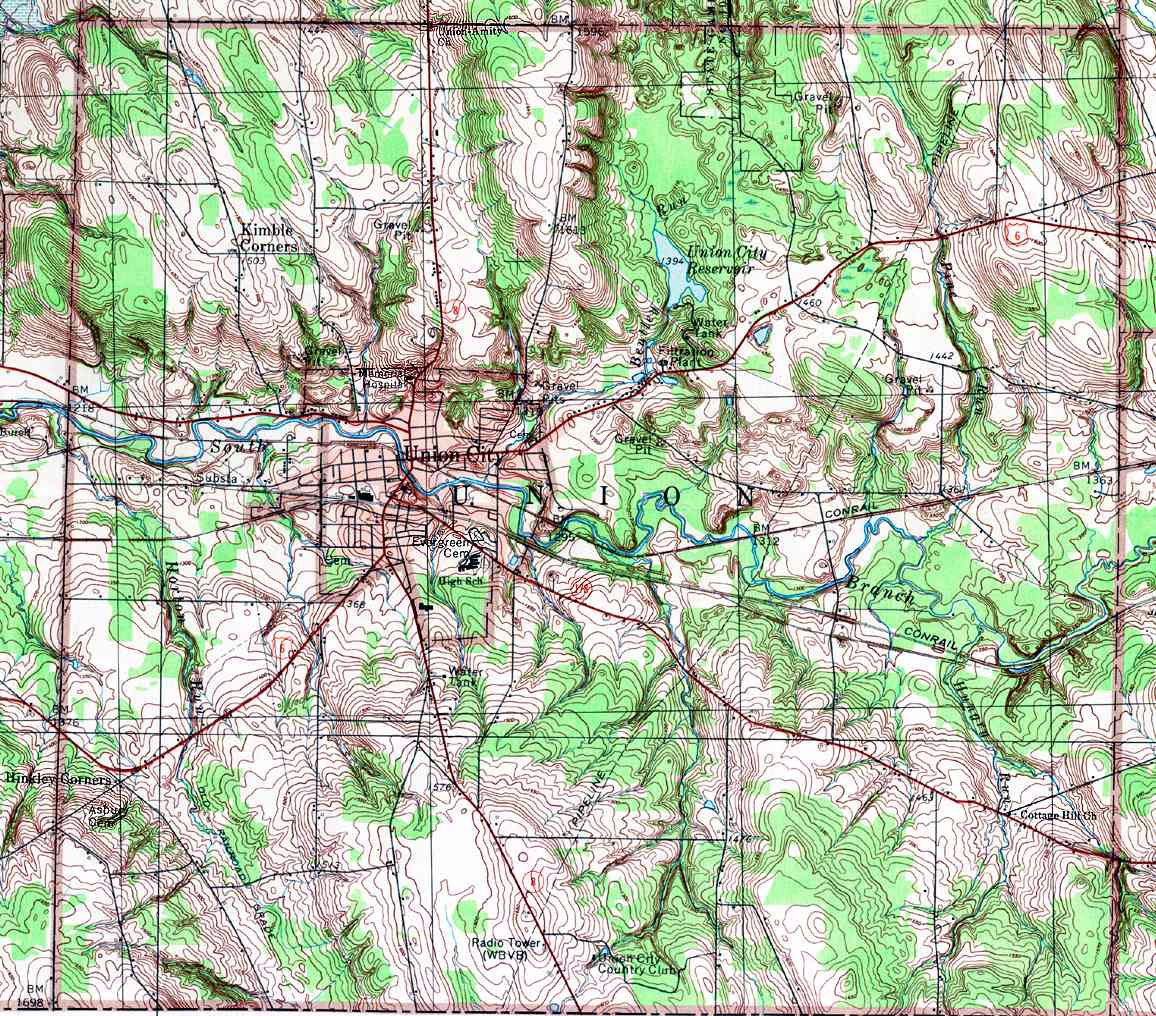
- Union, Hinkley Corners, Kimble Corners, Union City
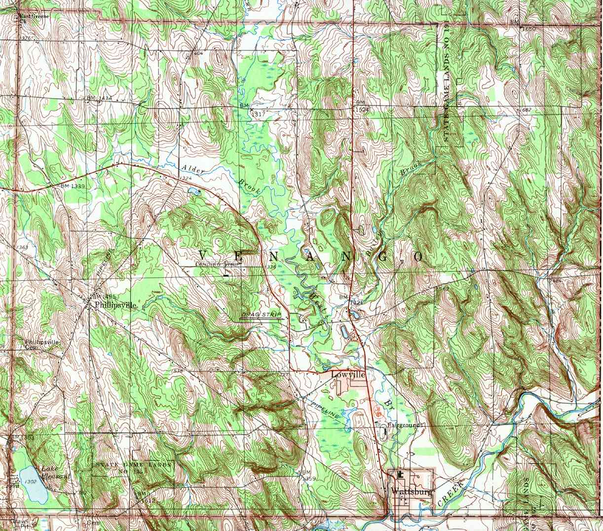
- Venango, Lowville, Phillipsville, Wattsburg
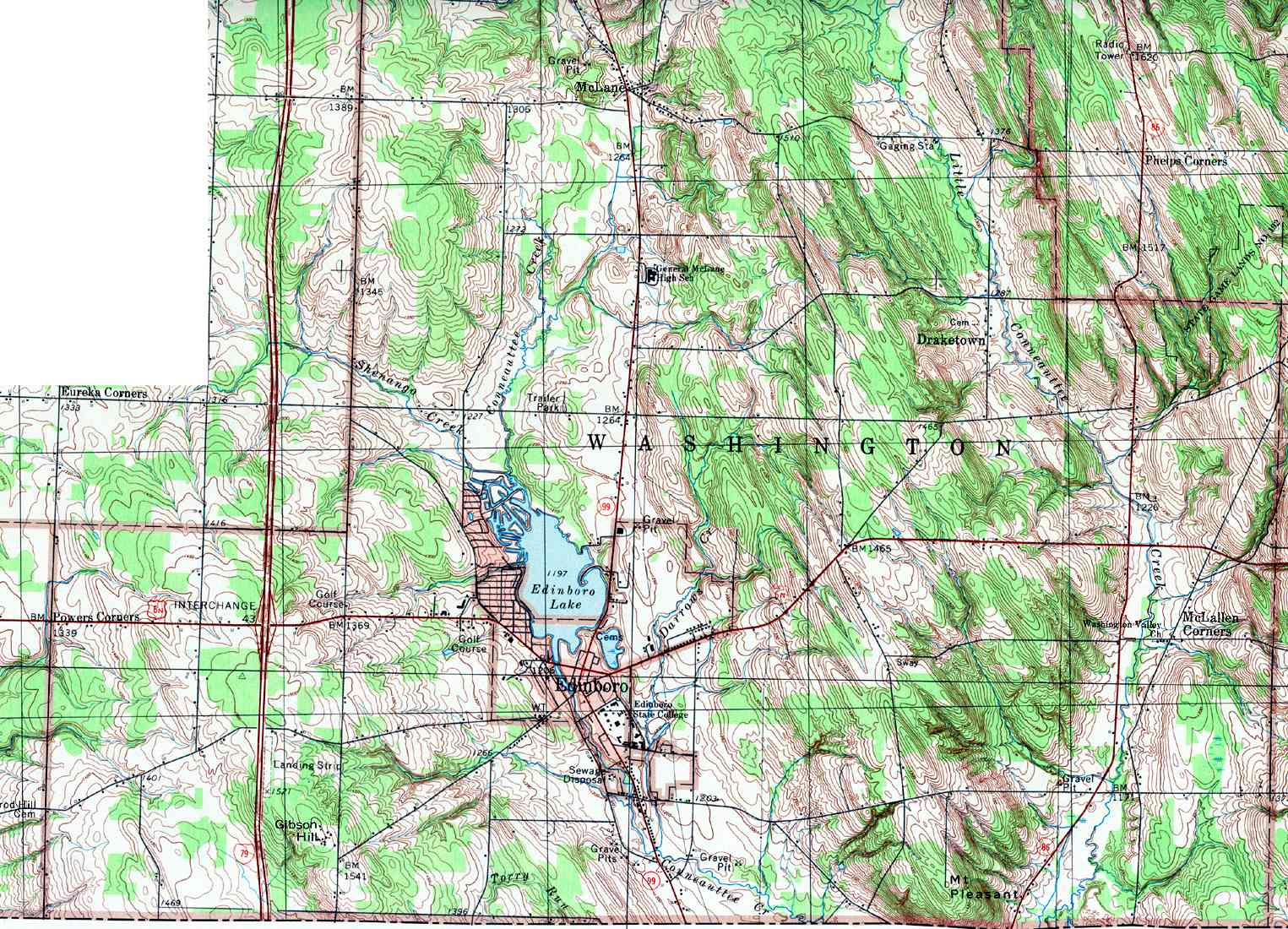
- Washington, Draketown, Edinboro, Gibson Hill, McLallen Corners, McLane, Mt Pleasant
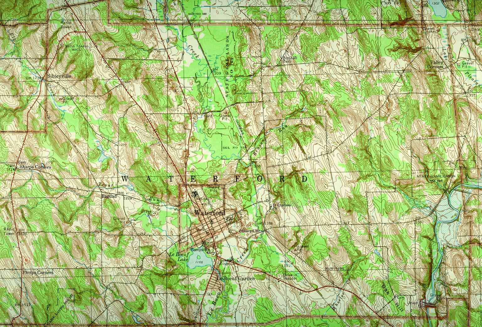
- Waterford, Bagdad, Le Boeuf Garden, Phelps Corners, Sharps Corners, Sibleyville, Valley Corners, Waterford
- Wayne, Beaver Dam, Corry, Five Points, Mertz Corners, Ranges Corners, Wheelock