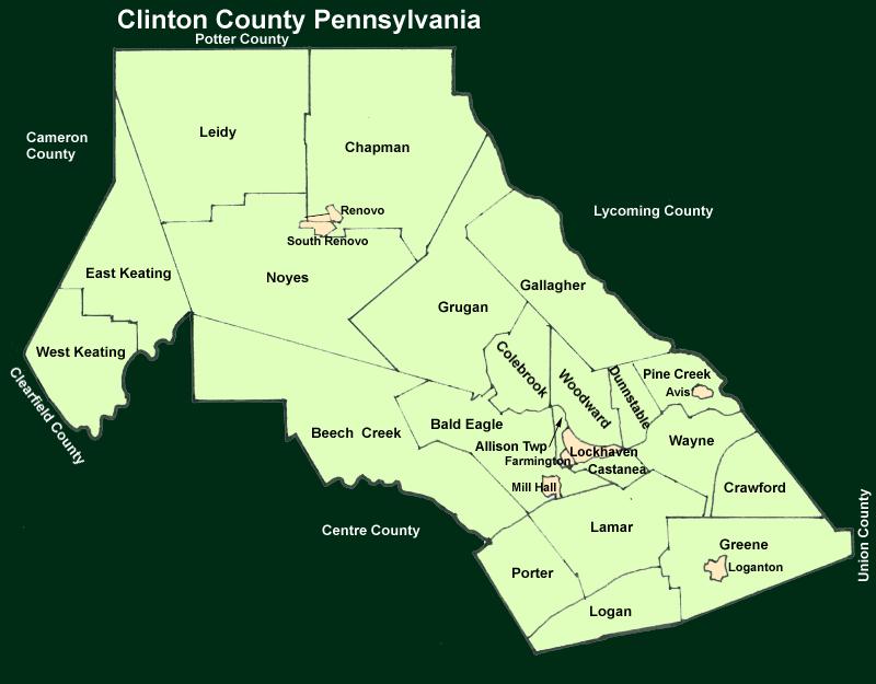
Image Map:
The image map shown below shows townships and boroughs in Clinton County Pennsylvania. A text list of the townships is shown below. The source maps are 1/50,000 USGS Geological Survey Maps of Clinton County (East) and Clinton County (West) dated 1986; based on 1/24,000 maps dated 1945 through 1973. The adjacent counties shown on the image map are links to their USGS maps.
The Clinton County USGS Map is presented in its entirety (6.2MB).
County Genealogy Sites:
Link to Pennsylvania county USGenWeb sites at the bottom of the Pennsylvania Map Index page.