|
||
|
|
||
|
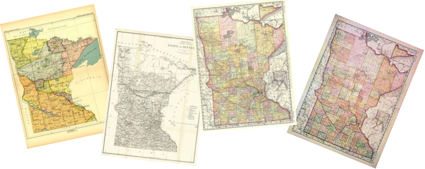
| Minnesota Counties |
|
|
|
Aitkin Several Randy Wall Maps** |
Anoka 1914 County and Township Plat/Landowner Maps |
Becker Undated County** |
|
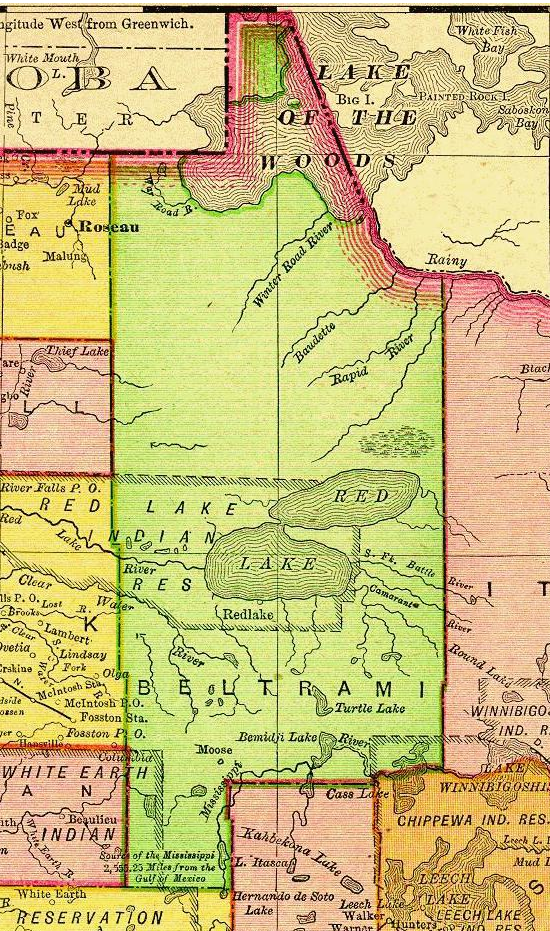
Beltrami 1895 County** |
Belton No Information Received Yet |
Big Stone County** 1895 and Undated |
|
Blue Earth Variety** |
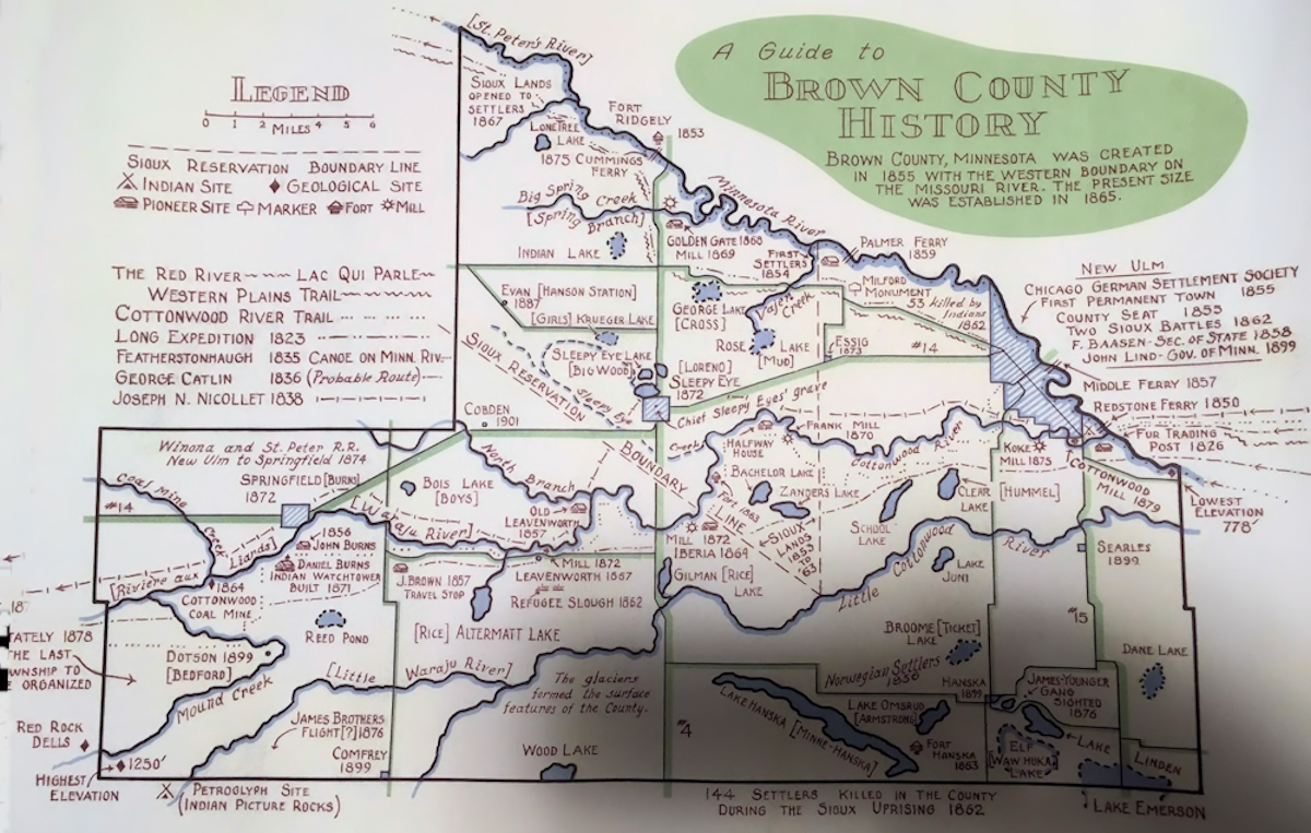
Brown County Historical |
Carlton No Information Received Yet |
|
Carver Various Township Plat Maps** |
Cass No Information Received Yet |
Chippewa 1917 County** |
|
Chisago No Information Received Yet |
Clay Township Plats 1899, 1909, 1916 & 1920** Most show landowners |
Clearwater 1916 - Township Plats - Landowners |
|
Cook No Information Received Yet |
Cottonwood No Information Received Yet |
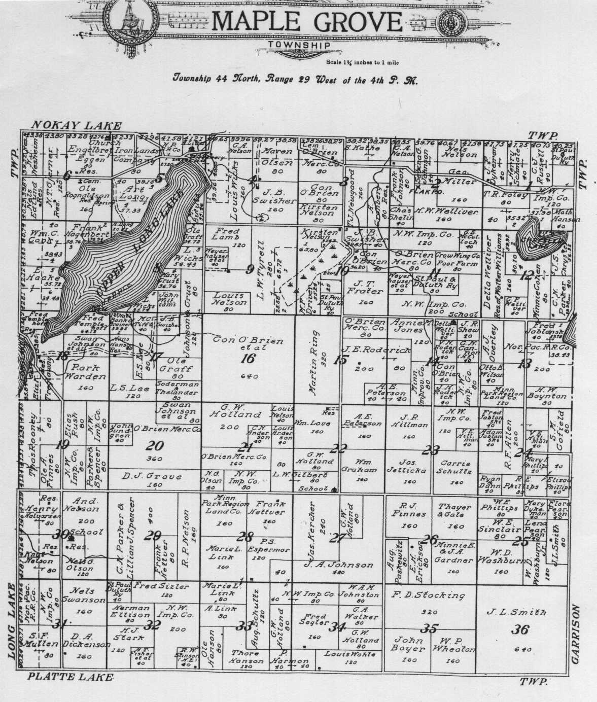
Crow Wing Brainerd - Several County** Maple Grove Township-1912 Landowners |
|
Dakota No Information Received Yet |
Dodge 1895 County/Townships** |
Douglas No Information Received Yet |
|
Faribault Various Township Plat Maps** |
Fillmore Various - County** |
Freeborn Various Township Plats** |
|
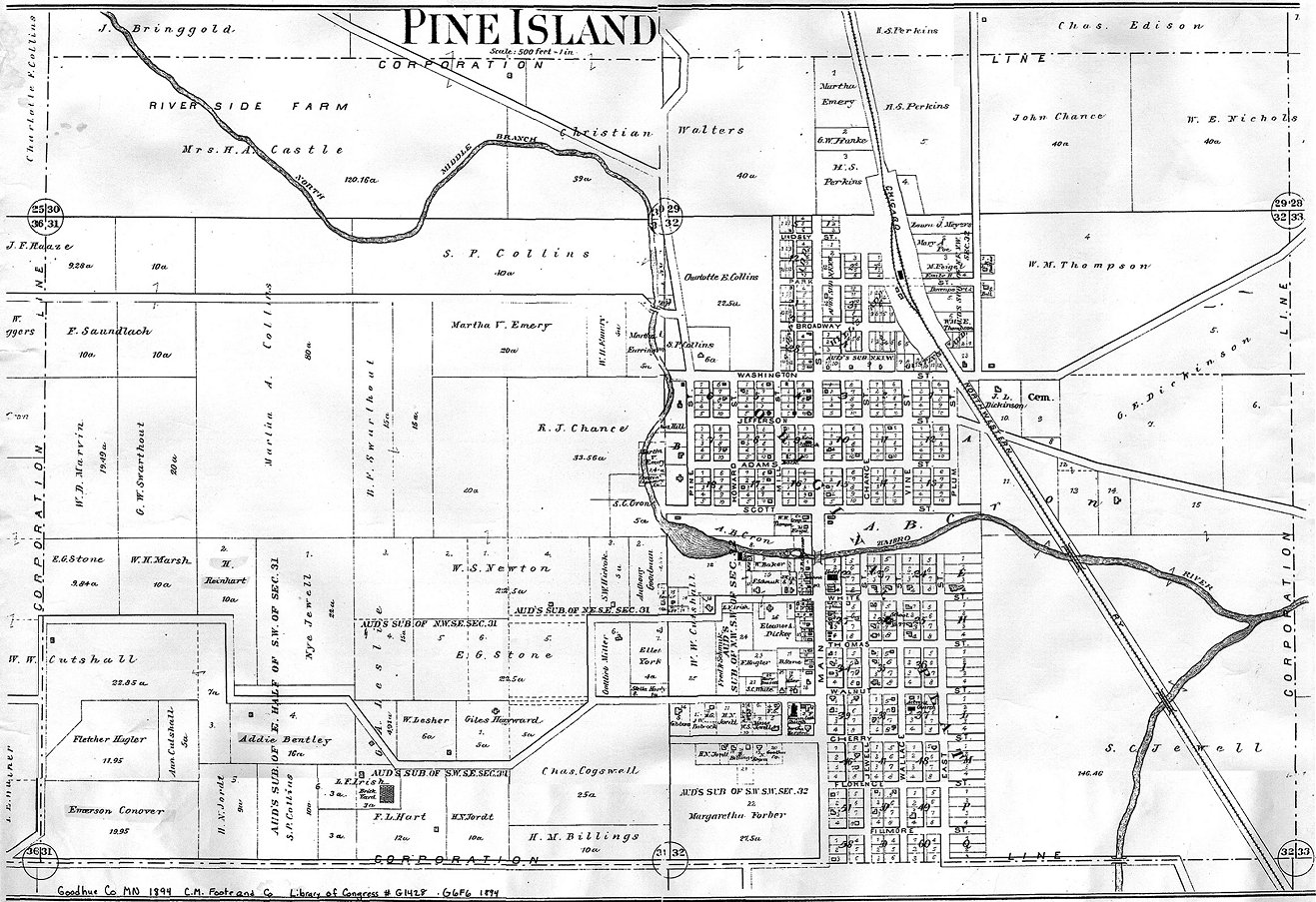
Goodhue Pine Island Village*** 26 1921 Township Plats Landowners 1895 County** |
Grant 1916 - Township Plats - Landowners |
Hennepin Townships** |
|
Houston No Information Received Yet |
Hubbard No Information Received Yet |
Isanti Township Plats Landowners ** |
|
Itasca No Information Received Yet |
Jackson Townships ** |
Kanabec No Information Received Yet |
|
Kandiyohi 1916 - Township Plats - Landowners |
Kittson 1916 - Township Plats - Landowners |
Koochiching No Information Received Yet |
|
Lac Qui Parle 1895 County** |
Lake No Information Received Yet |
Lake of the Woods No Information Received Yet |
|
Le Sueur Undated St. Thomas Cem Plot Owners** |
Lincoln 1895 County Landowners** |
Lyon 1902 Grandview Township Undated Townships Landowners** |
|
Mahnomen Undated County Townships, Ranges, Sections, Cemeteries |
Marshall 1916 - Township Plats - Landowners |
Martin No Information Received Yet |
|
McCleod Undated County** |
Meeker Undated Town & Townships ** |
Mille Lacs No Information Received Yet |
|
Morrison Variety in County** |
Mower 2004 County Variety in County ** Undated Cemetery Locations |
Murray No Information Received Yet |
|
Nicollet No Information Received Yet |
Nobles 1916 - Township Plats - Landowners |
Norman Variety in County ** (Townships - Landowners) |
|
Olmsted Variety in County ** |
Otter Tail Variety in County ** |
Pennington 1916 - Township Plats - Landowners |
|
Pine No Information Received Yet |
Pipestone 1916 - Township Plats - Landowners |
Polk Variety in County ** 2006 Cemetery Locations |
|
Pope 1916 - Township Plats - Landowners |
Ramsey No Information Received Yet |
Red Lake 1916 - Township Plats - Landowners |
|
Redwood No Information Received Yet |
Renville No Information Received Yet |
Rice No Information Received Yet |
|
Rock 1916 - Township Plats - Landowners 1935 - Township Plats - Landowners ** |
Roseau 1916 - Township Plats - Landowners |
Saint Louis No Information Received Yet |
|
Scott No Information Received Yet |
Sherburne Variety in County ** |
Sibley No Information Received Yet |
|
Stearns No Information Received Yet |
Steele Various 1897 Township Plat Maps** |
Stevens 1916 - Township Plats - Landowners |
|
Swift 1916 - Township Plats - Landowners |
Todd Townships ** |
Traverse Townships ** |
|
Wabasha No Information Received Yet |
Wadena No Information Received Yet |
Waseca No Information Received Yet |
|
Washington Variety in County ** |
Watonwan No Information Received Yet |
Wilkin 1916 - Township Plats - Landowners |
|
Winona Variety in County** |
Wright 1874 County ** |
Yellow Medicine Townships ** |
| Extinct Counties | ||
|
** = Located on a USGenWeb® County Site. *** = From the map collection of the Library of Congress. This 1894 map includes names of some of the landowners. The LOC call number information is: Goodhue Co MN, 1894, C.M. Foote and Co, Library of Congress #G1428 .G6F6 1894. Submitted by: Scott Melendez, January 12, 2001. |
| Minnesota State Maps |
|
|
|
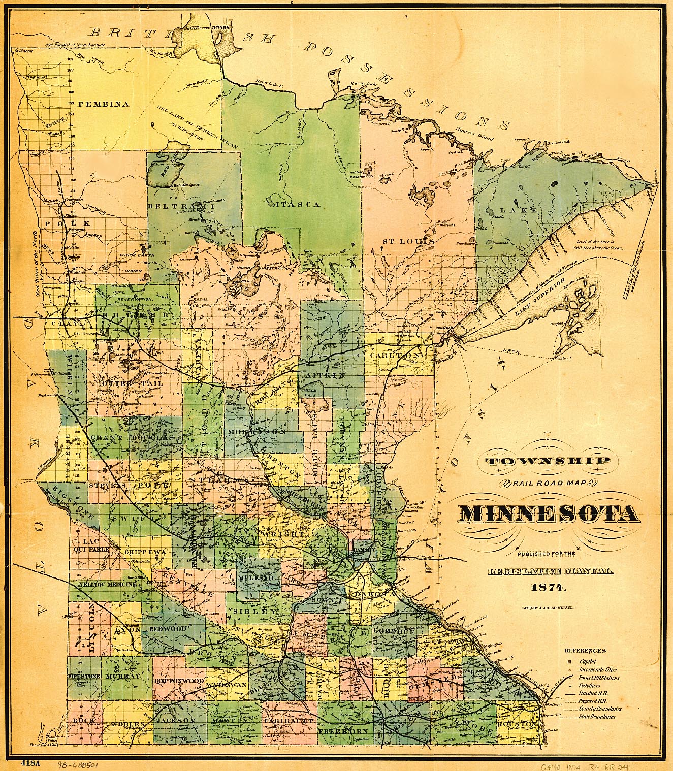
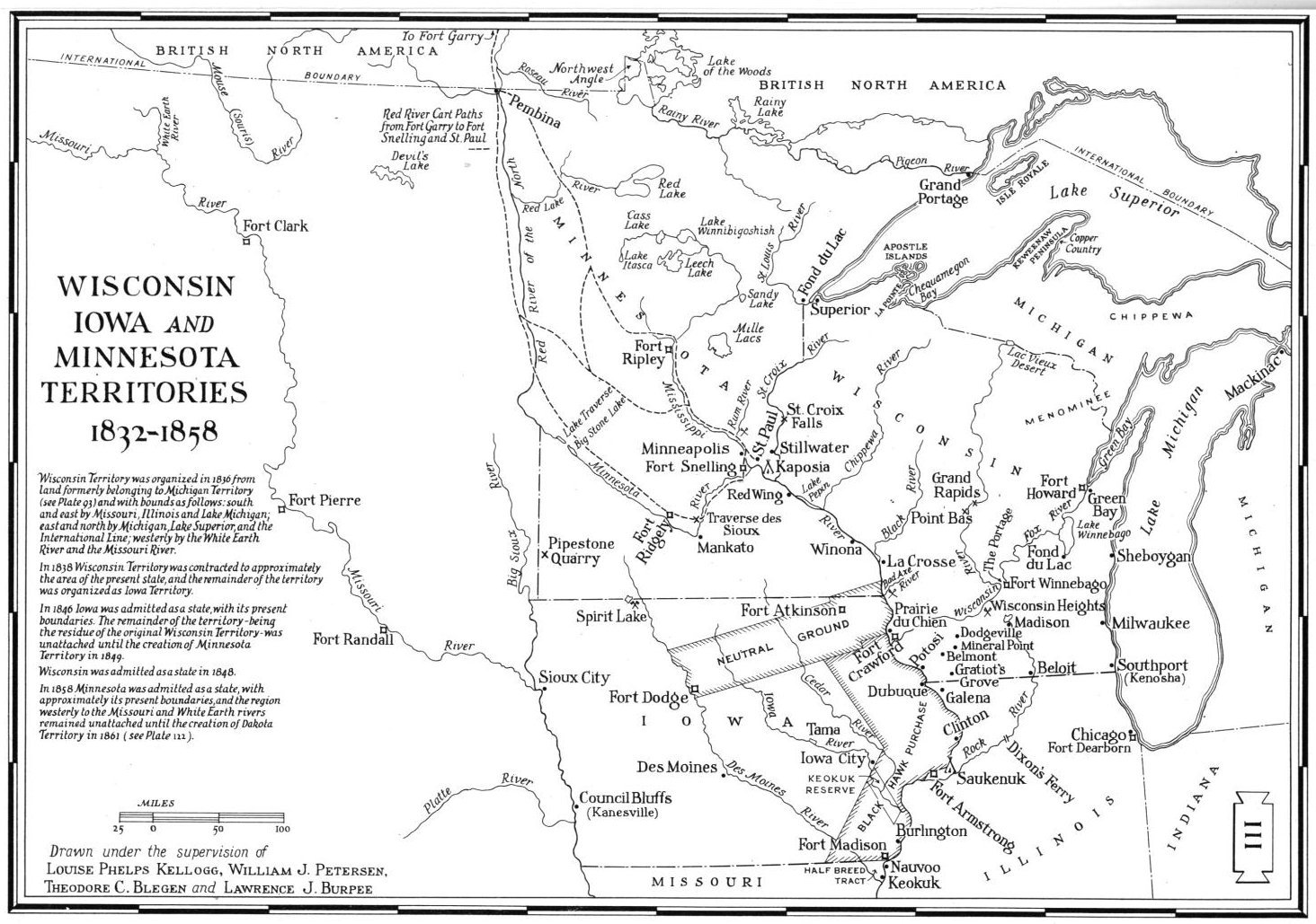
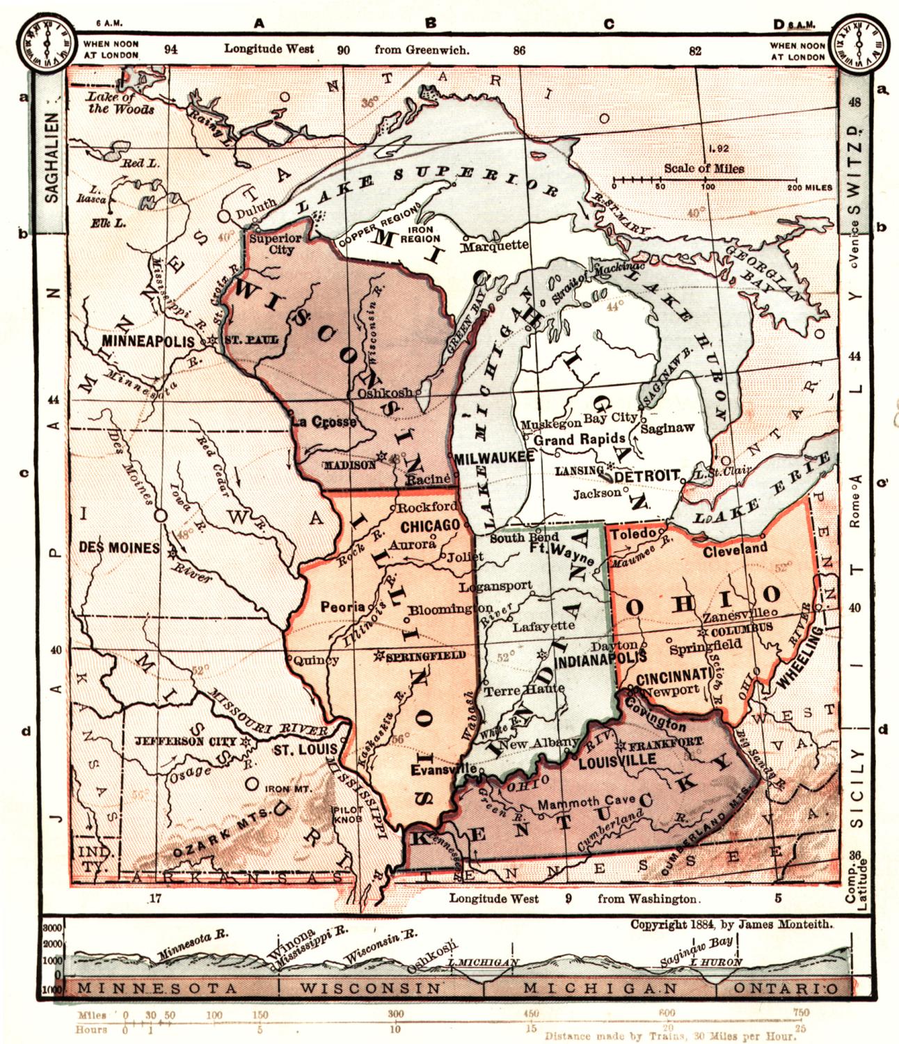
Township and Railroad Map of Minnesota
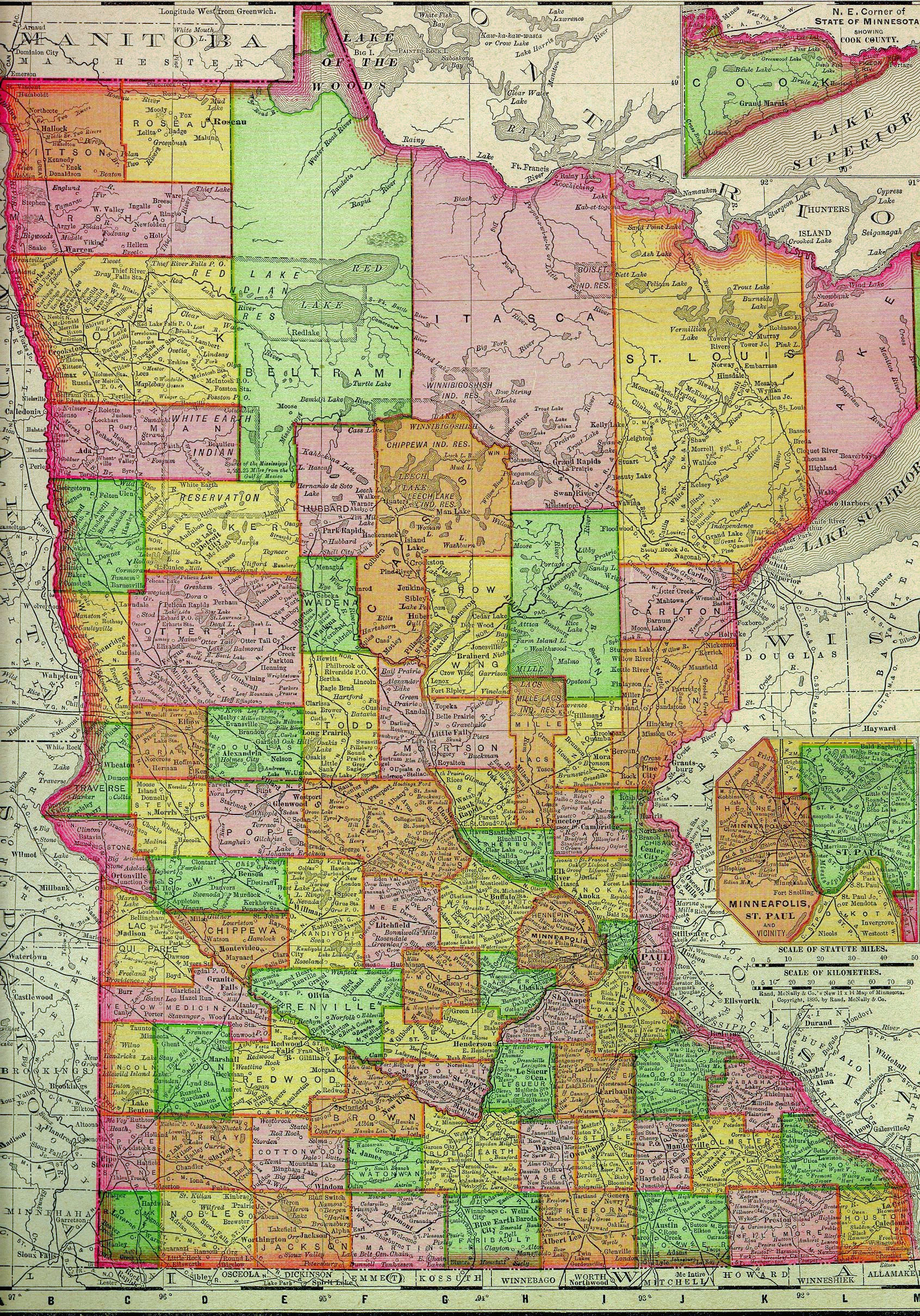
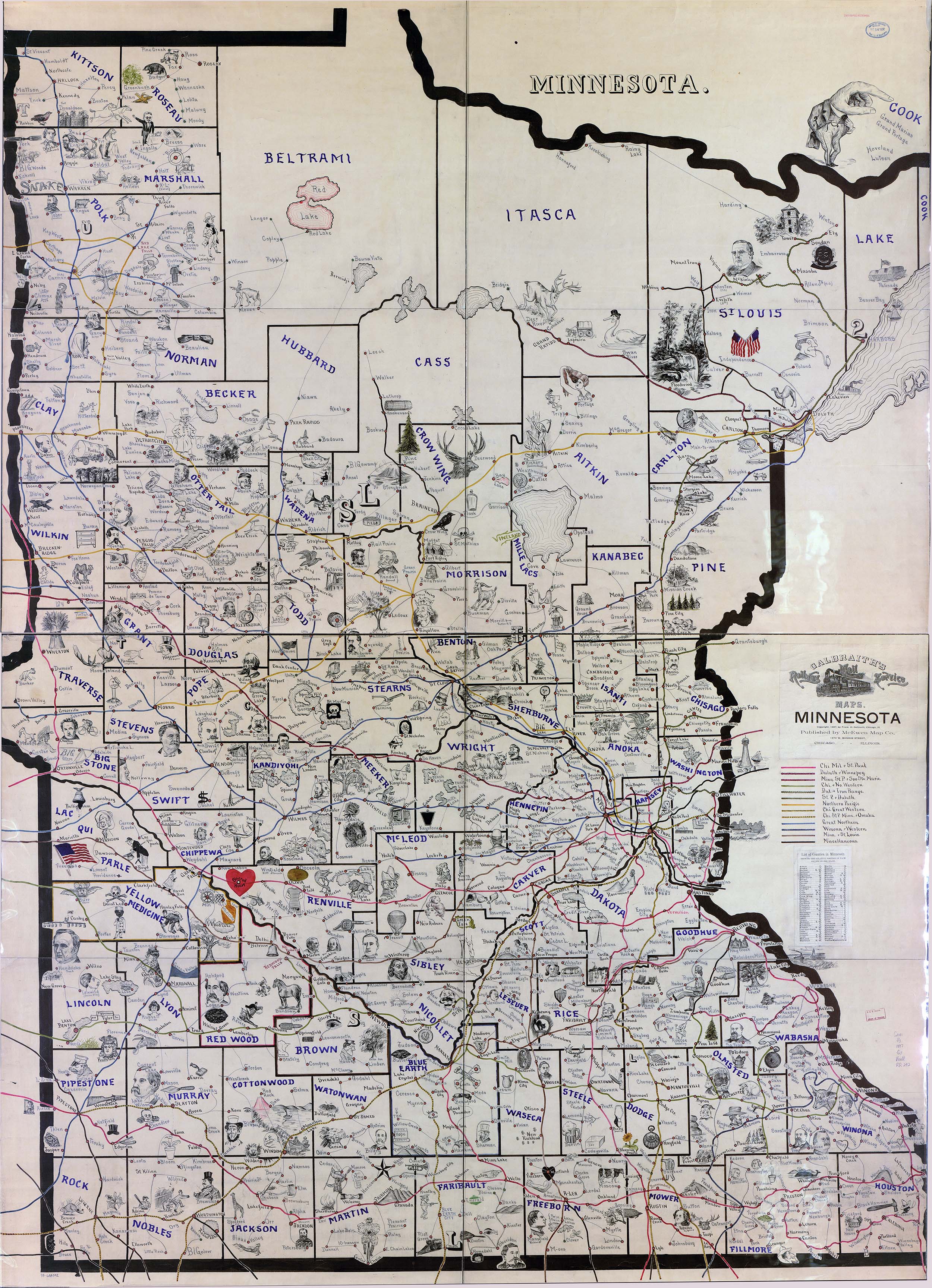
Circa 1874. Published for the Legislative Manual. Lith by A.J. Reed, St. Paul. 1895 State Galbraith's Railway Mail Service Map of Minnesota Circa 1897. Published by the United States Railway Mail Service. Undated State Wisconsin, Iowa and Minnesota Territories 1832-1858 Drawn under the supervision of Louise Phelps Kellogg, William J. Petersen, Theodore C. Blegen and Lawrence J. Burpee Midwest Map Circa 1884 James Monteith, 1884 - this is a neat map which includes Wisconsin, Illinois, Ohio, Kentucky, Michigan, Minnesota, Iowa and Missouri. The Michael Fox Map Collection Minnesota Historical Society John R. Borchert Map Library, University of Minnesota County Digitized Plat Maps and Atlases |
|
|
|
We welcome your contributions! Contact: Available Minnesota Digital Maps Library Coordinator Updated 30 July 2021 |
|
|


