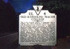
(Click image for enlargement)
Old Randolph Macon College, UL-4
Rte. 58, .3 mile west of Boydton
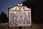
(Click image for enlargement)
Occoneechee Indians, U-60
Rte. 58, 1.5 miles east of Clarksville
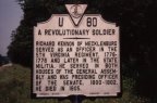
(Click image for enlargement)
General Richard Kennon, a Revolutionary Soldier, U-80
Rte. 58. at Boydton
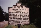
(Click image for enlargement)
Taylors Ferry. UL-5
Rte. 58, .3 mile west of Boydton
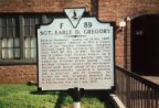
(Click image for enlargement)
Sgt. Earle D. Gregory, F-89
E. 2nd St., at Boyd St. in Chase City (Rtes. 49/ 92)

(Click image for enlargement)
Prestwould Plantation. F-95
Rte.15, 3 miles north of Clarksville
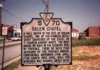
(Click image for enlargement)
Salem Chapel, S-70
Rte.1, at South Hill
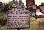
(Click image for enlargement)
Early Exploration, S-76
Edward Bland & Abraham Wood
Rte.1, 1.6 miles north of South Hill