
Smith County
Cemetery Photographs
Brandon Cemetery
Latitude: N 32:13:18.8
Longitude: W 095:07:11.8
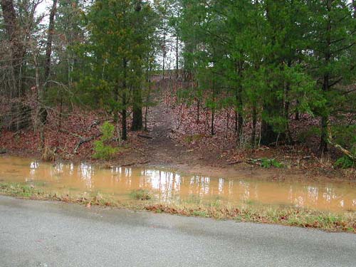
This cemetery is located NW of Omen about 1 or 1½ miles. Almost due
north of Shiloh Cemetery, on what was the old Brandon farm place.
West from Omen on FM 345, right into East Shore Estates
Subdivision (CR 2143 - Old Whitehouse Road), right onto N. Lakeview Drive, right onto
Sunshine Lane, right onto Cardinal Lane, right onto N. Ramp Drive, right onto
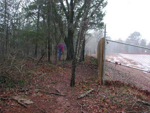
Fisherman's Drive. On the east side of Fisherman's Dr between the
addresses of 15680 & 15700 is a path leading to the cemetery - 75 feet inside the
wood line, next to wooden fence of oil well.
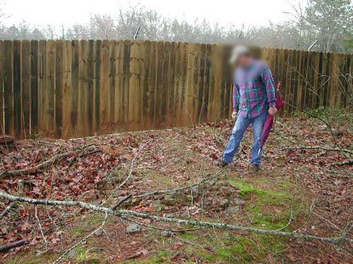
NOTE - Feb 15, 2003: This cemetery appears to have been disturbed
sometime in the last two years due to the drilling of an oil well.
| Description Link |
Photo Link |
Date |
Submitter |
| Cemetery View |
Image |
|
Lawrence E. Oliver |
| Cemetery View |
Image |
|
Lawrence E. Oliver |
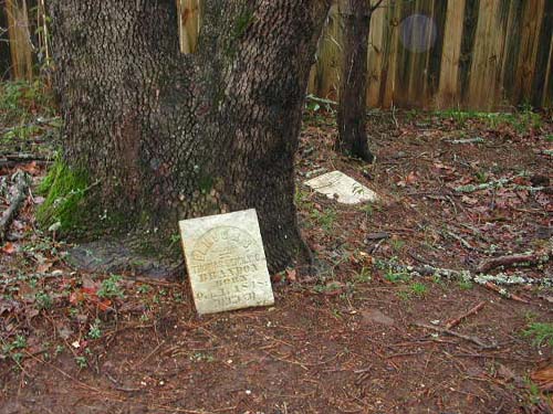
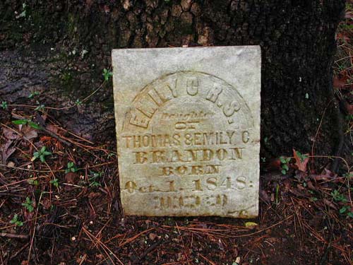
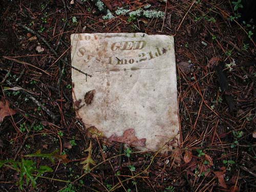
| Emily C. Brandon |
Image |
|
Lawrence E. Oliver |
| Emily C. Brandon |
Image |
|
Lawrence E. Oliver |
| Emily C. Brandon |
Image |
|
Lawrence E. Oliver |
| Unmarked Grave |
Image |
|
Lawrence E. Oliver |
| Unmarked Graves |
Image |
|
Lawrence E. Oliver |
Copyright © 1997-present USGenWeb Project Archives