
USGenWeb Archives
Crossroads Presbyterian Cemetery
Monroeville, Allegheny County, PA
![]()
A Project of Allegheny County PAGenWeb Archives
Copyright Information Pennsylvania Tombstone Project
Tombstone Photography Tips Photo Submission Form

|
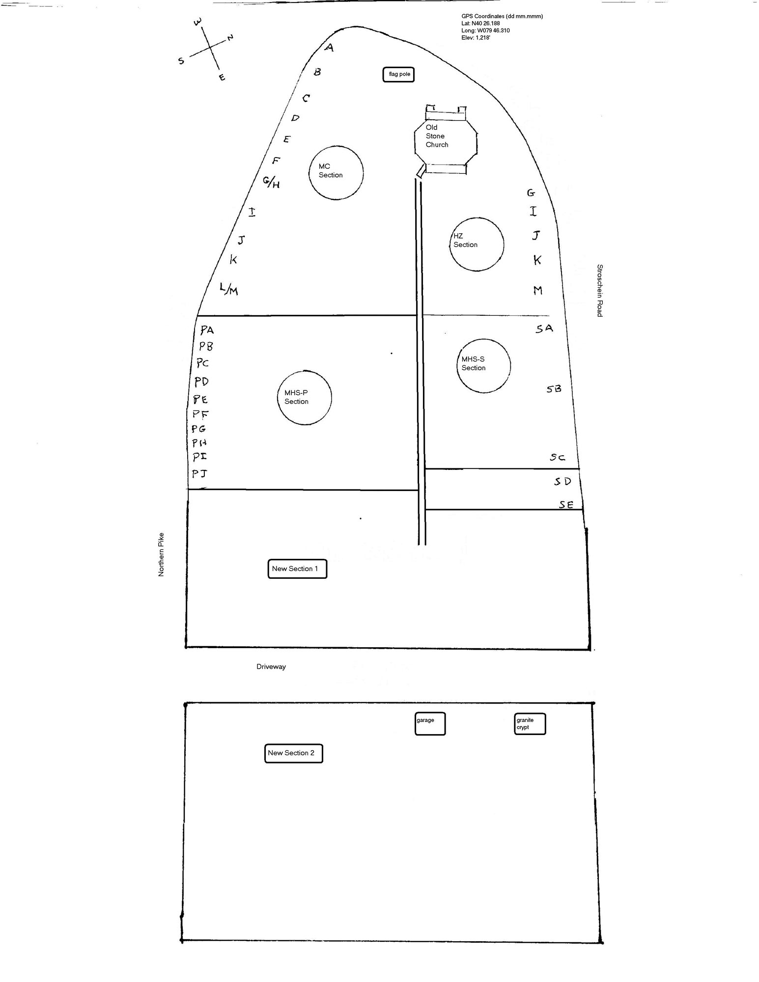
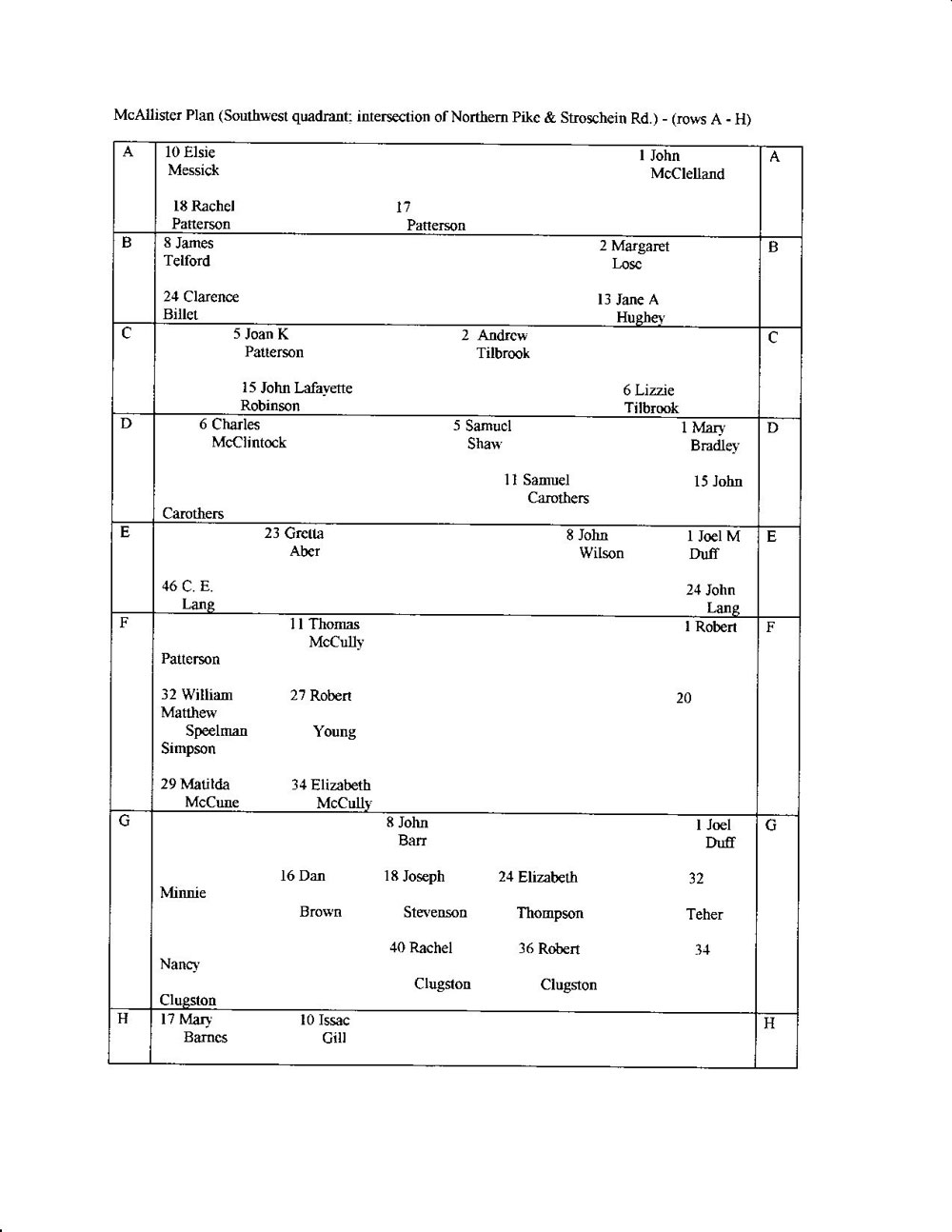
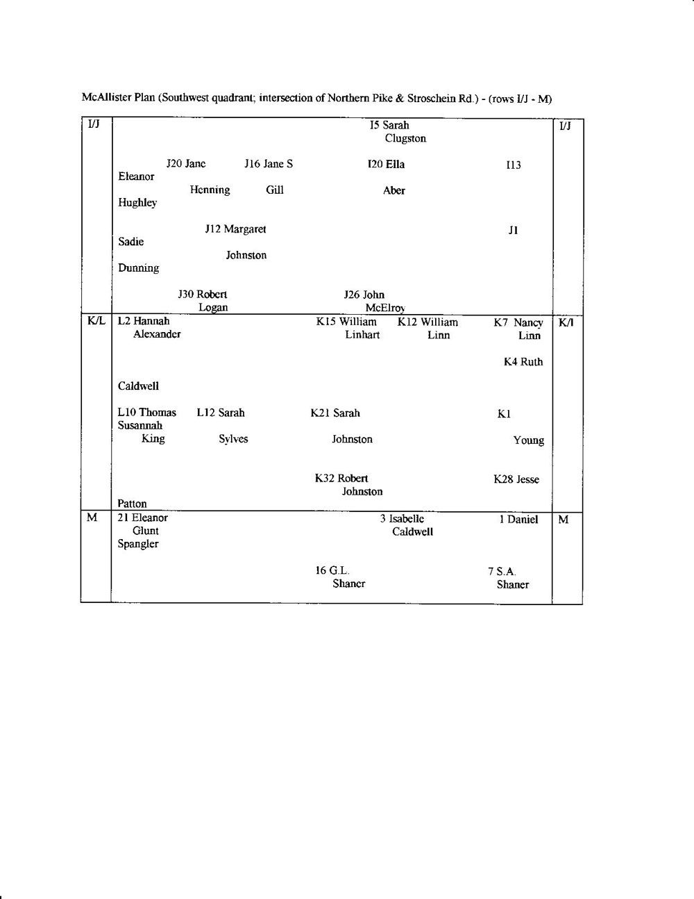
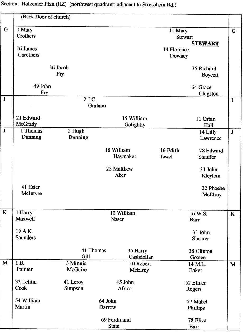
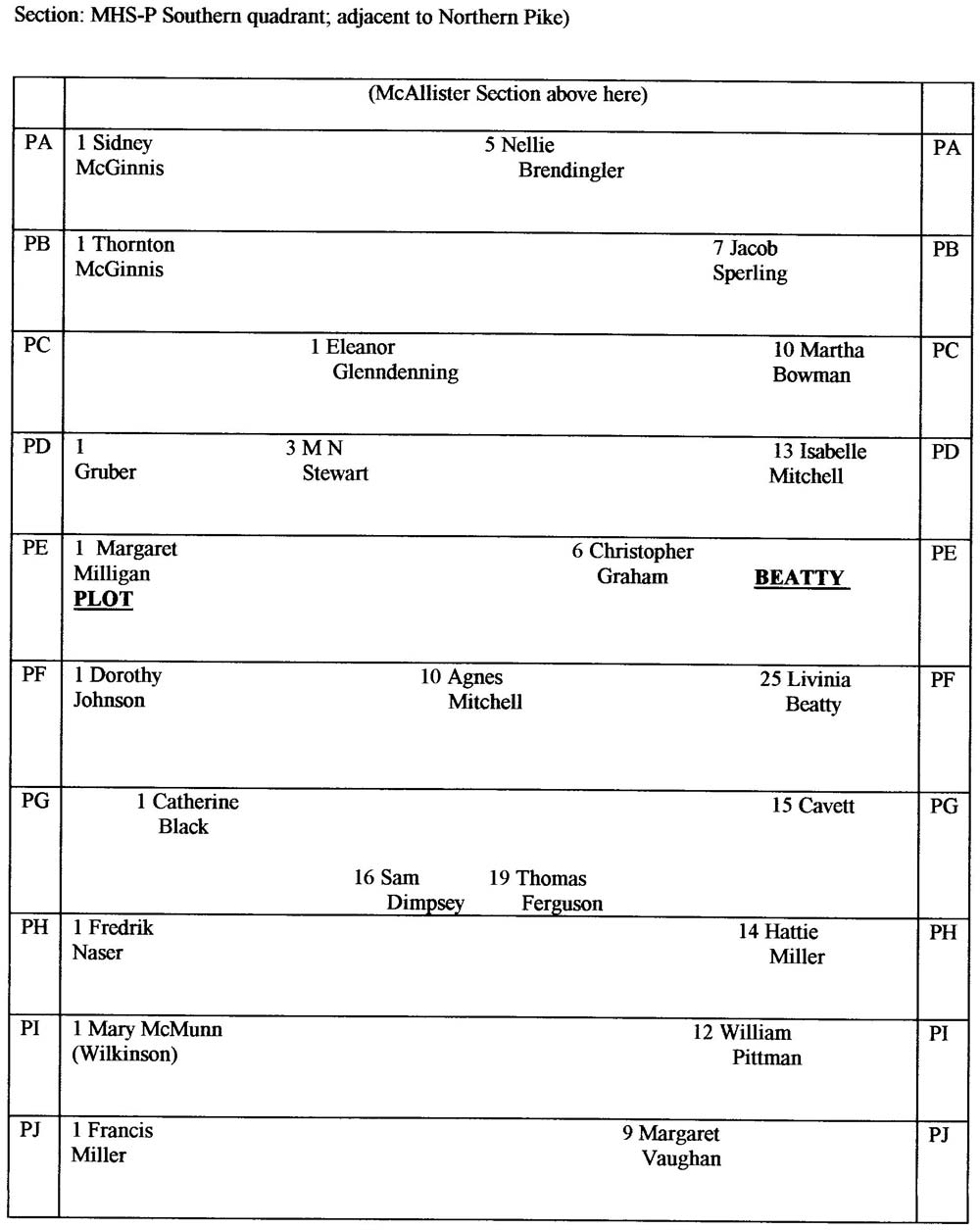
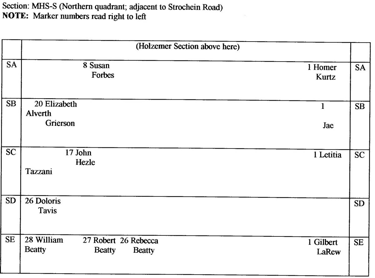
Monroeville Historical Society Plan Map using Row and Plot Numbering System
click on map for enlarged view Monroeville Historical Society Plan Map In the 1980's, as part of their Eagle Scout Projects, two boy scouts Scott McAllister and David Holzemer developed a map plan of the existing tombstones remaining in the two oldest sections of the cemetery. These sections are referred to as the MC (McAllister), and HZ (Holzemer) Sections. Expanding upon these plans, members of the Monroeville Historical Society created maps for the MHS-P (Monroeville Historical Society-Northern Pike), and MHS-S (Monroeville Historical Society- Stroschein Road) Sections. While compiling the information for this project, these Monroeville Historical Society records were originally utilized. Later, as the project progressed, the Cemetery Association Lot Plans were made available for use, and the entire project was completely redesigned to utilize their Lot numbering system. However, there were several instances where several older graves were not included in the Cemetery Association records, and their location could not be readily identified according to the cemetery plan of lots. In these few cases, their location is identified by their record in the Monroeville Historical Society's Maps. |
Allegheny County PAGenWeb Archives File Manager Ellis Michaels
this page was last updated