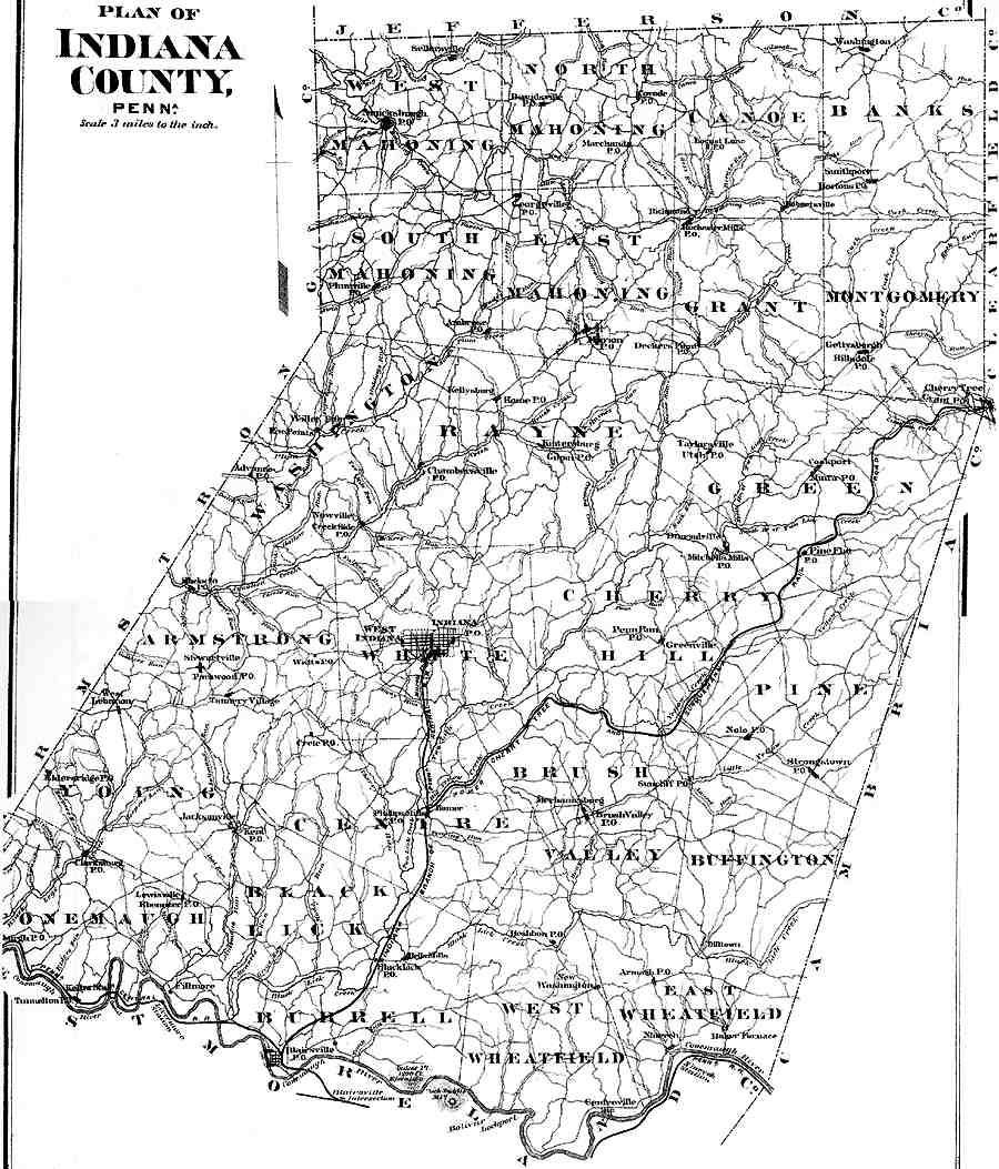
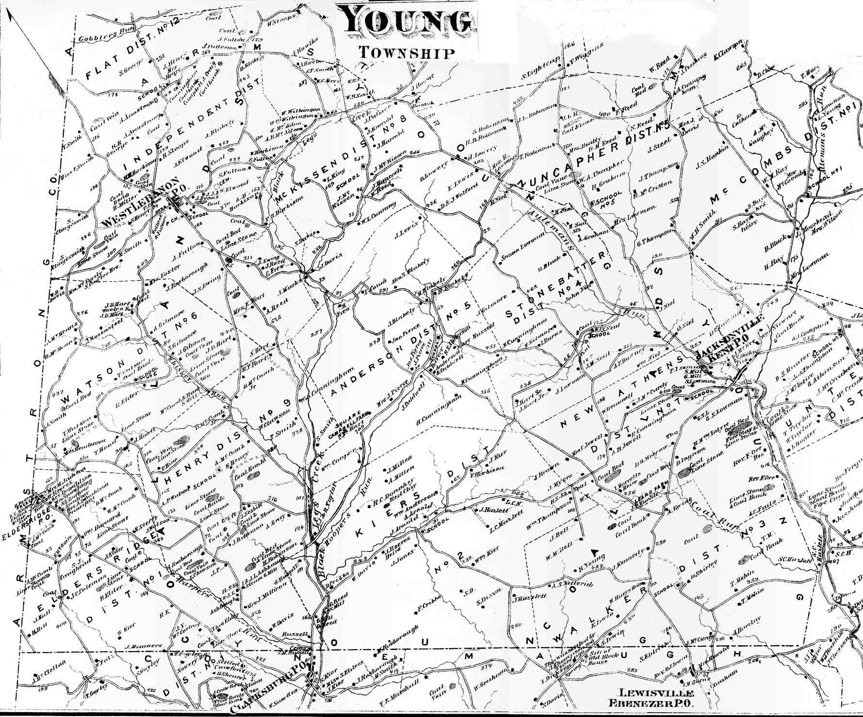
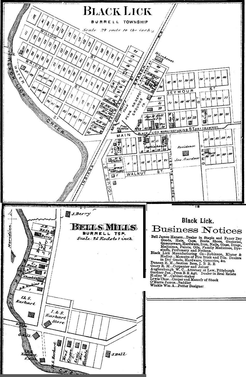
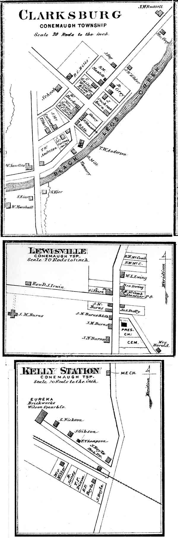
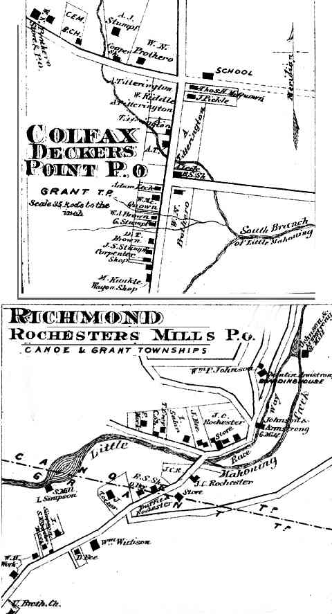
Township and borough maps of Indiana County Pennsylvania from Atlas of Indiana Co. Pennsylvania, published by F.W. Beers & Co., New York, 1871. The Historical and Genealogical Society of Indiana County published a fully indexed reproduction.
|
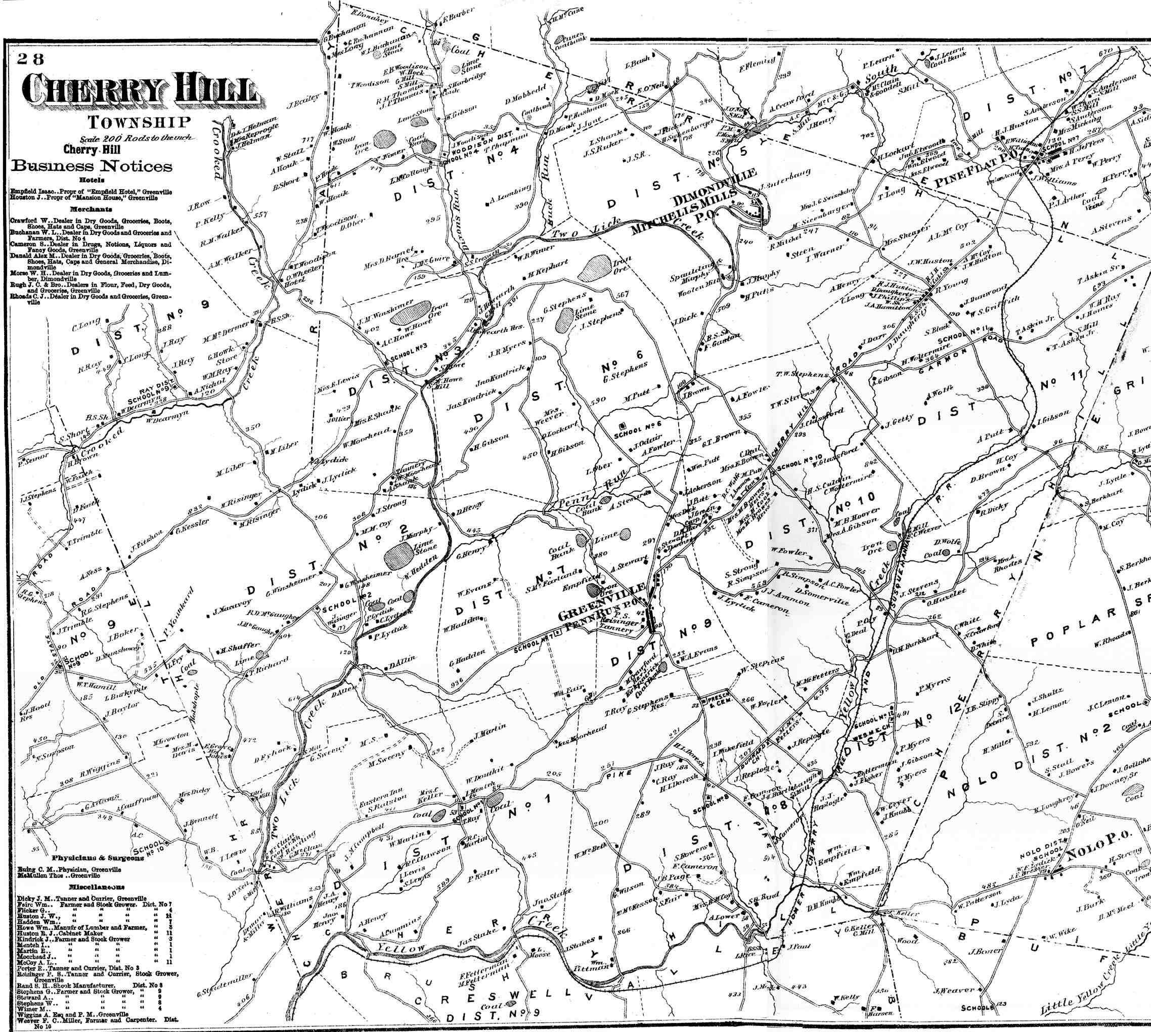
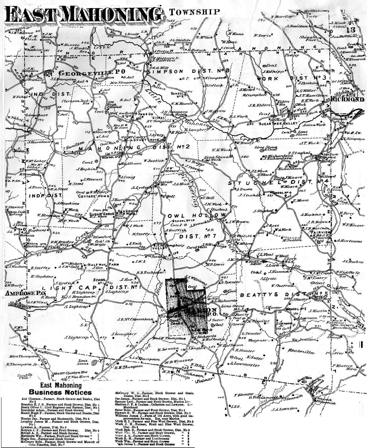
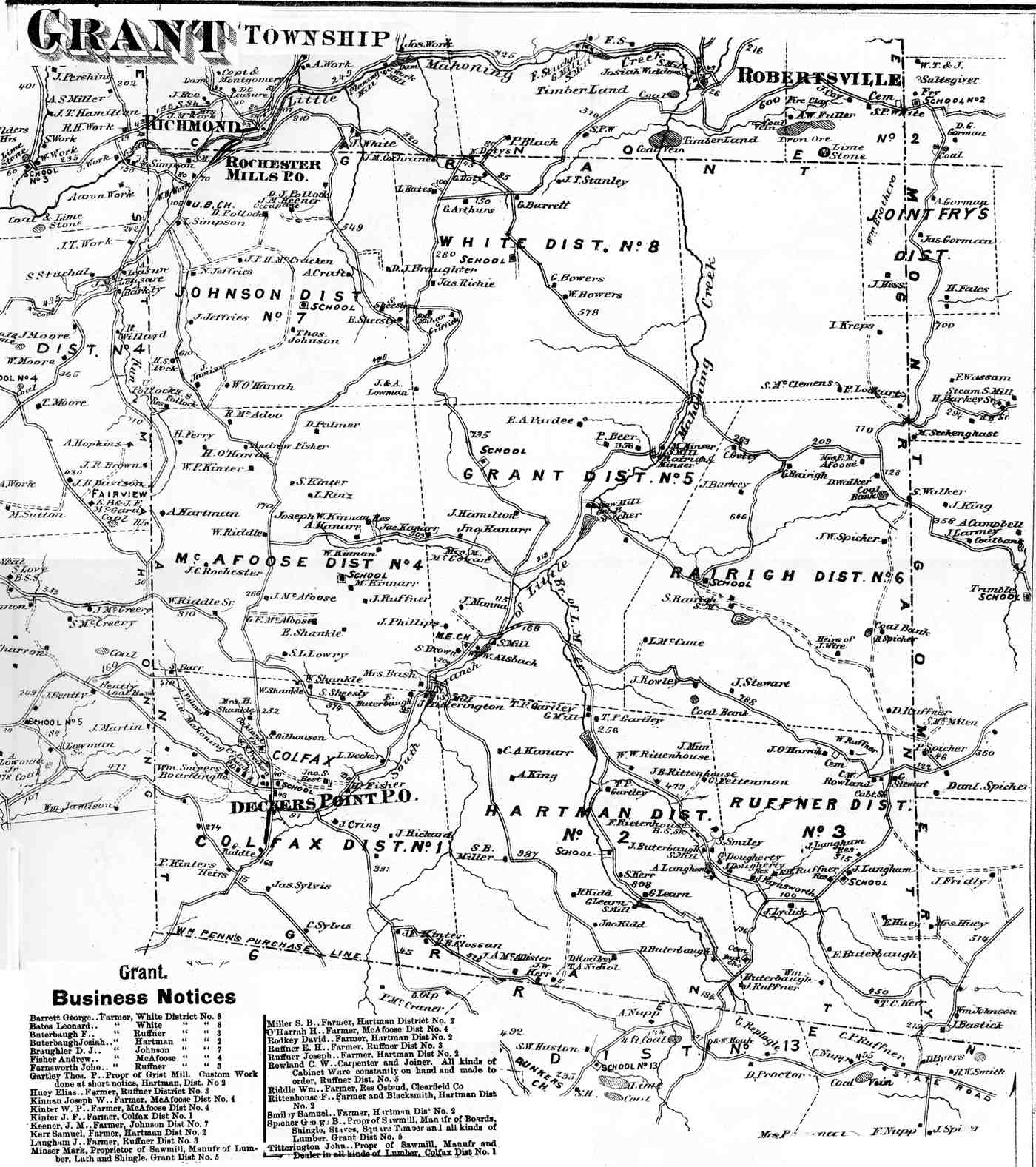
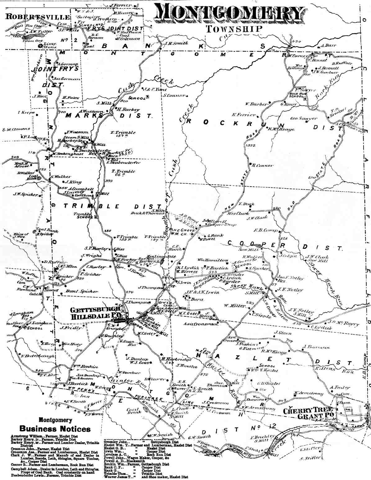
TOWNSHIP MAPS Atlas page numbers are shown in parentheses. |
||
|---|---|---|
|
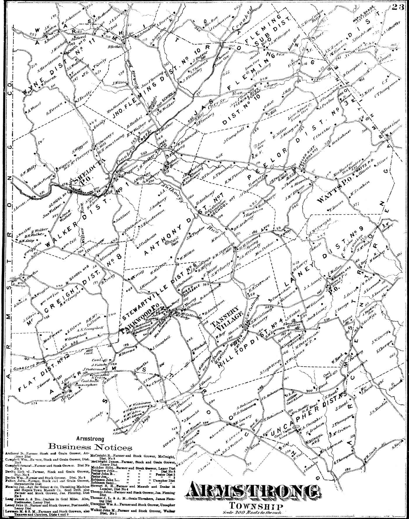
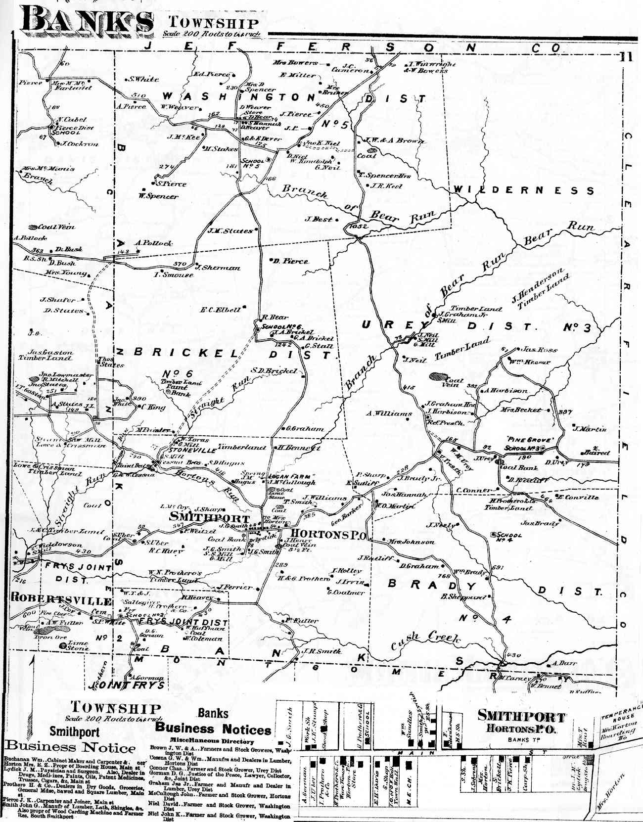
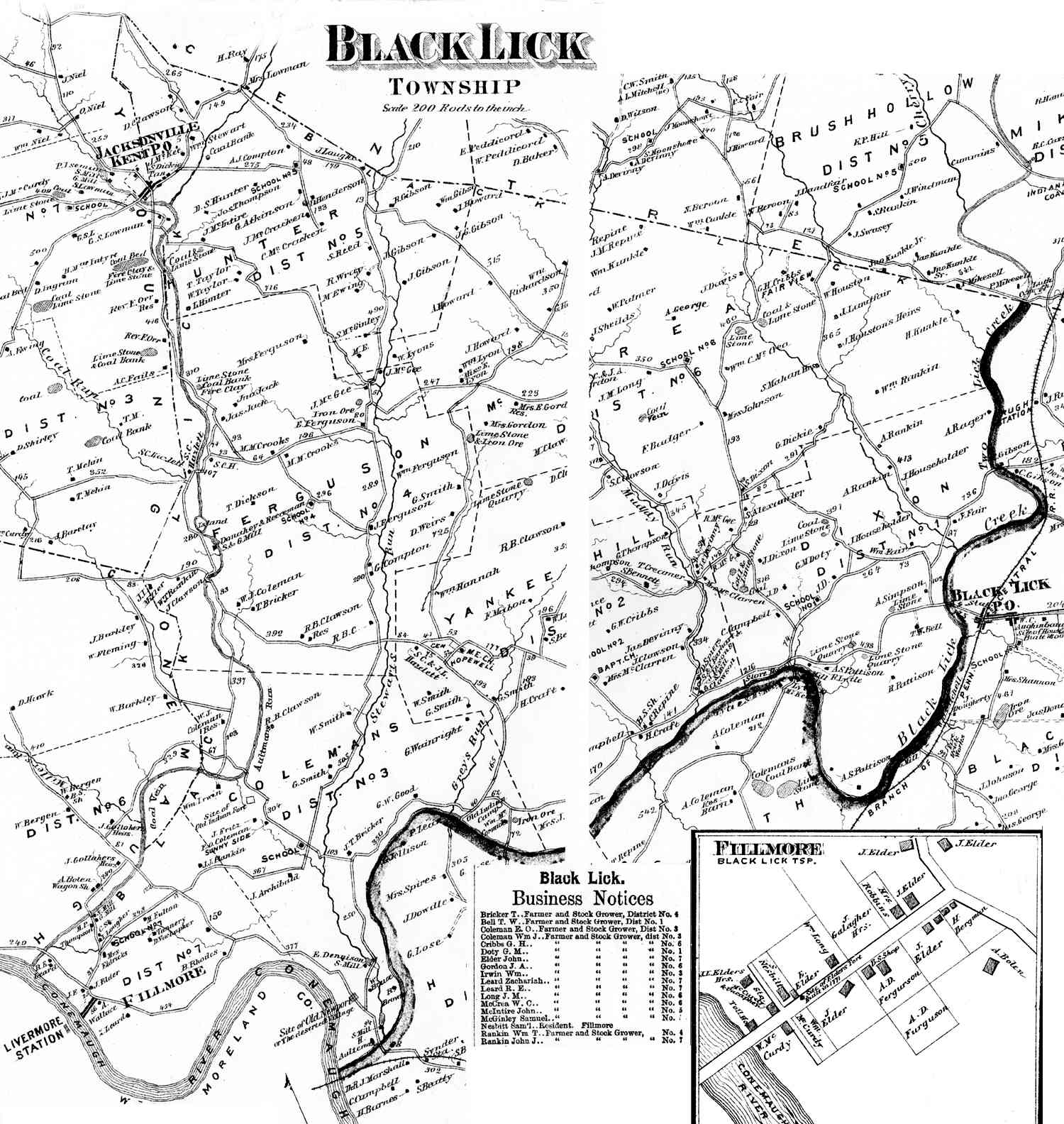
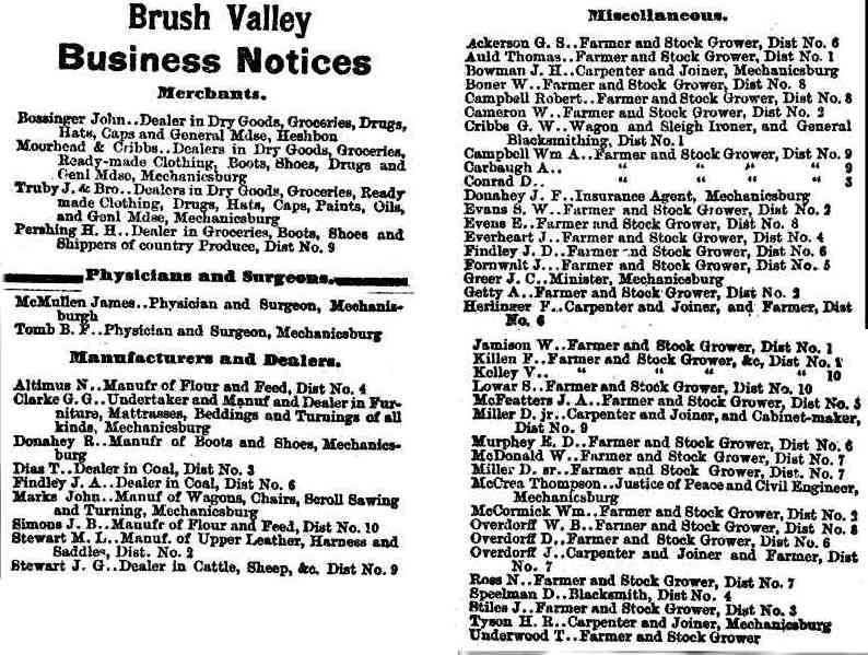
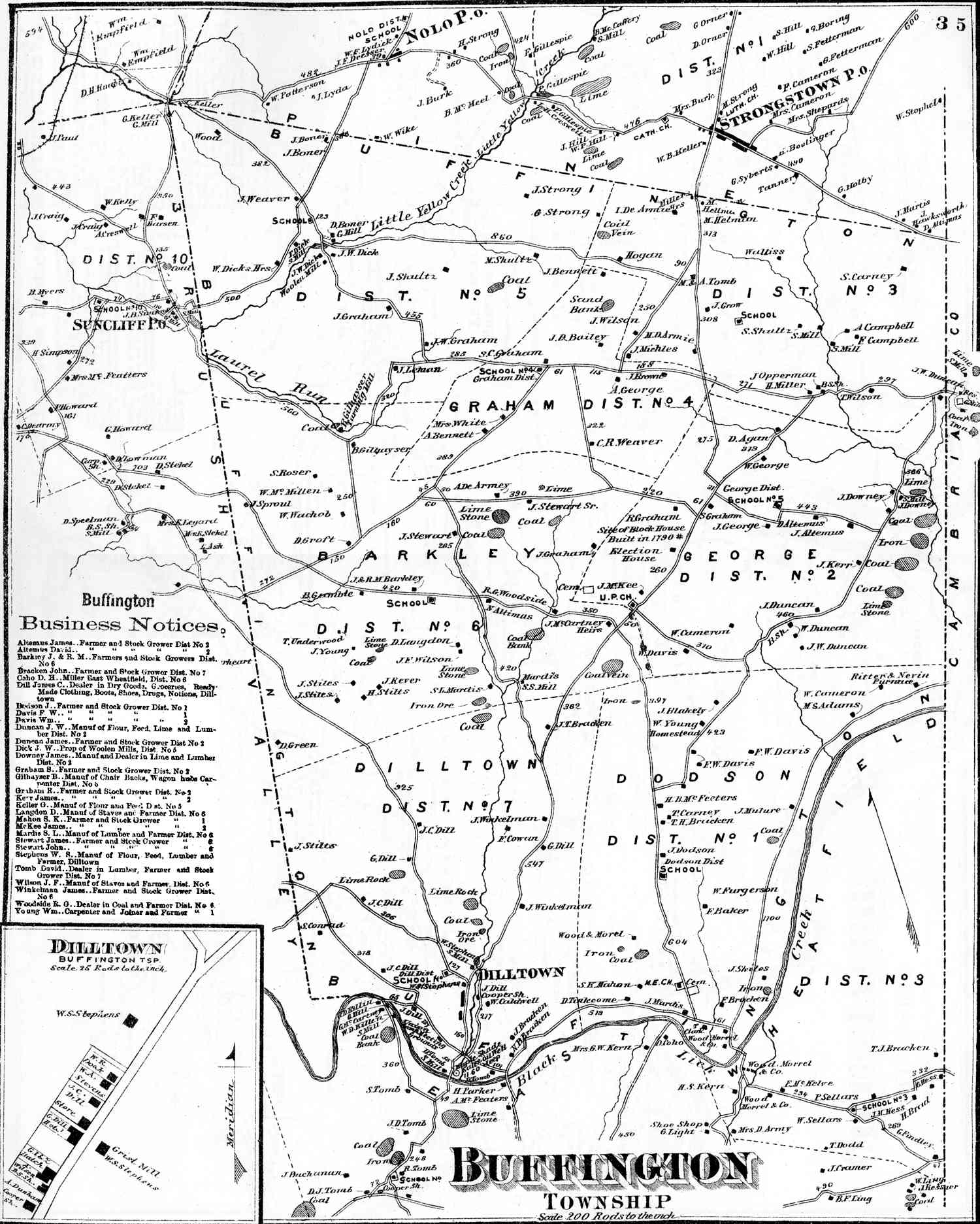
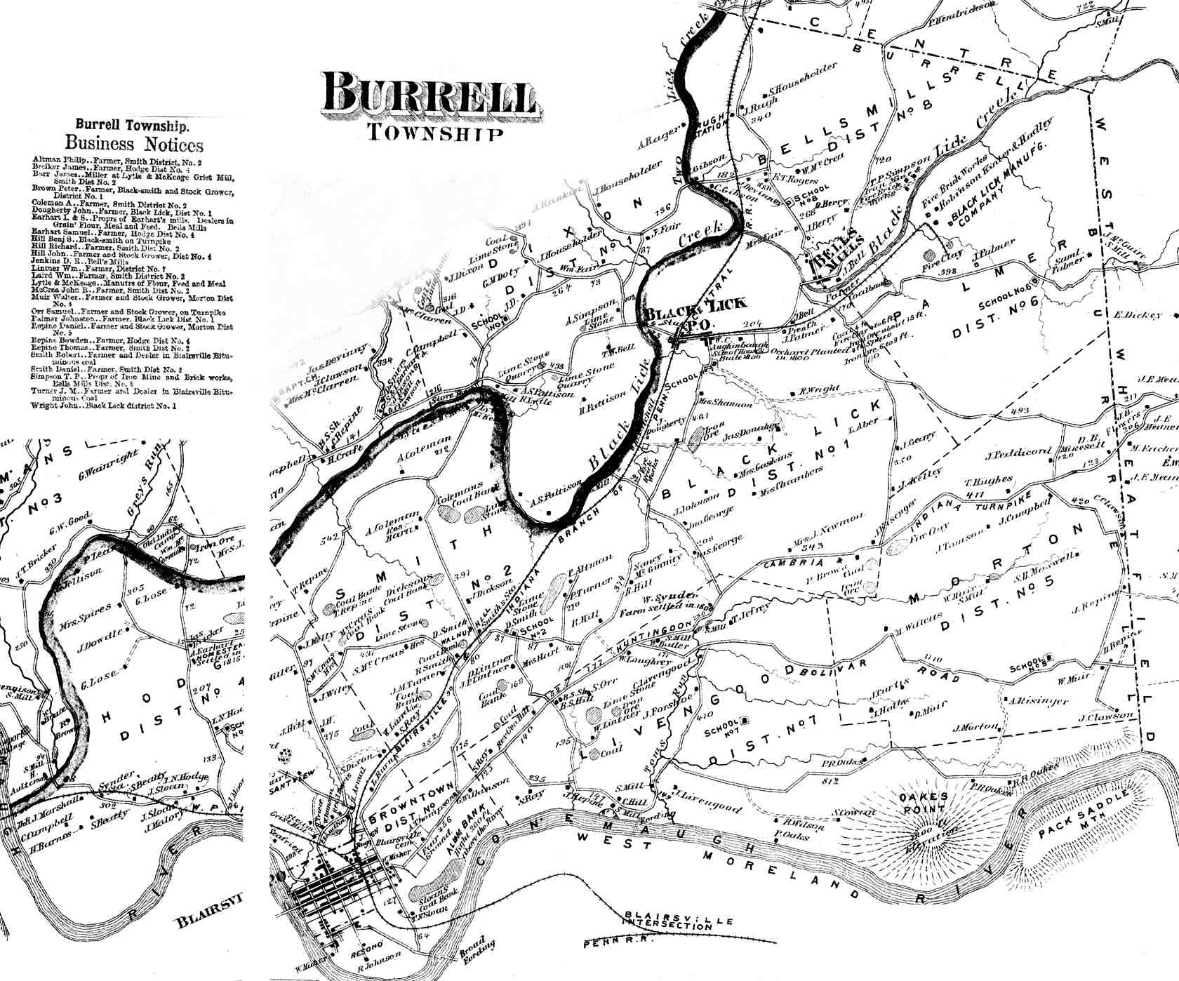
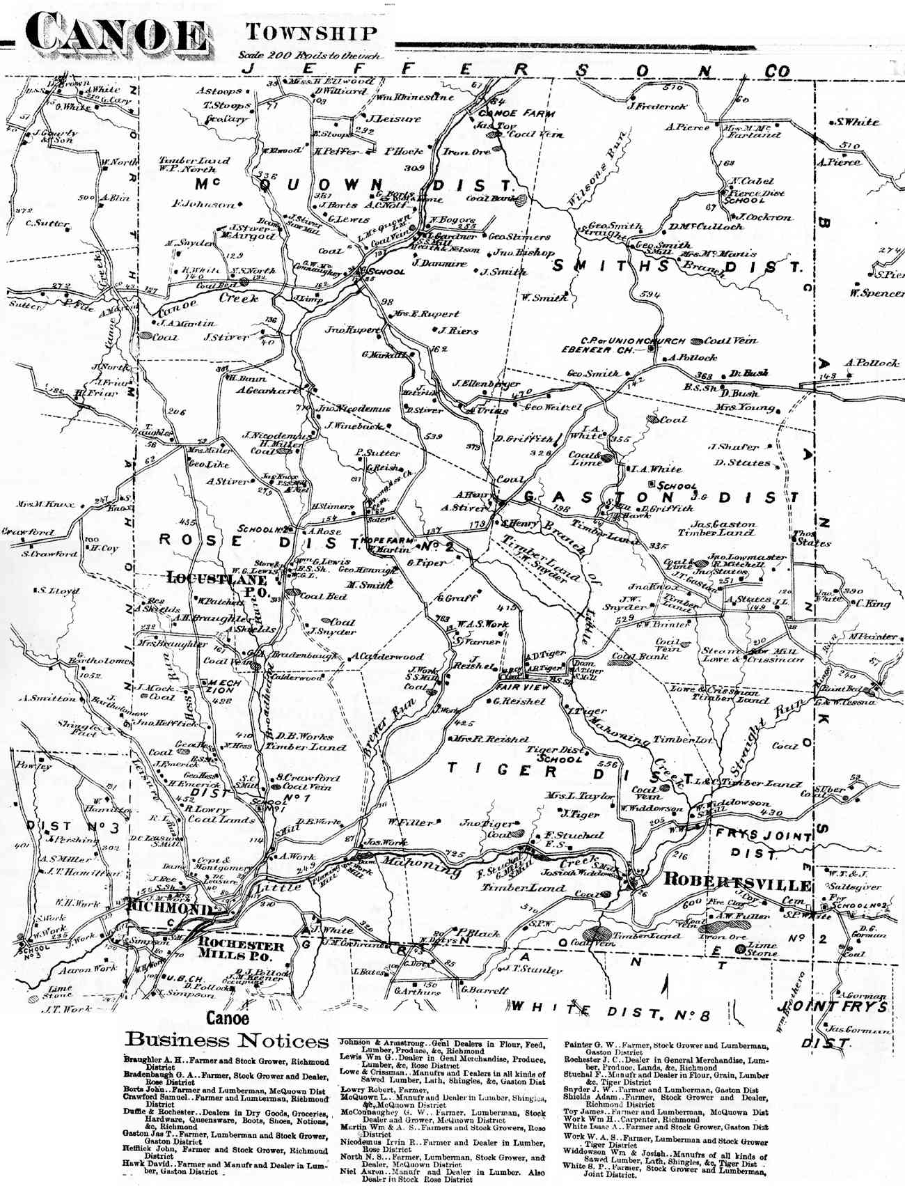
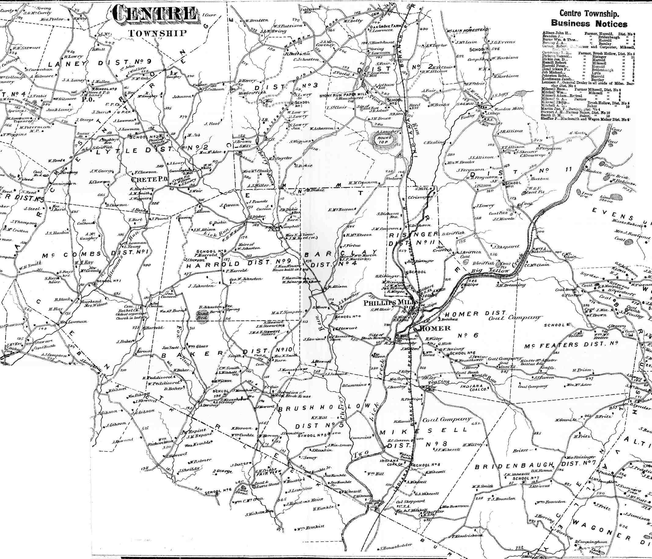
Armstrong (23) Banks (11) Black Lick (39) Brush Valley (34) Bus. Buffington (35) Burrell (40) Canoe (10) Centre (31) |
Cherry Hill (28) Conemaugh (36) East Mahoning (13) East Wheatfield (44) Grant (15) Green (21) Montgomery (16) North Mahoning (9) |
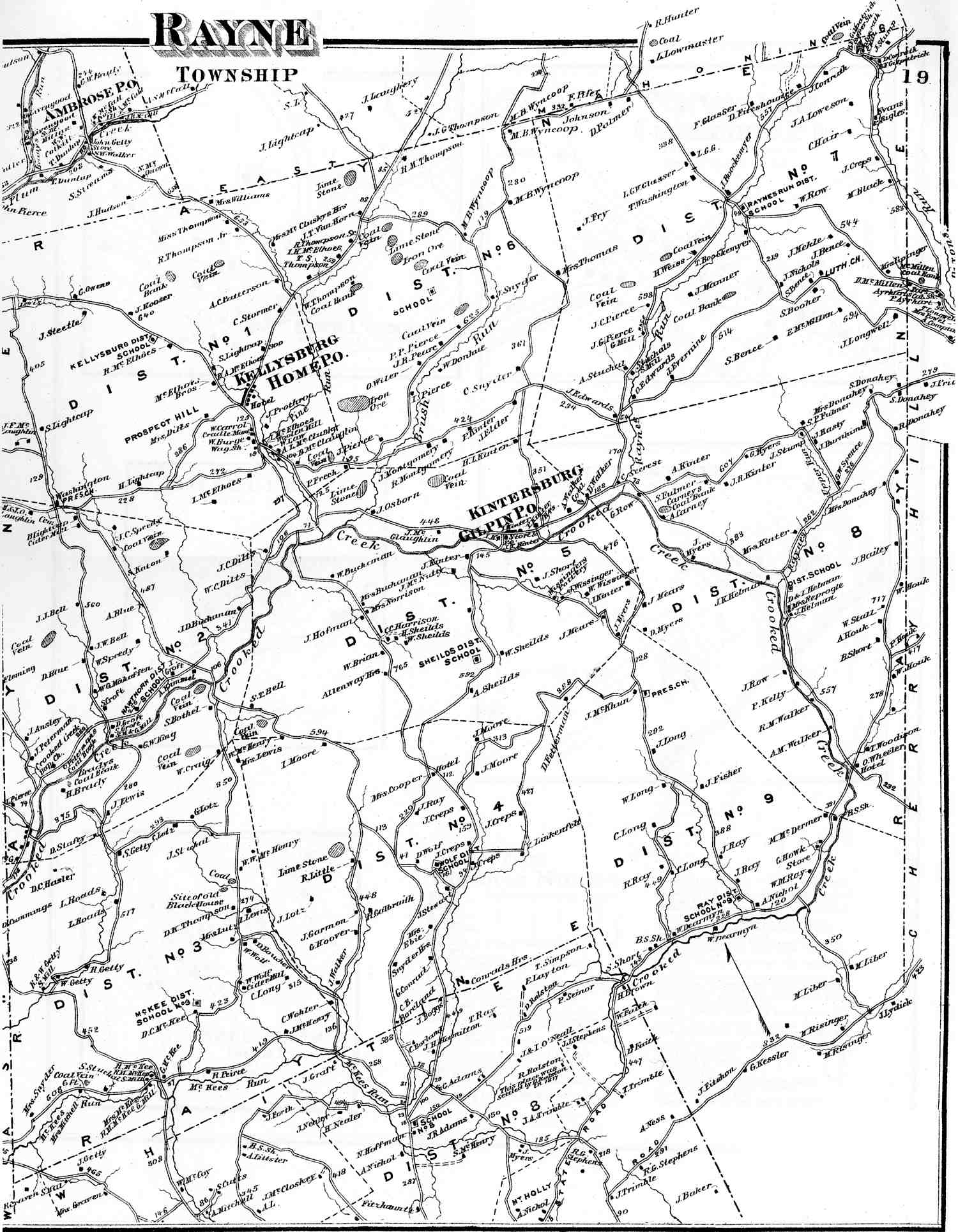
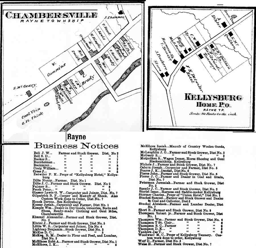
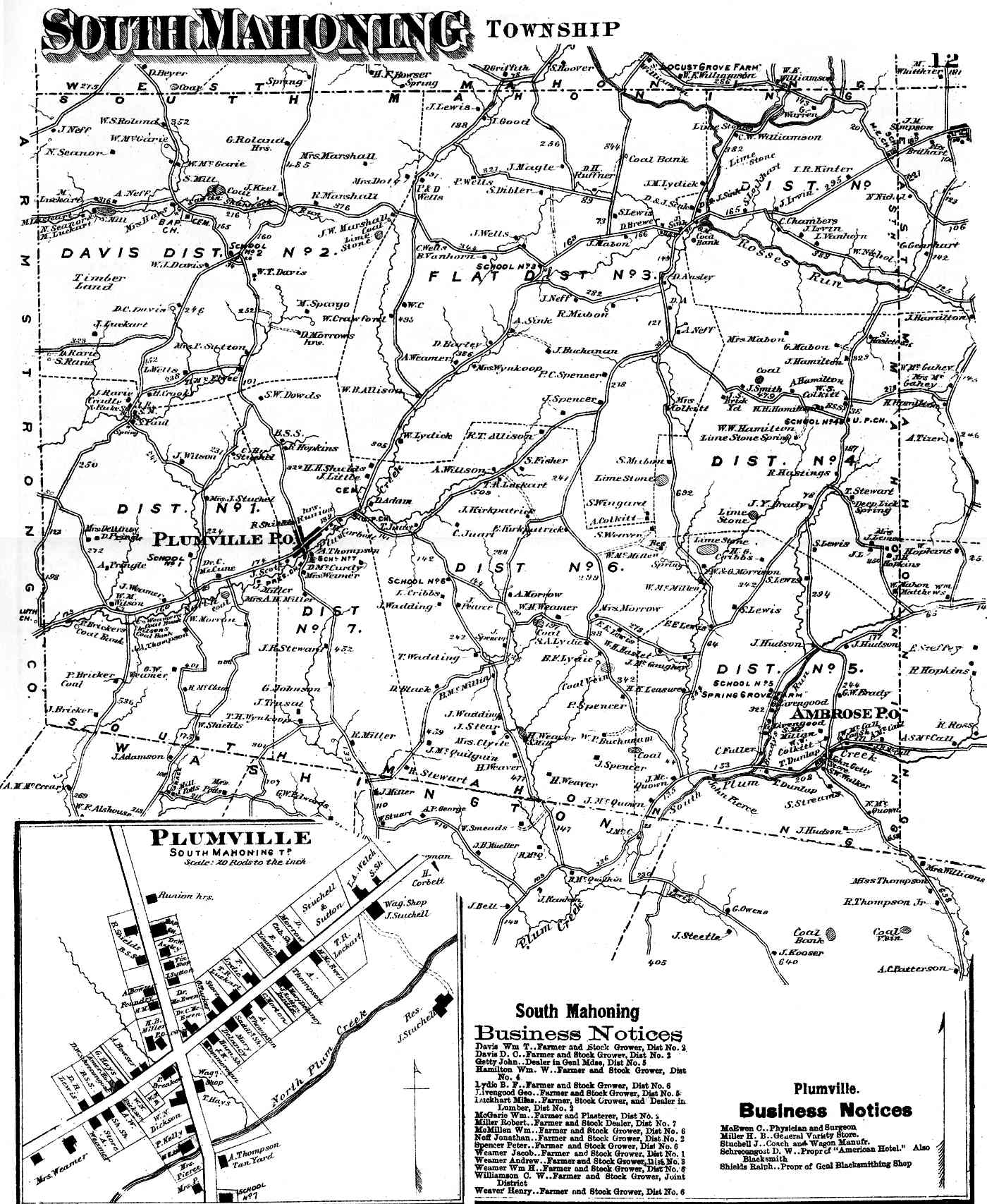
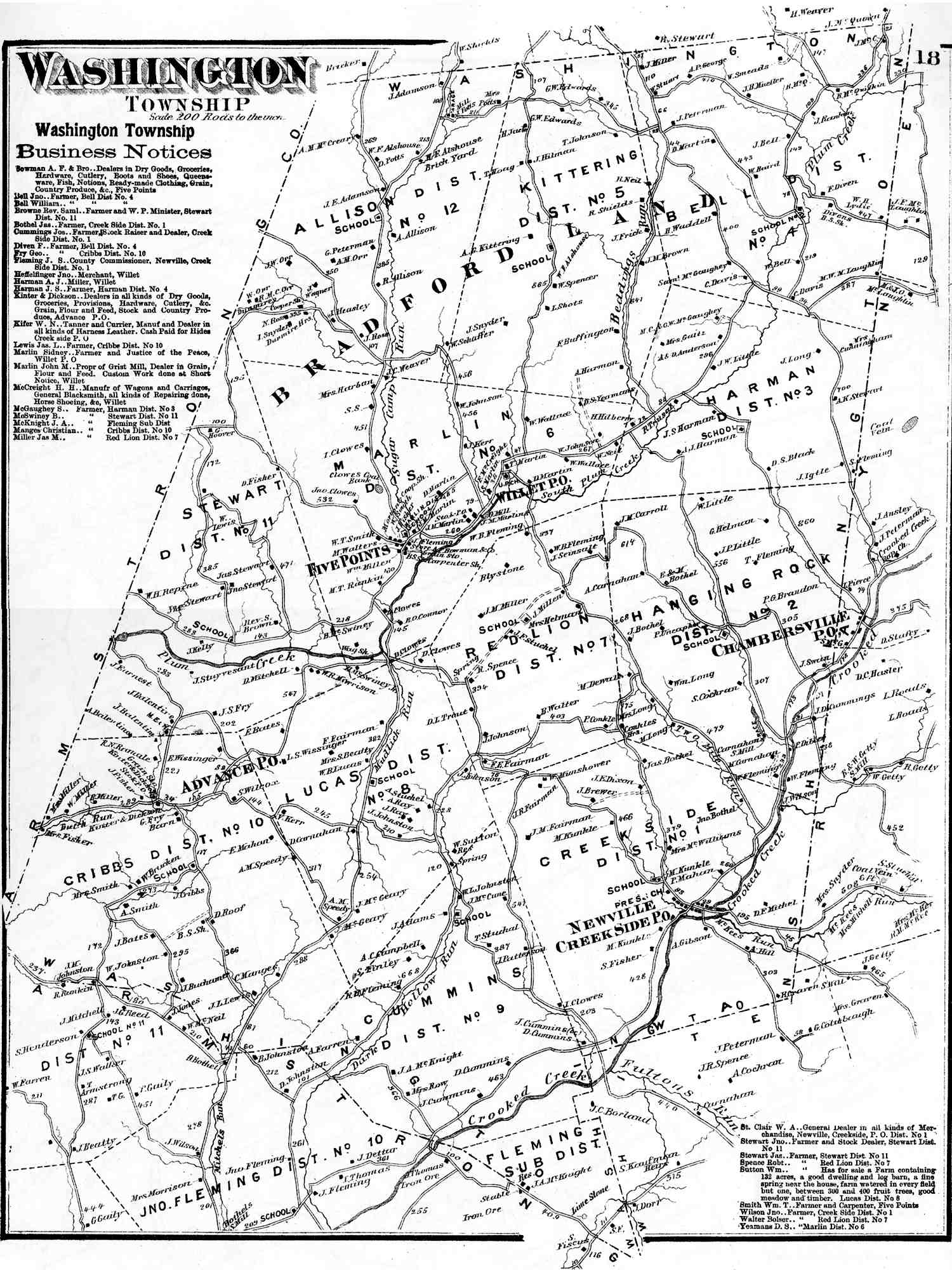
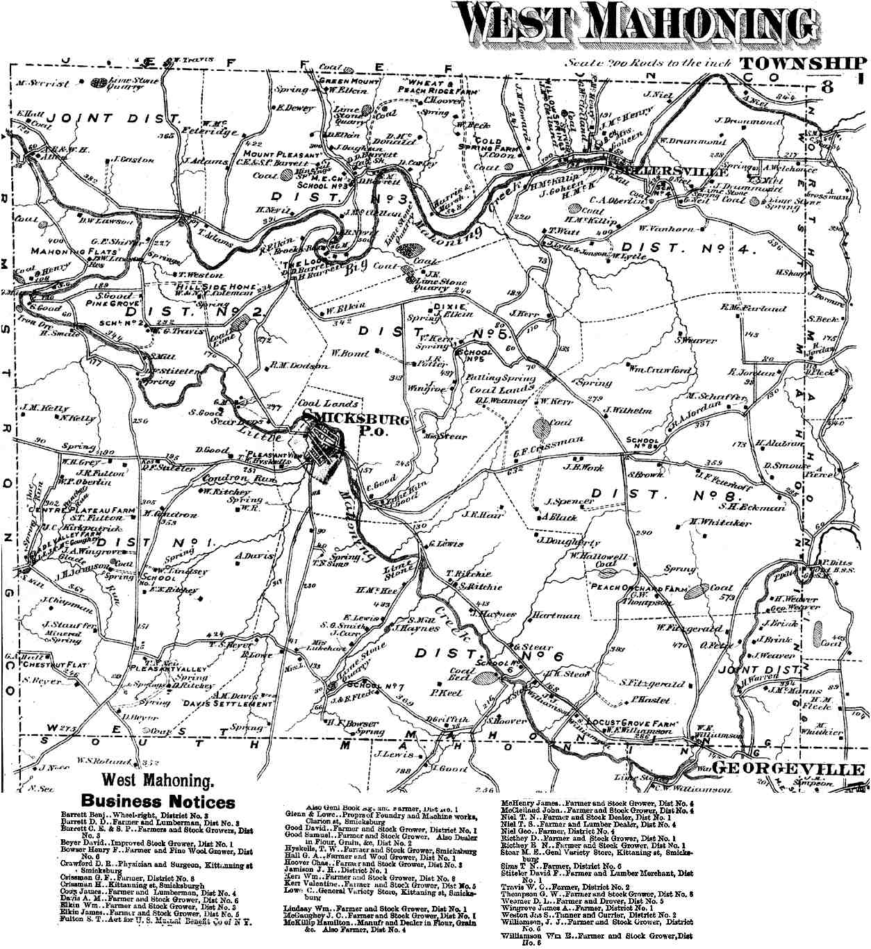
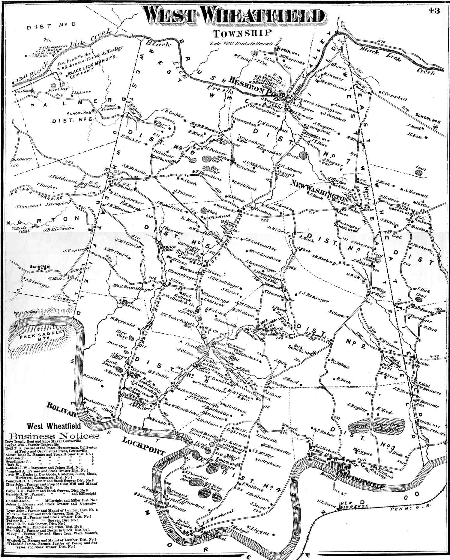
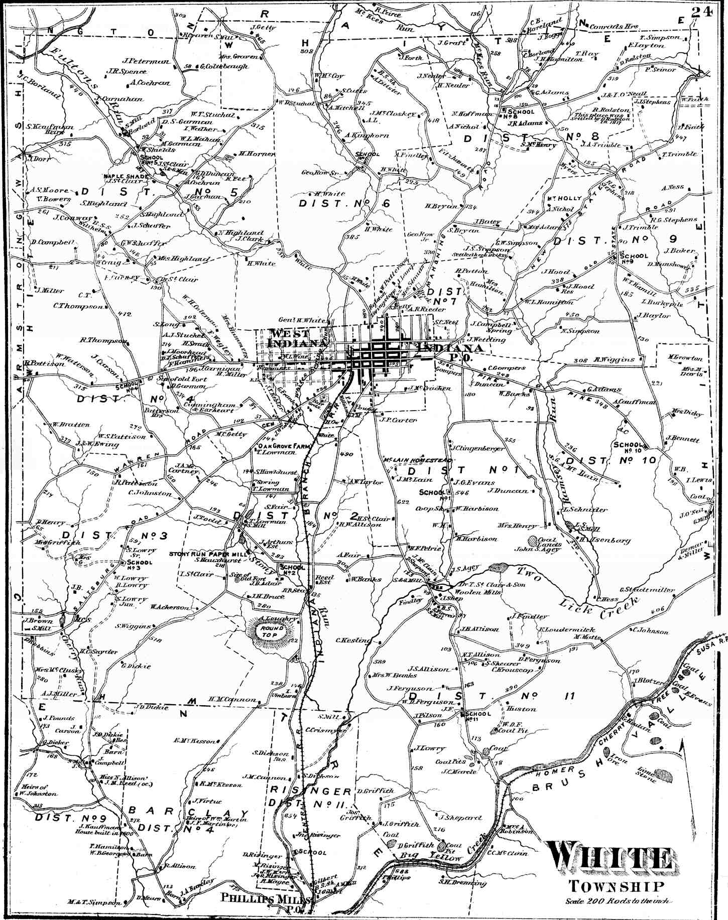
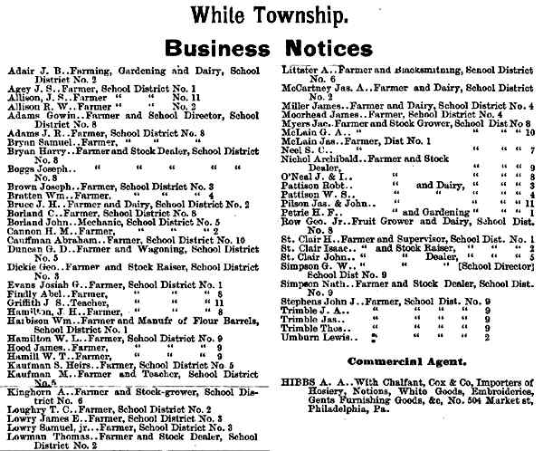
Pine (29) Bus. Rayne (19) Bus. South Mahoning (12) Washington (18) West Mahoning (8) West Wheatfield (43) White (24) Bus. Young (30) Bus. |
|
BOROUGH AND TOWN MAPS Note: Some boroughs are combined on a page or appear with the township map. |
|||
|---|---|---|---|
| TOWNS | TOWNSHIP | TOWNS | TOWNSHIP |
|
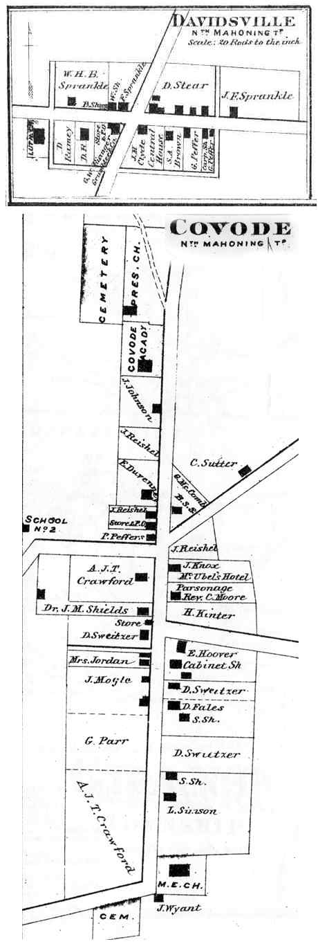
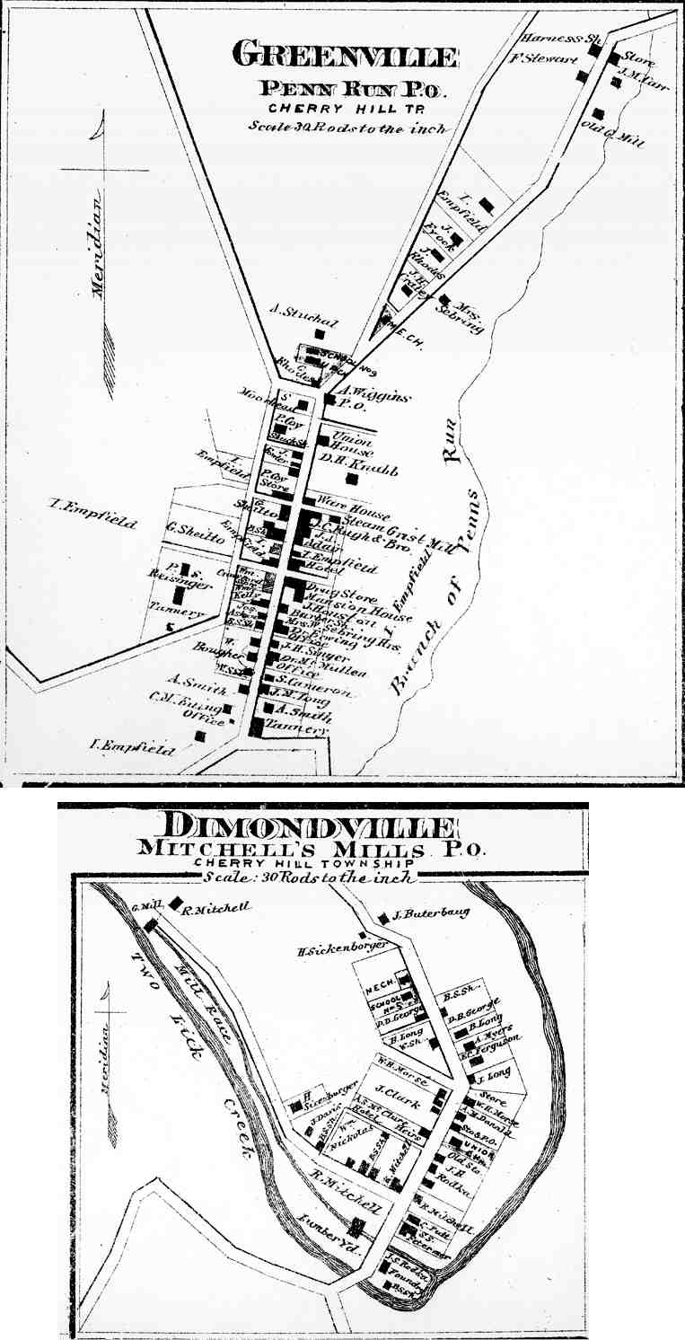
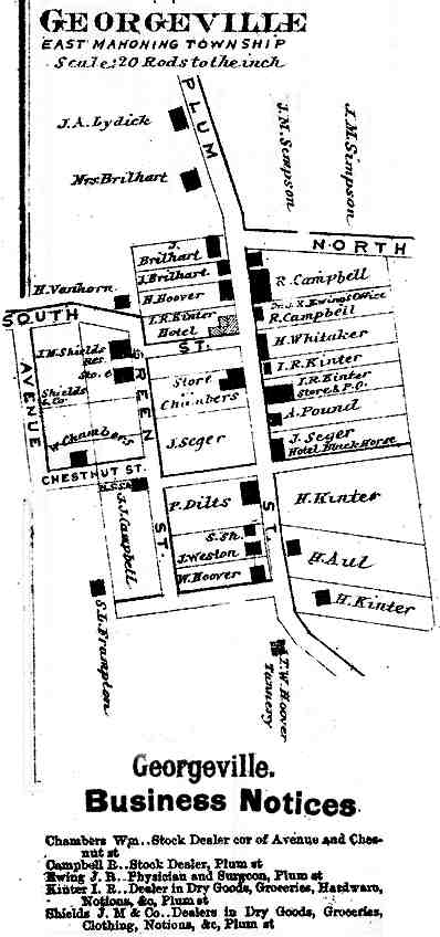
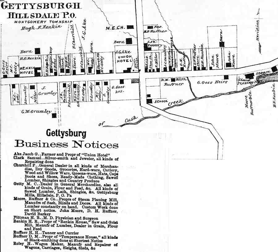
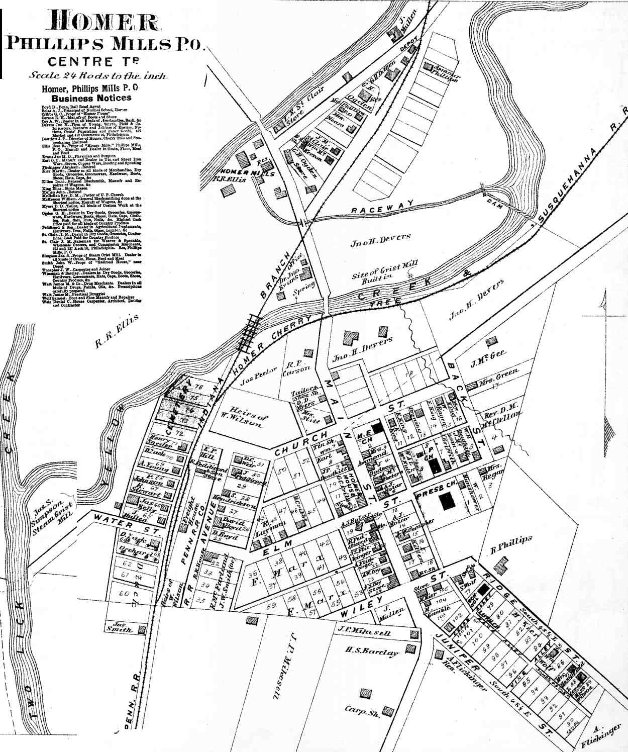
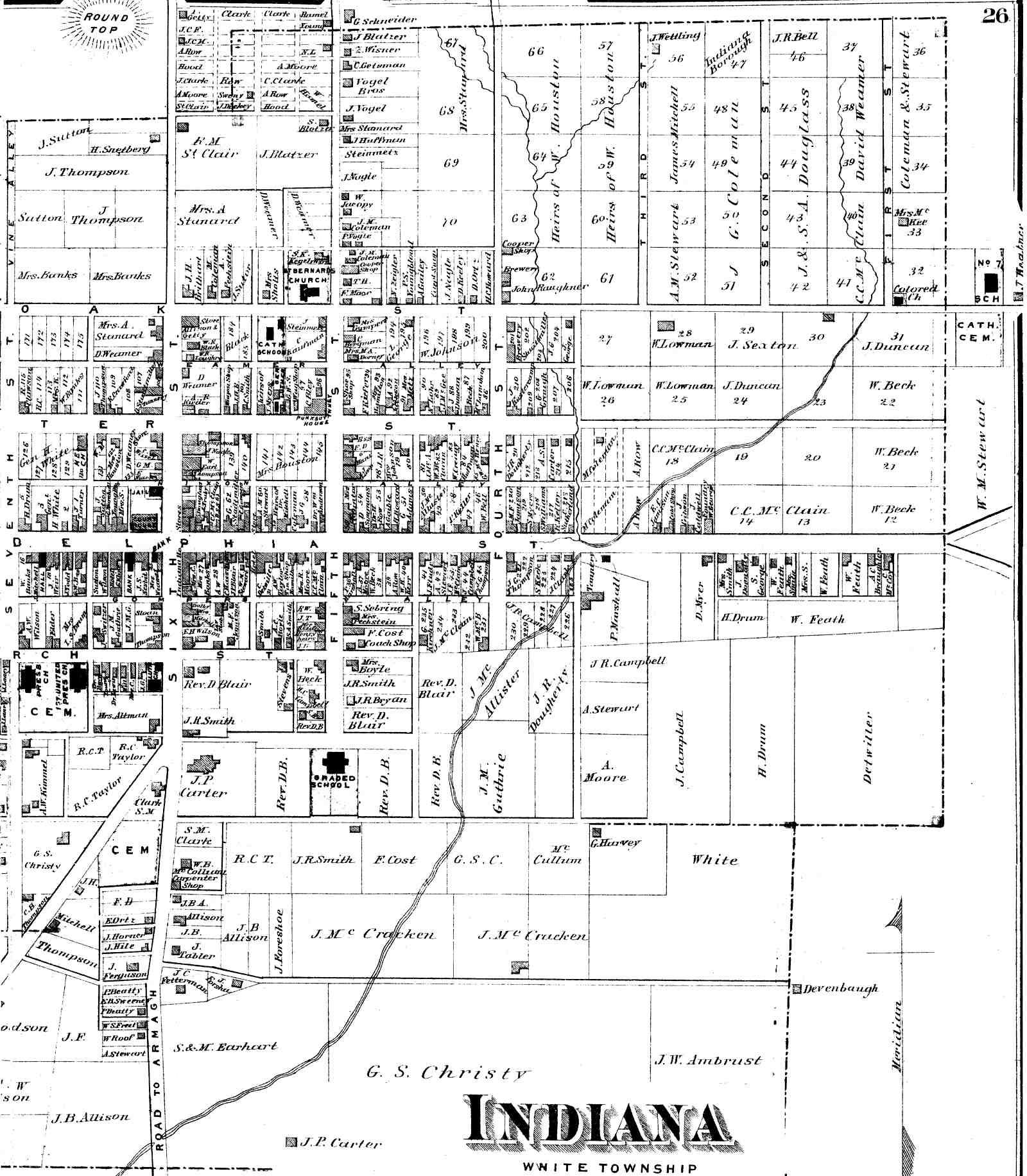
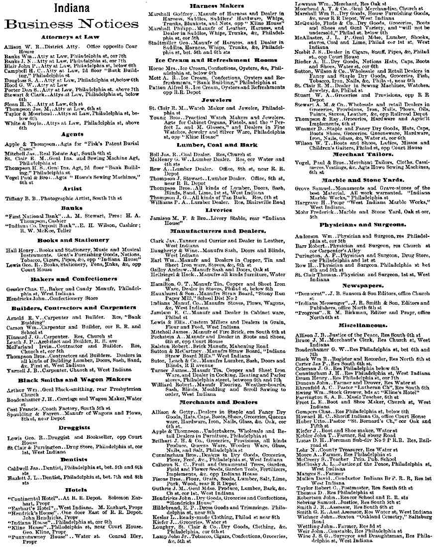
Armagh (45) Bells Mills (38) Black Lick (38) Blairsville (41) Blairsville Bus. (42) Centerville (45) Chambersville (20) Cherry Tree (17) Clarksburg (38) Colfax (15) Cookport (21) Covode (14) Davidsville (9) Dilltown (35) Dimondville (27) Fillmore (39) Five Points (20) Georgeville (13) Gettysburgh (17) Greenville (27) Homer (33) Indiana (east) (26) Indiana (west) (24) Indiana Bus. (24) |
East Wheatfield Burrell Burrell Burrell Burrell West Wheatfield Rayne Montgomery Conemaugh Grant Green North Mahoning North Mahoning Buffington Cherry Hill Black Lick Washington East Mahoning Montgomery Cherry Hill Centre White White White |
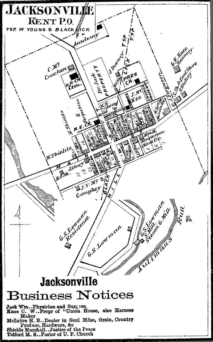
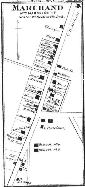
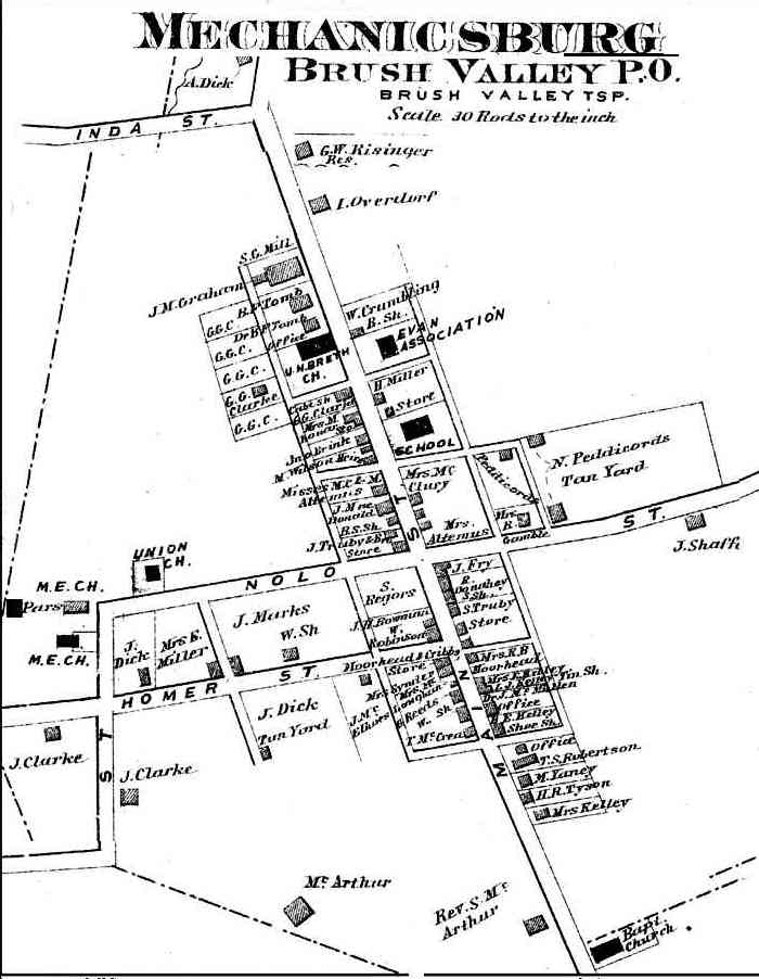
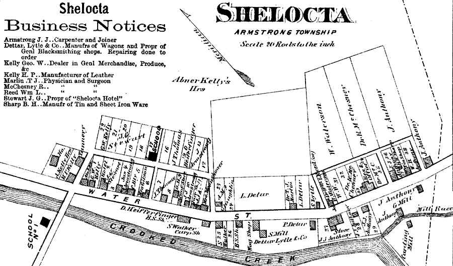
Jacksonville (39) Kellysburg (20) Kelly Station (38) Lewisville (38) Marchand (9) Marion (14) Mechanicsburg (33) Newville (20) Nineveh (45) Nolo (27) Pine Flat (21) Plumville (12) Richmond (14) Saltsburg (37) Shelocta (27) Smicksburg (8) Smithport (11) Strongstown (27) Taylorsville (21) West Indiana (26) White Co. Bus. (24) West Lebanon (31) Willet (20) |
Black Lick Rayne Conemaugh Conemaugh North Mahoning East Mahoning Brush Valley Washington East Wheatfield Pine Green South Mahoning Canoe Conemaugh Armstrong West Mahoning Banks Pine Green White White Young Washington |
Click on map to see larger map.