
|
The USGenWeb Archives Digital Map Library
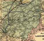
Ohio State Maps

The Ohio Digital Map Library is part of the United States Digital Map
Library.
This project and its all-volunteer staff are dedicated to free, online
access for the general public. We rely on contributions, and if you
would like to be part of the Digital Map Library team, make
contributions, have questions about our copyright policy, or the use of
our graphics, please visit our Contributor & Copyright Page.
Our map graphics require long download times because the file sizes are quite large. Although they are normally around 500k or
less, they can run as high as 1.5 megs. If you experienced difficulty with downloading any of the maps, please visit our
Advice Page.
State Maps
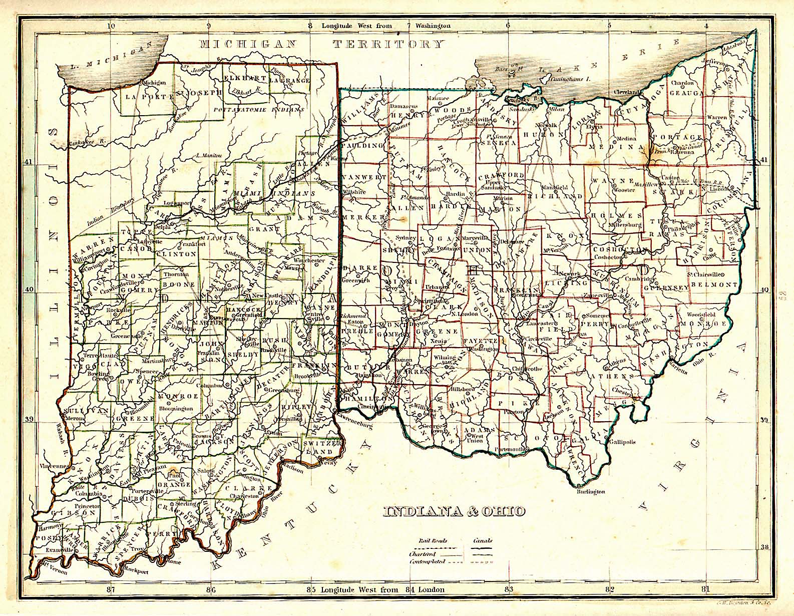
Indiana and Ohio - 1835 (501 kb)
Covering all the counties.
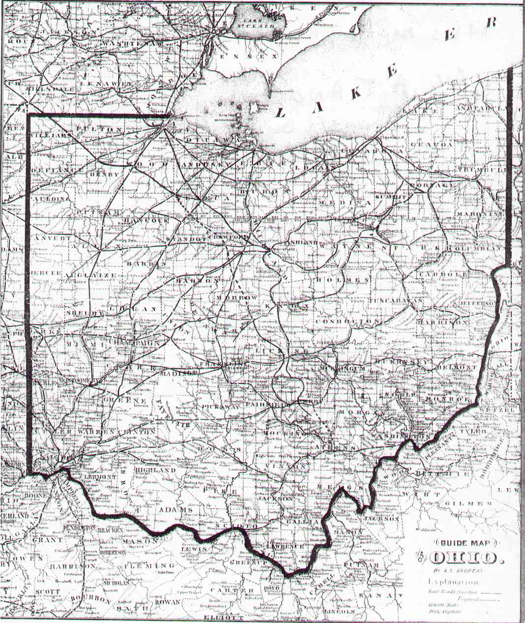
Guide Map of Ohio - 1873 (220 kb)
By A. T. Andreas
Lakeside Building Cor. Clark and Adams St.
Chicago, Ill.
Mitchell Map of North America - 1851
Copyright 1839, Printed 1851. Published by Thomas, Cowperthwait & Co., Philadelphia 1851.
Donated by Dean Williams
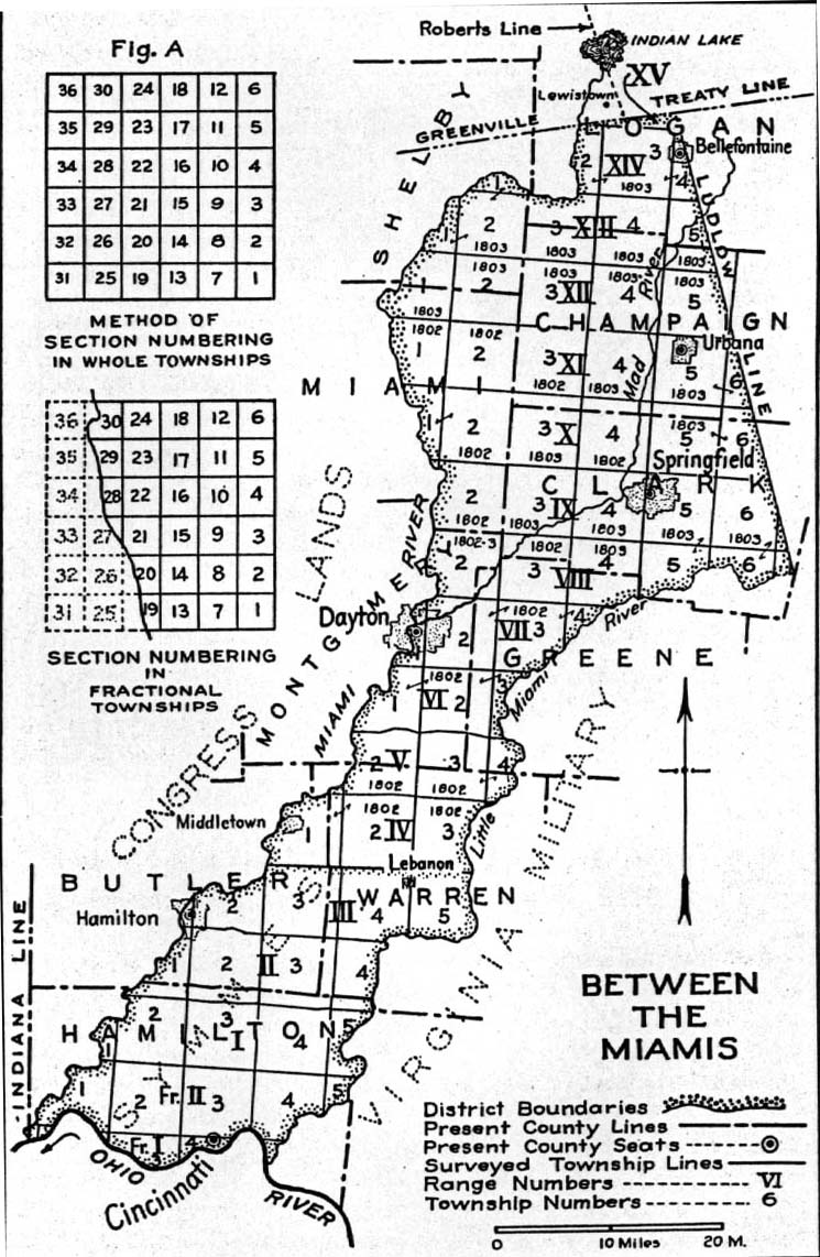
Between the Miamis (192 KB)
Covering parts of Butler, Champaign, Clark, Greene, Hamiton, Logan and Warren Counties.
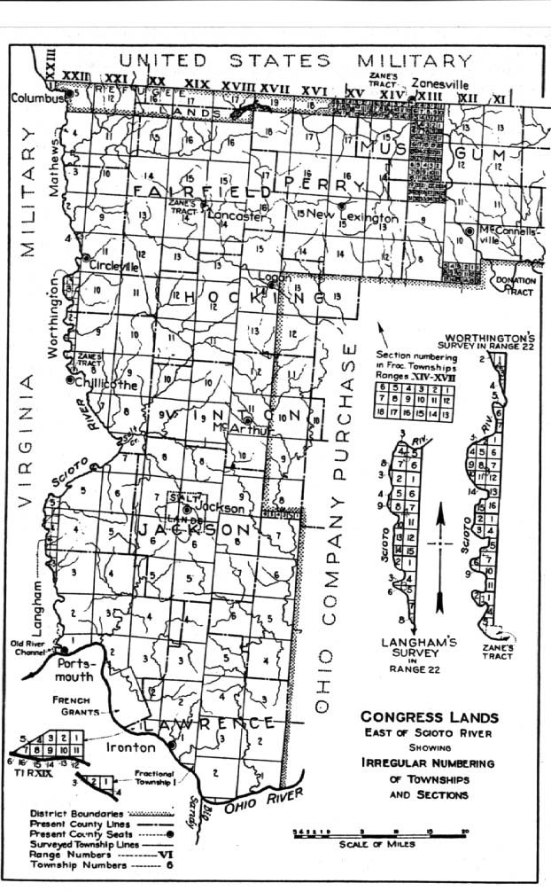
Congress Lands - East, Act of 1796 (163 KB)
Covering Fairfield, Hocking, Jackson, Lawrence, Muskingum, Perry and Vinton Counties
Congress Lands - West, Act of 1796 (176 KB)
Covering parts of Butler, Darke, Hamilton, Logan, Miami, Montgomery, Preble, and Shelby Counties.
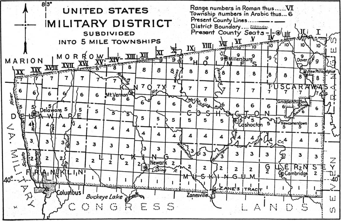
US Military District Map (194 KB)
Covering Coshocton, Delaware, Franklin, Guernsey, Holmes, Knox, Licking, Muskingum and Tuscarawas Counties.
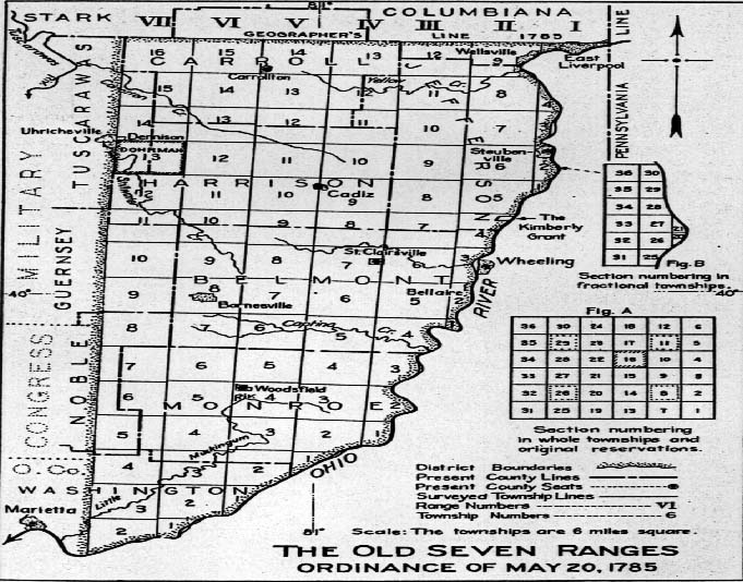
The Old Seven Ranges, ordinance of May 20, 1785 (117 KB)
Covering Belmont, Carroll, Harrison, Jefferson, Monroe and Washington Counties.
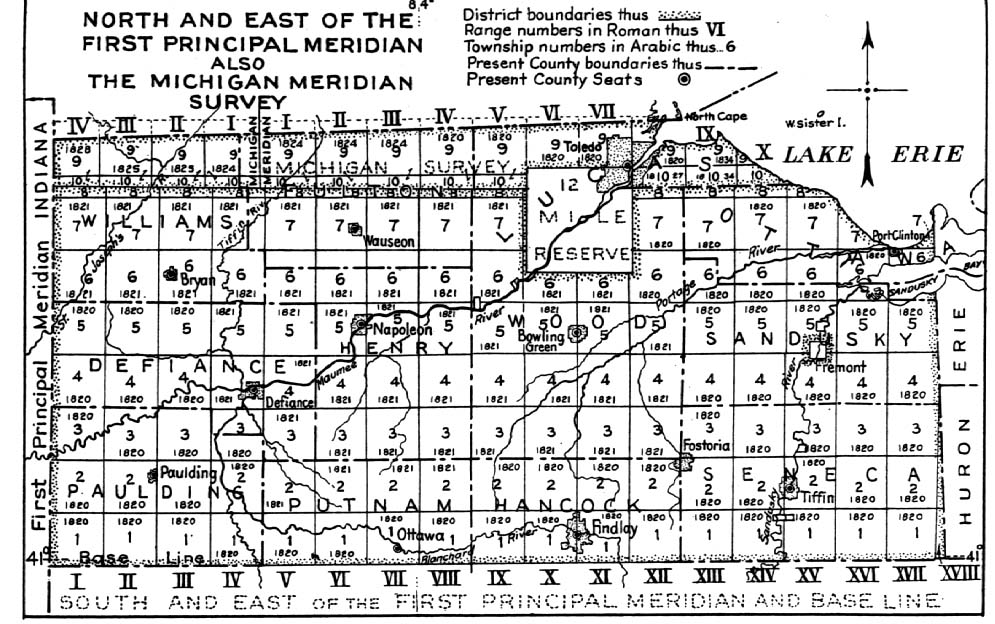
N & E of the First Principal Meridian and also the Michigan Meridian Survey
(194 KB)
Covering Defiance, Fulton, Hancock, Henry, Lucas, Ottawa, Sandusky, Seneca, Paulding, Putnam, Williams and Wood Counties.
Ranges and Townships Based on Pennsylvania Line and Ohio River (141 KB)
Covering Athens, Ashland, Belmont, Carroll, Crawford, Columbiana, Counties.
Virgina Military District
Covering Adams, Brown, Champaign, Clermont, Clinton, Delaware, Fayett, Franklin, Greene, Hardin, Logan, Madison, Pickaway, Pike,
Ross, Scioto and Warren Counties.
County Maps
Adams *
Allen *
Ashland *
Ashtabula *
Athens *
Auglaize
Belmont *
Brown *
Buttler
Carroll *
Champaign *
Clark *
Clermont *
Clinton
Columbiana *
Coshocton *
Crawford *
Cuyahoga
Darke *
Defiance *
Delaware
Erie
Fairfield *
Fayette *
Franklin *
Fulton
Gallia *
Geauga *
Green *
Guernsey
Hamilton *
Hancock *
Hardin *
Harrison *
Henry
Highland *
Hocking *
Holmes *
Huron
Jackson *
Jefferson
Knox
Lake *
Lawrence *
Licking *
Logan *
Lorain *
Lucas
Madison *
Mahoning *
Marion *
Medina *
Meigs *
Mercer
Miami *
Monroe *
Montgomery *
Morgan *
Morrow *
Muskingum
Nobel
Ottawa
Paulding *
Perry *
Pickaway *
Pike *
Portage *
Preble *
Putnam
Richland *
Ross
Sandusky *
Scioto *
Seneca *
Shelby *
Stark *
Summit
Trumbull *
Tuscarawas
Union
Van Wert *
Vinton
Warren *
Washington *
Wayne *
Williams *
Wood *
Wyandot
Early Town Maps
Croghanville - 1816

|
Other Ohio Links
|

|
Joy Fisher
Coordinator
Rebecca Maloney
Special Projects Representative
© 1999- The USGenWeb Archives Digital Map Library
|
