
|
The USGenWeb Archives Digital Map Library
- Maryland State Maps
State Map Coordinator

The
Maryland Digital Map Library
If you would like to be part of the Digital Map Library team, please e-mail
Rebecca Maloney To make contributions
email the State Map Coordinator, your contributions are both needed and appreciated!
Maryland State Maps
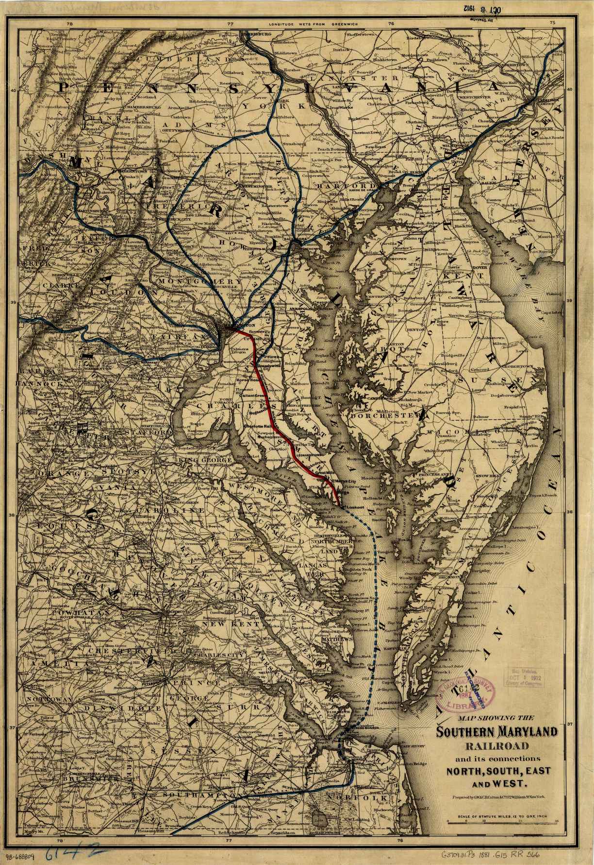
Southern Maryland RailRoad and its connections[c. 1881]
By G. W. & C. B. Colton & Co.
Scan courtesy of Library of Congress,
American Memory website.
This is a public domain map. This map of Maryland was converted
from a 6,384k Mr Sid (.sid) formatted file. We greatly reduced the file size by JEPG compression.
You may save on a new 3.5" floppy disks.
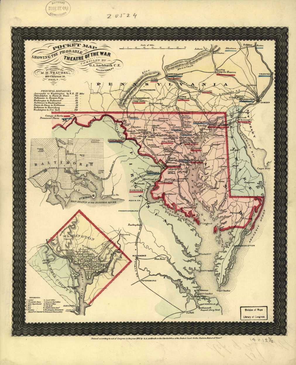
Pocket Map Showing the Probable Theater of War [c. 1861]
By G. A. Aschbach C. E.
Scan courtesy of Library of Congress,
American Memory website.
This is a public domain map. This map of Maryland was converted
from a 3,695k Mr Sid (.sid) formatted file. We greatly reduced the file size by JEPG compression.
You may save on a new 3.5" floppy disks.
Maryland County Maps

|
Other Maryland Links
|

|
-
This page was last updated Sunday, 14-Nov-2021 18:16:08 EST
Copyright © 1999 - USGenWeb Archives Project
|
