Your contributions to the Illinois Digital Map Library are both needed and appreciated!
Illinois State Maps
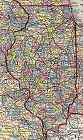
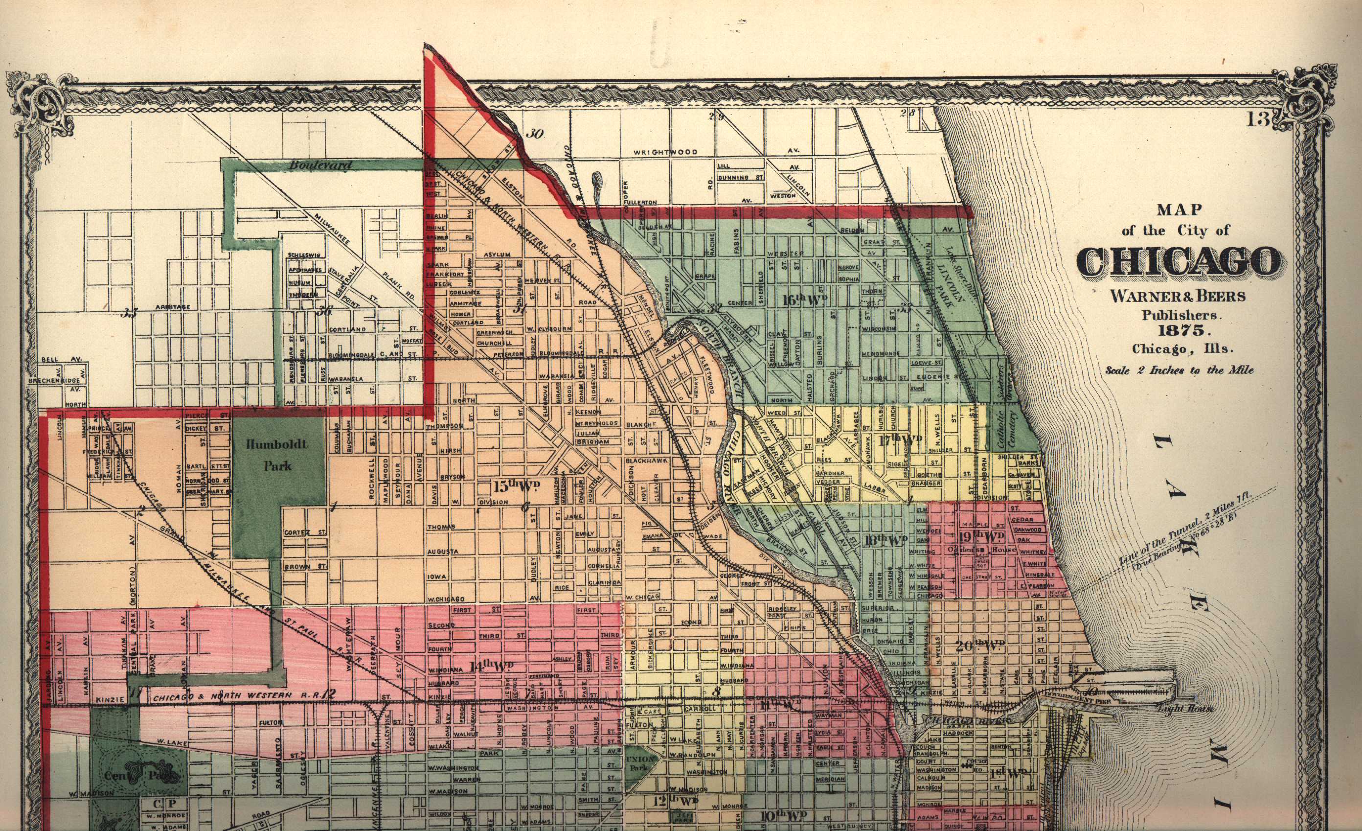
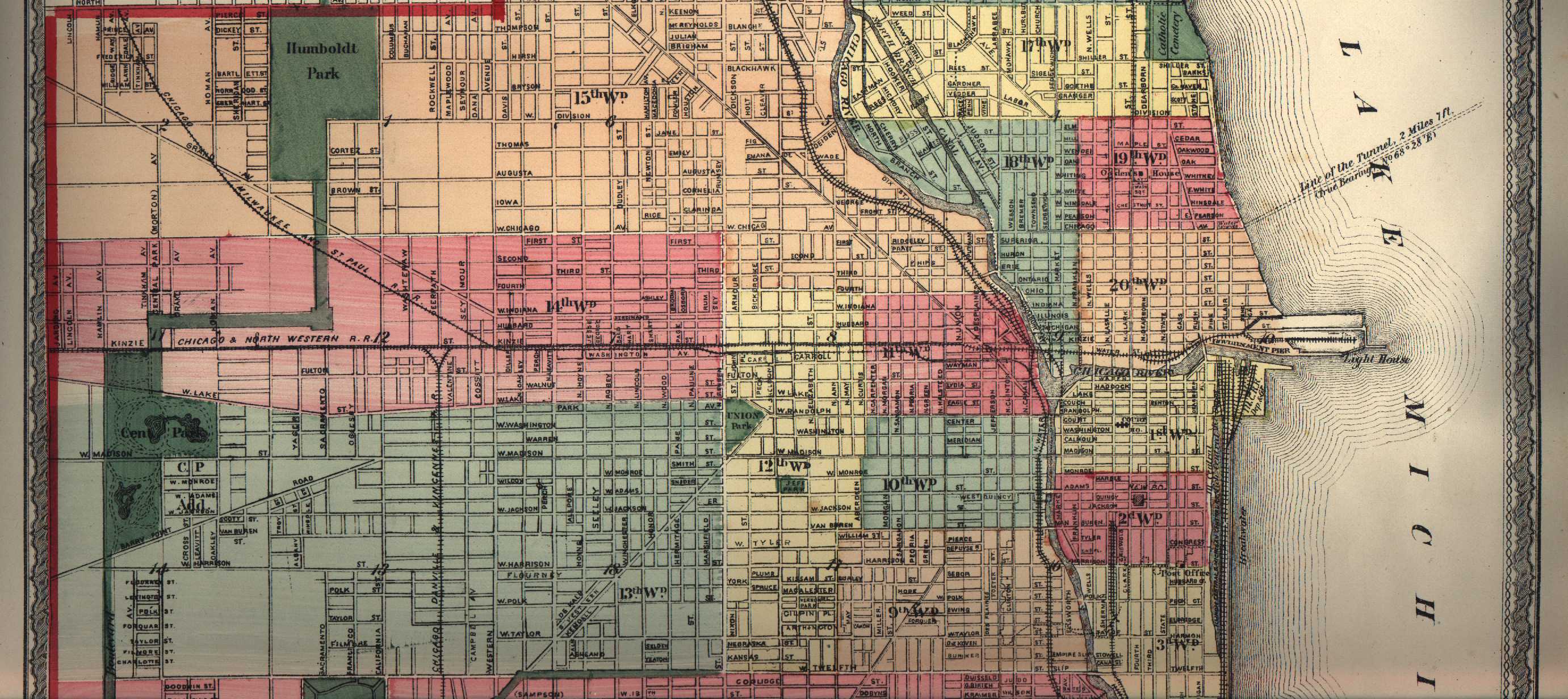
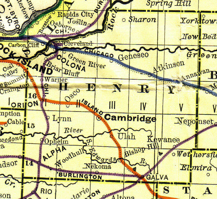
Illinois, 1875, 971k.
Source: "Atlas of Henry Co. Illinois to Which is Added an Atlas of the United States," Warner & Beers Publishers, Chicago, 1875. Submitted to ILGenWeb by
Alice Gless.
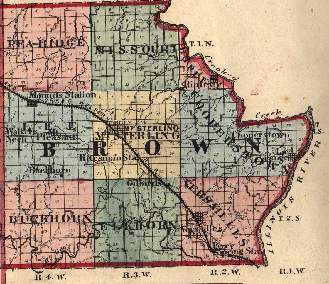
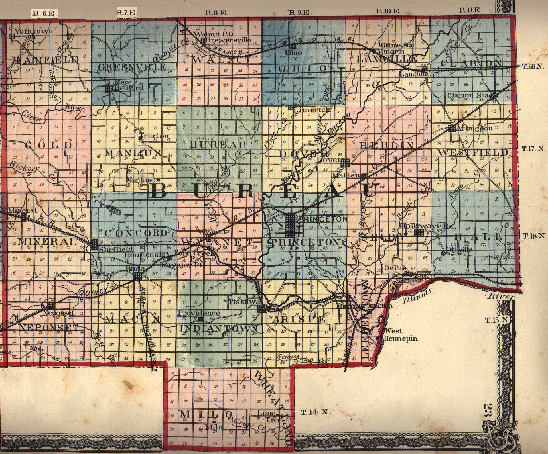
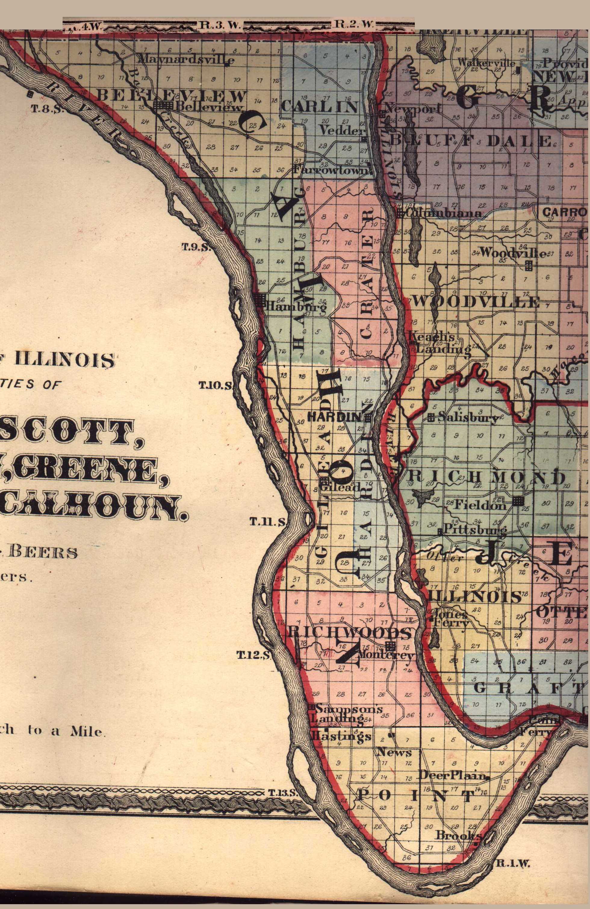
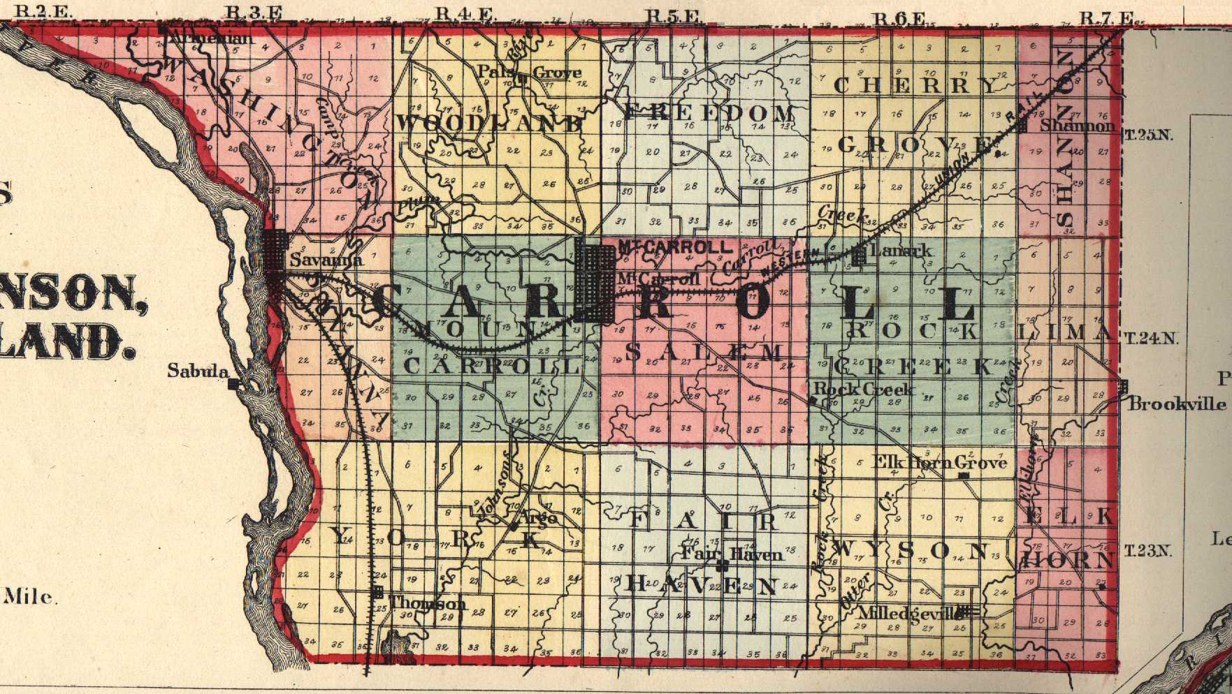
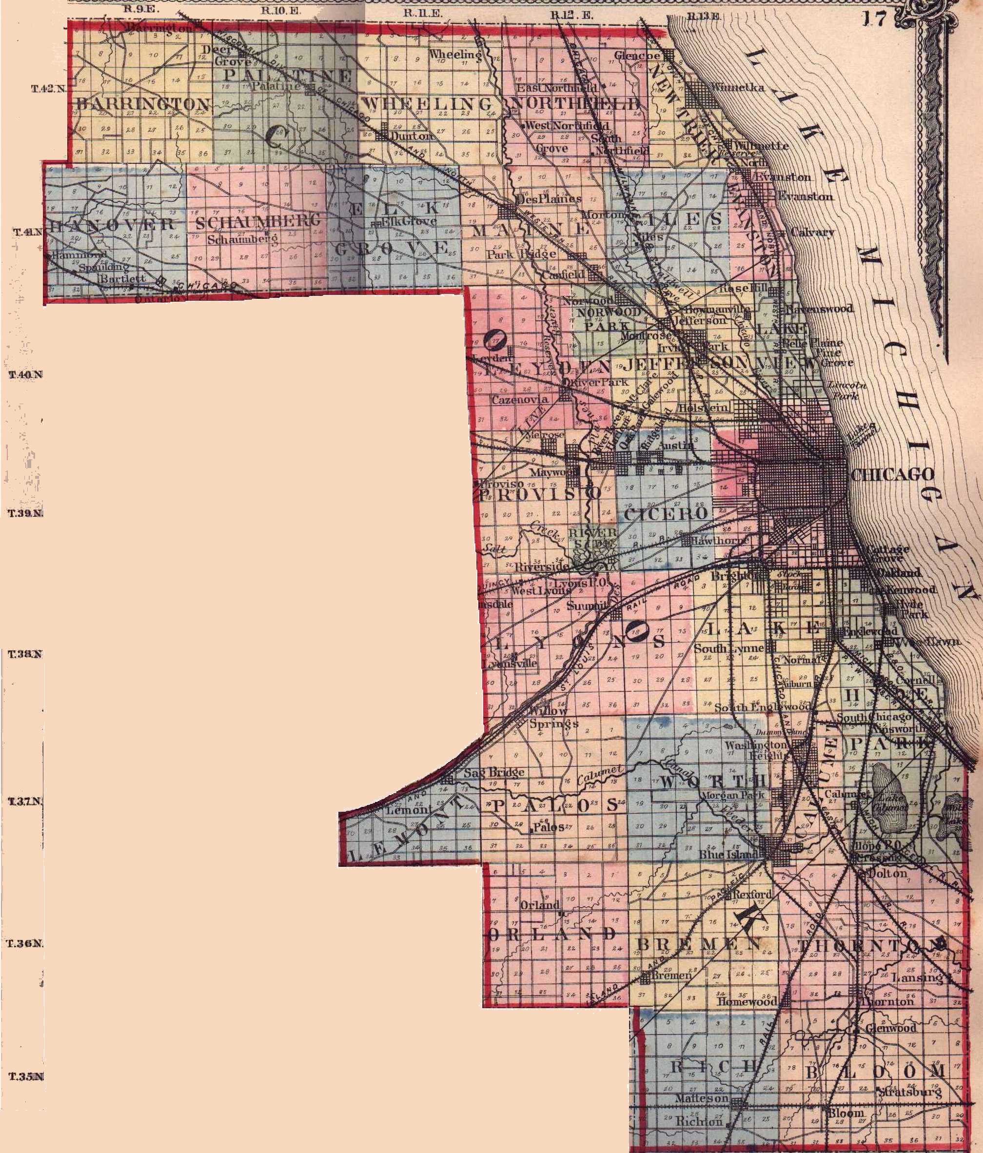
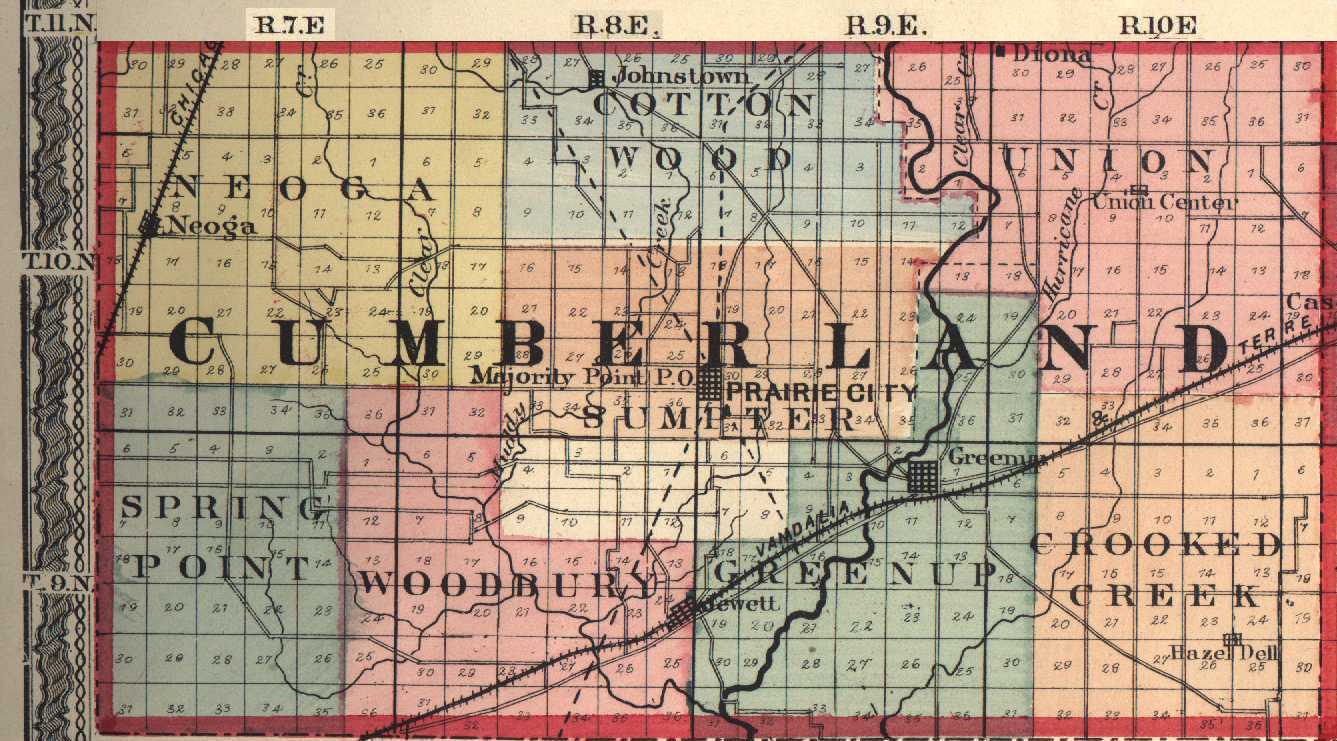
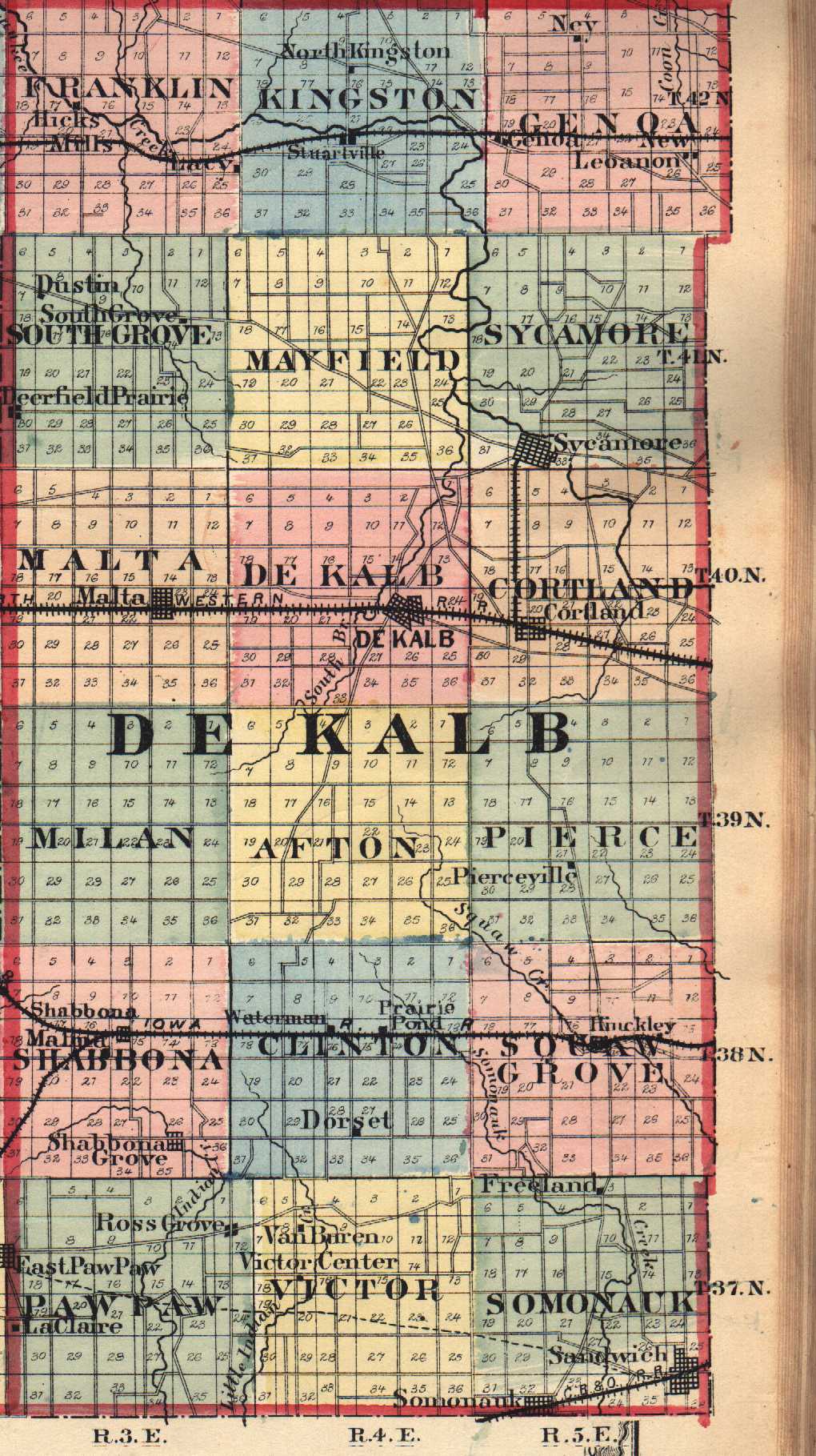
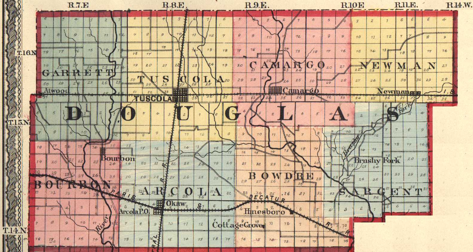
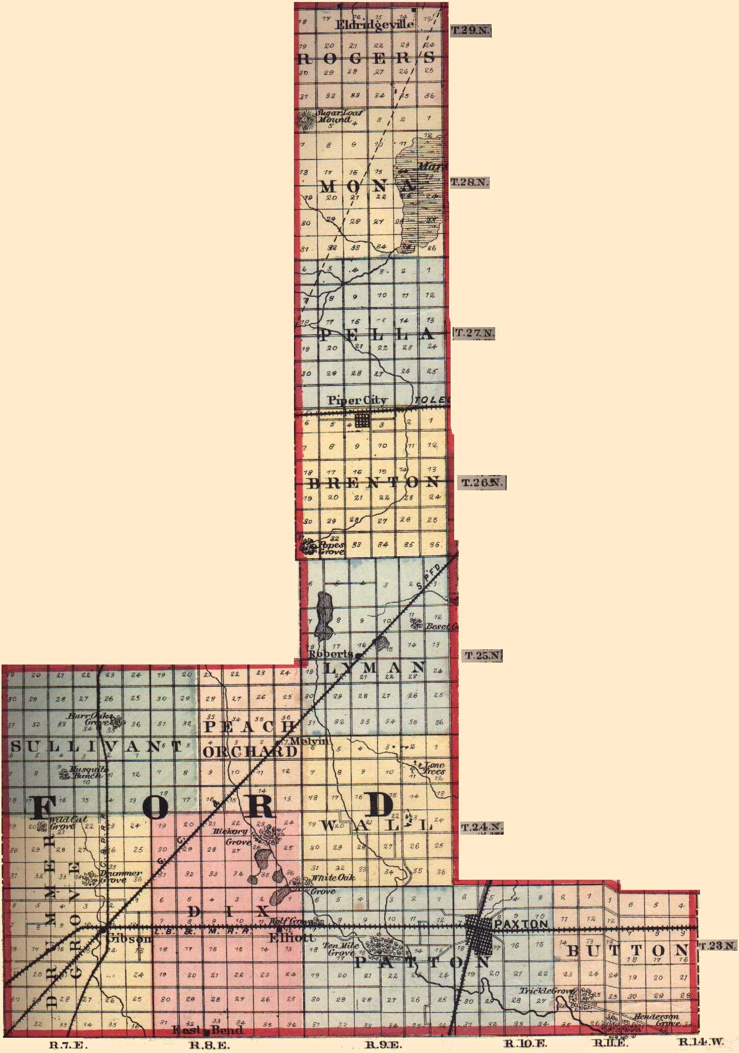
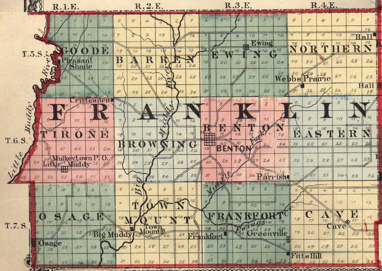
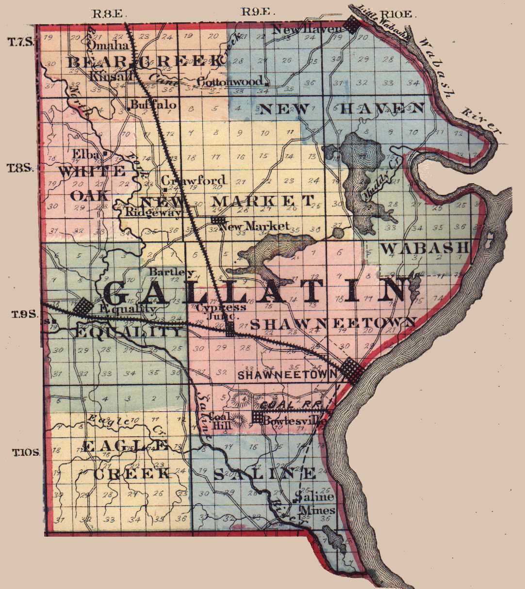
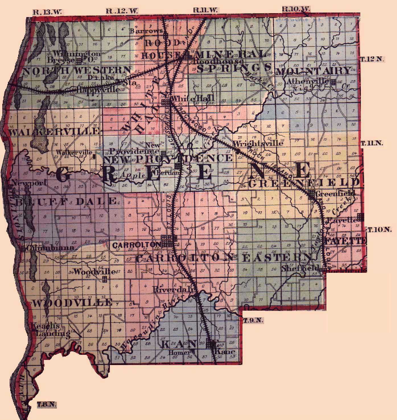
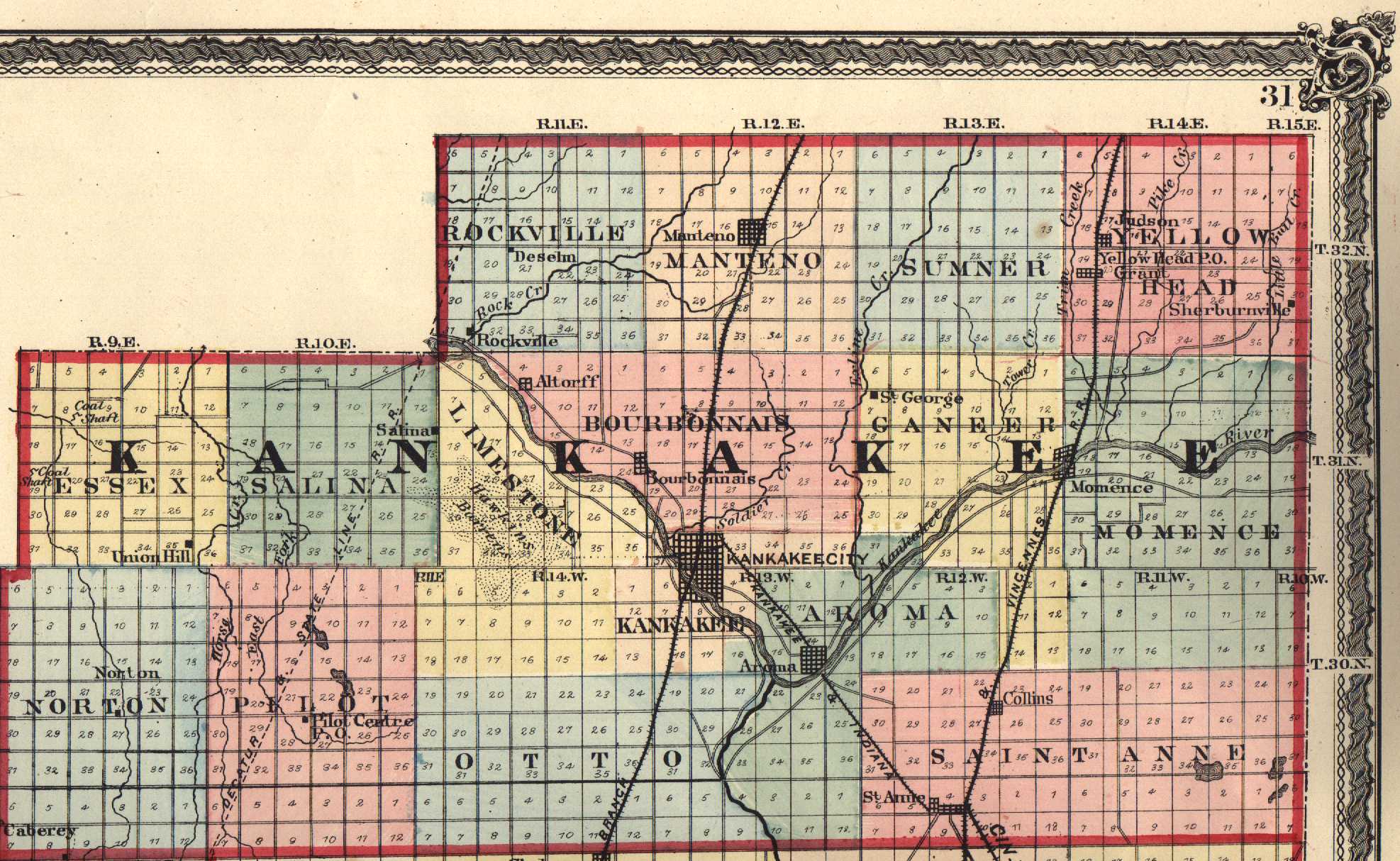
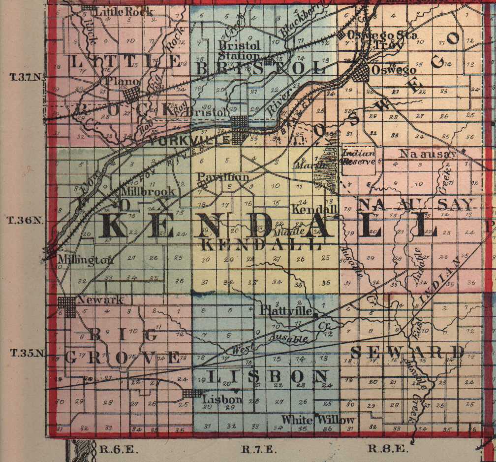
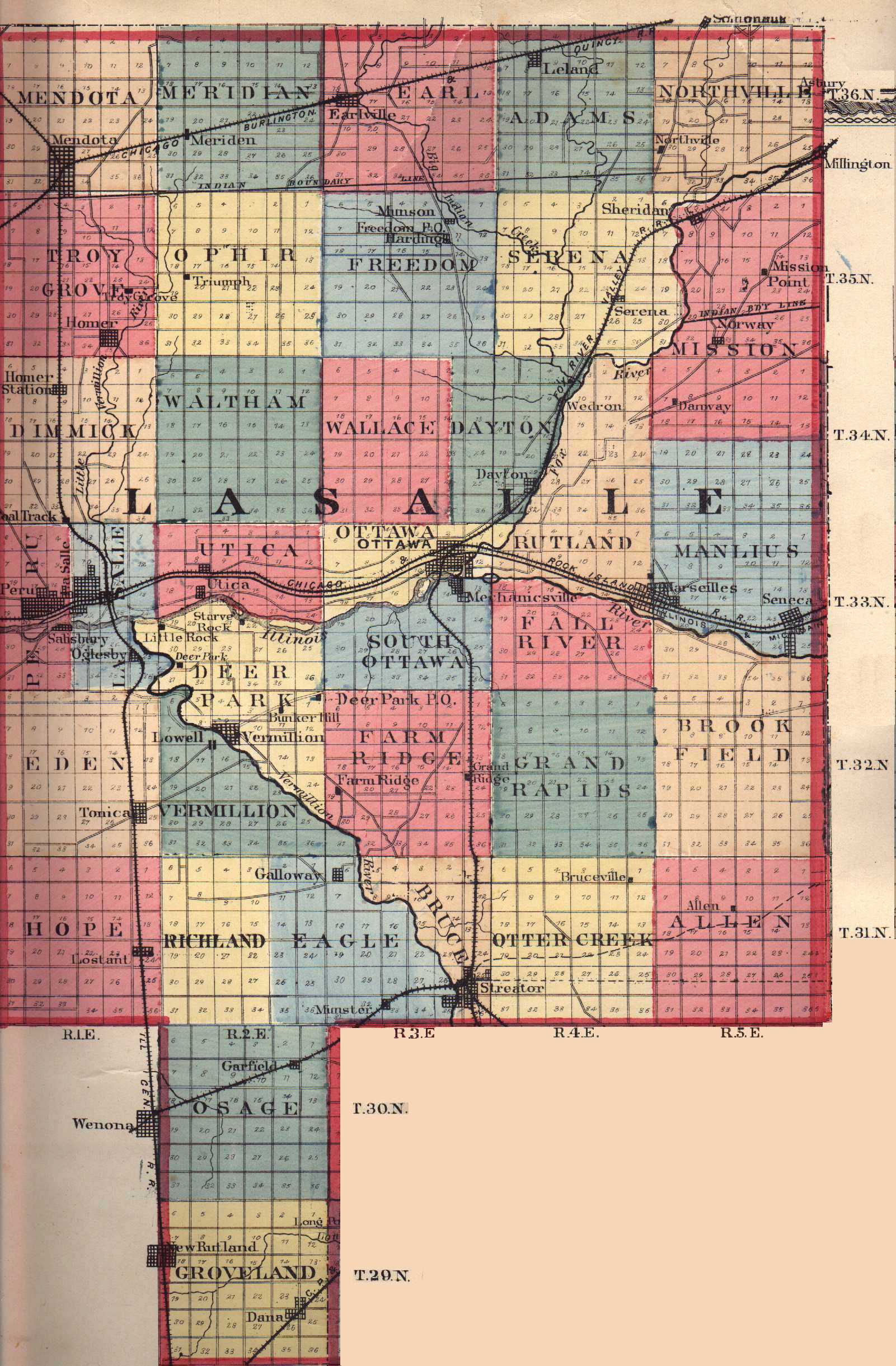
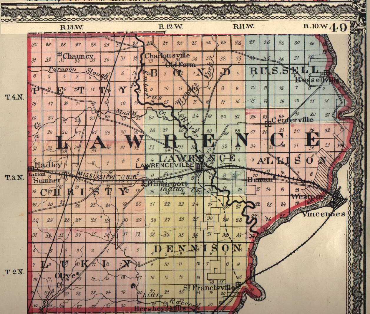
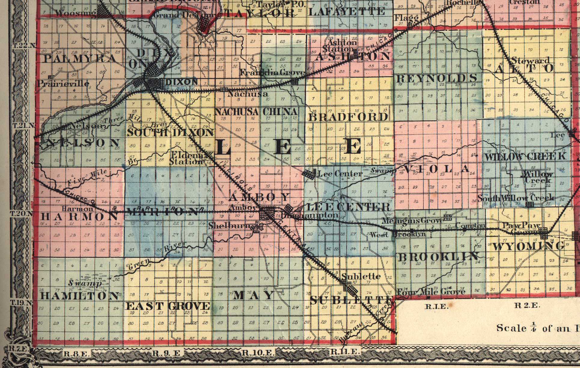
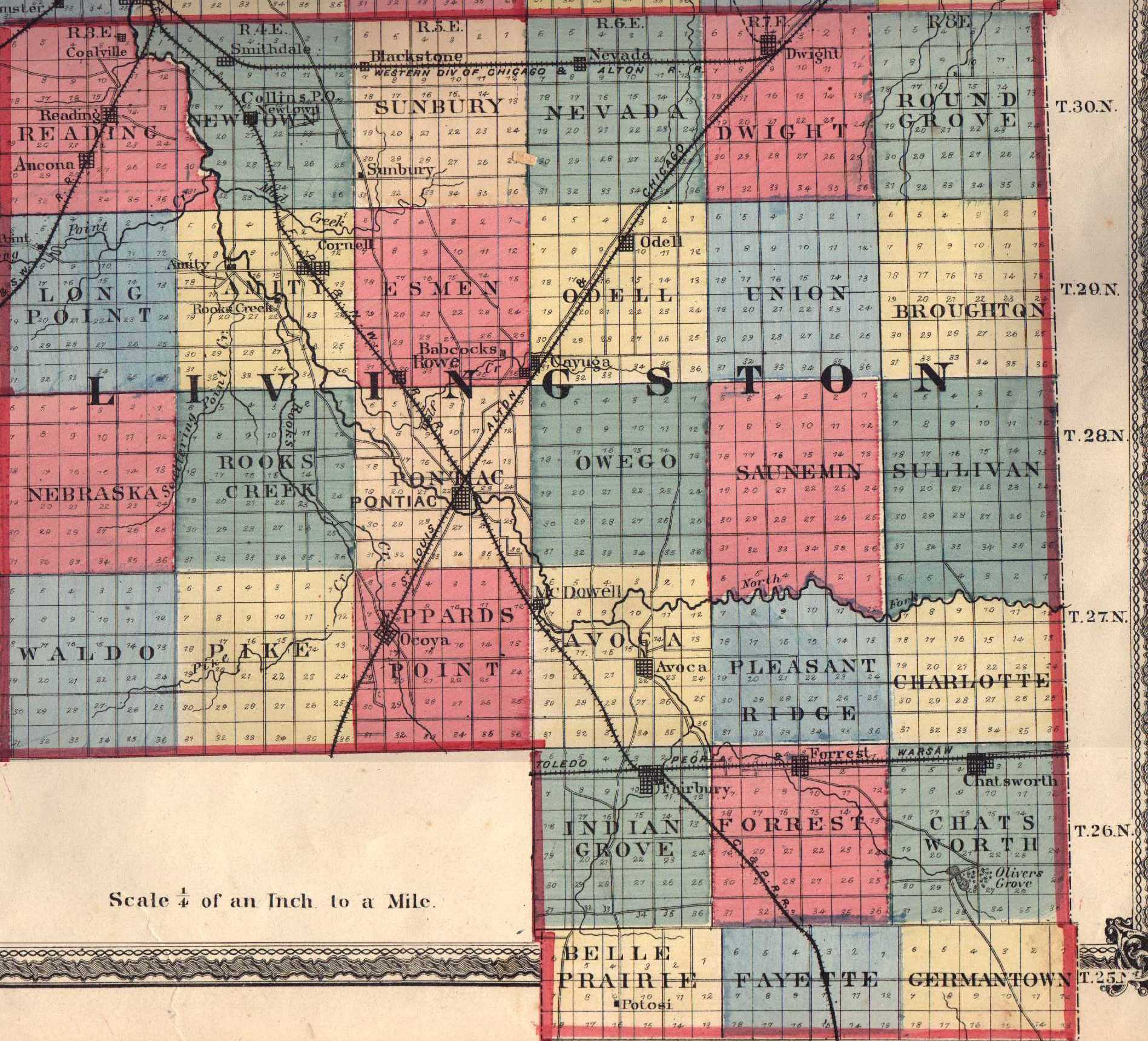
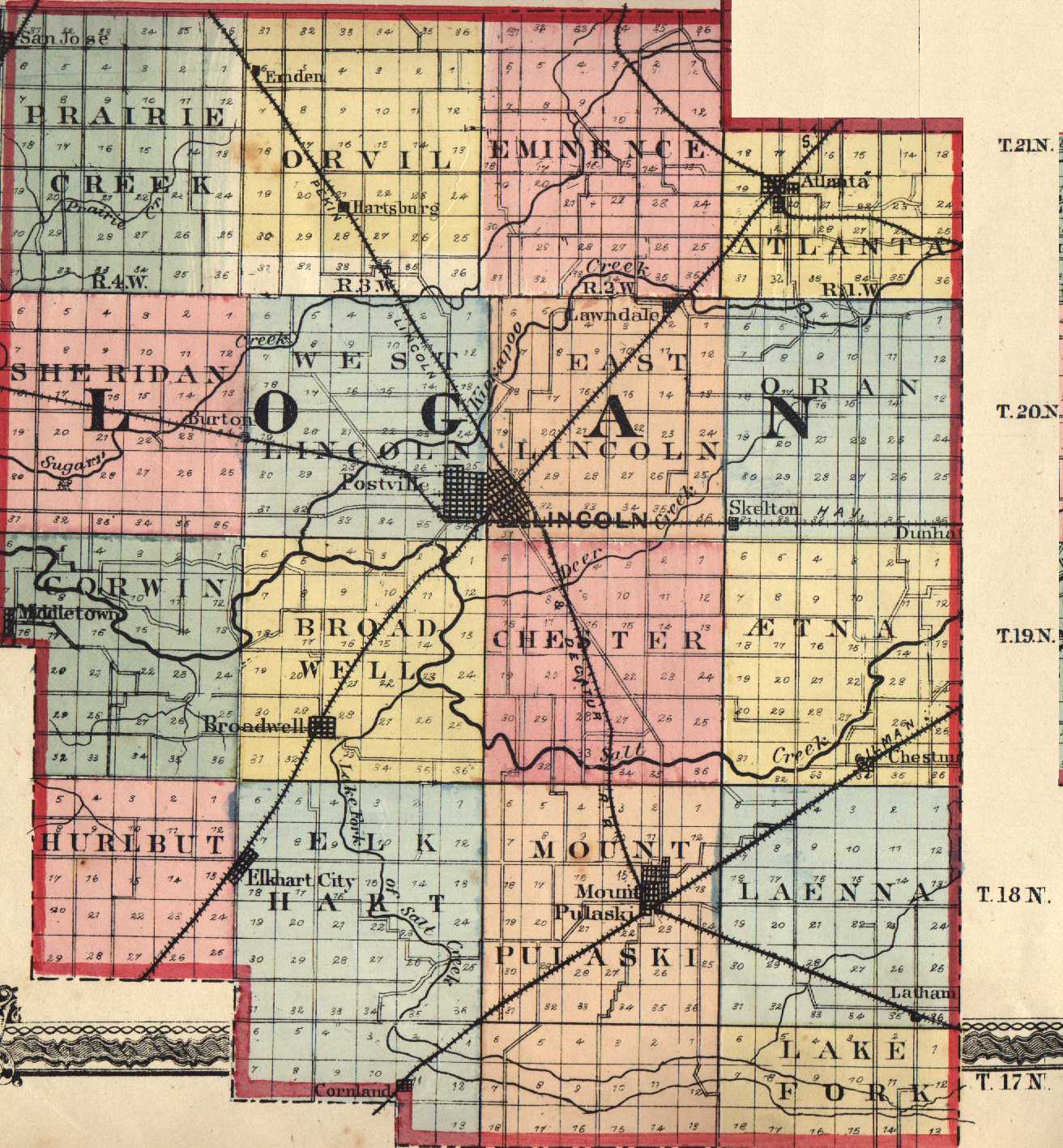
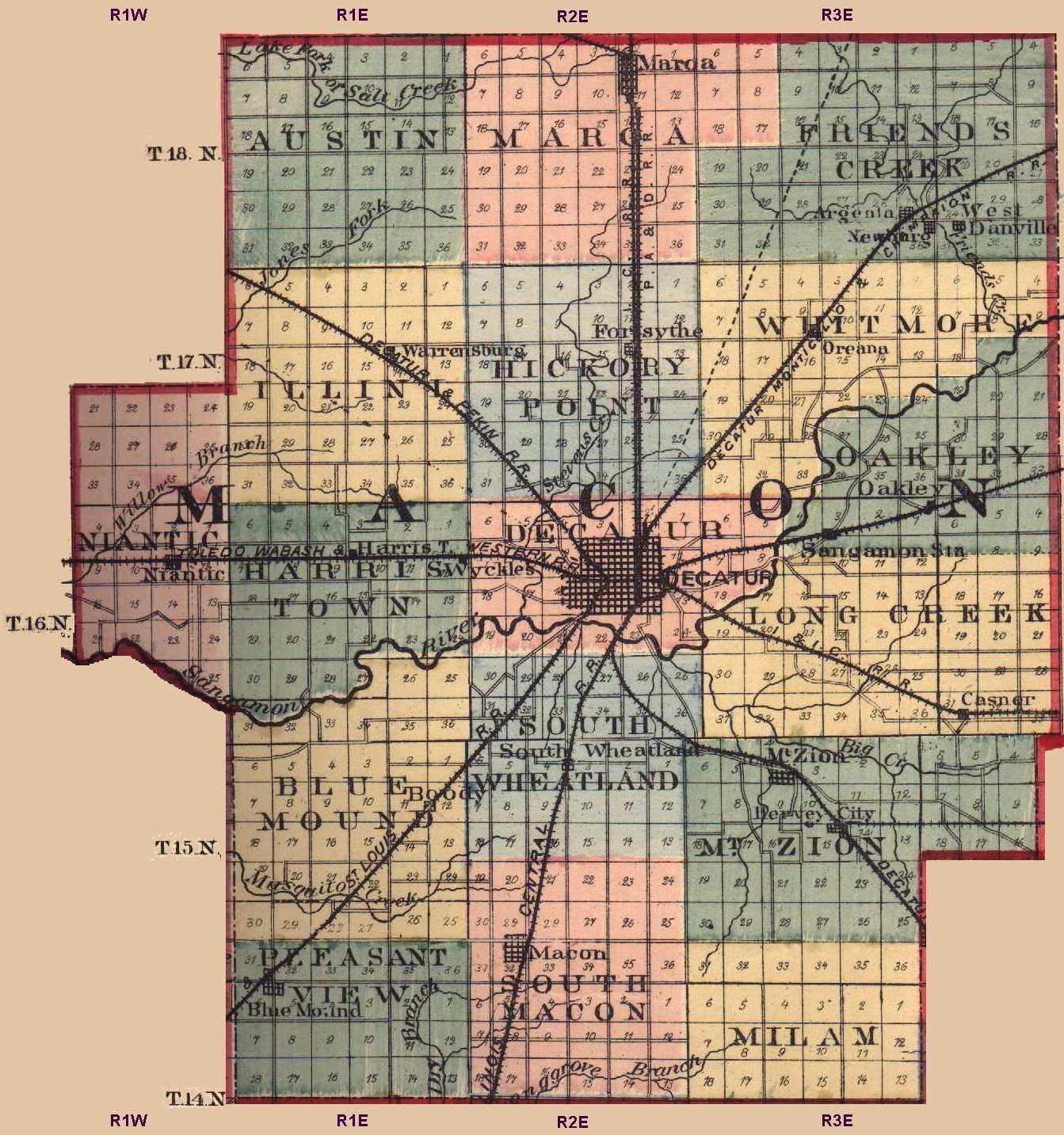
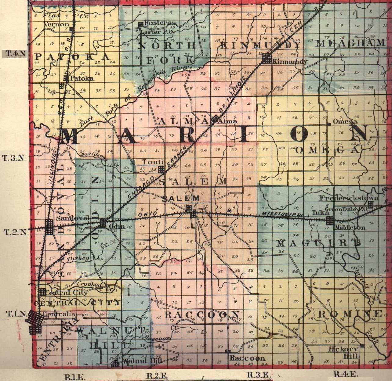
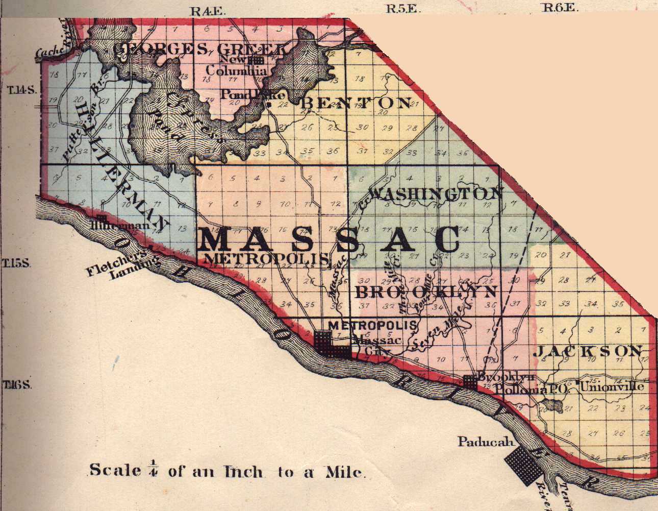
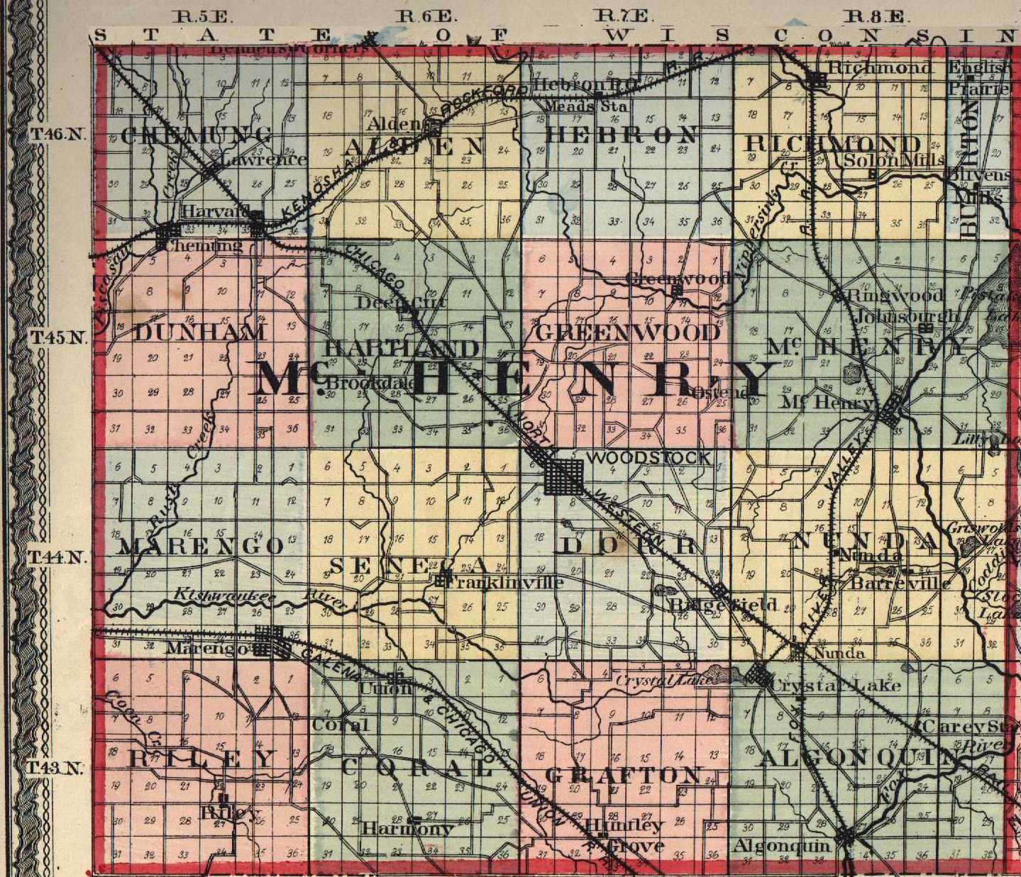
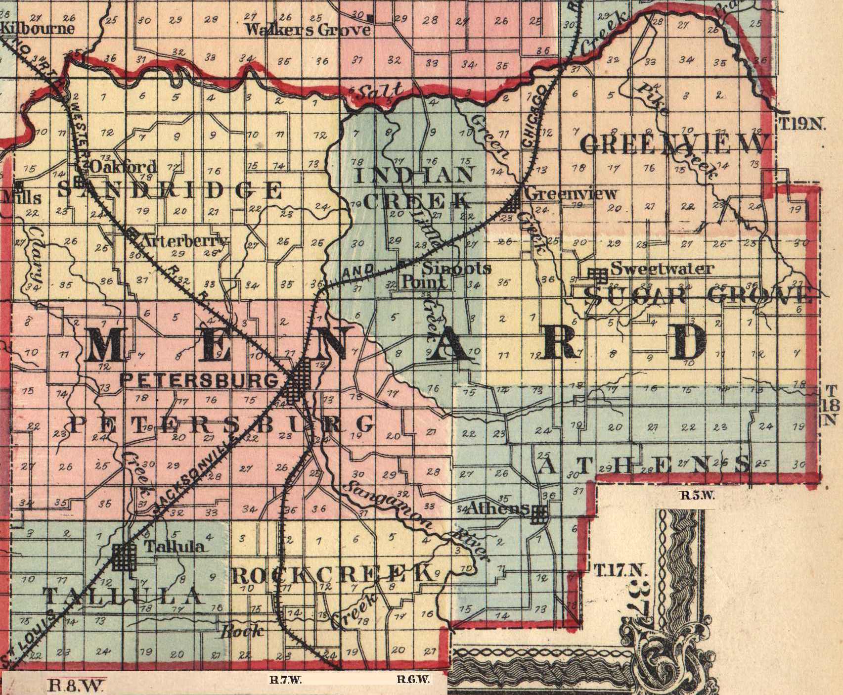
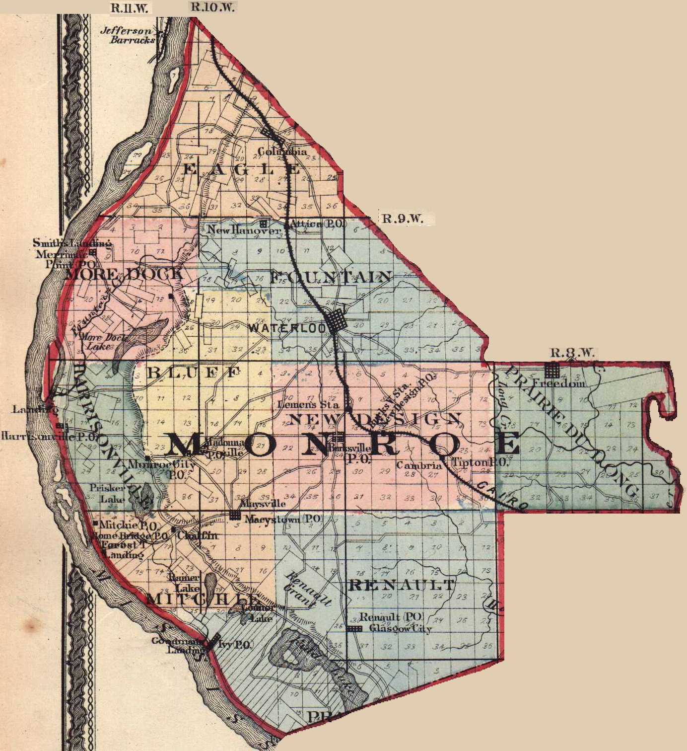
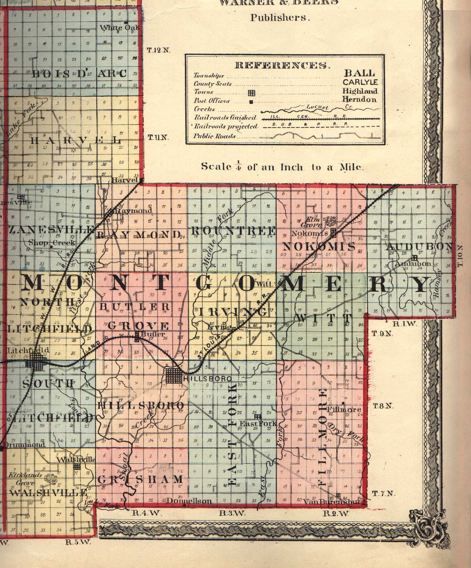
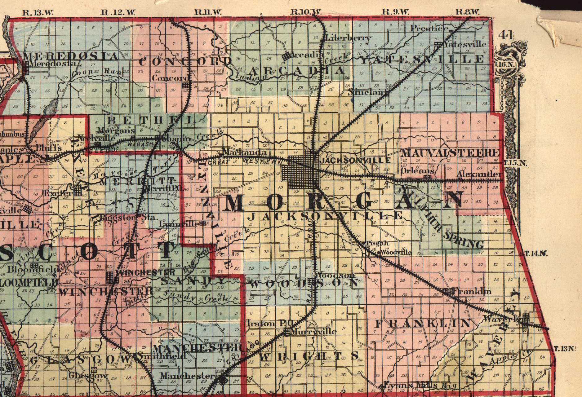
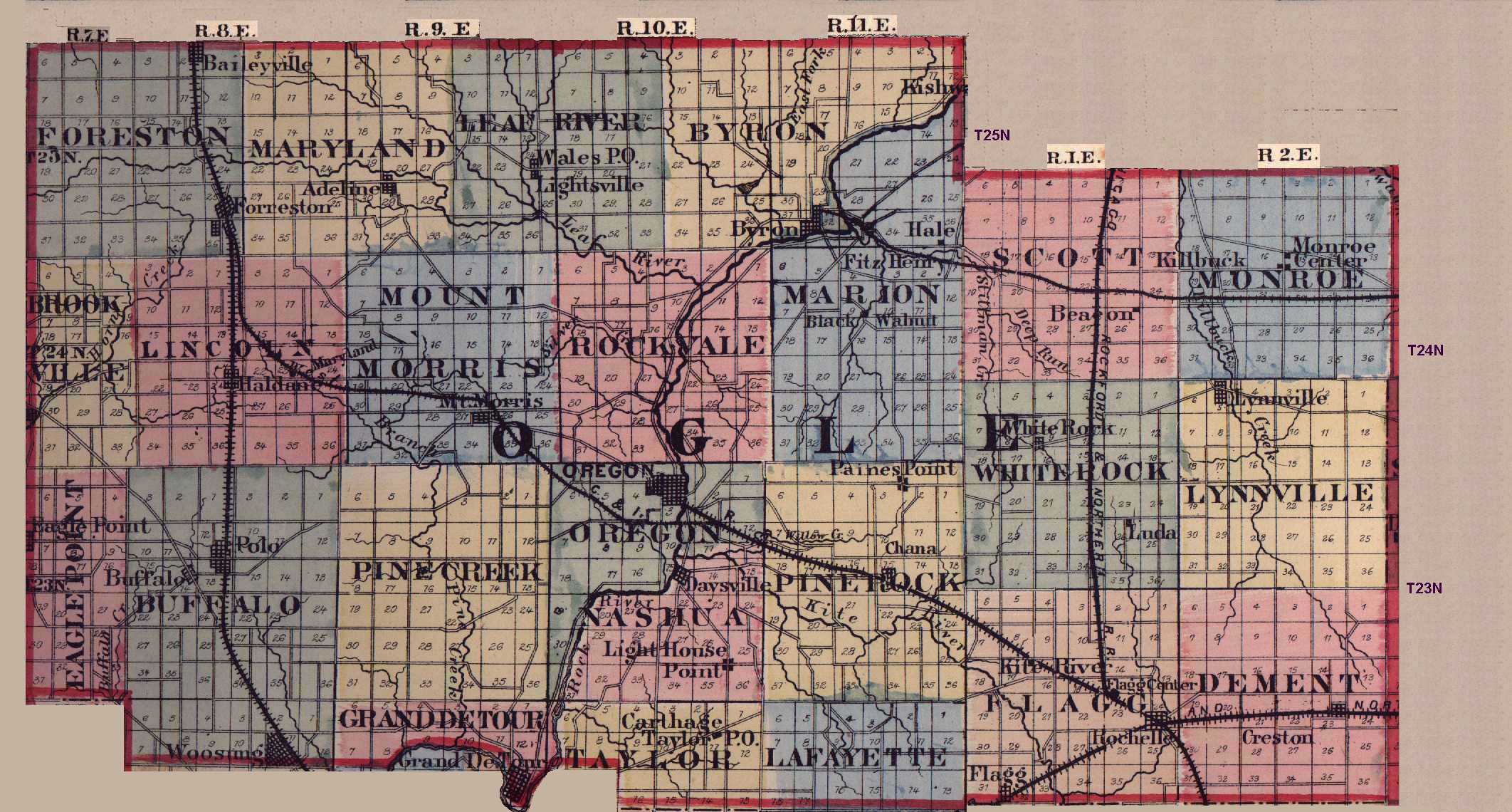
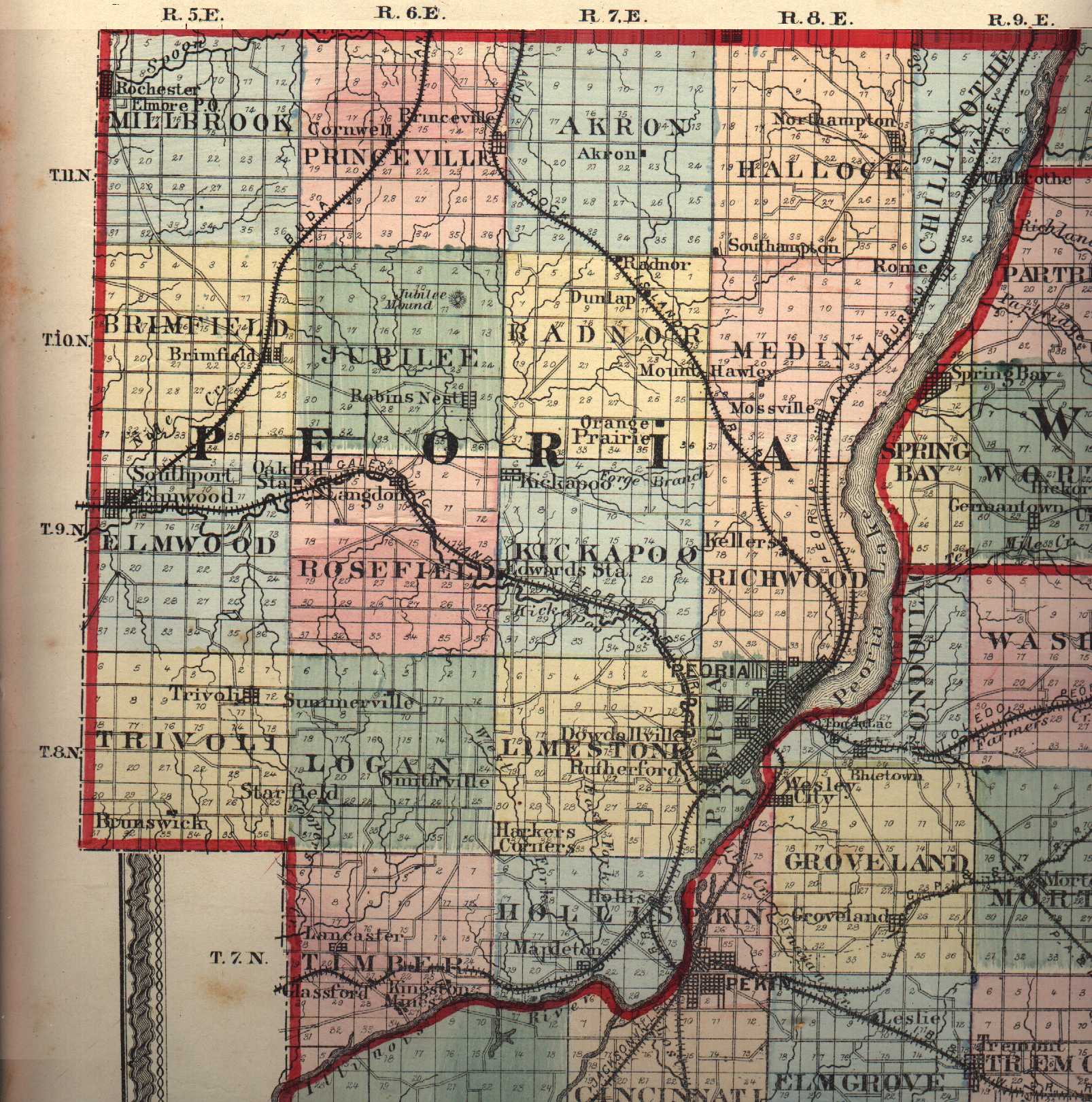
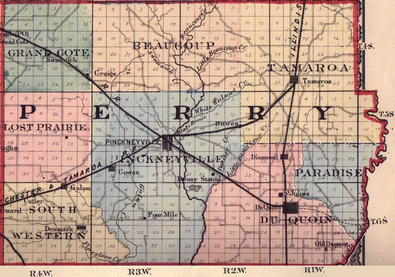
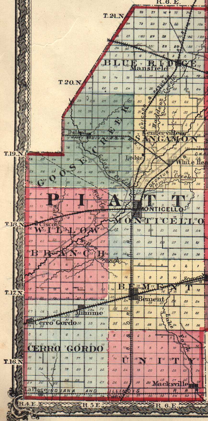
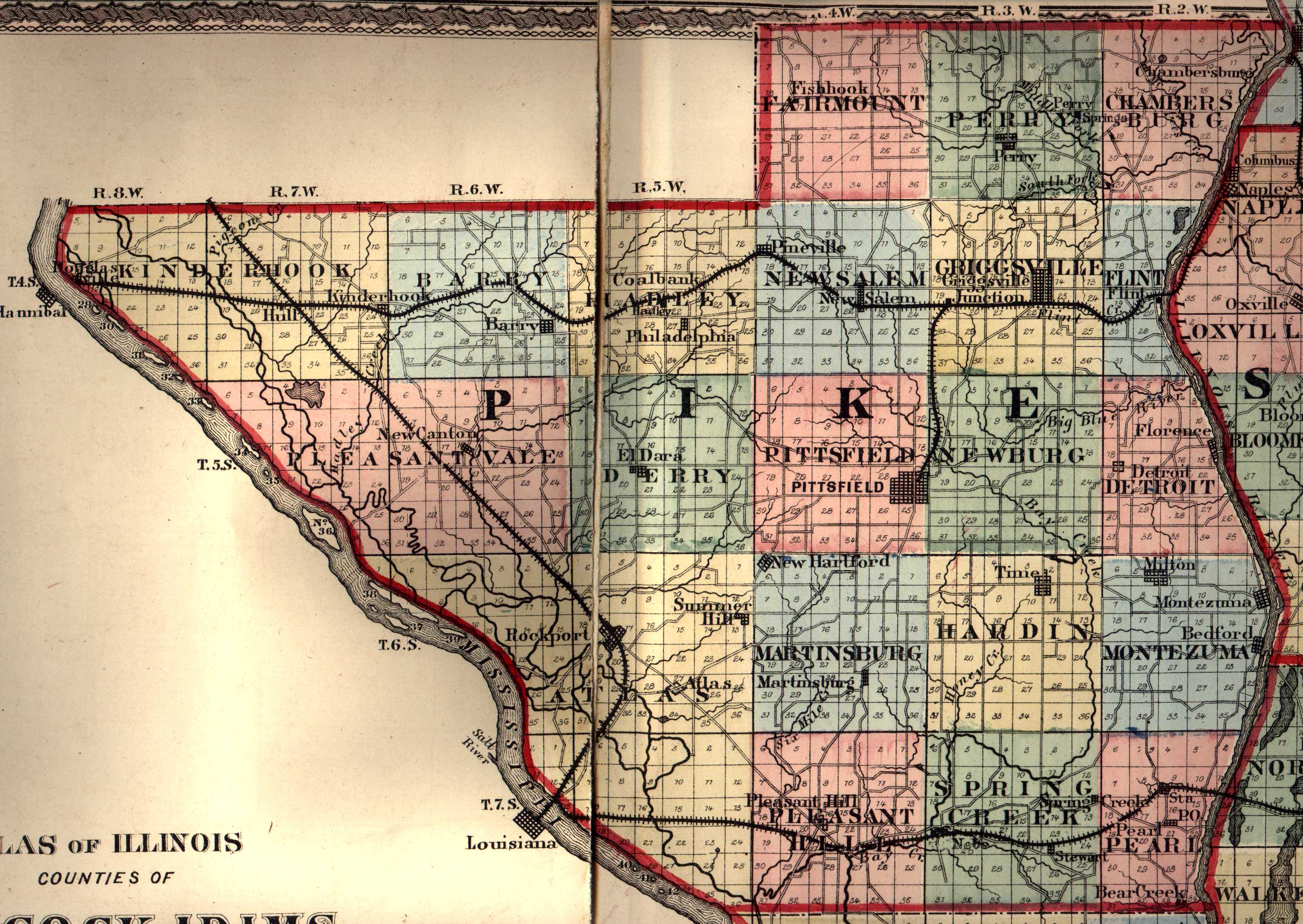
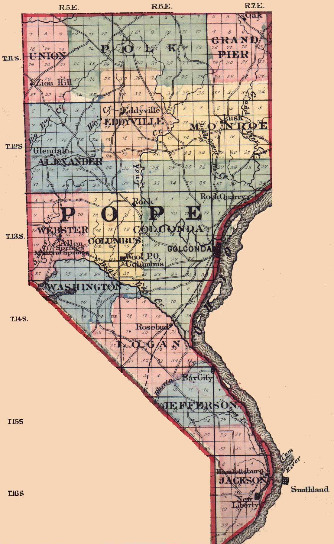
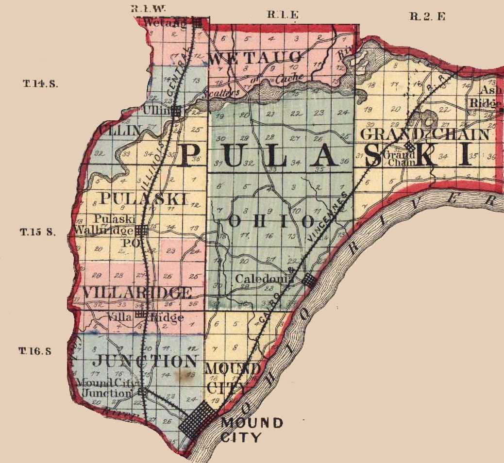
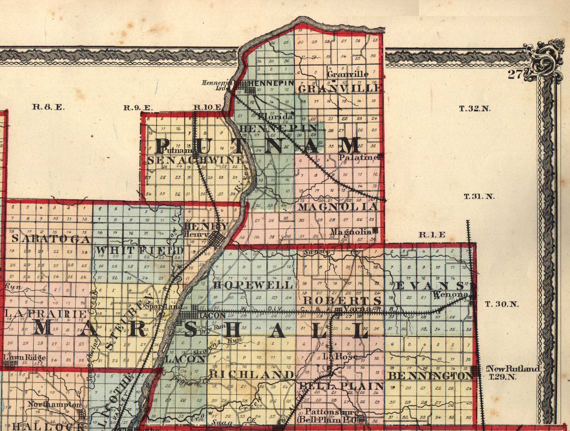
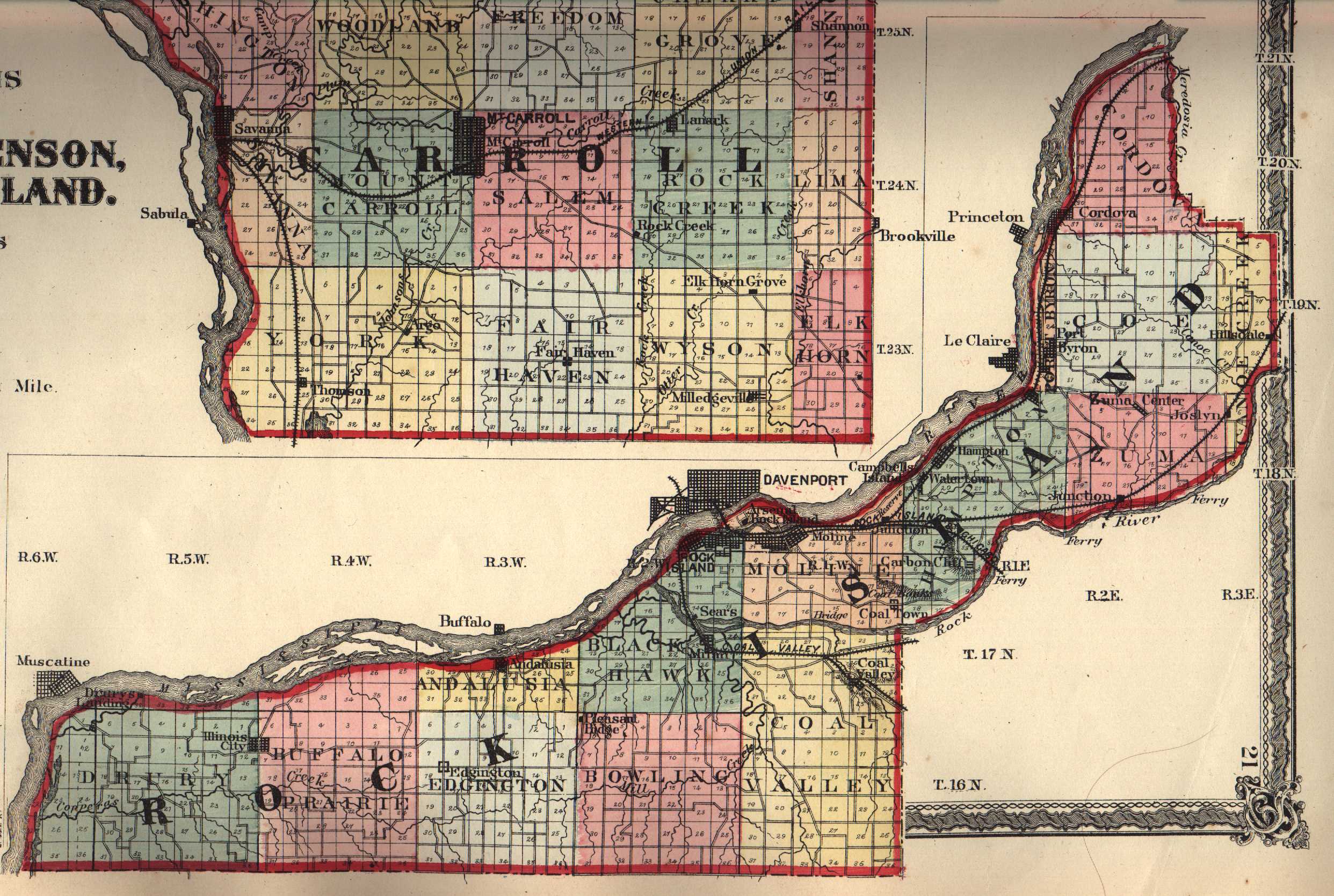
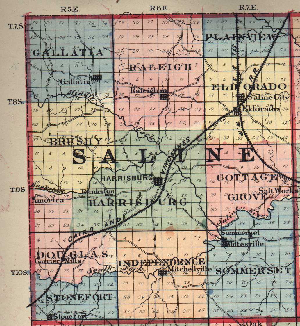
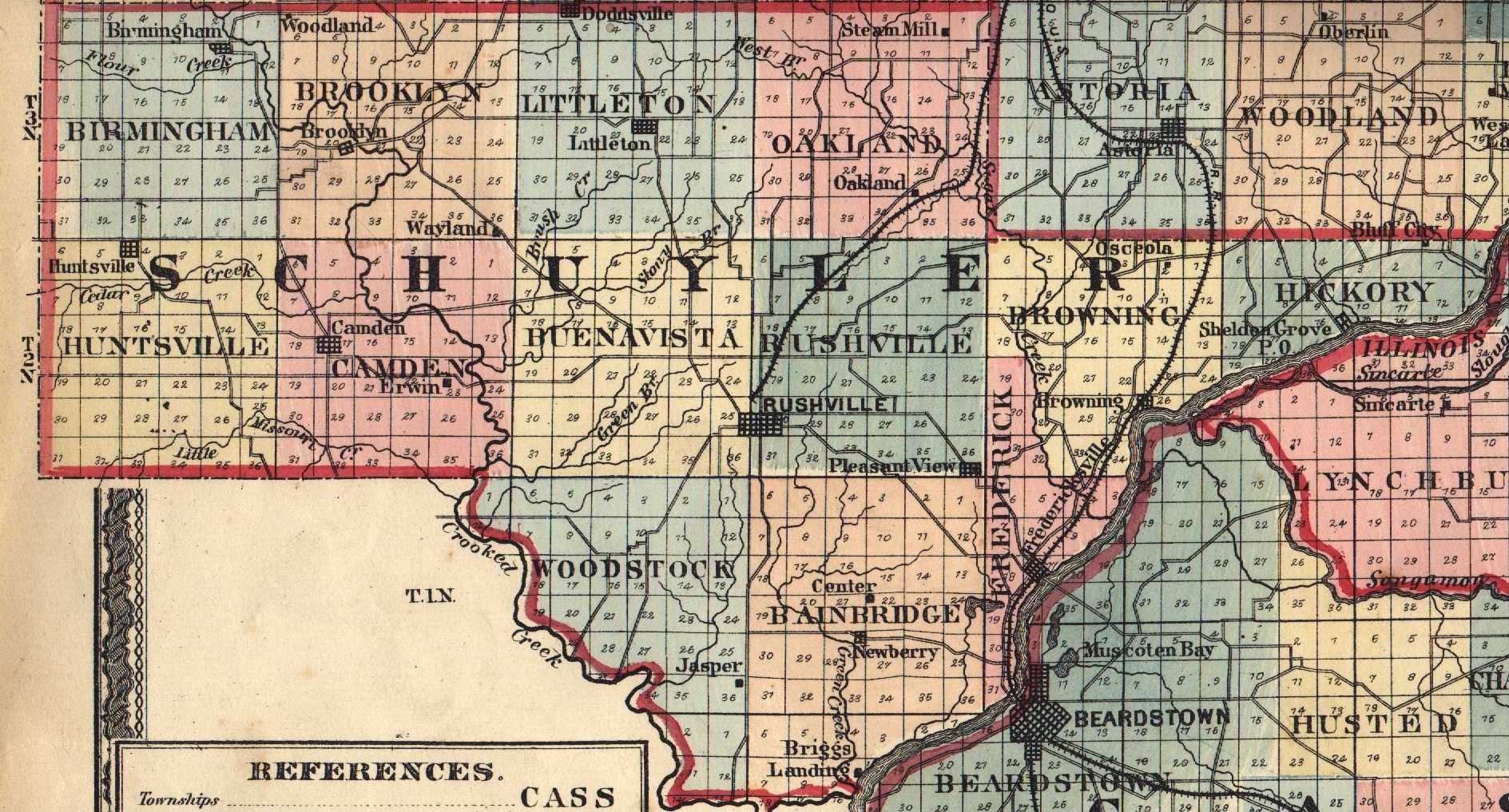
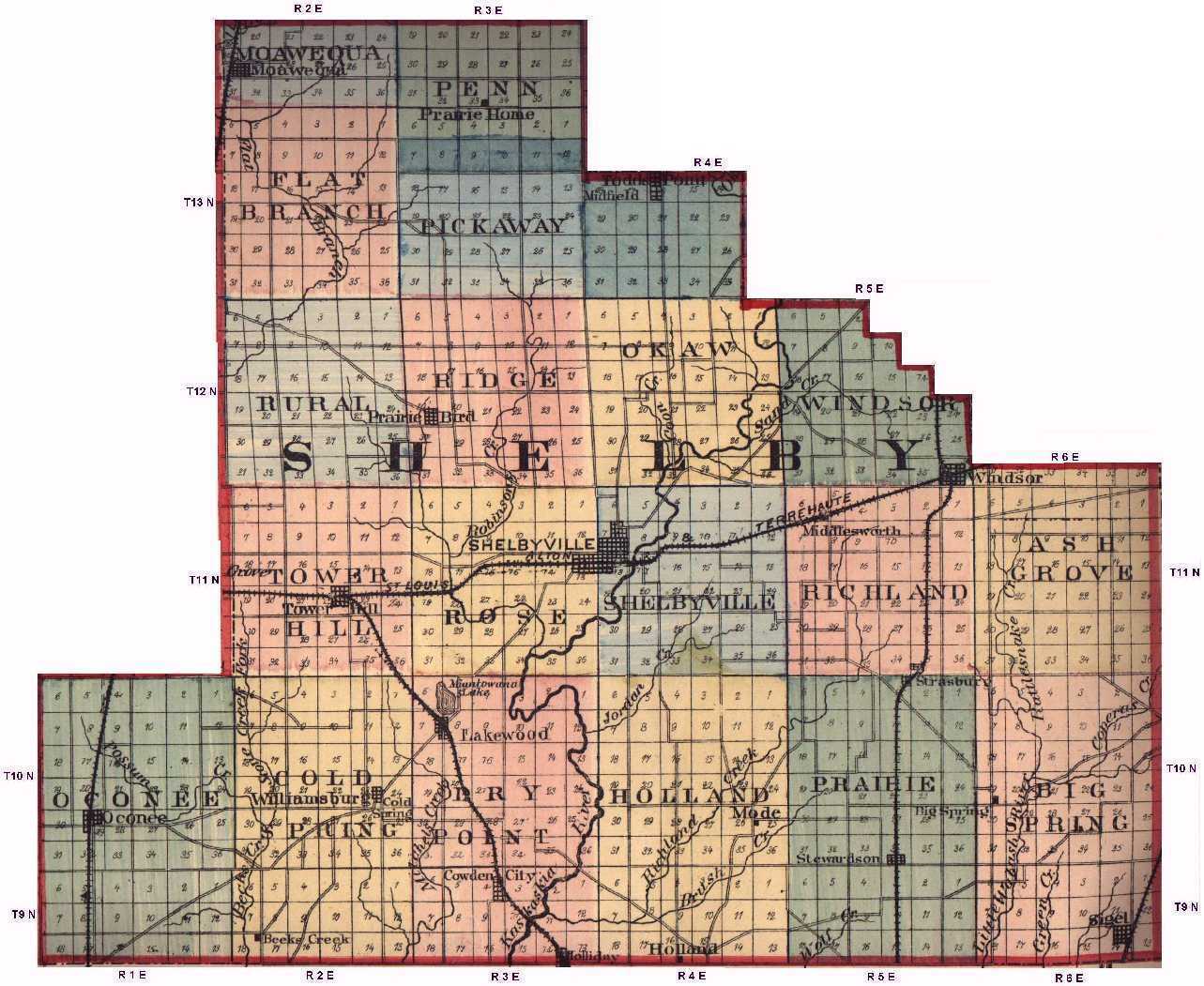
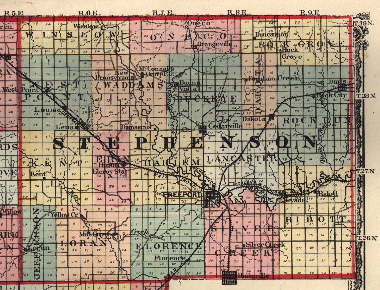
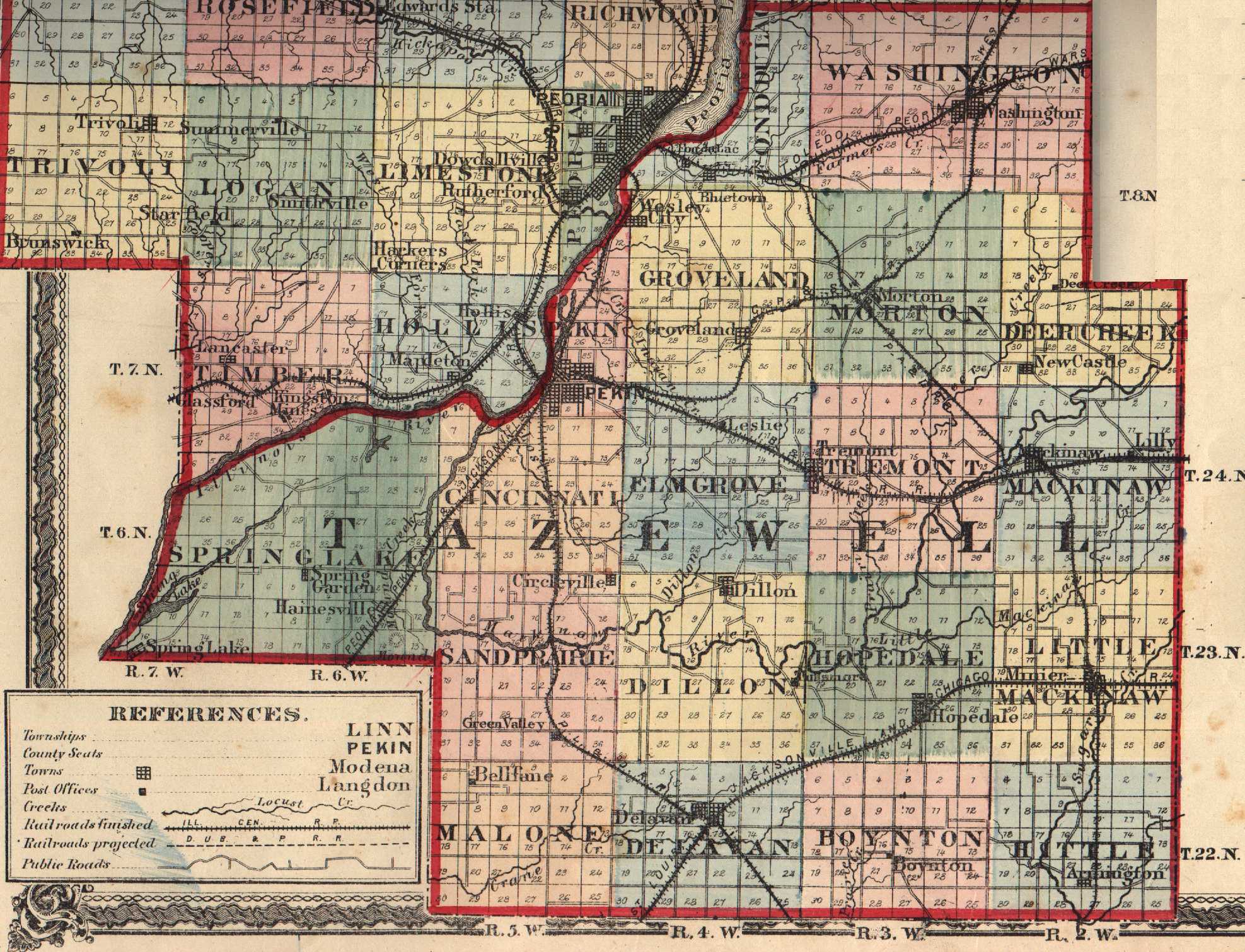
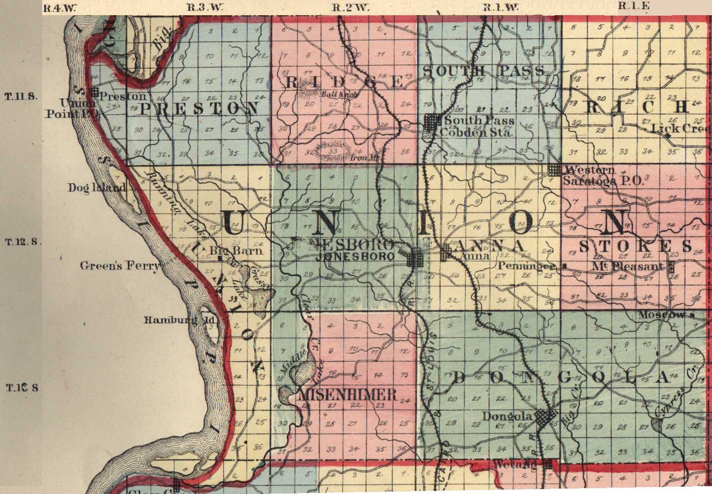
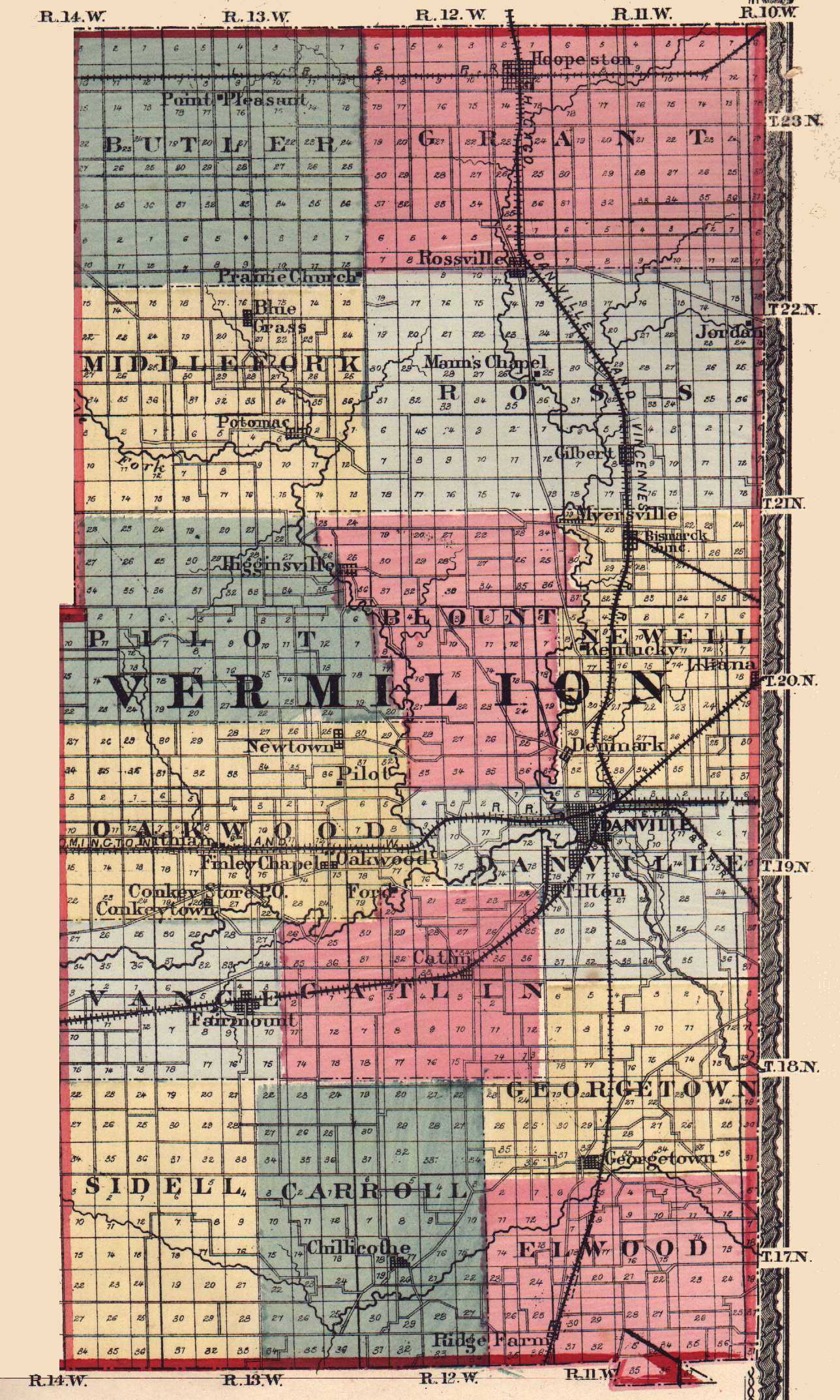
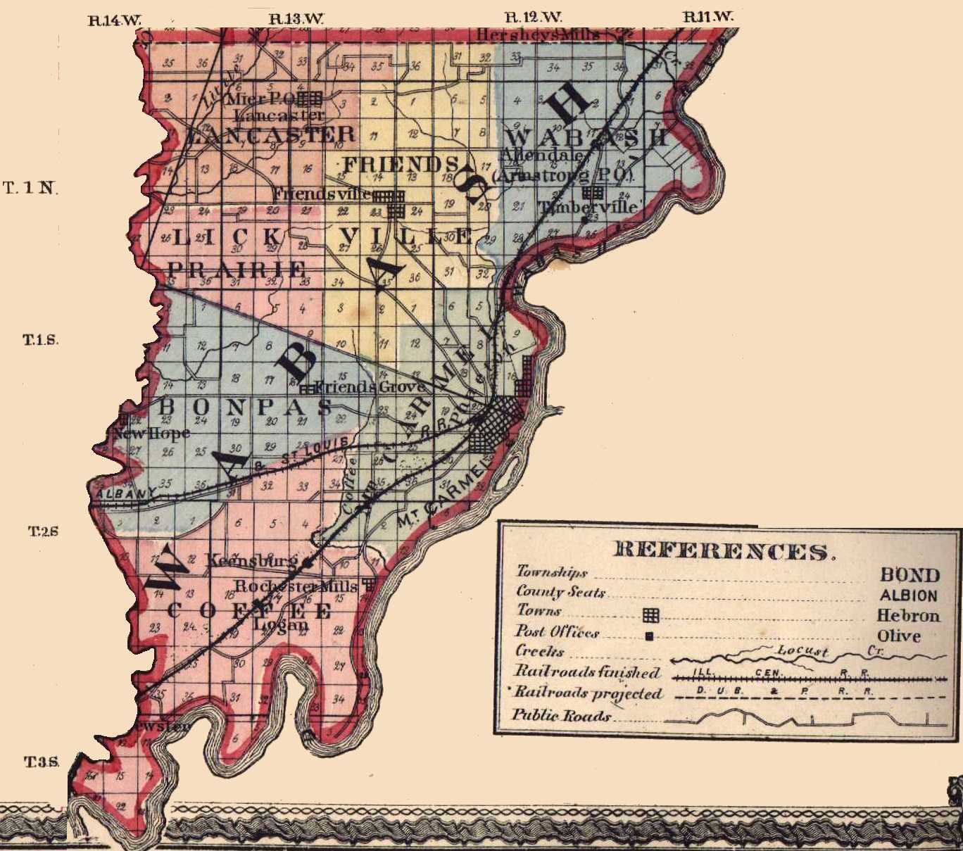
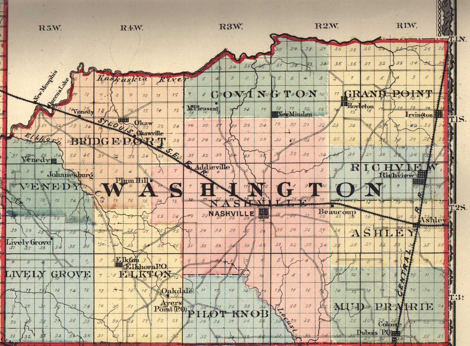
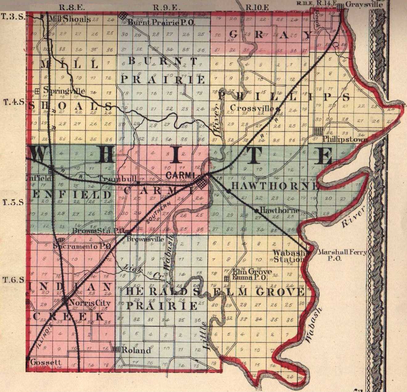
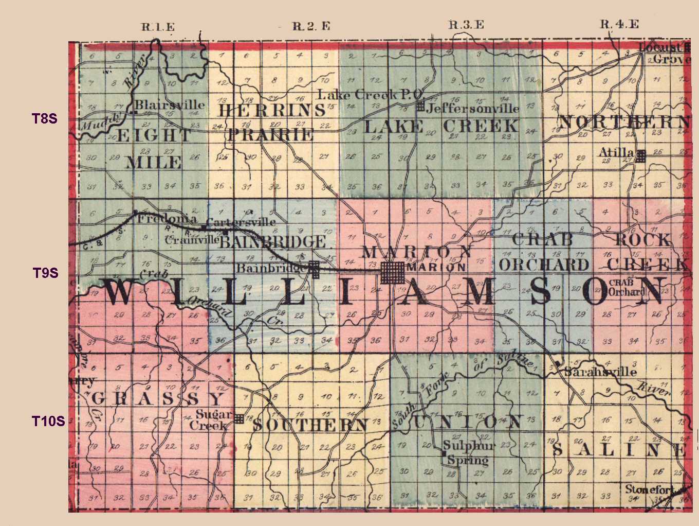
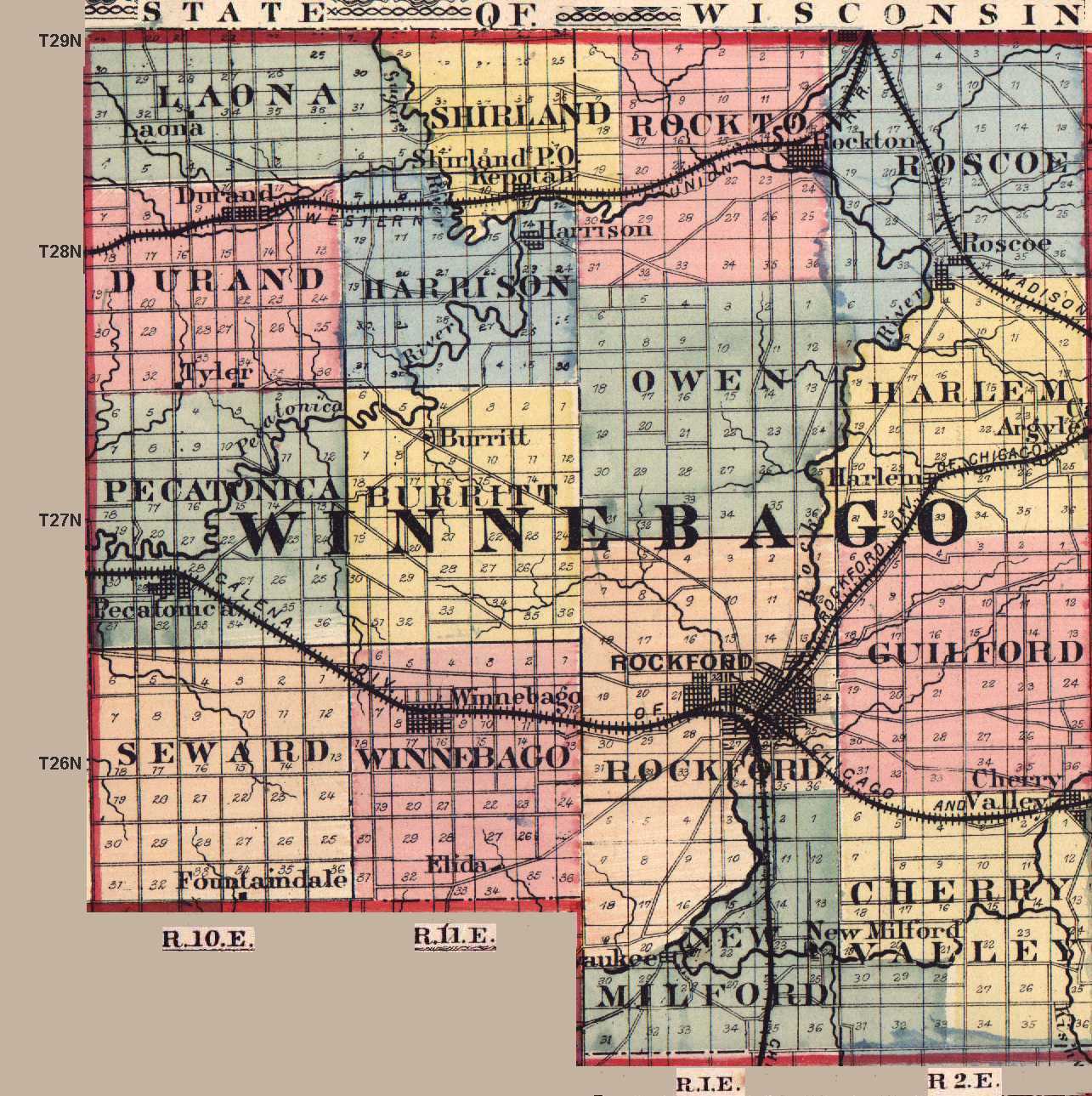
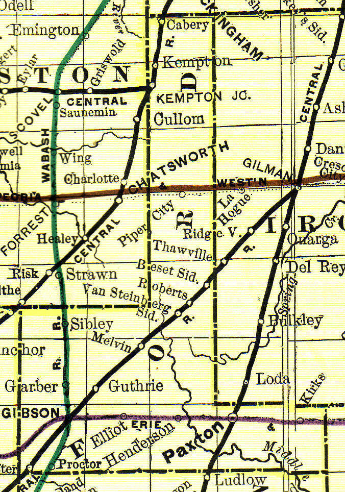
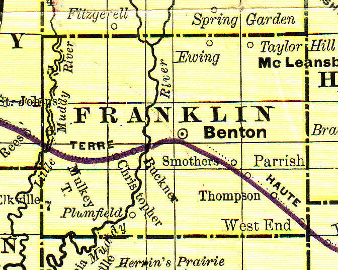
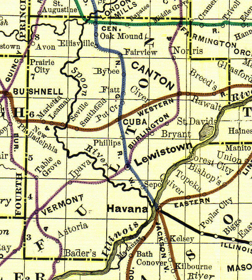
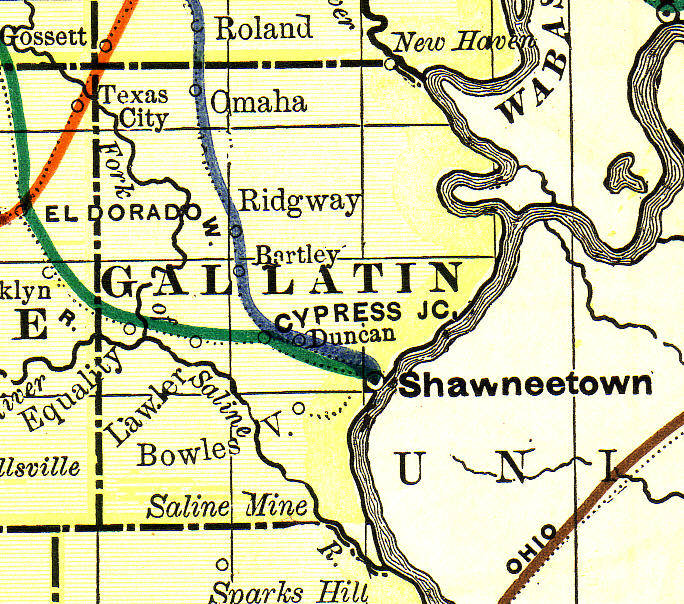
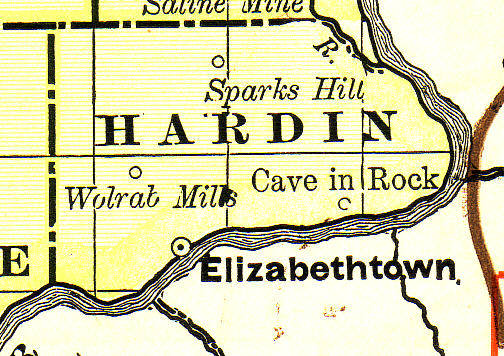
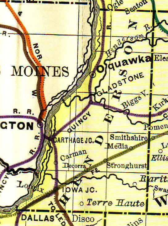
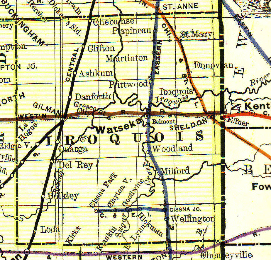
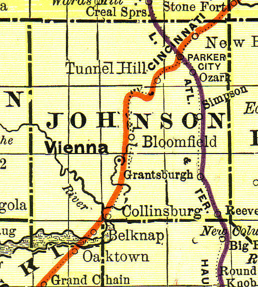
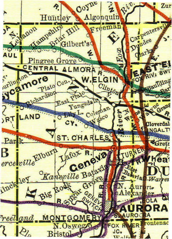
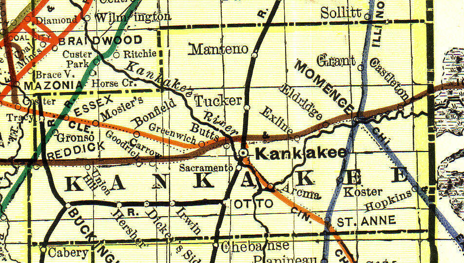
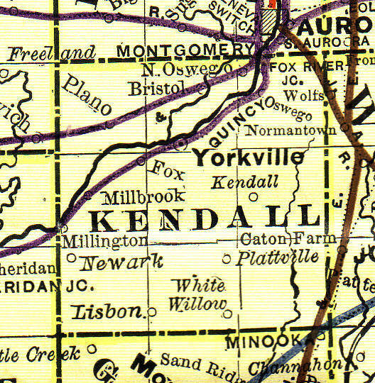
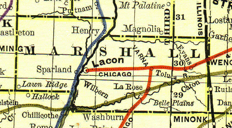
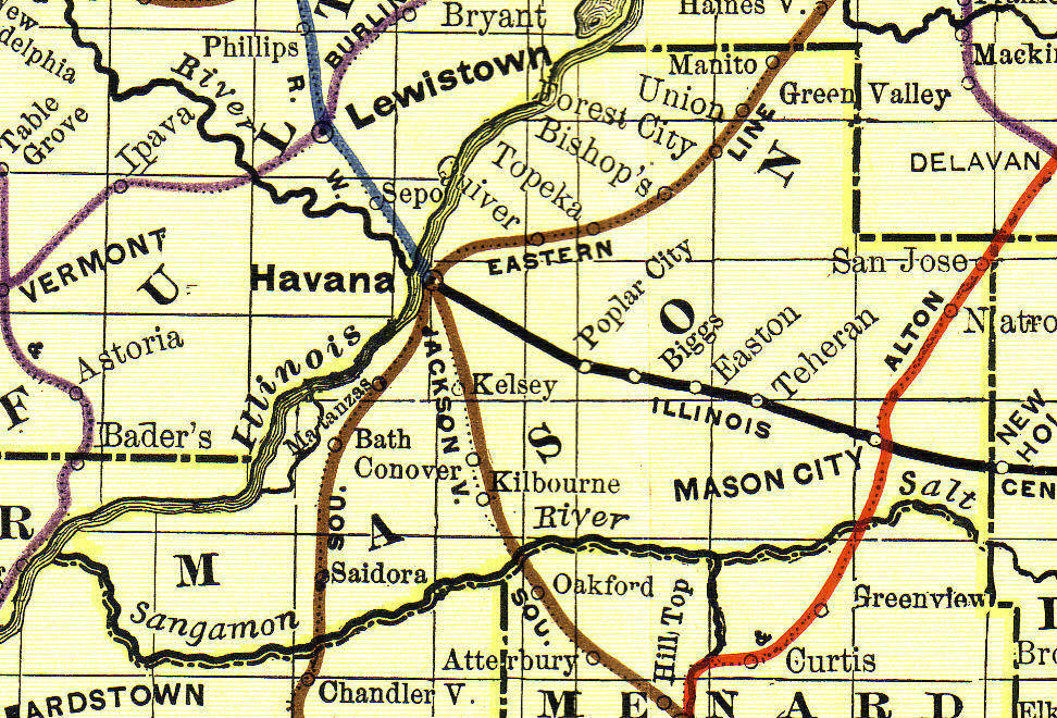
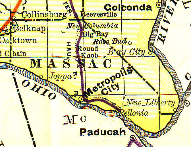
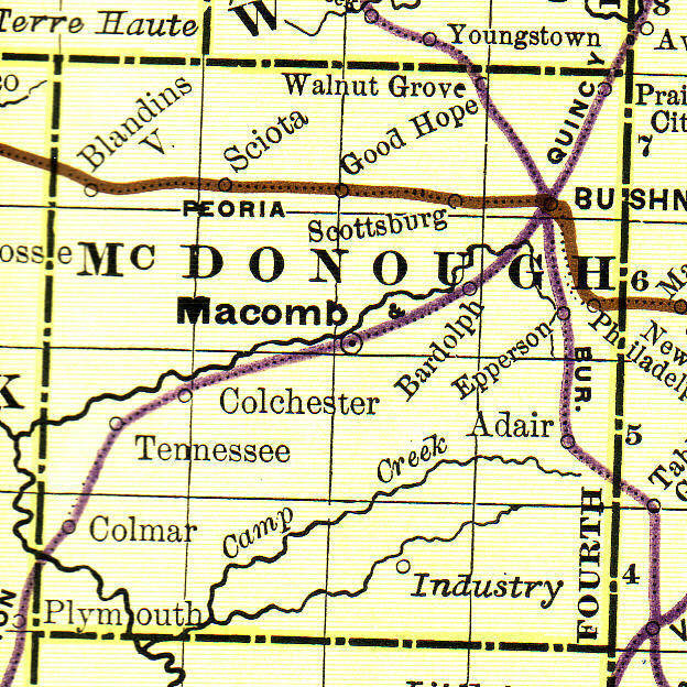
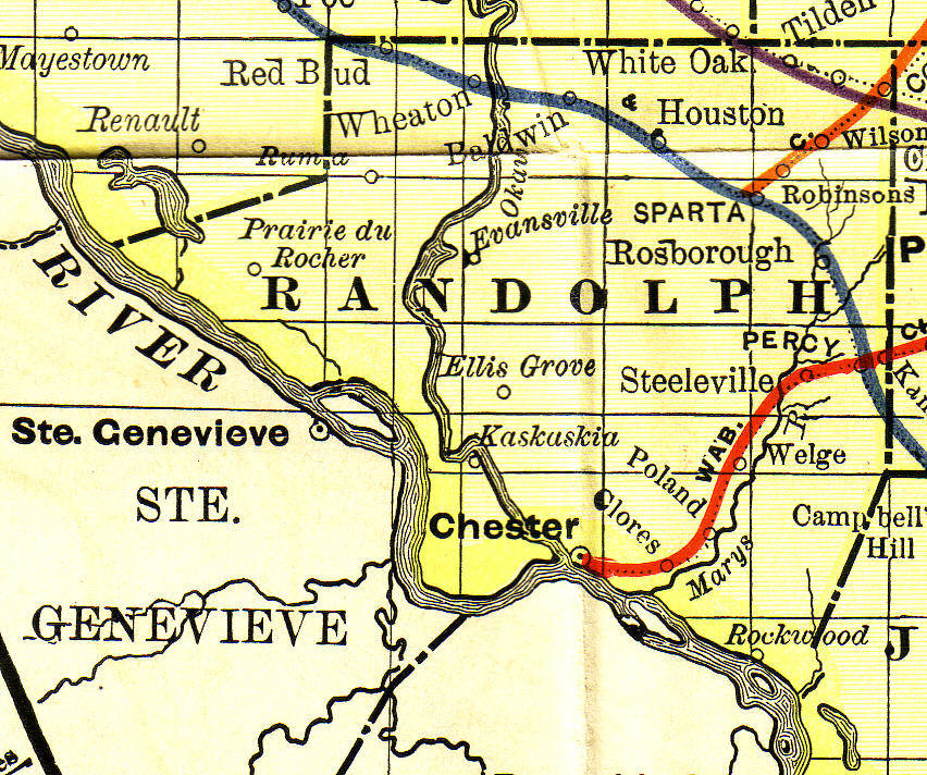
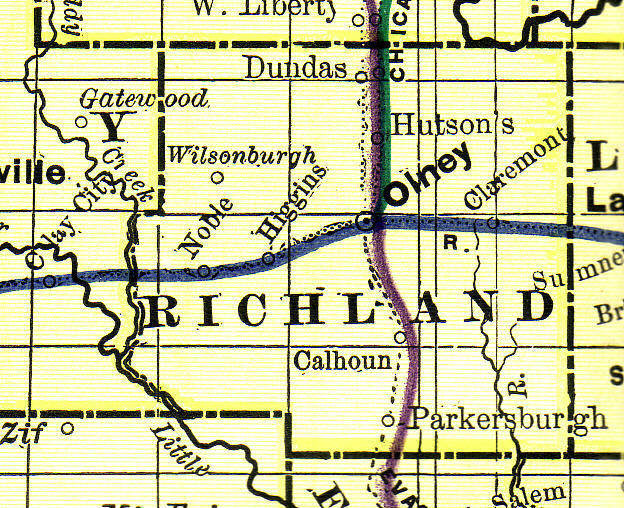
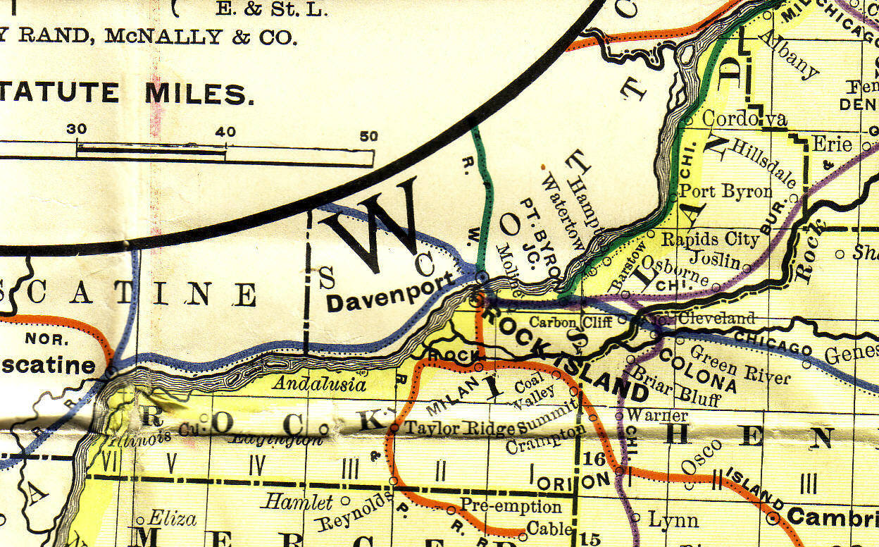
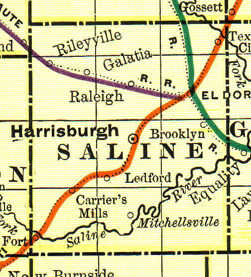
County Maps
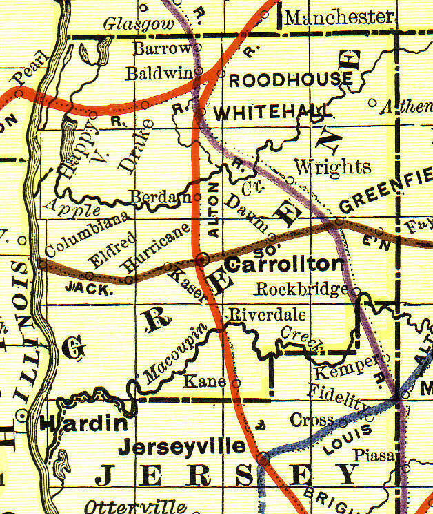
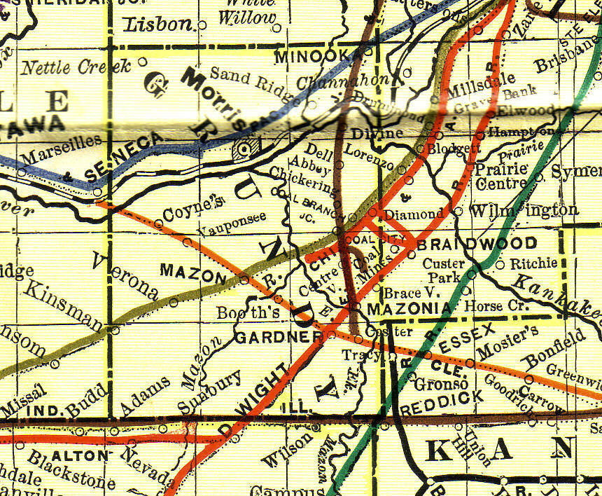
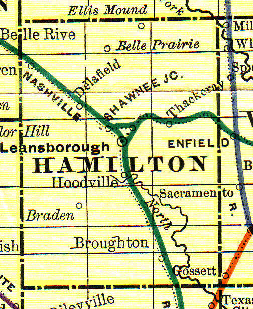
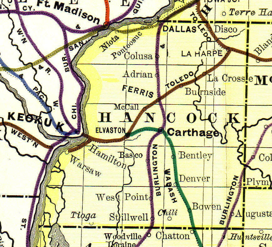
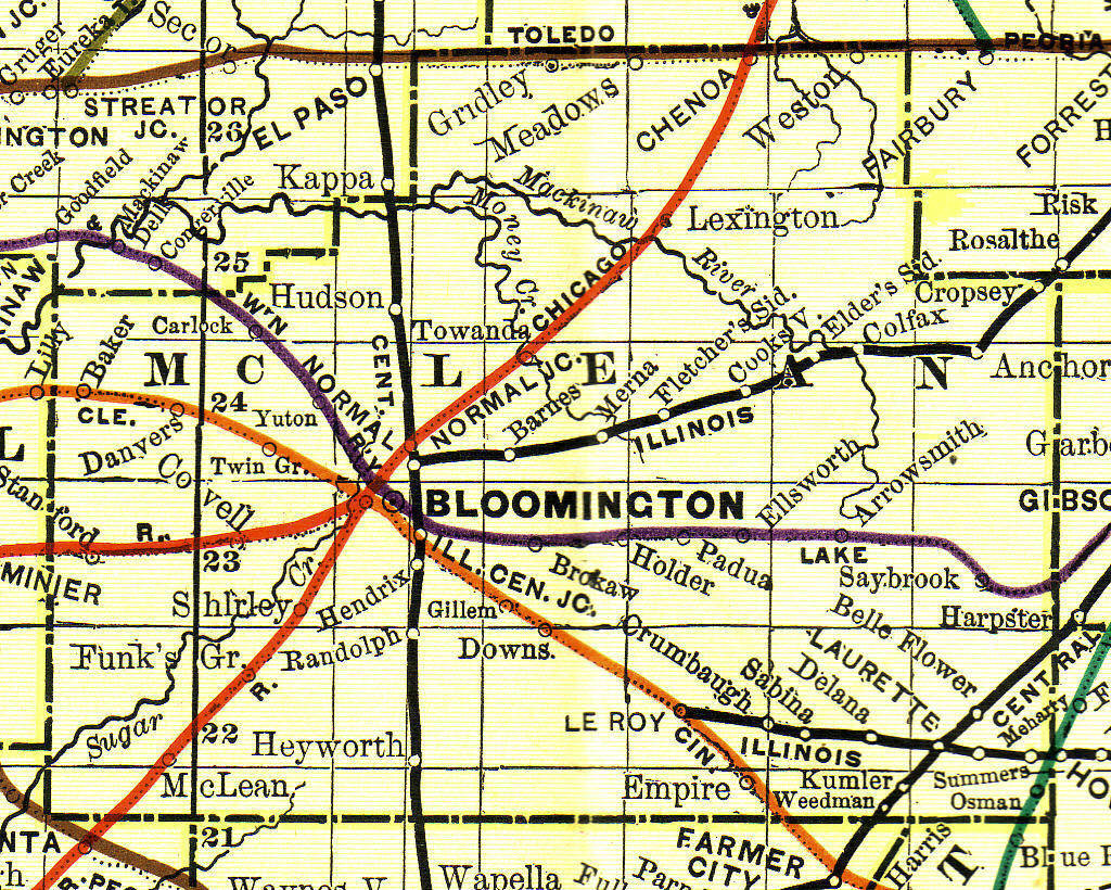
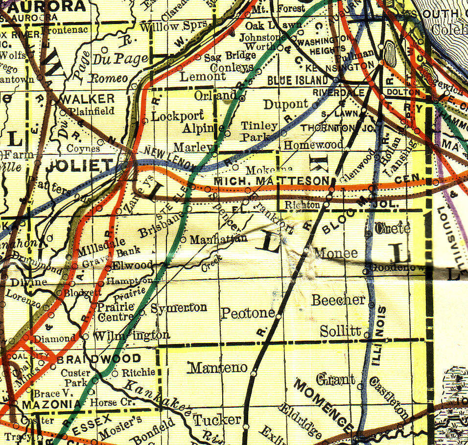
Illinois Railroad Map Legend, 1892
Source: "Rand, McNally & Co." Submitted by Deb Haines.
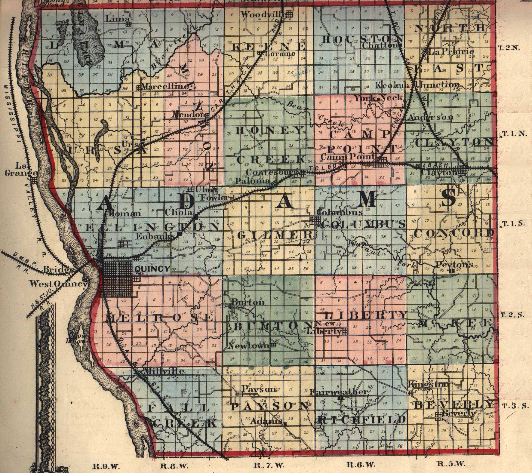
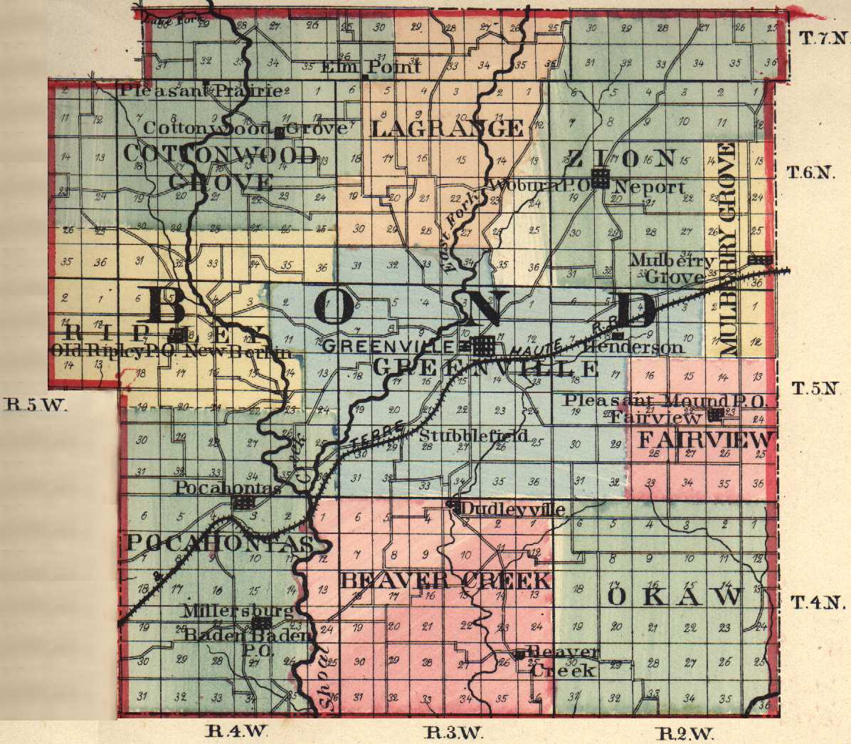
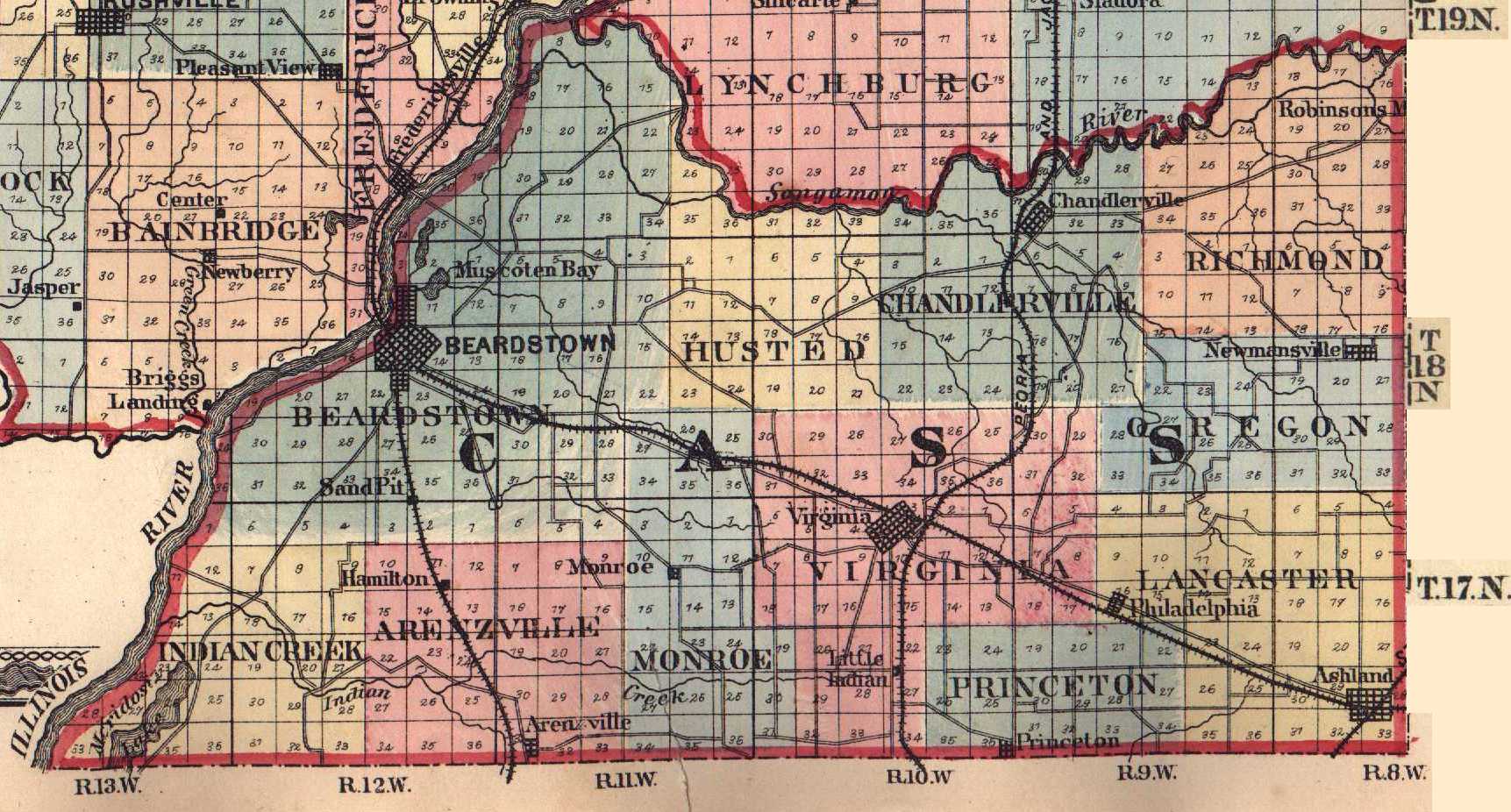
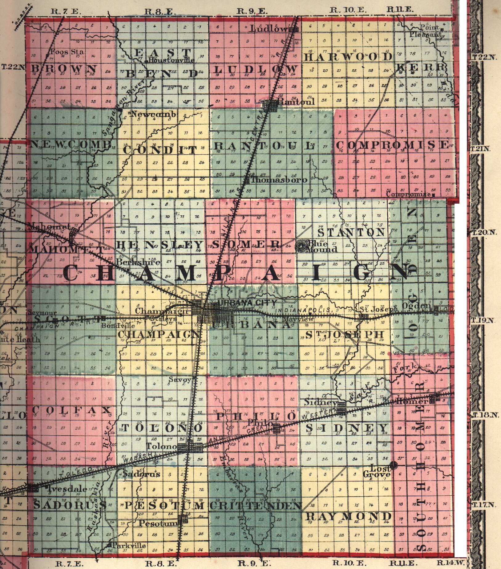
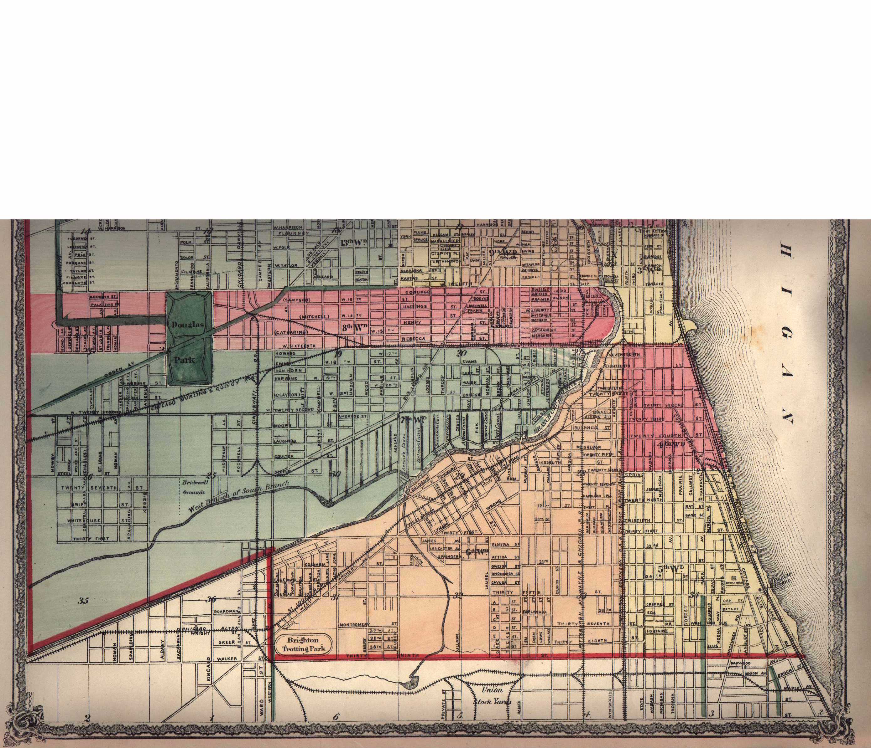
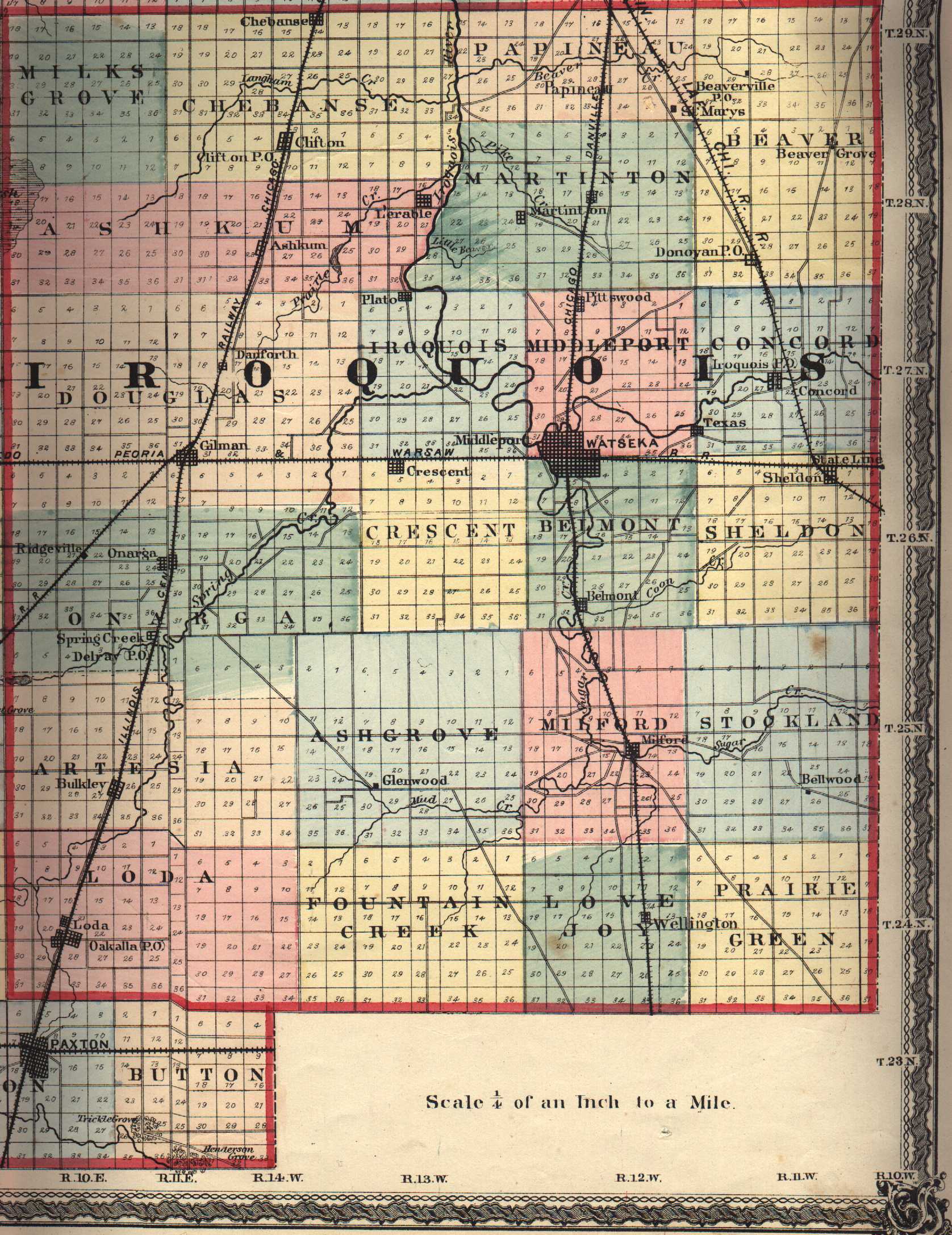
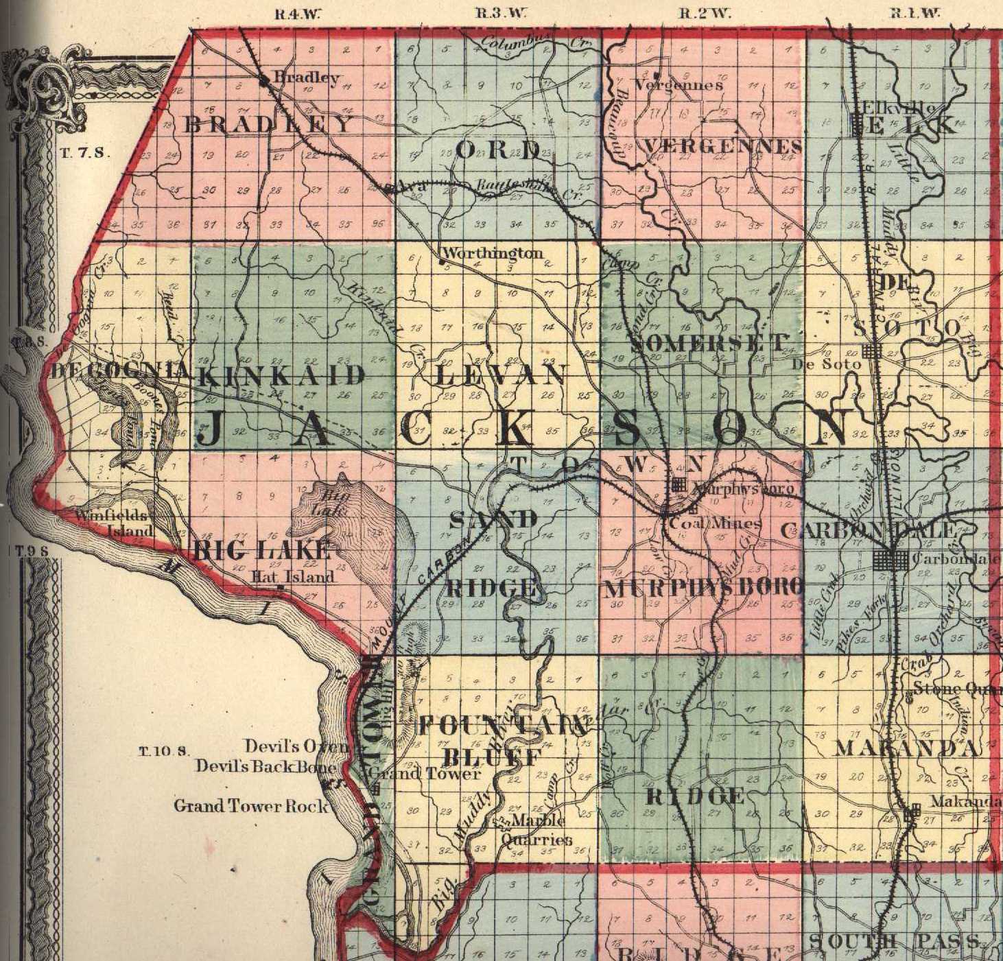
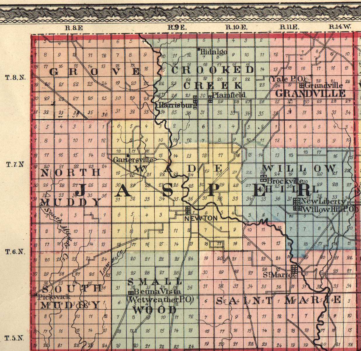
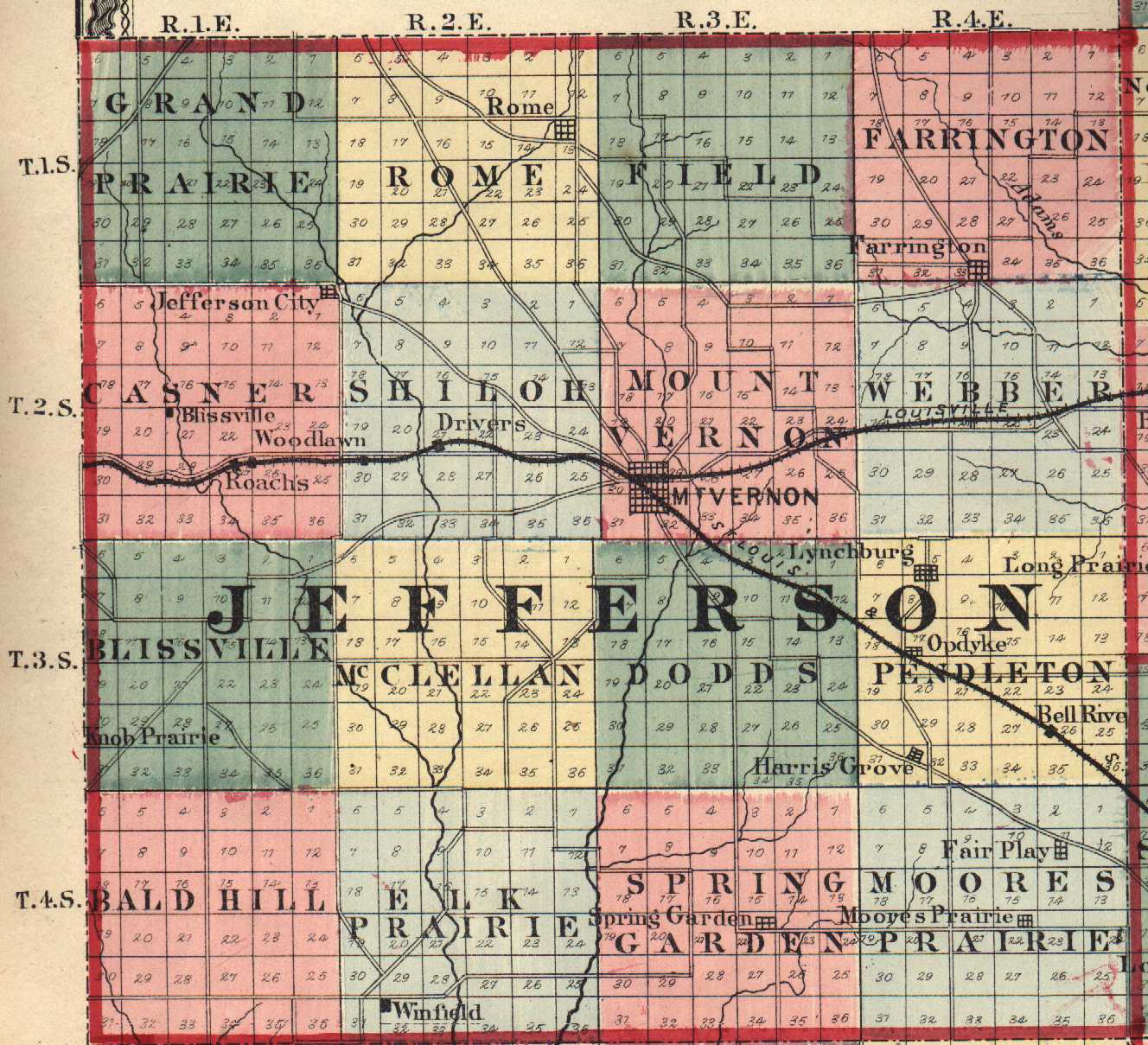
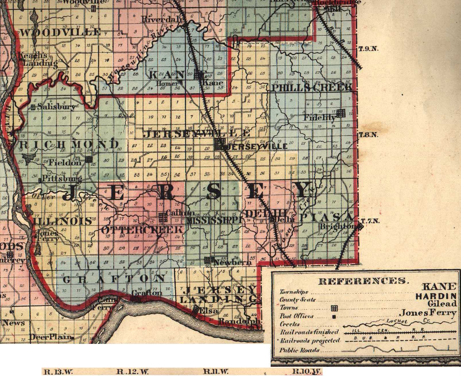
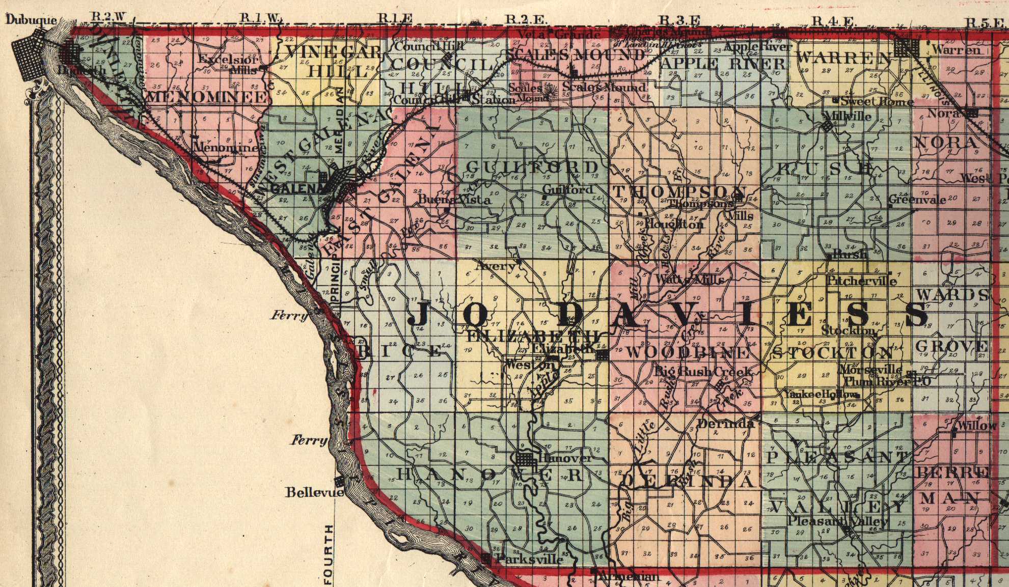
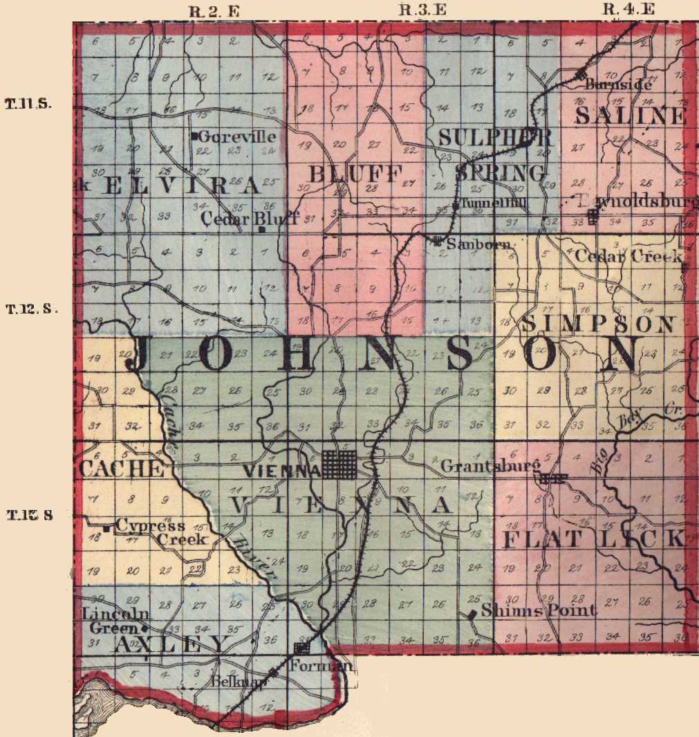
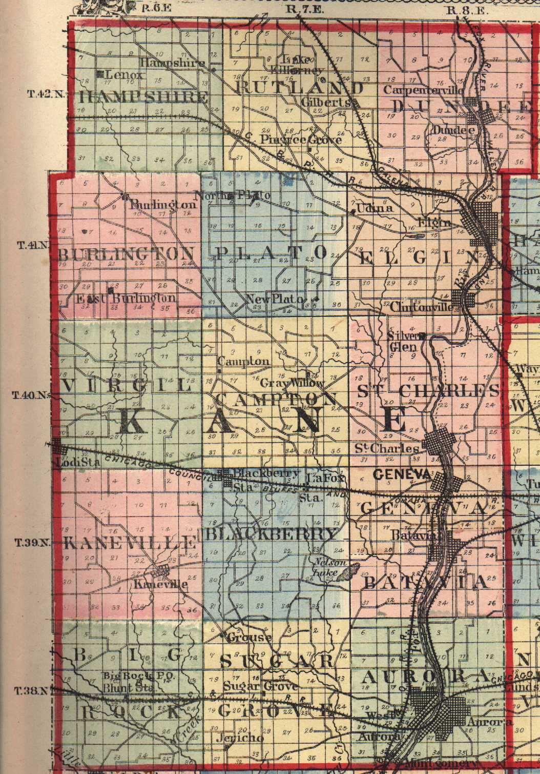
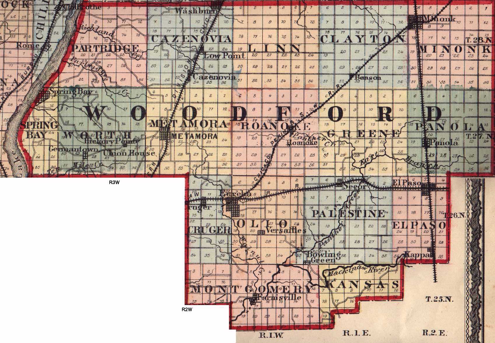
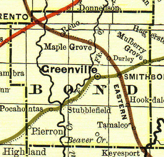
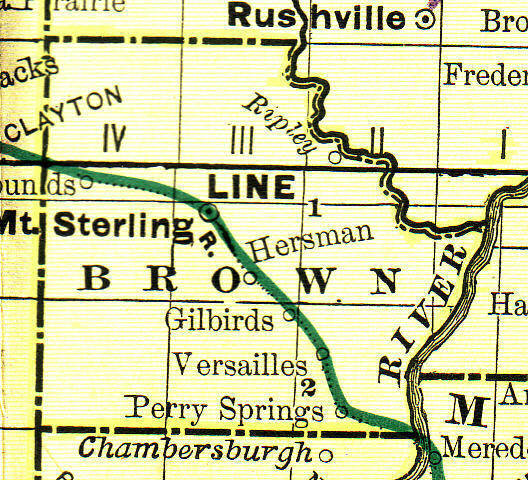
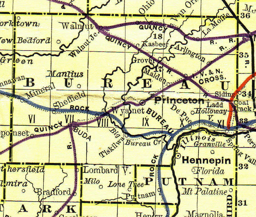
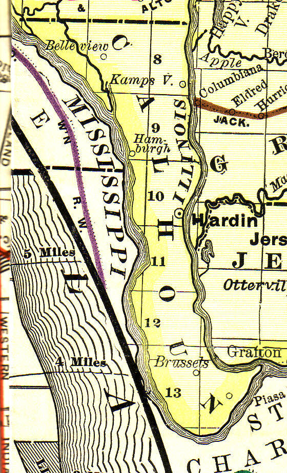
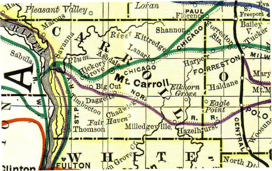
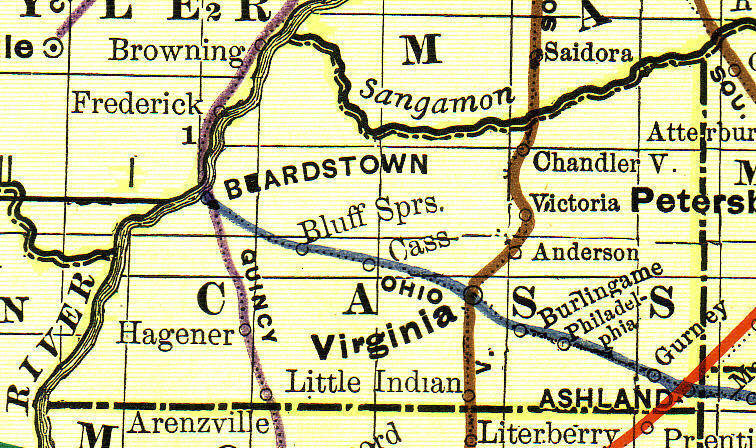
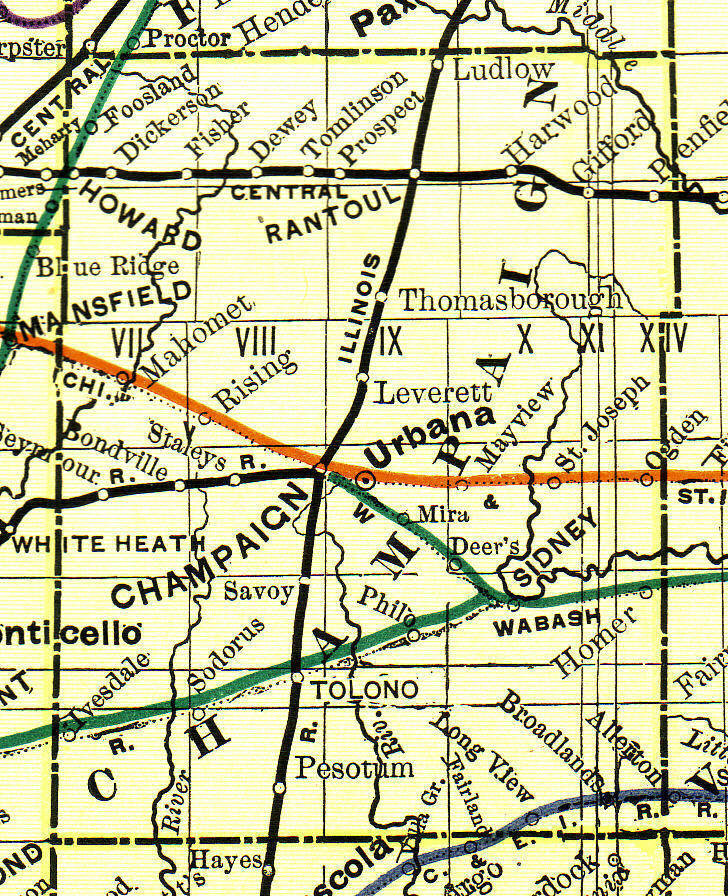
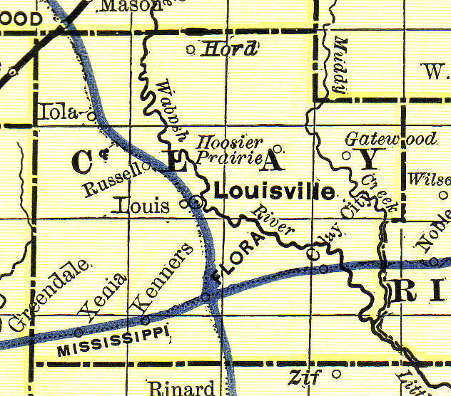
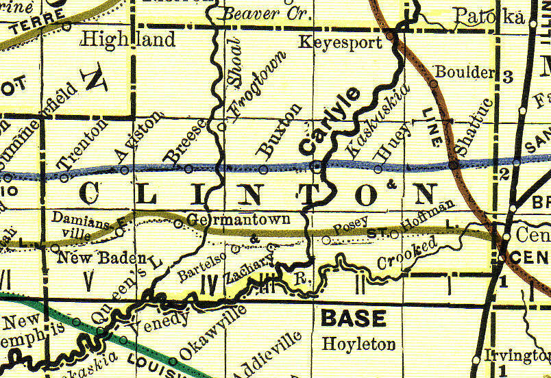
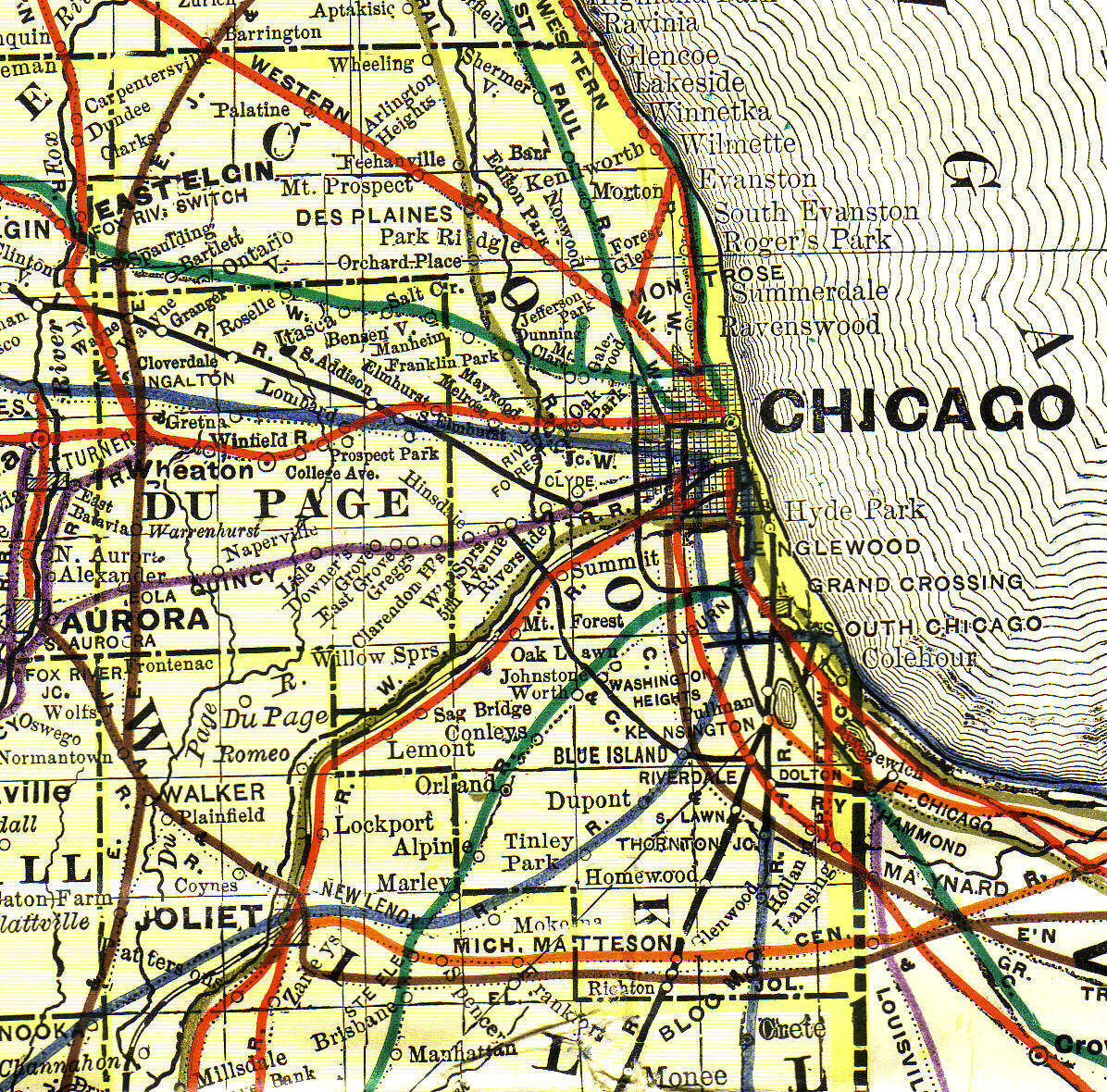
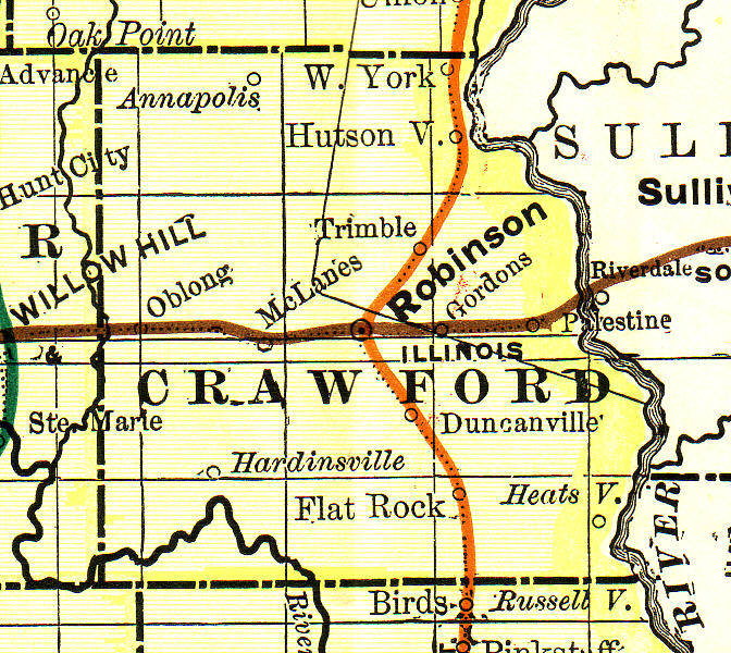
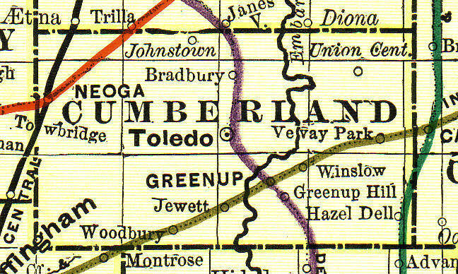
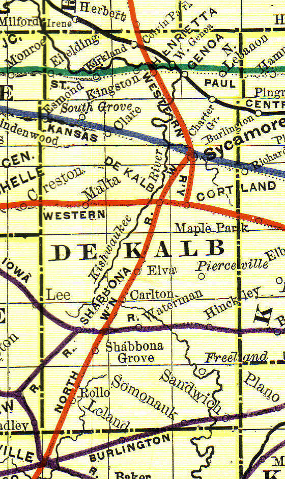
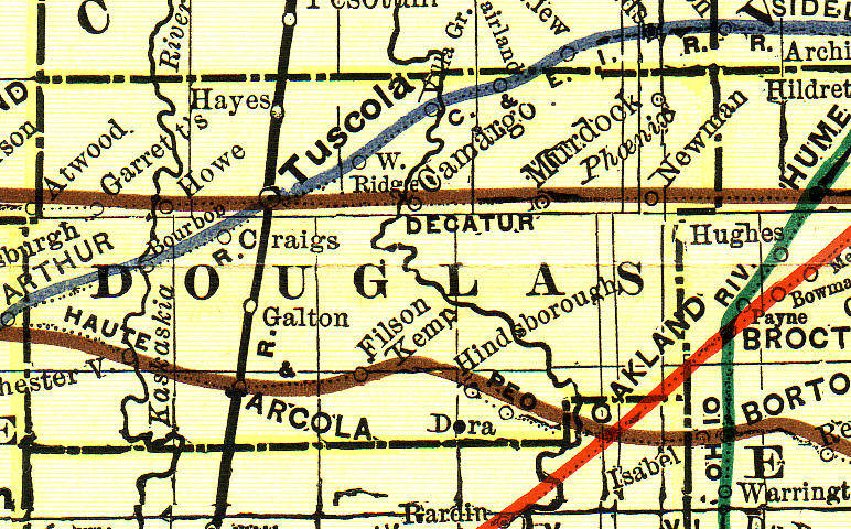
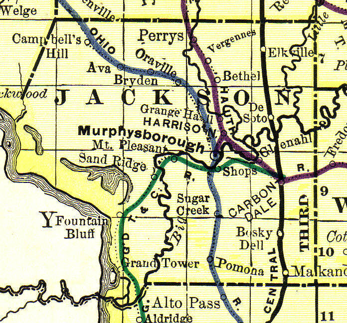
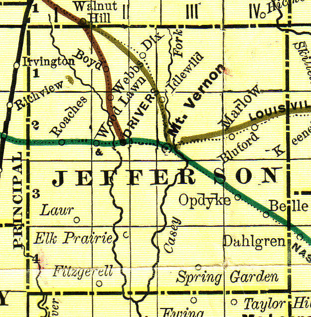
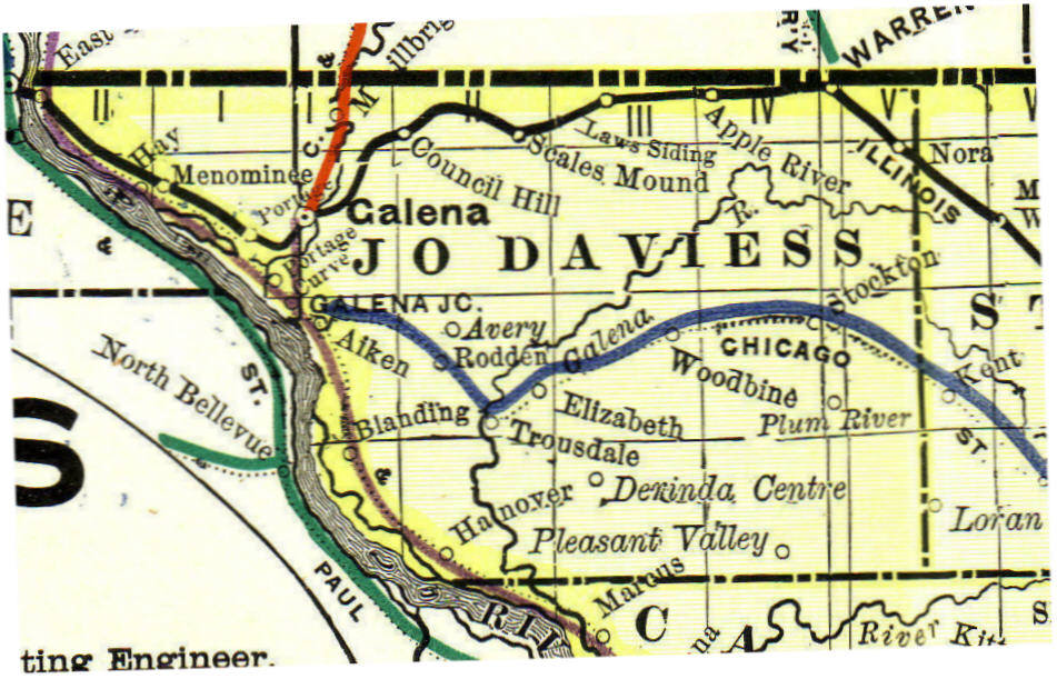
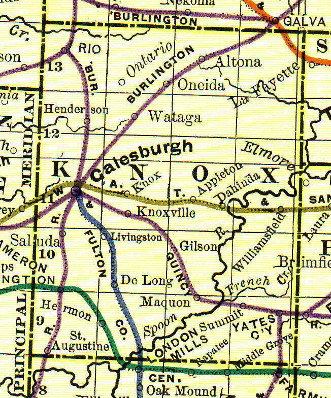
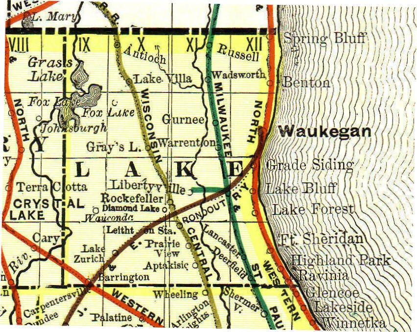
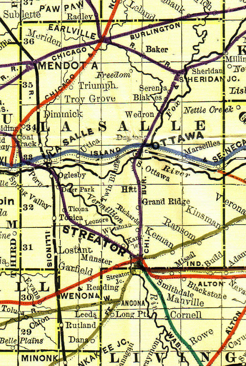
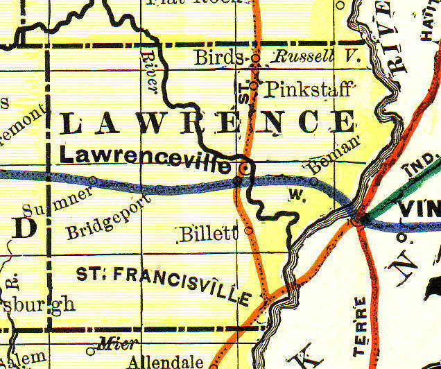
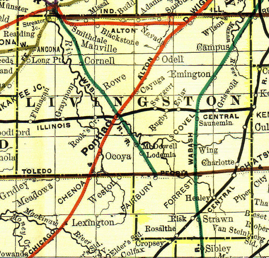
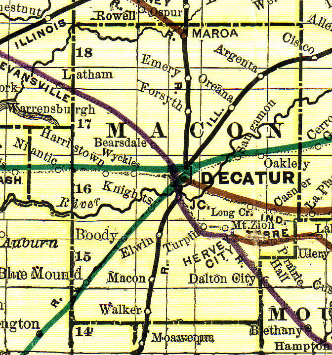
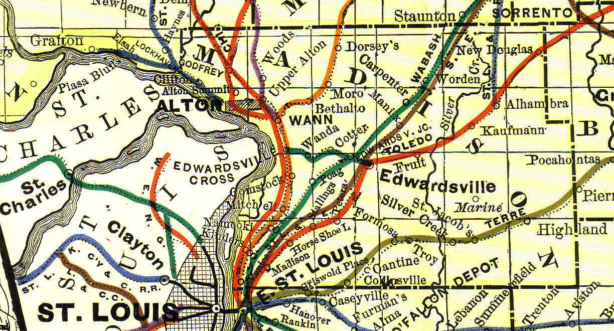
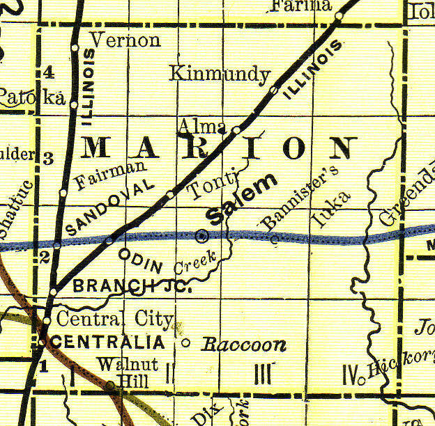
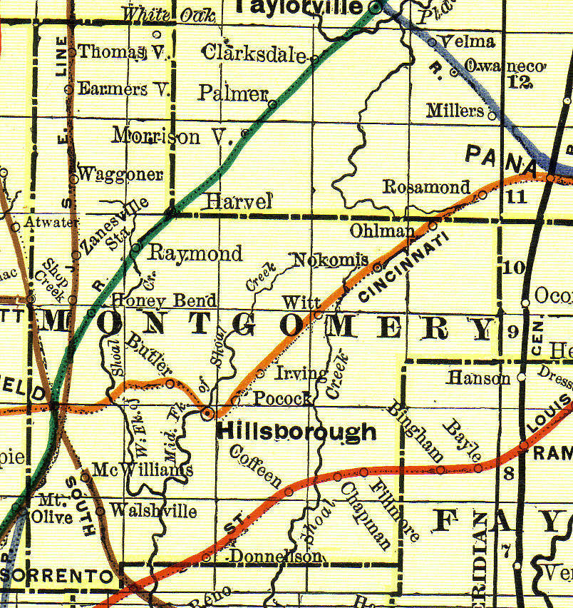
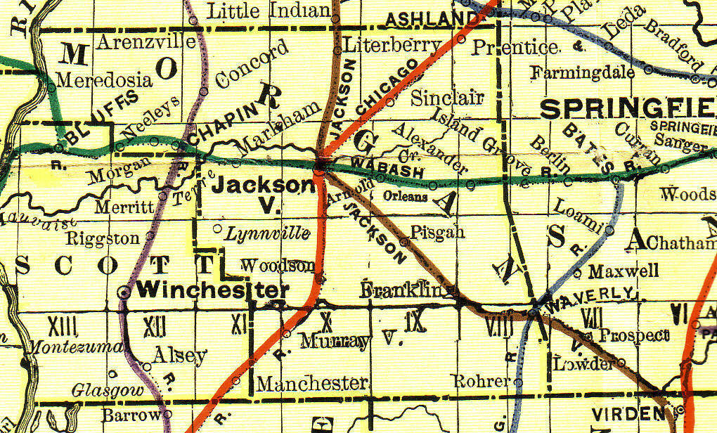
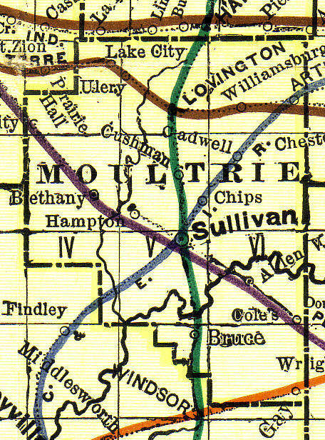
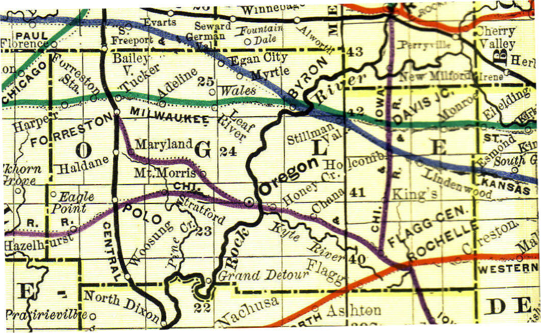
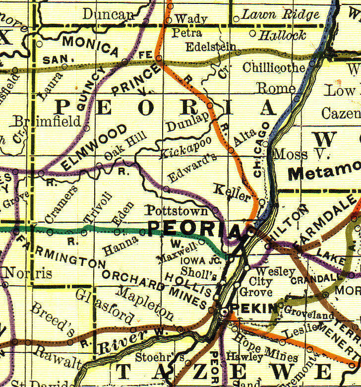
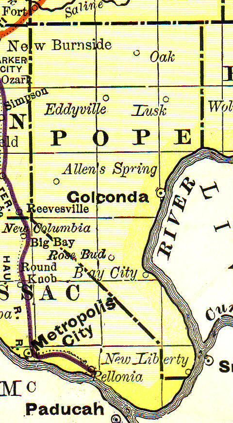
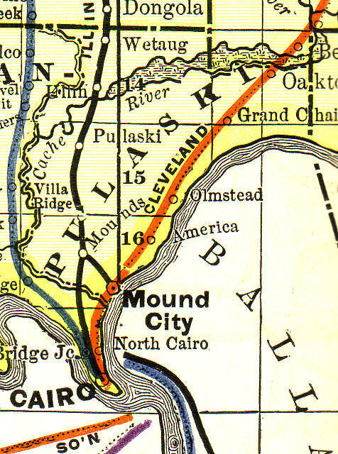
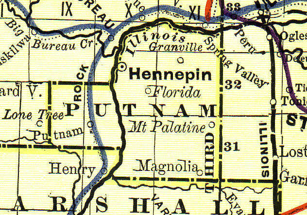
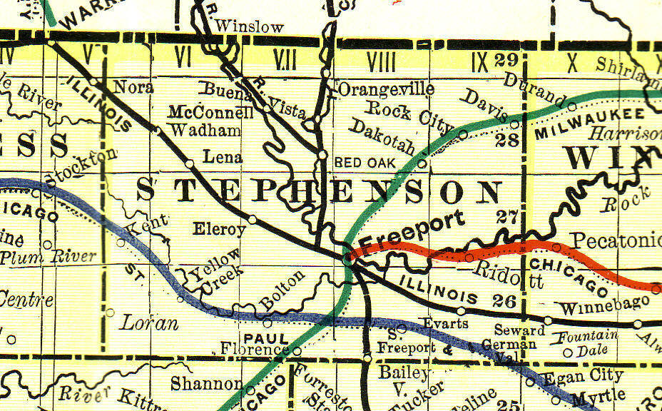
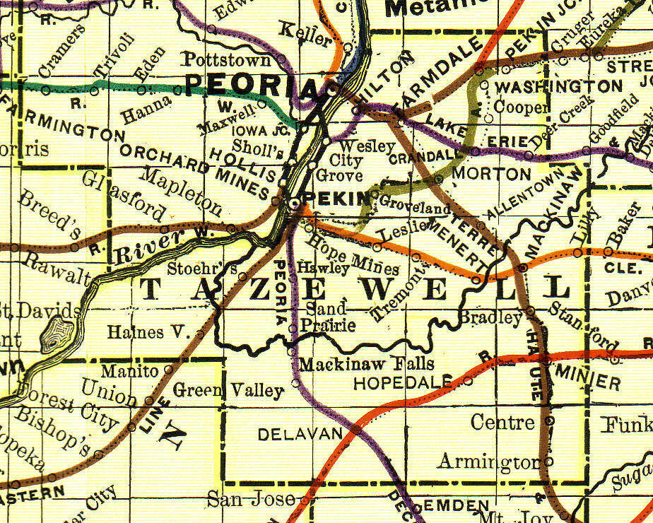
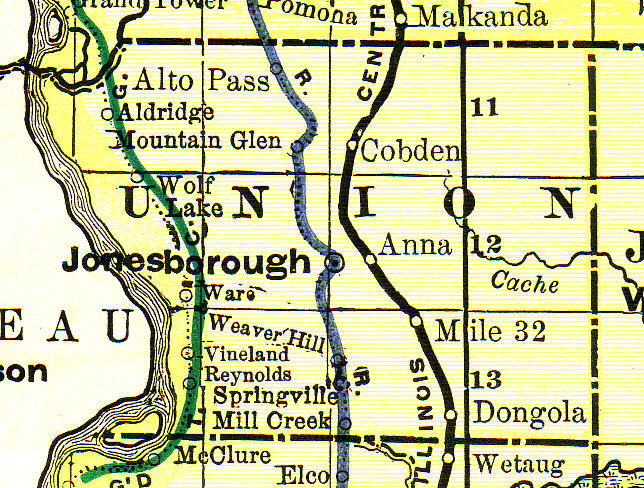
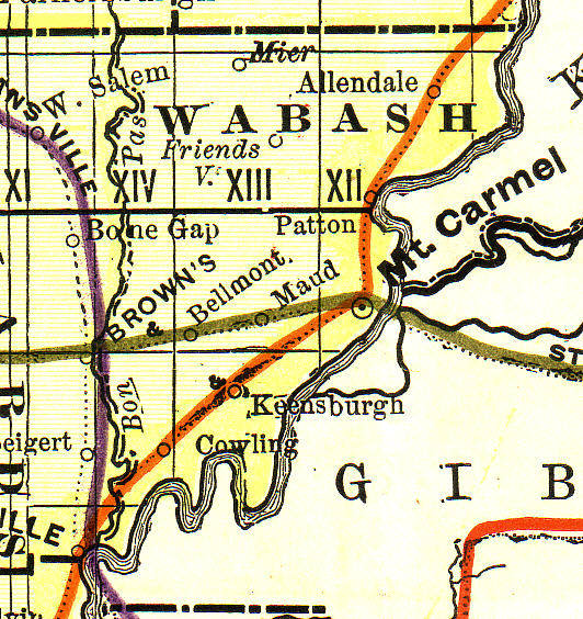
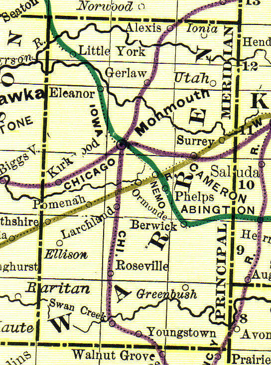
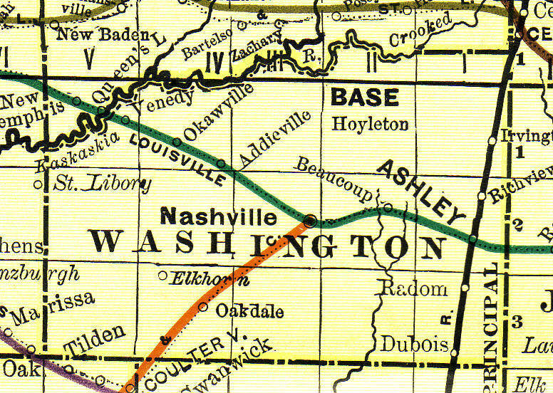
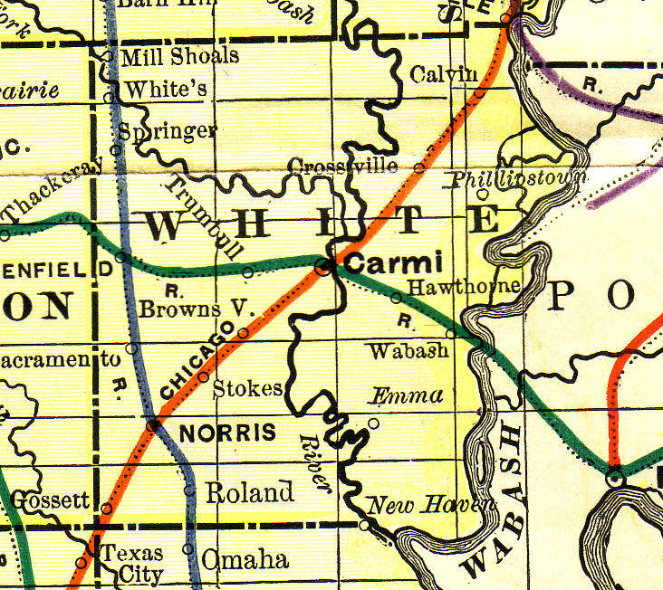
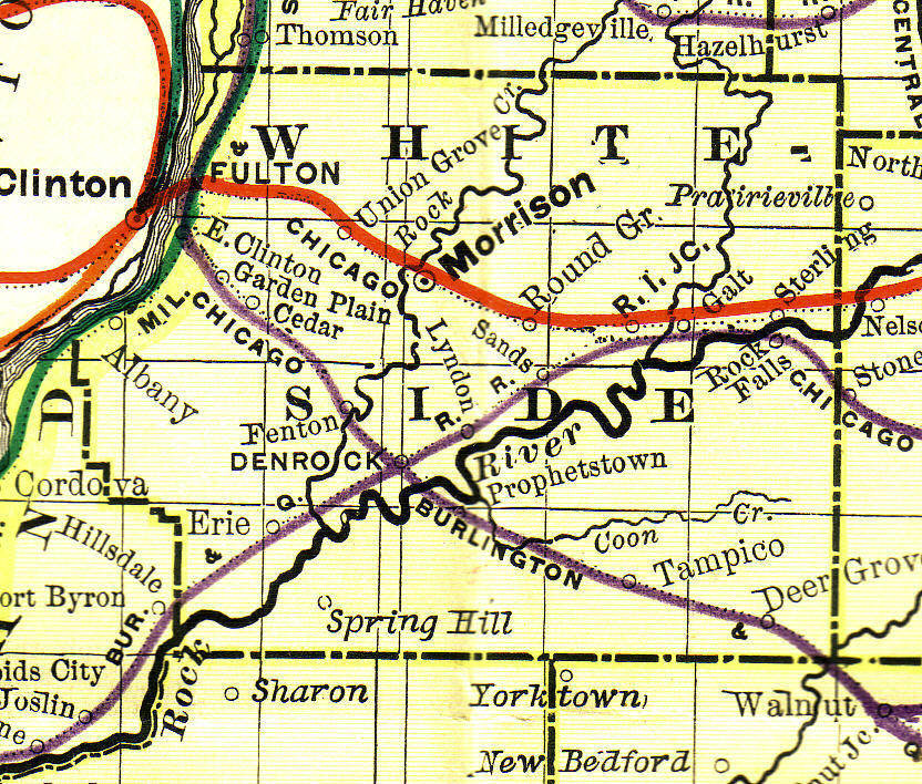
Illinois County Maps
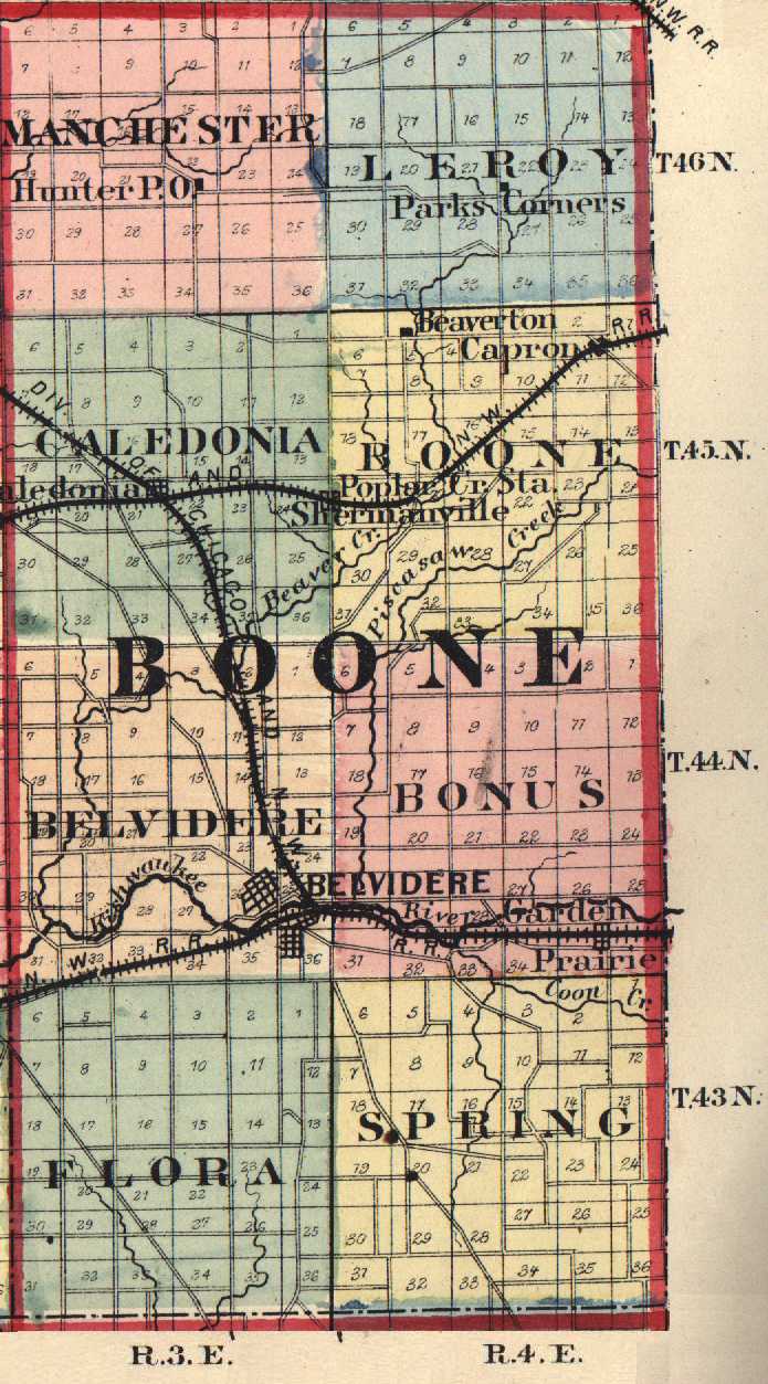
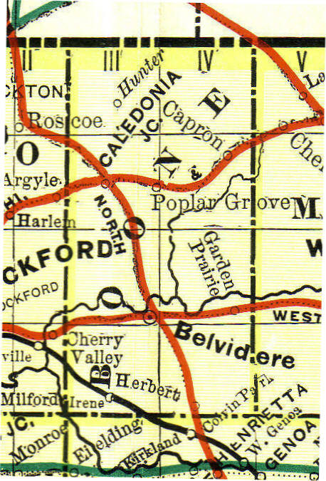
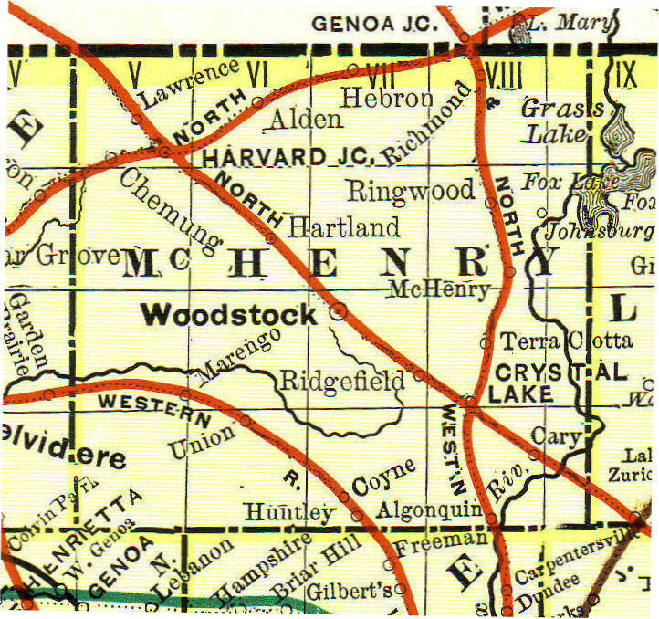
Boone County Maps, Submitted by Martin Johnson.
Belvidere Plat Map, 1870 (1.16 MB)
Boone County Map, 1870 (large 5.35 MB)
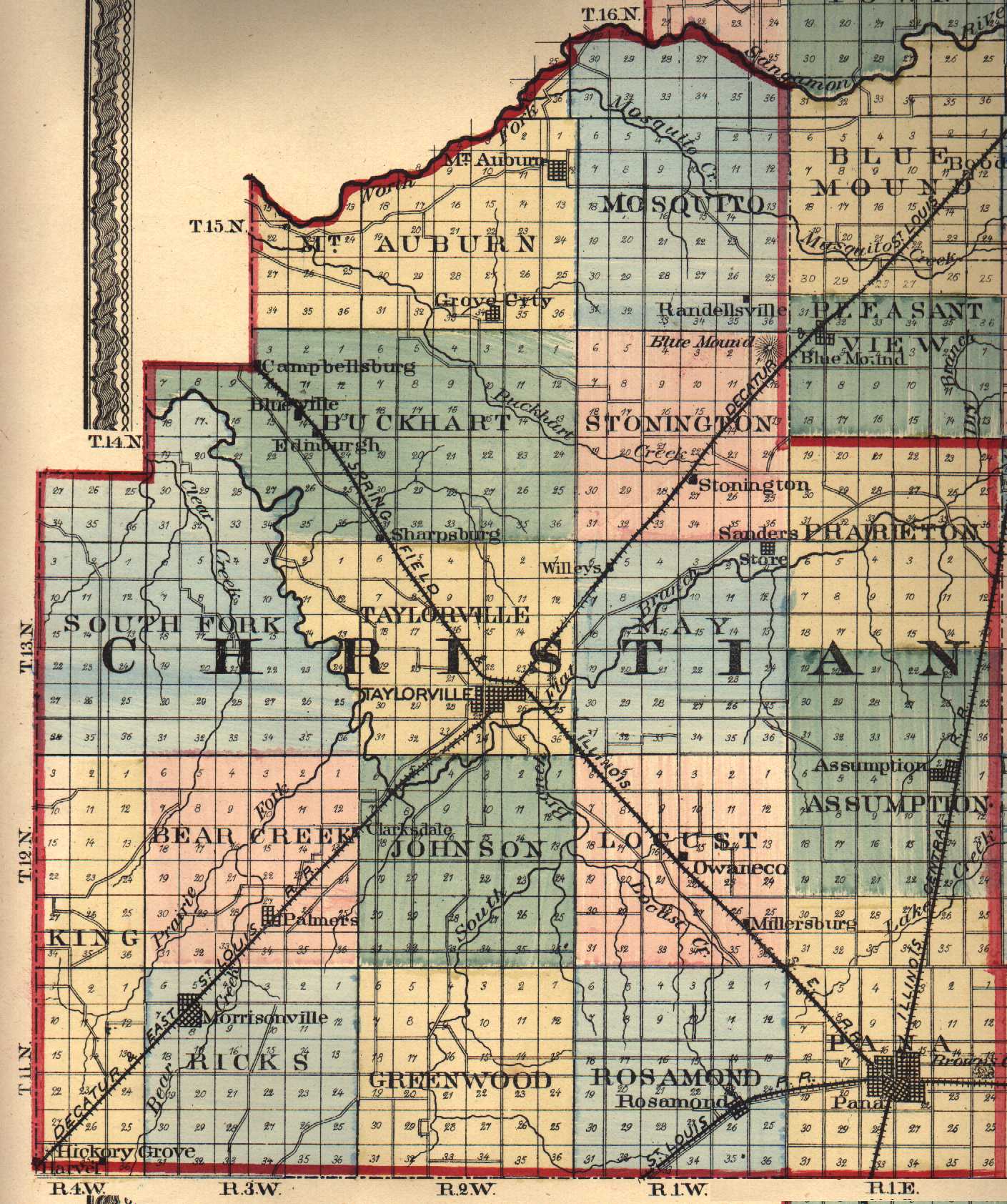
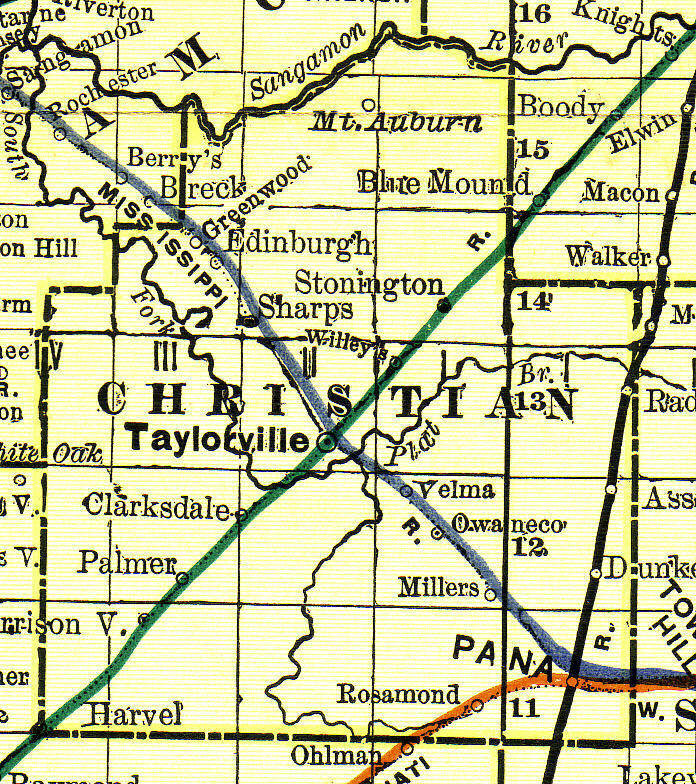
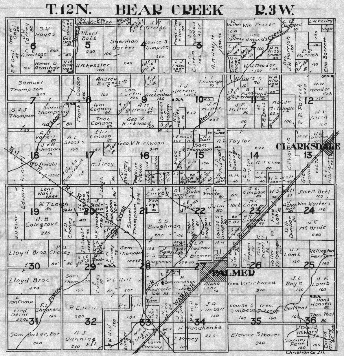
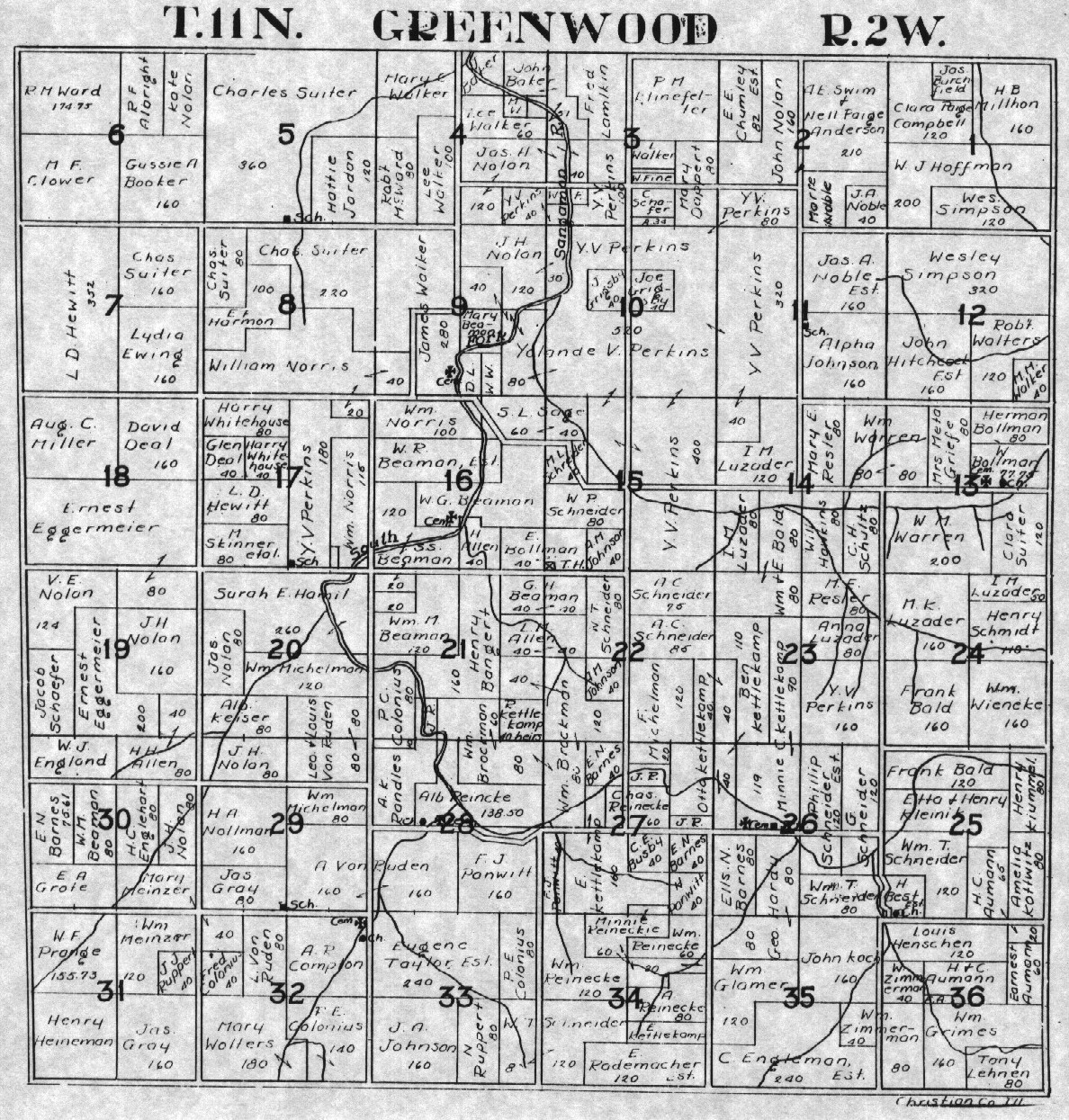
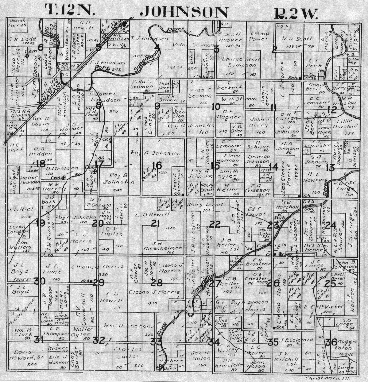
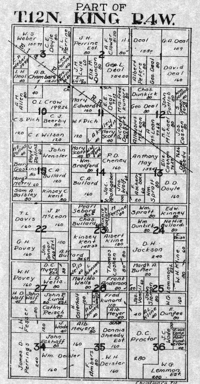
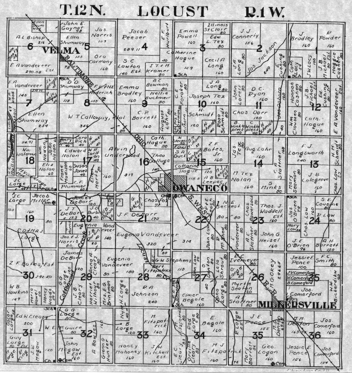
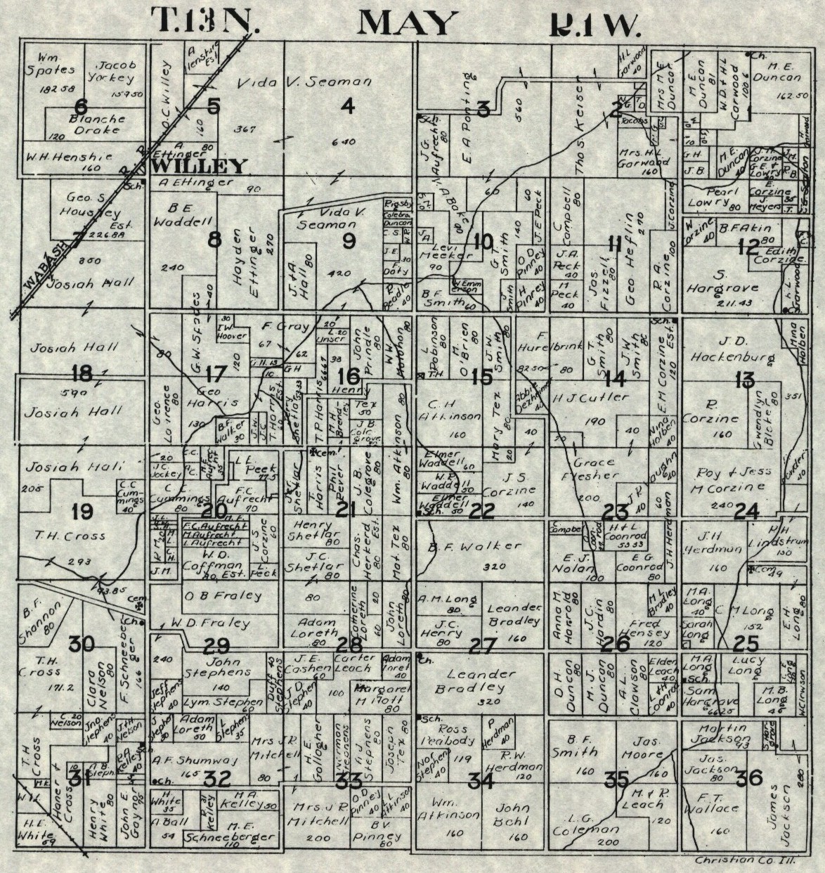
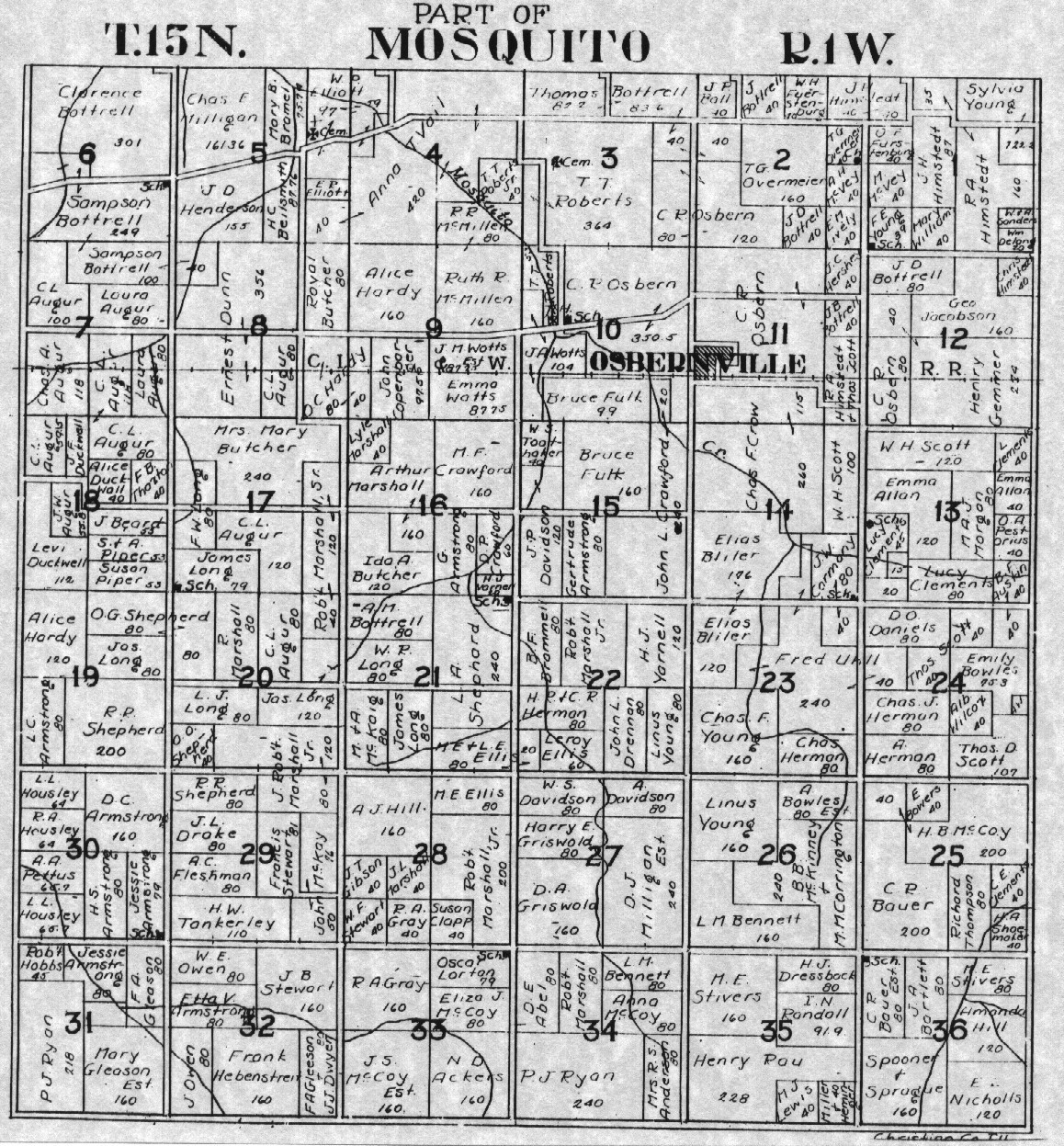
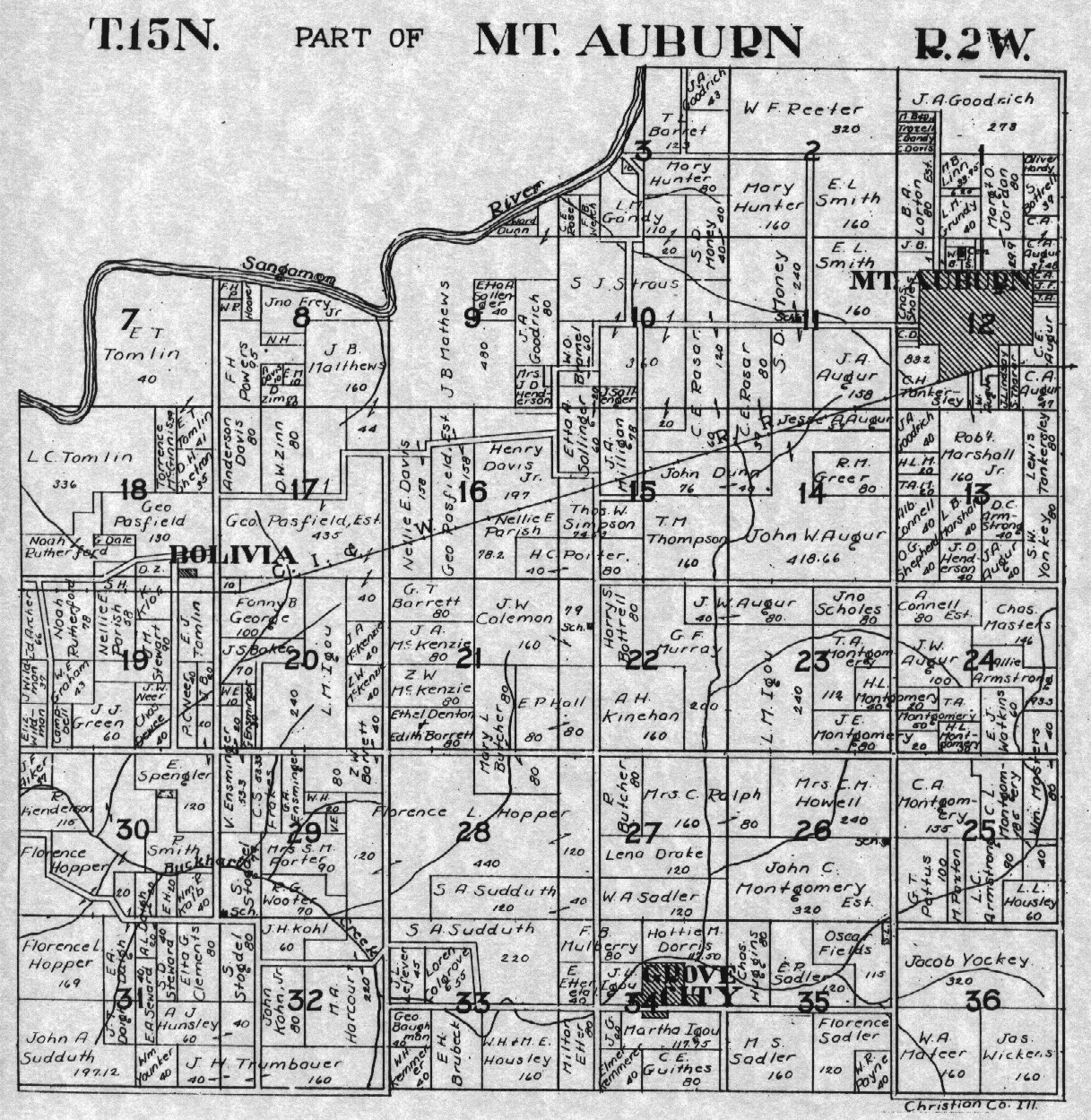
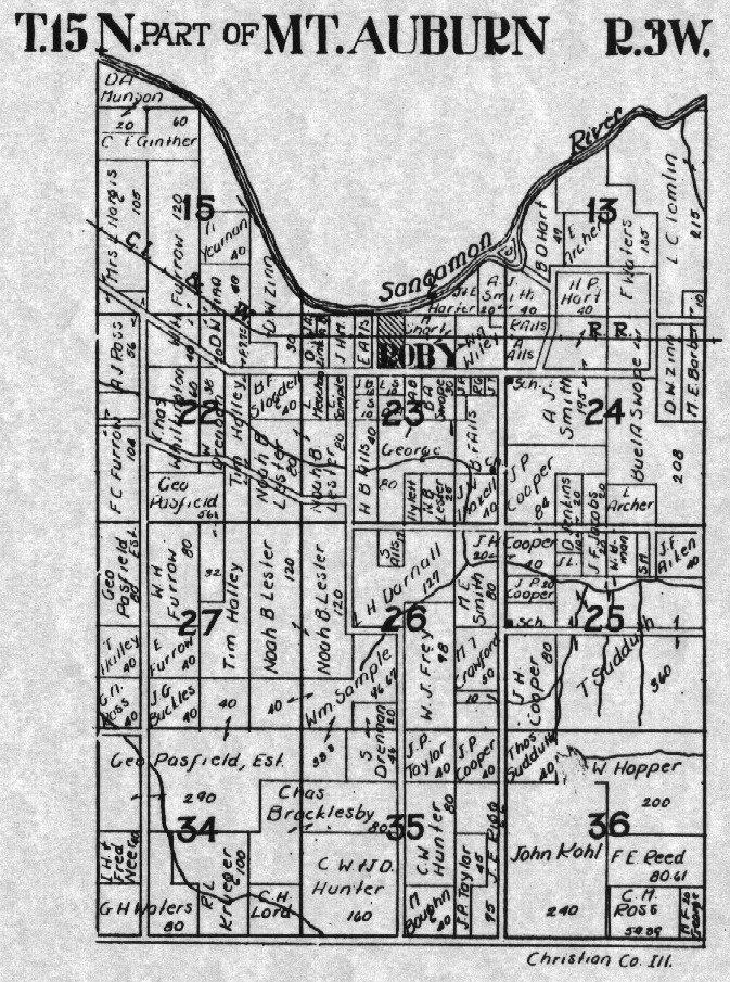
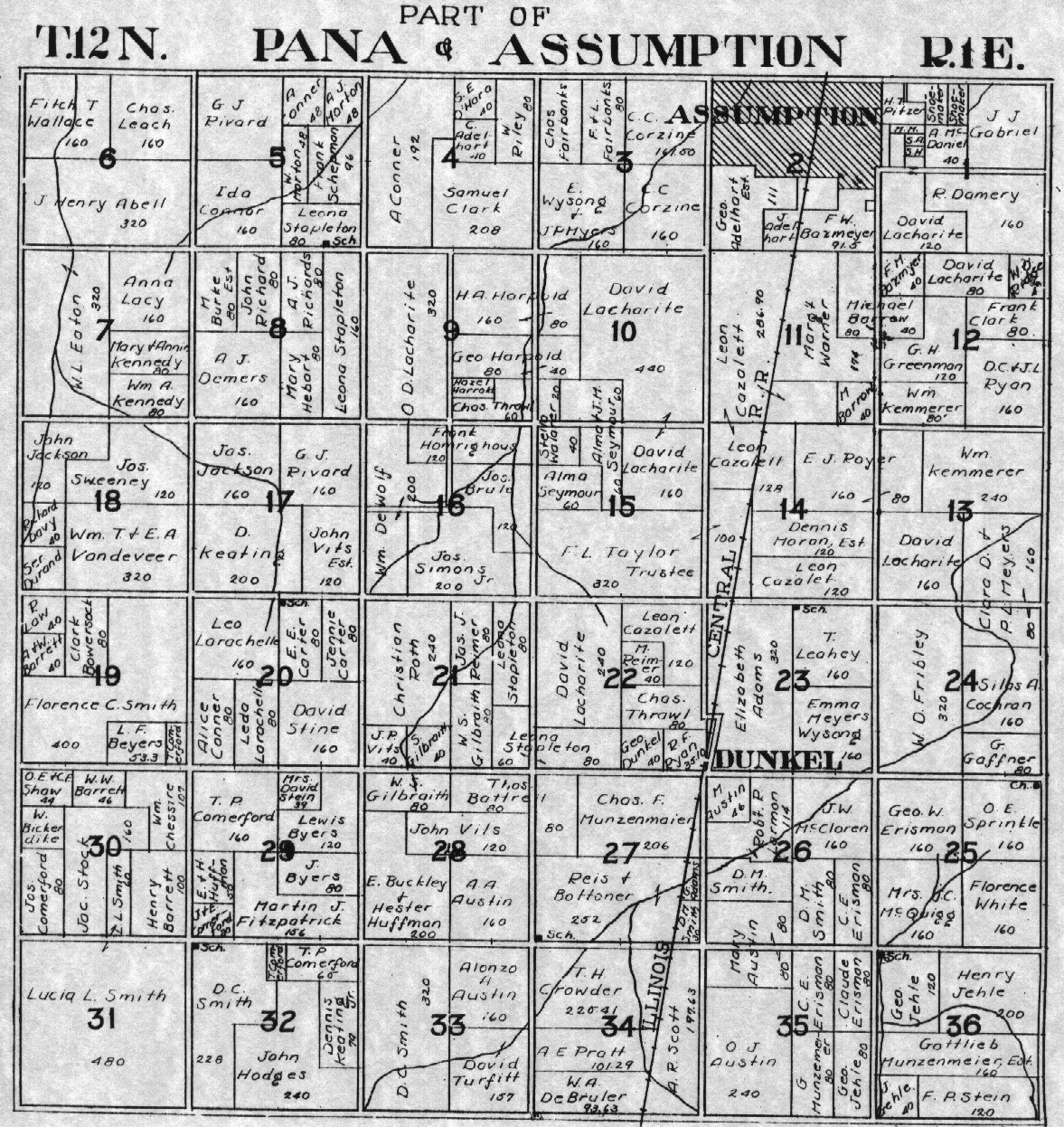
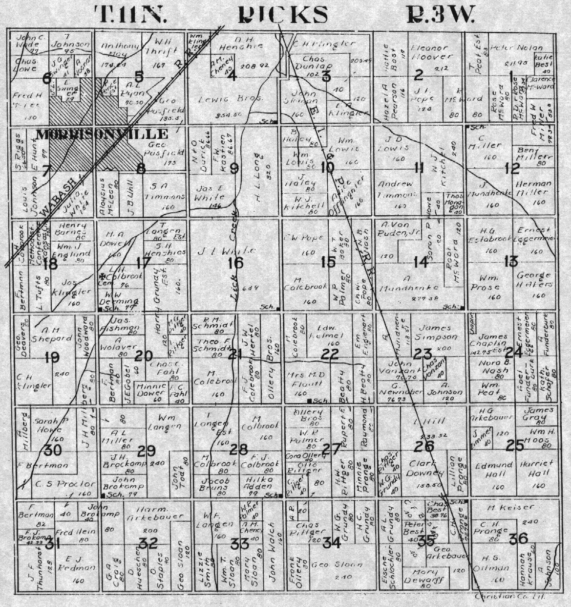
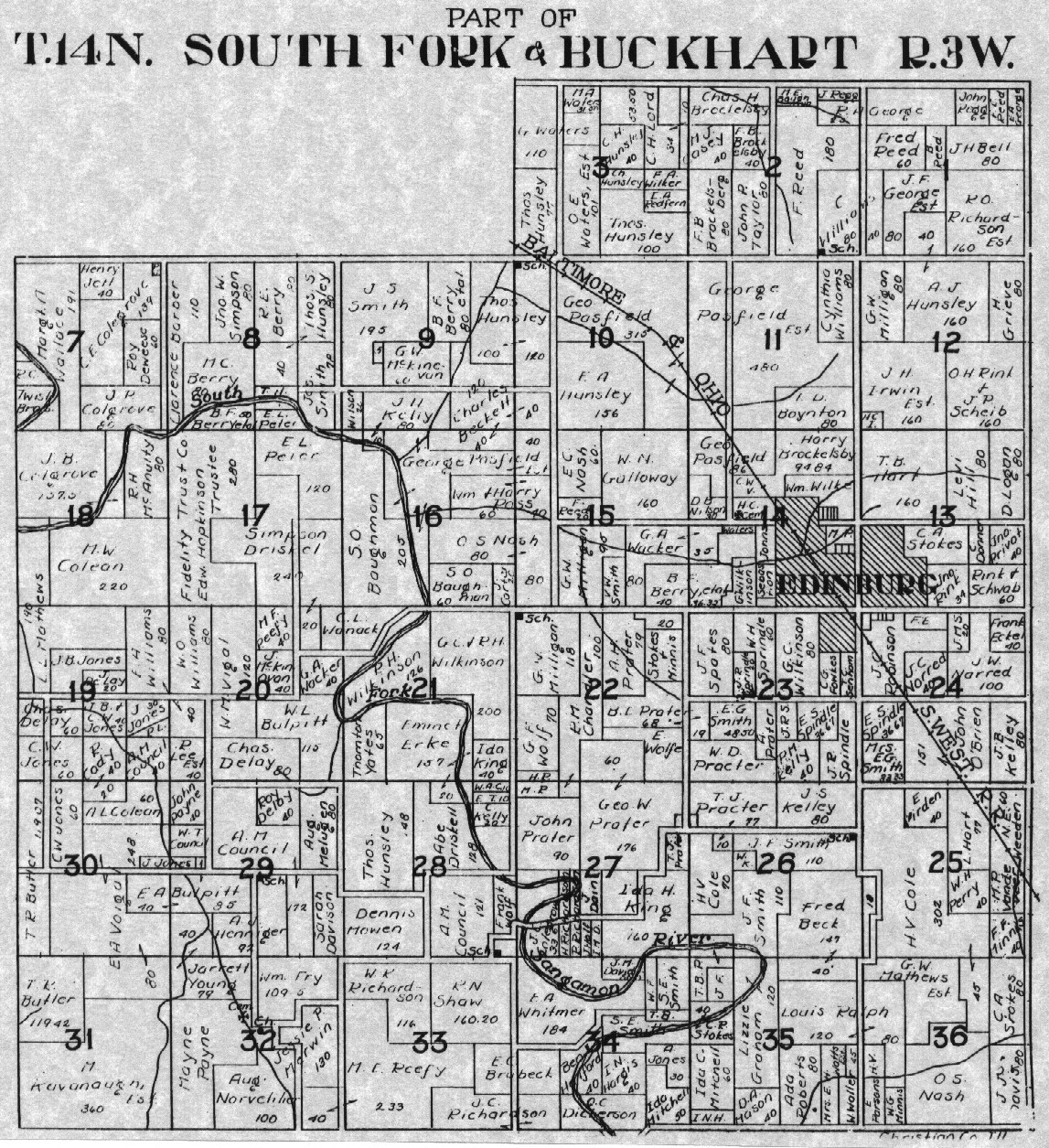
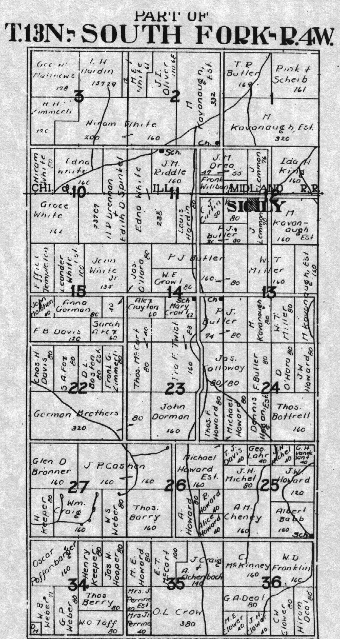
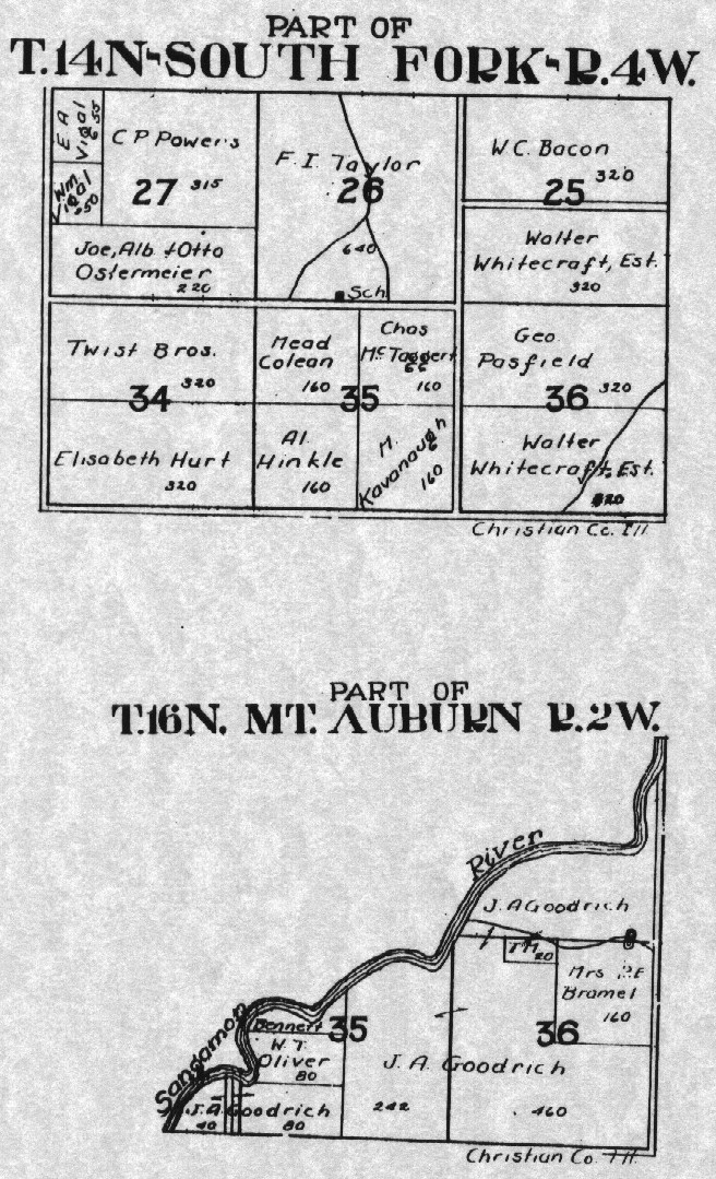
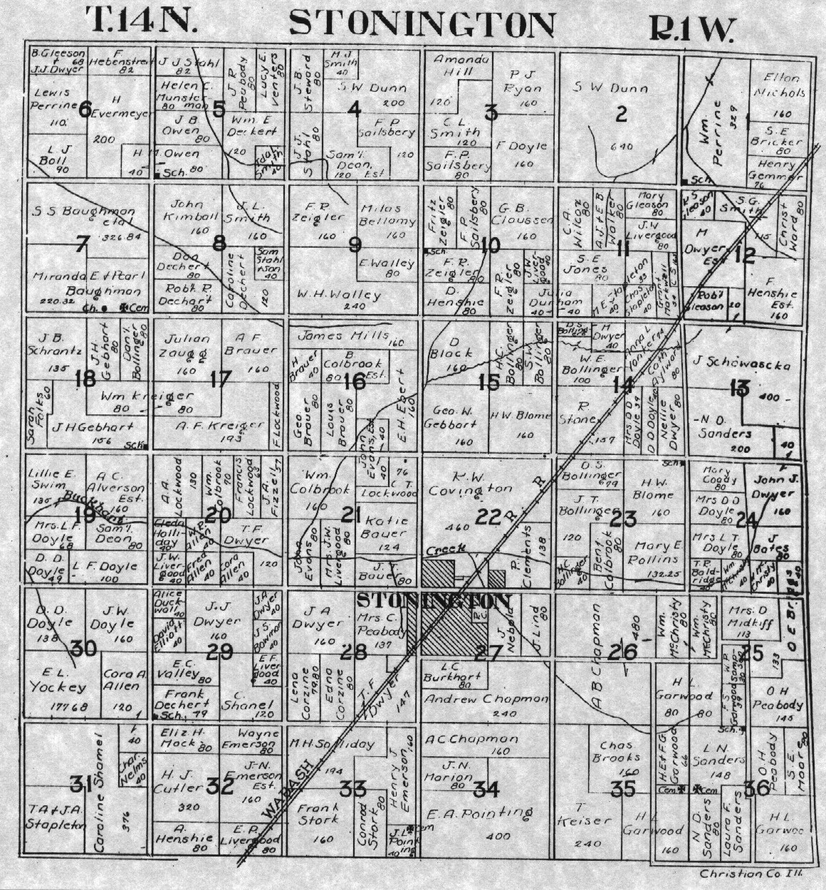
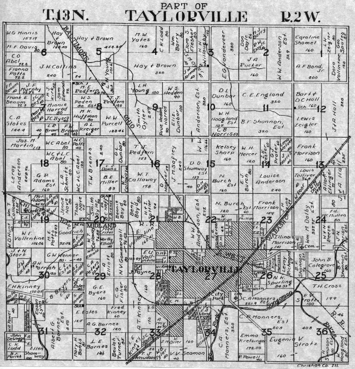
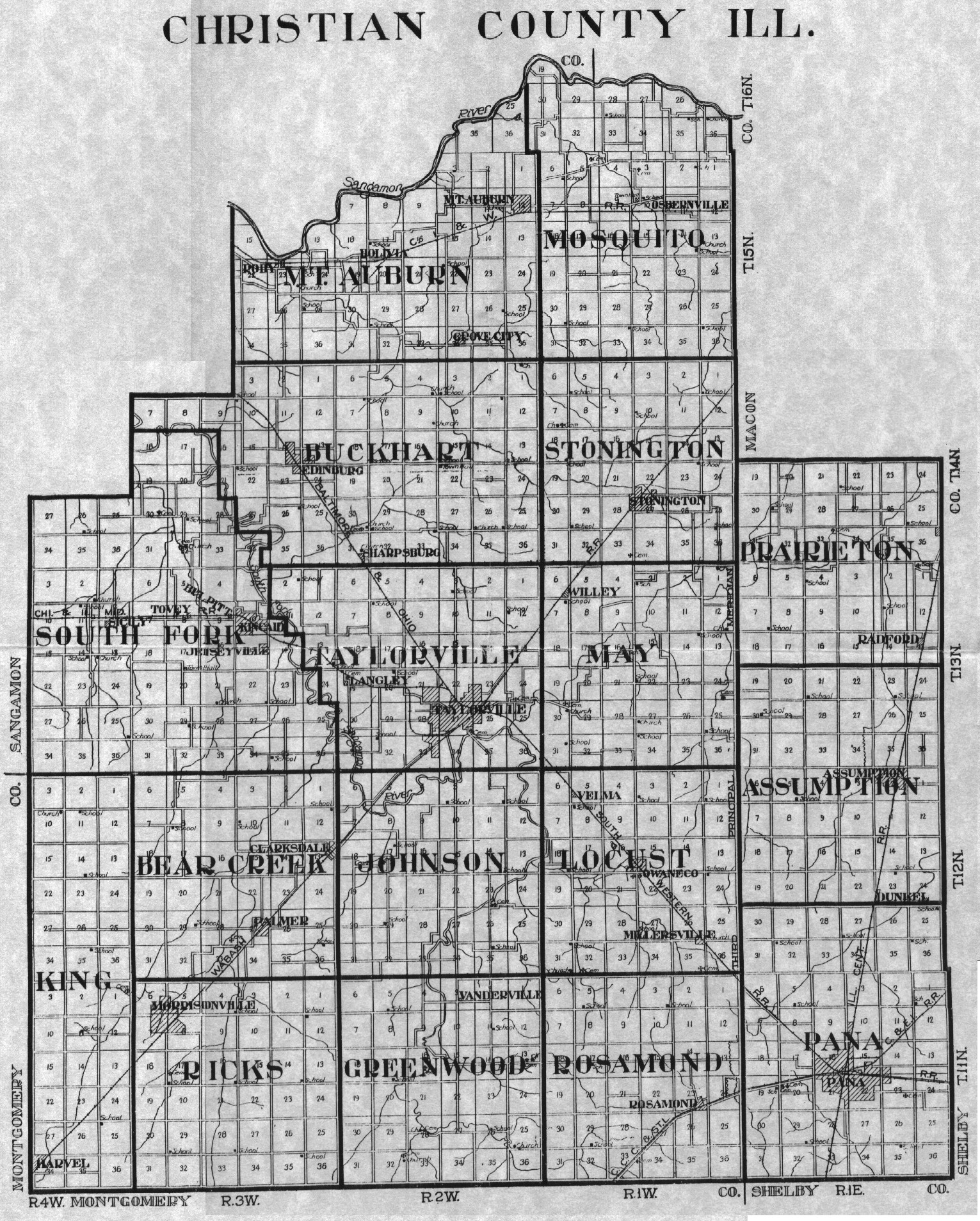
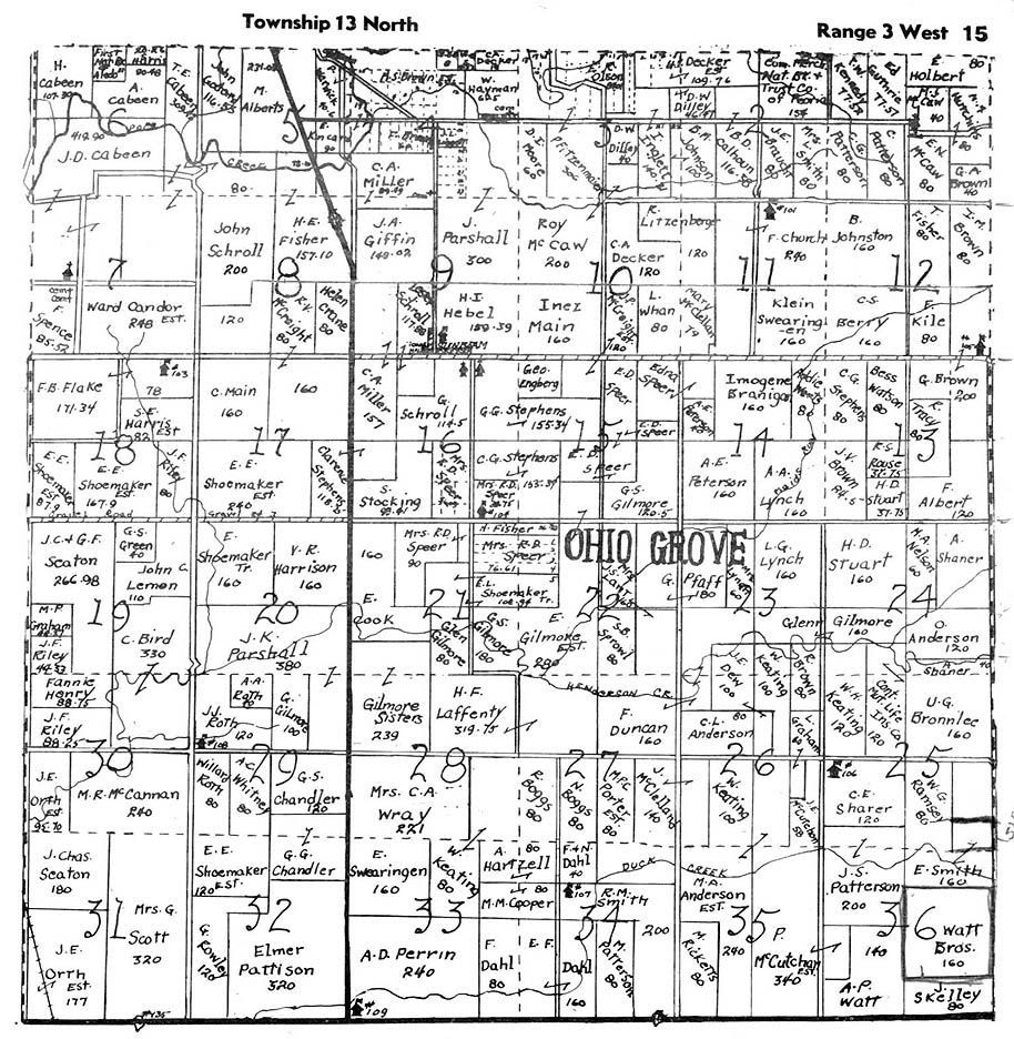
Christian County Plat Maps, 1925. Submitted by Morgan Edward Johnson.
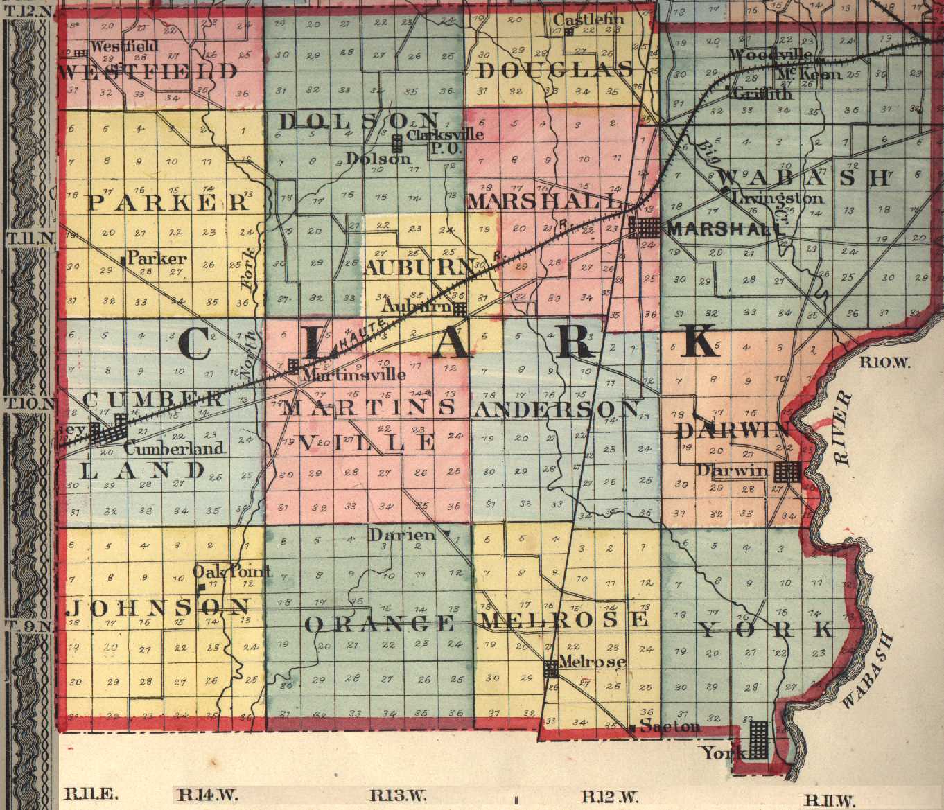
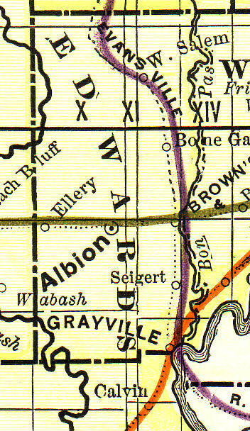
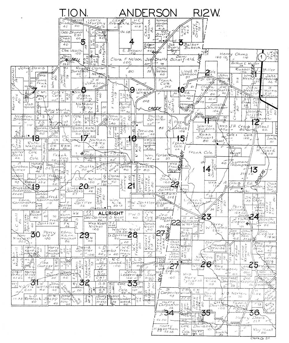
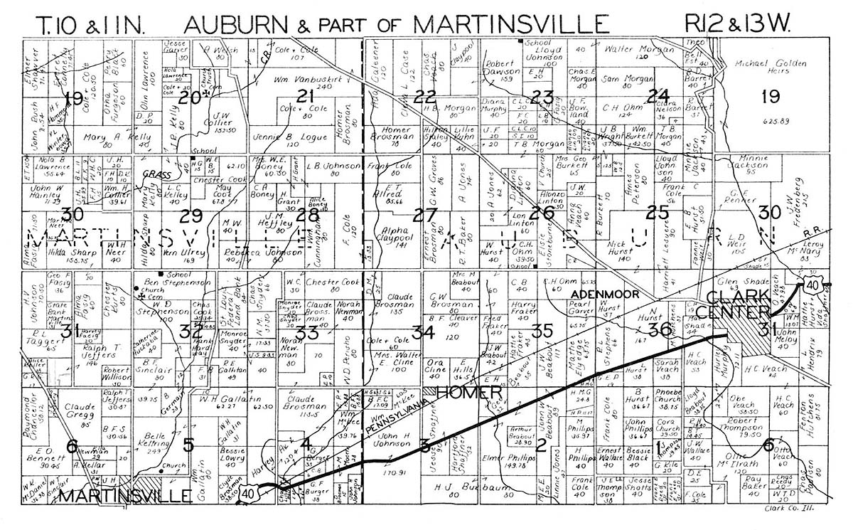
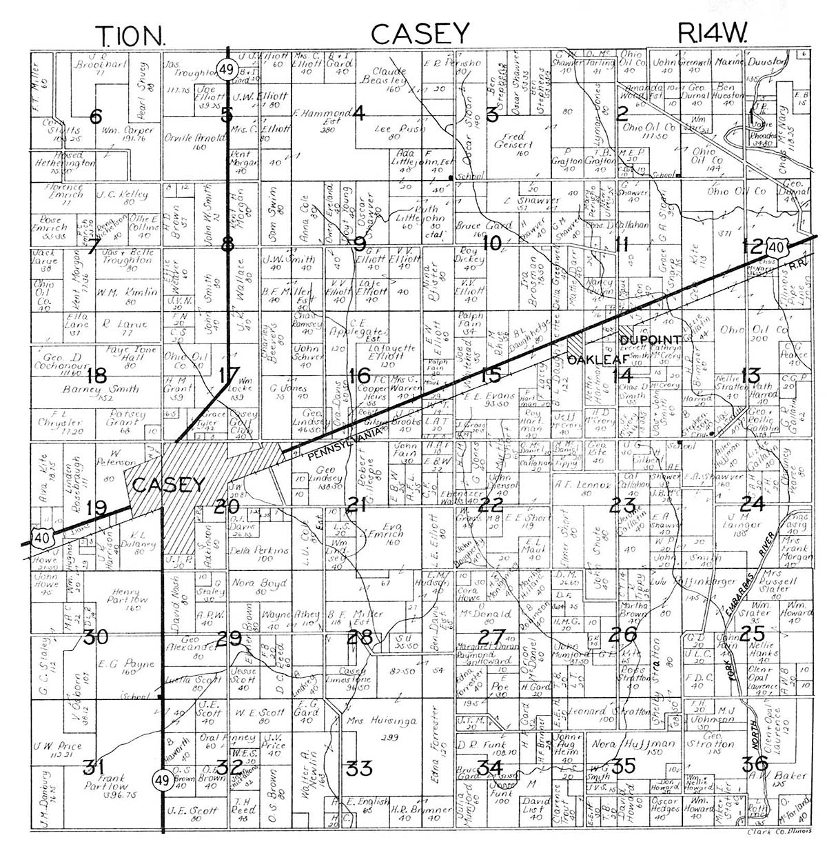
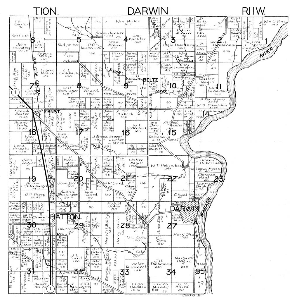
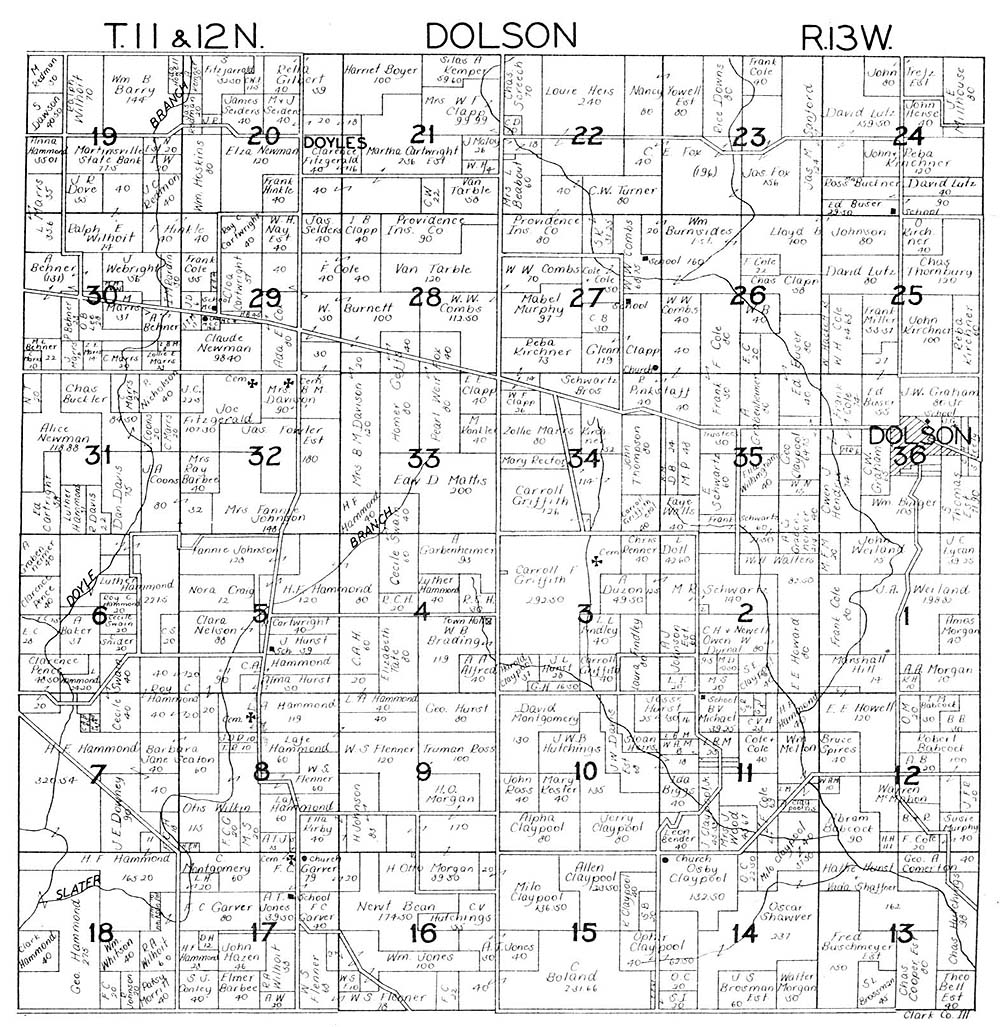
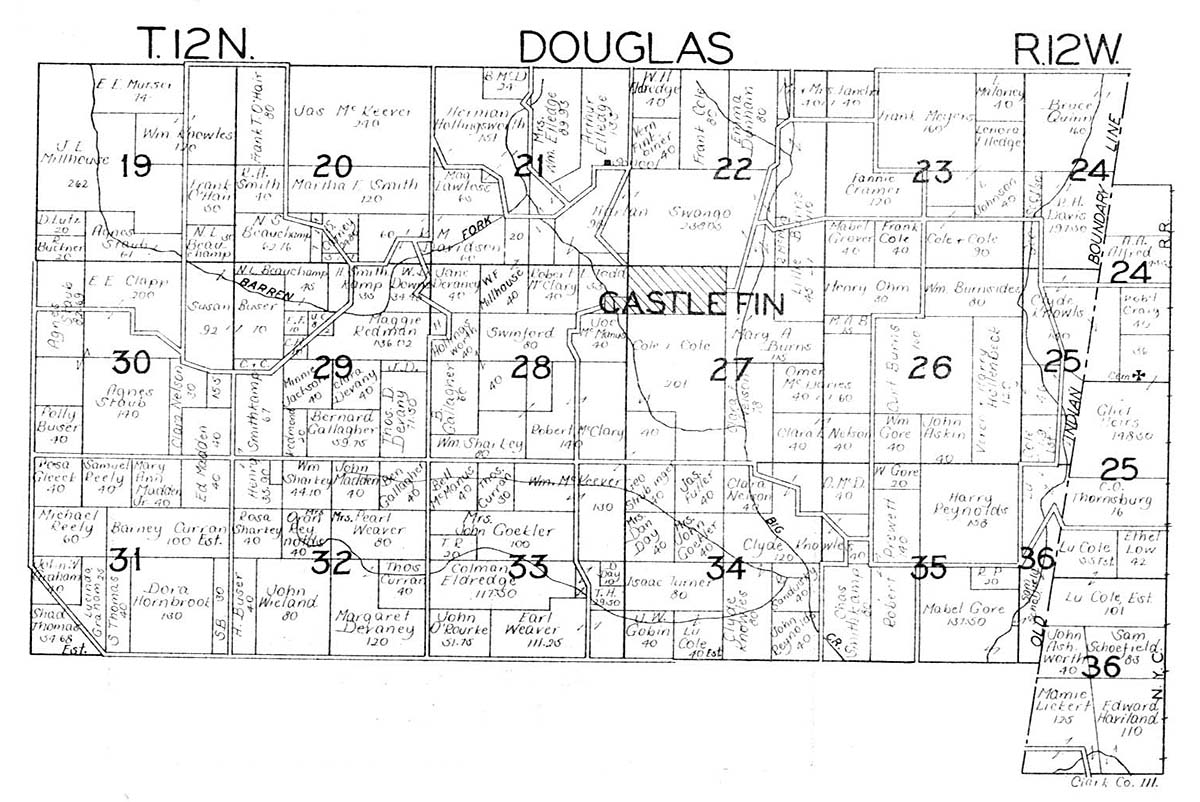
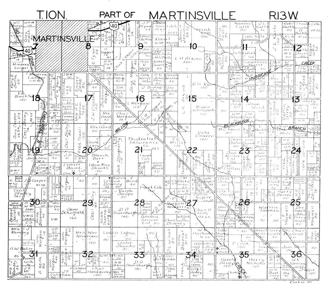
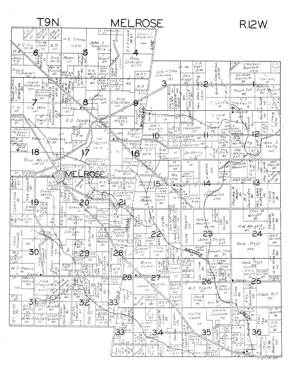
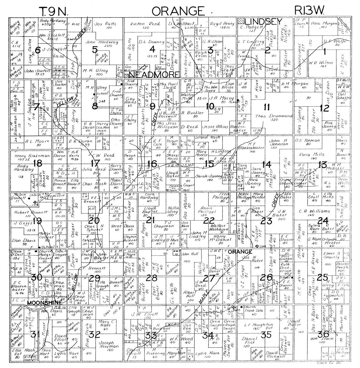
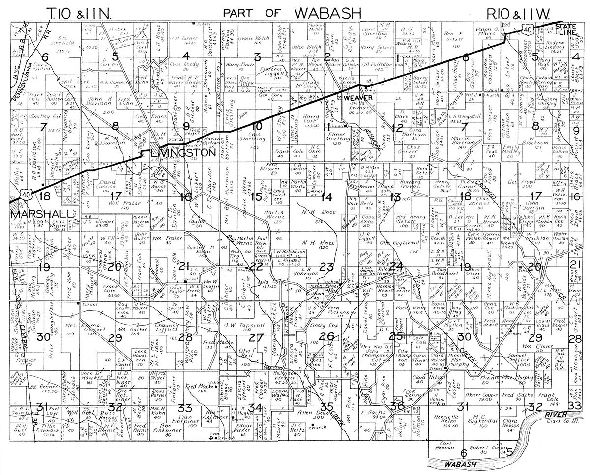
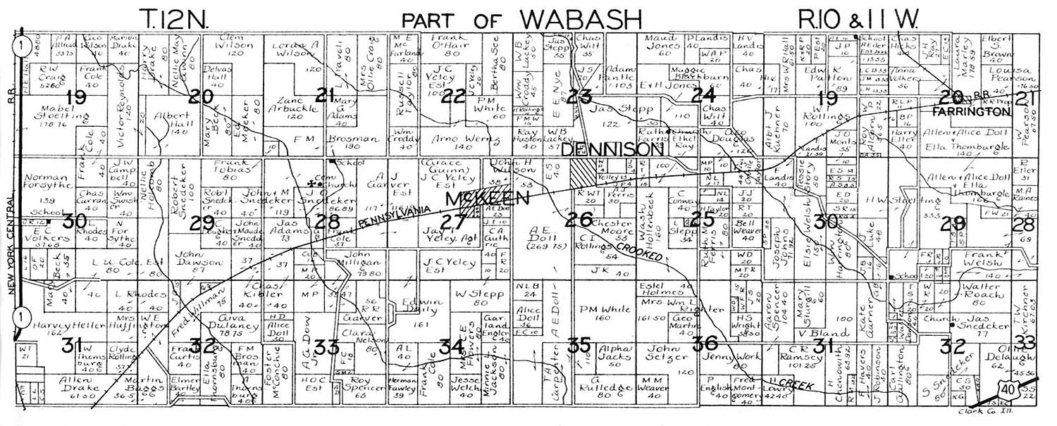
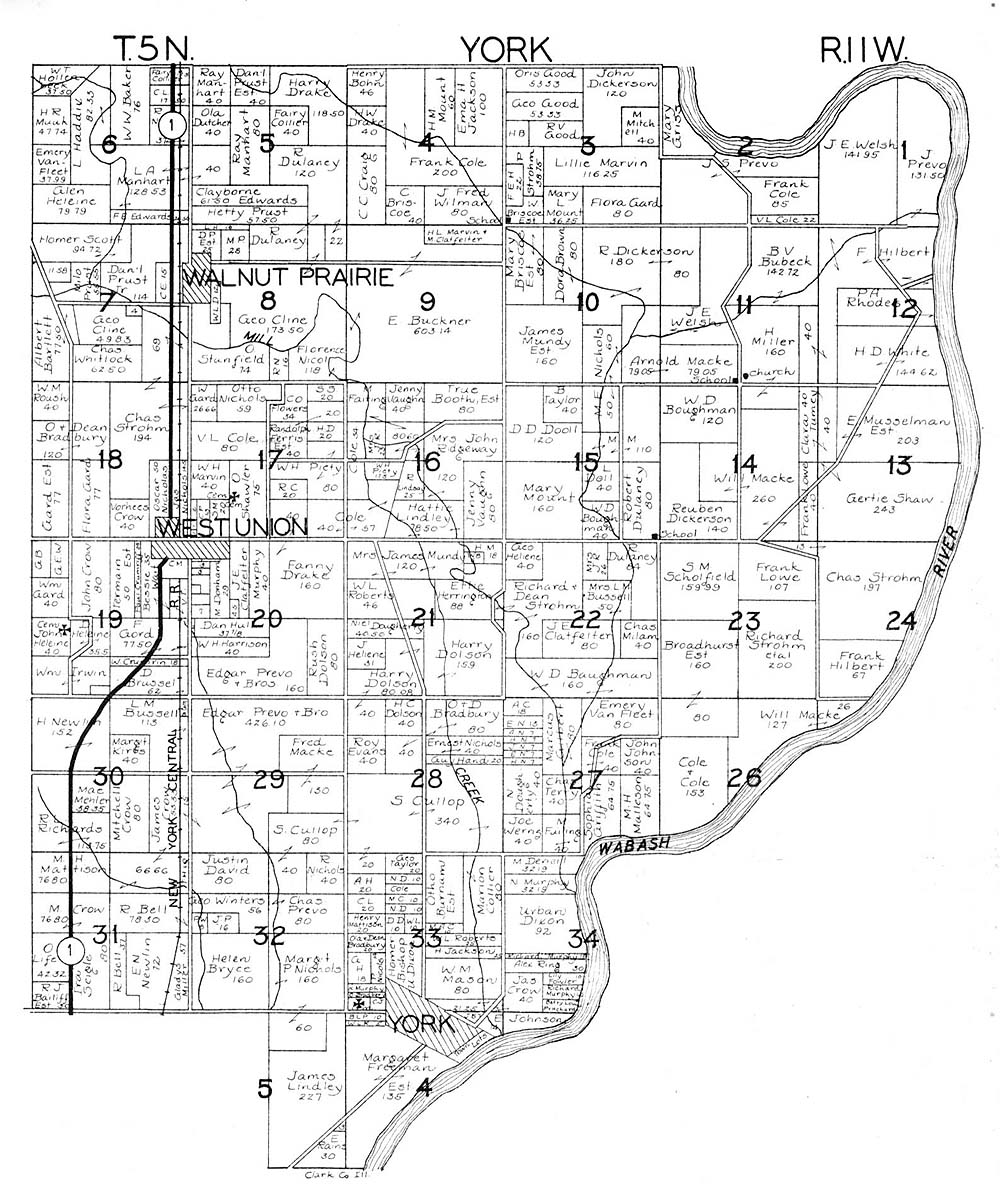
Clark County Plat Maps, Plat Book of Clark County Illinois, Published by W. W. Hixson & Co., Rockford IL, ca 1930. Submitted by Joy Fisher.
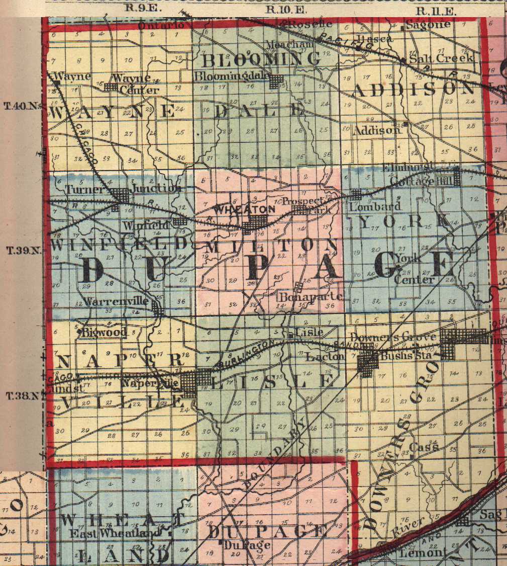
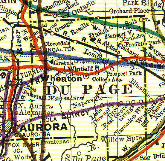
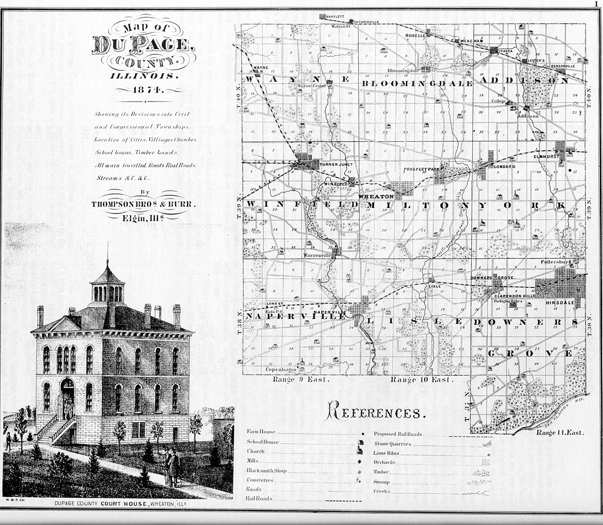
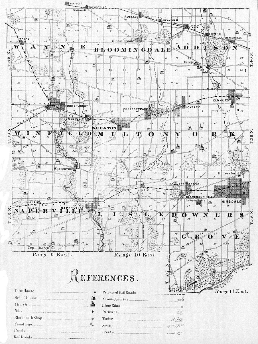
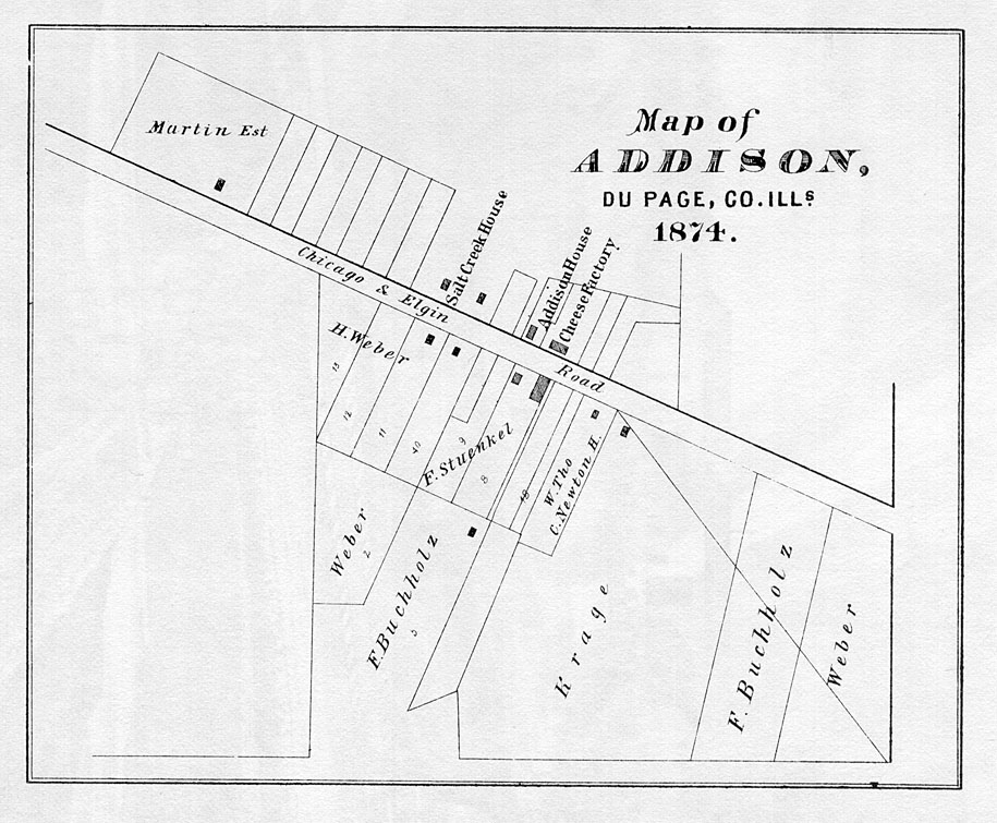
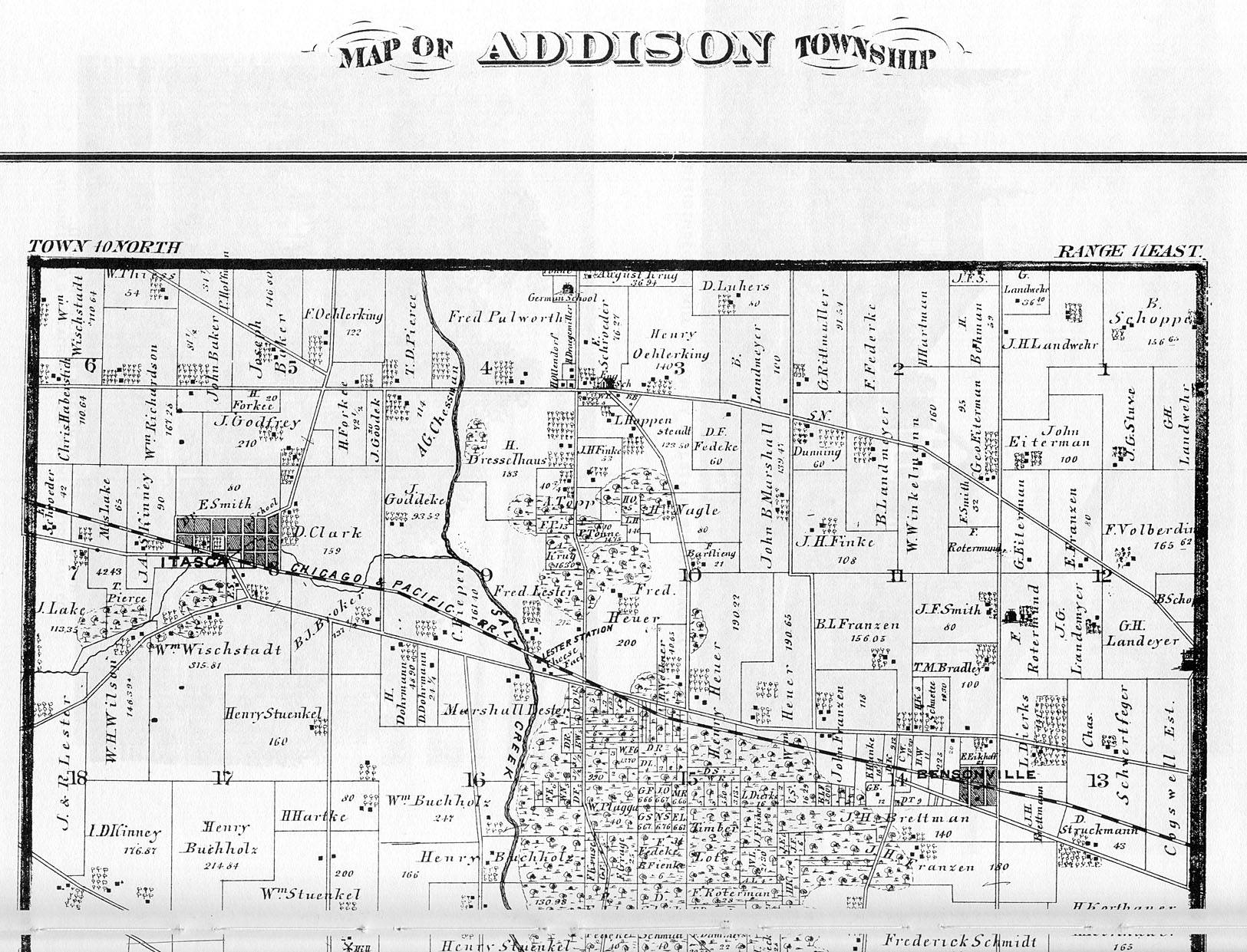
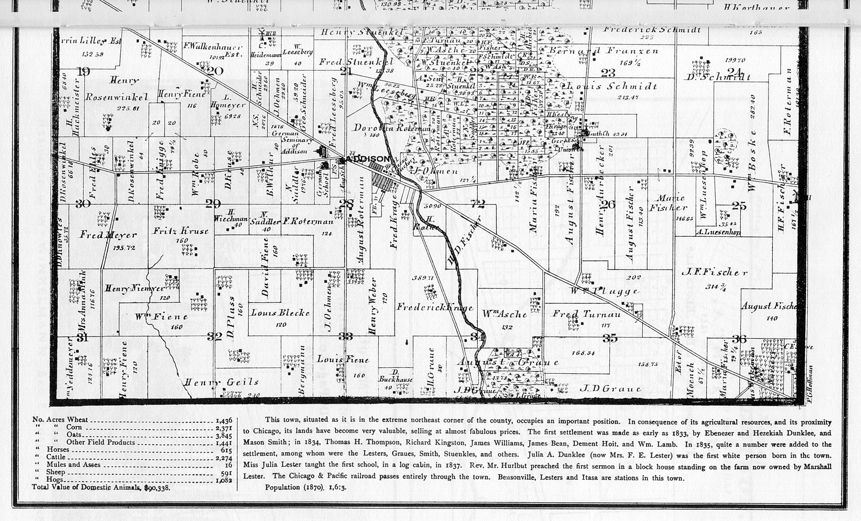
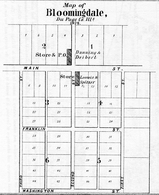
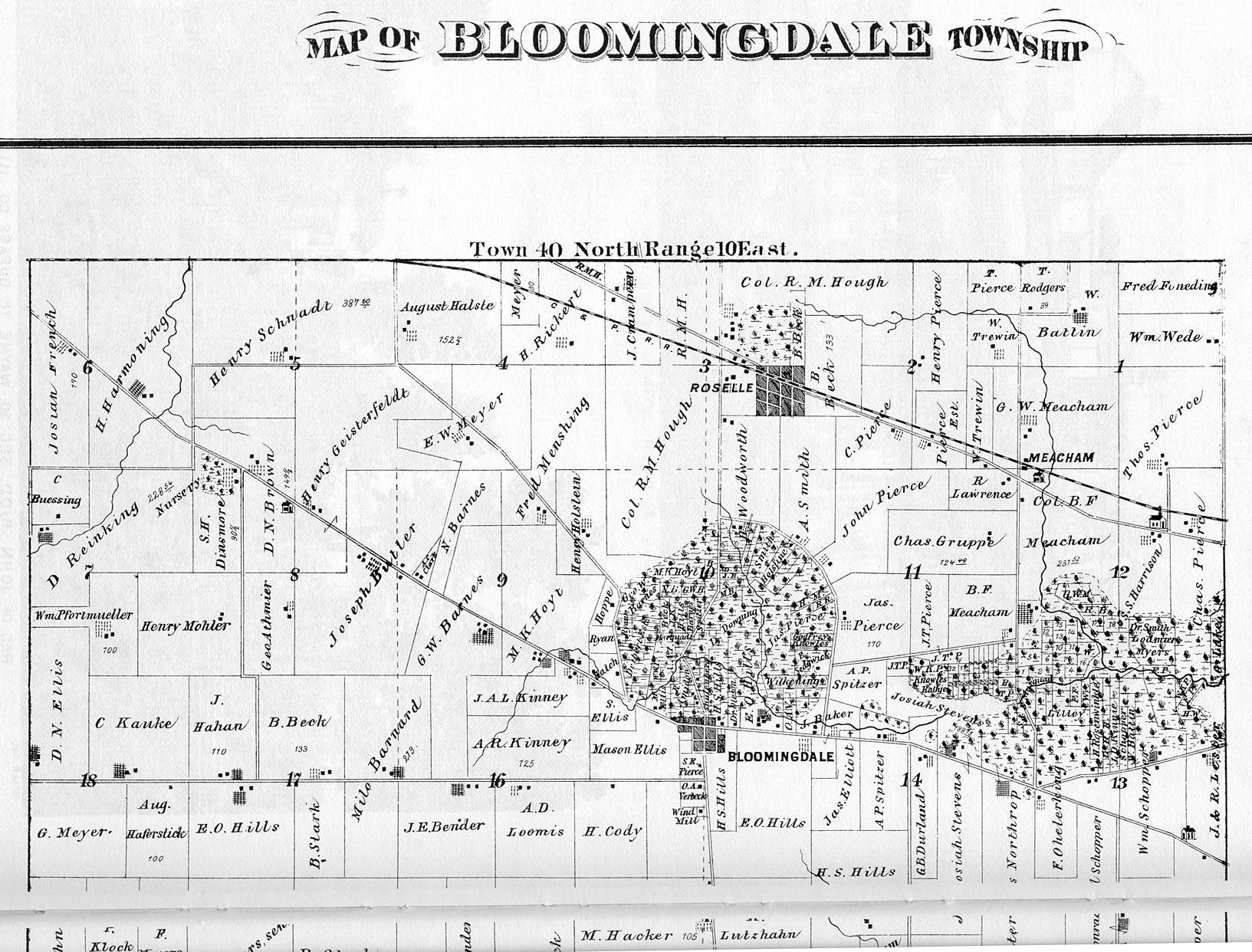
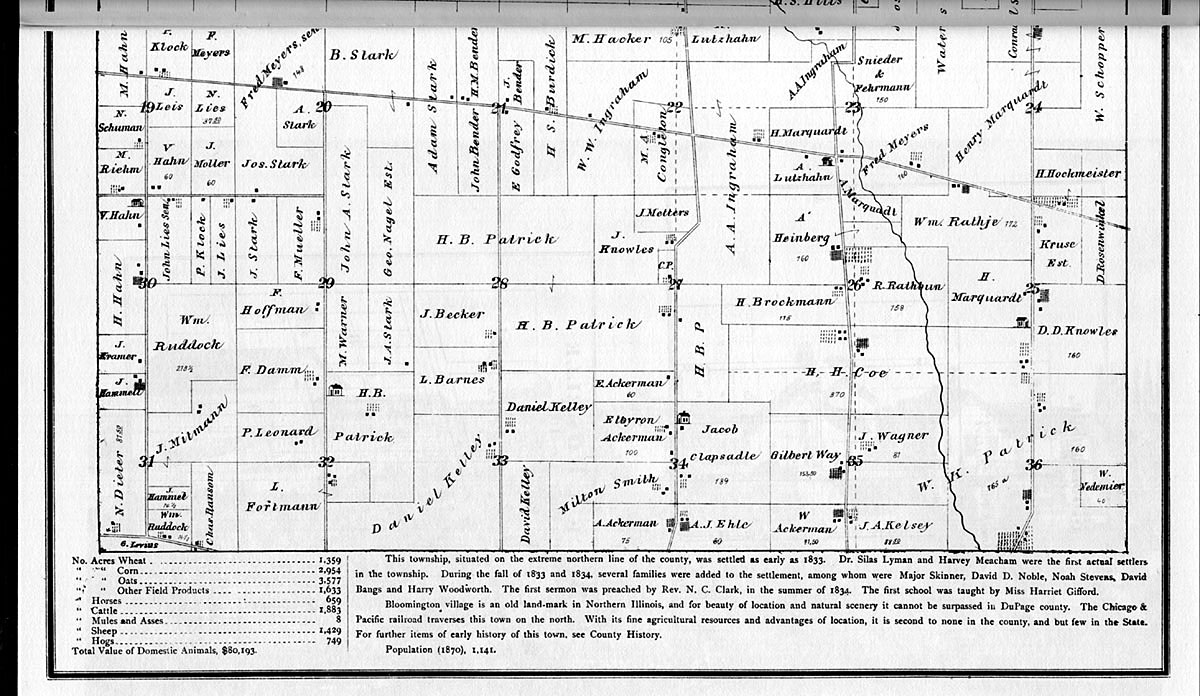
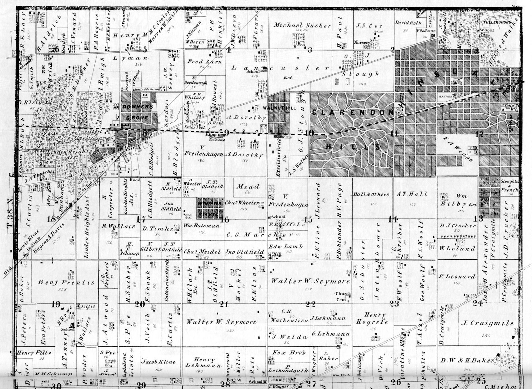
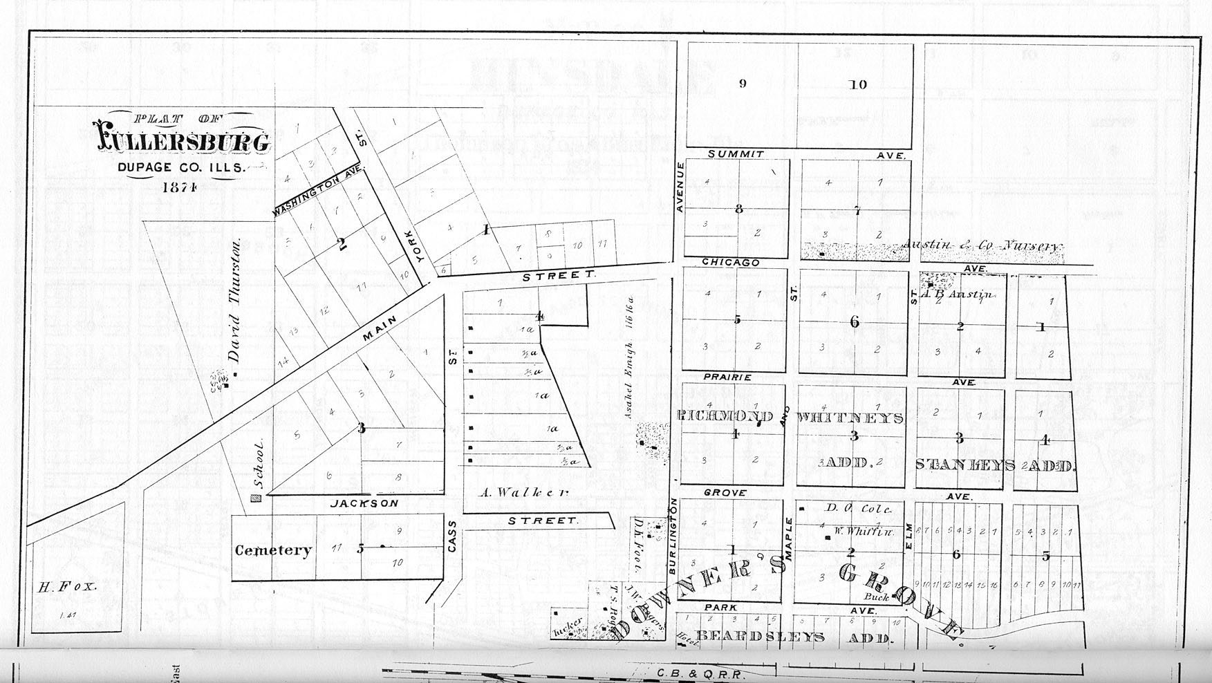
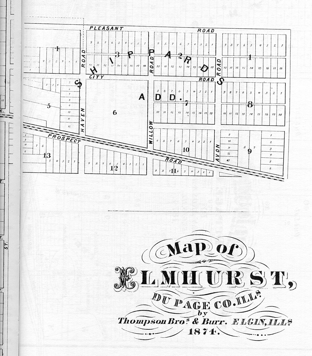
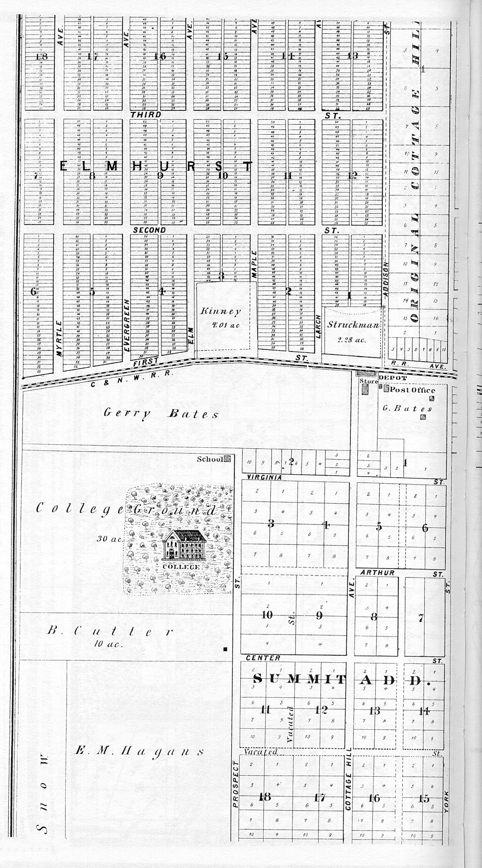
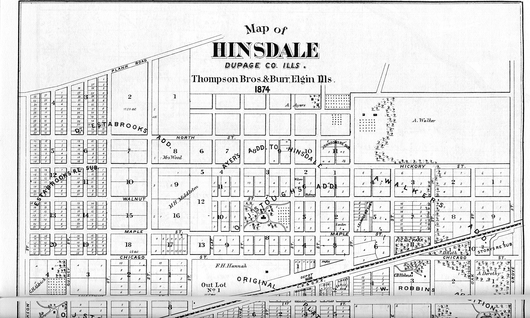
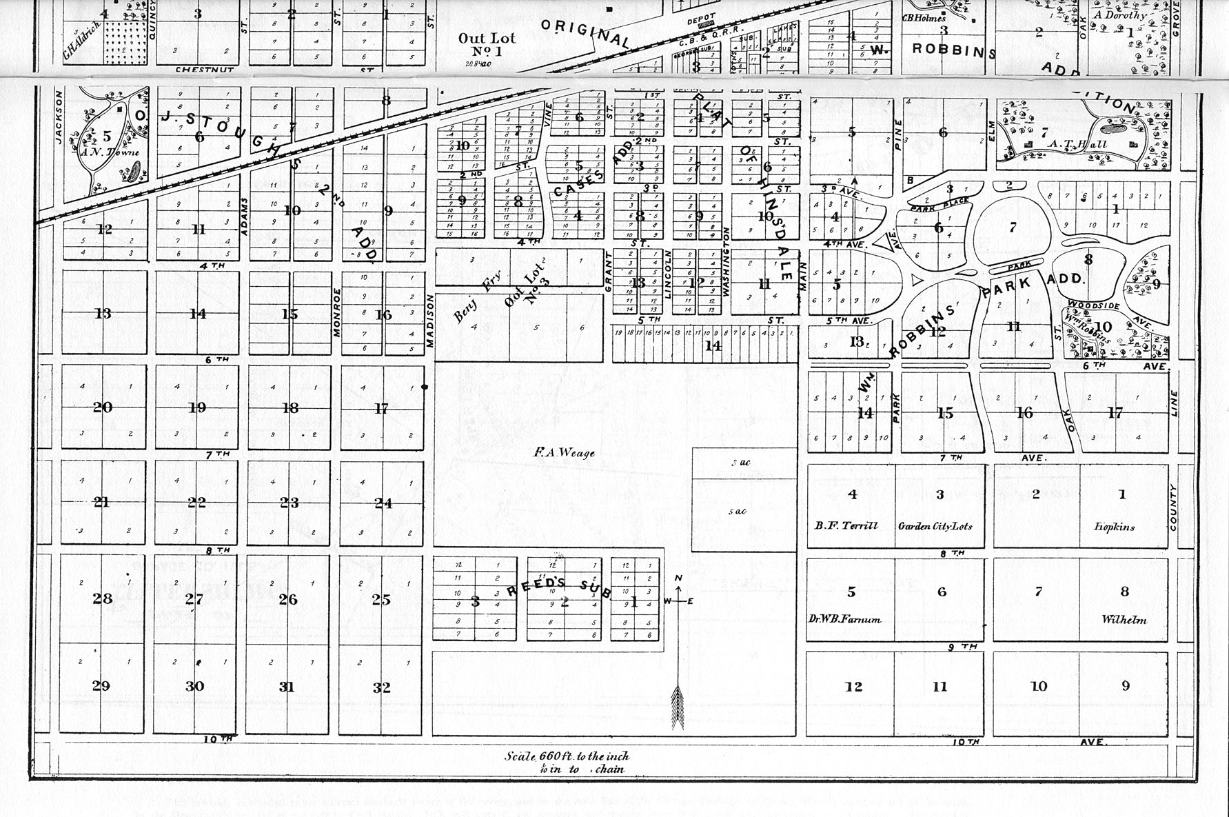
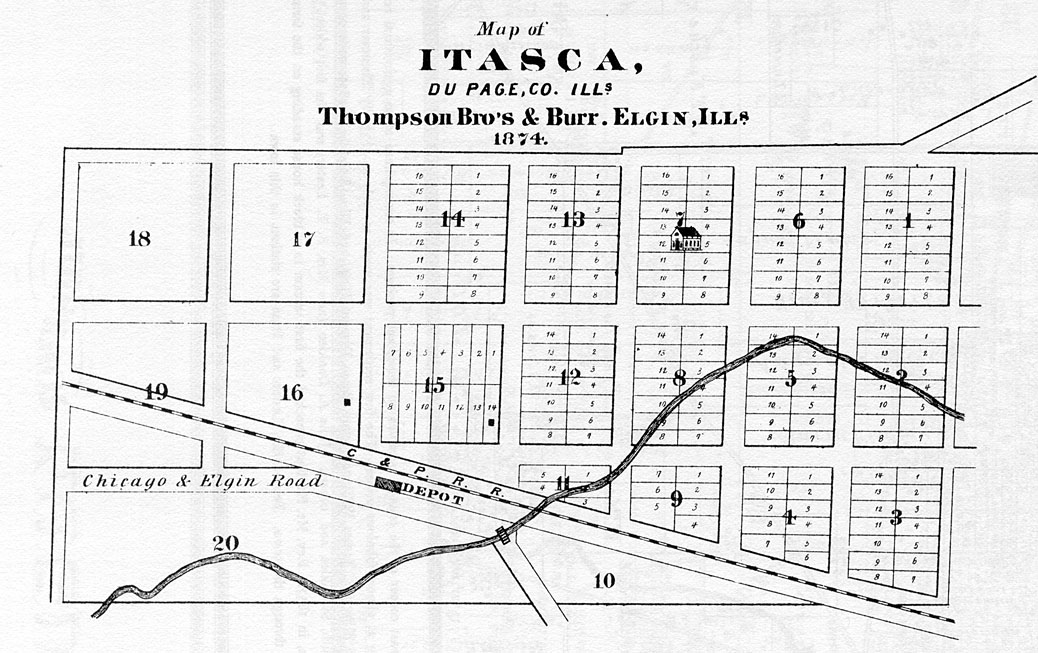
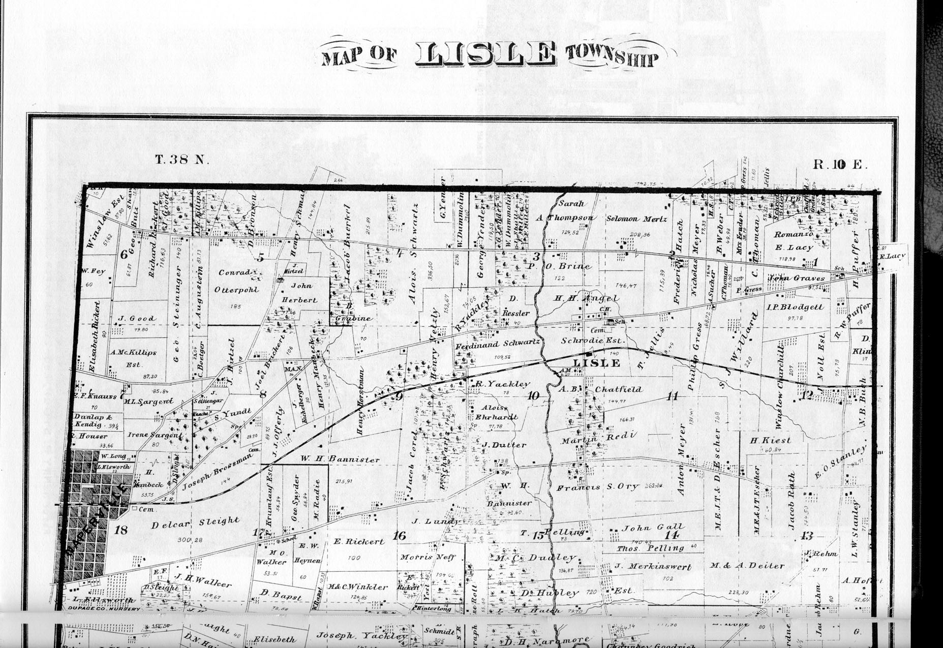
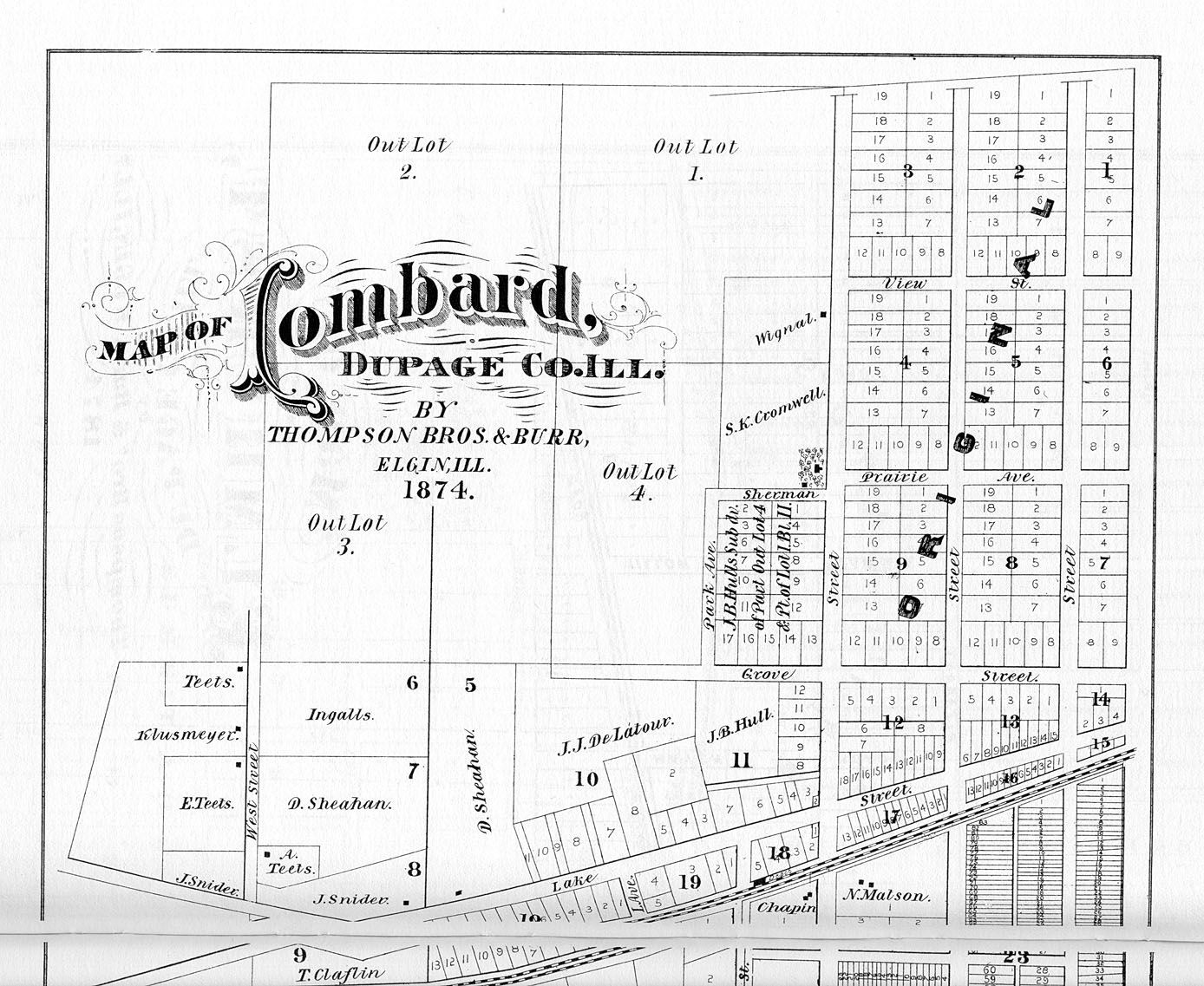
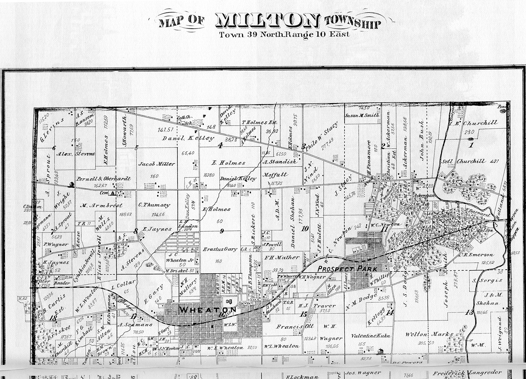
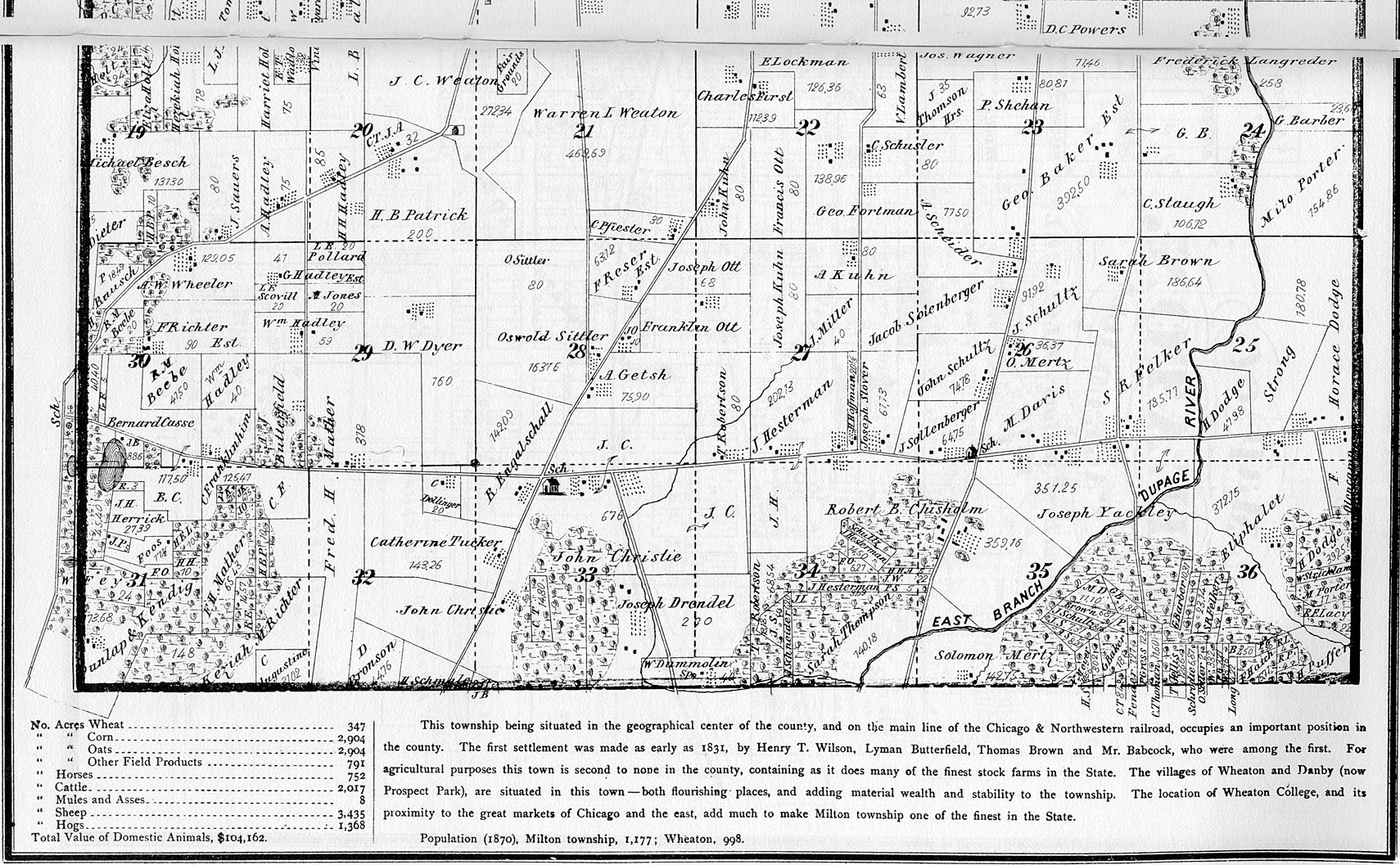
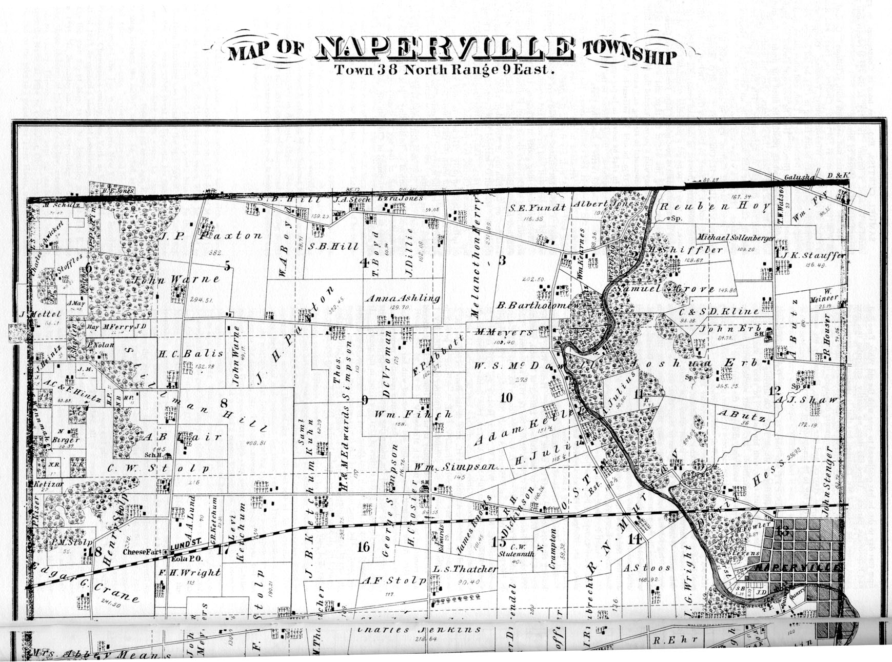
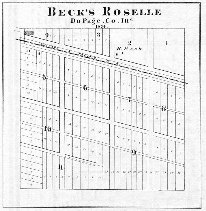
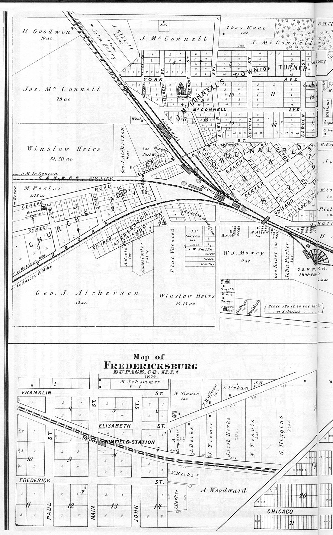
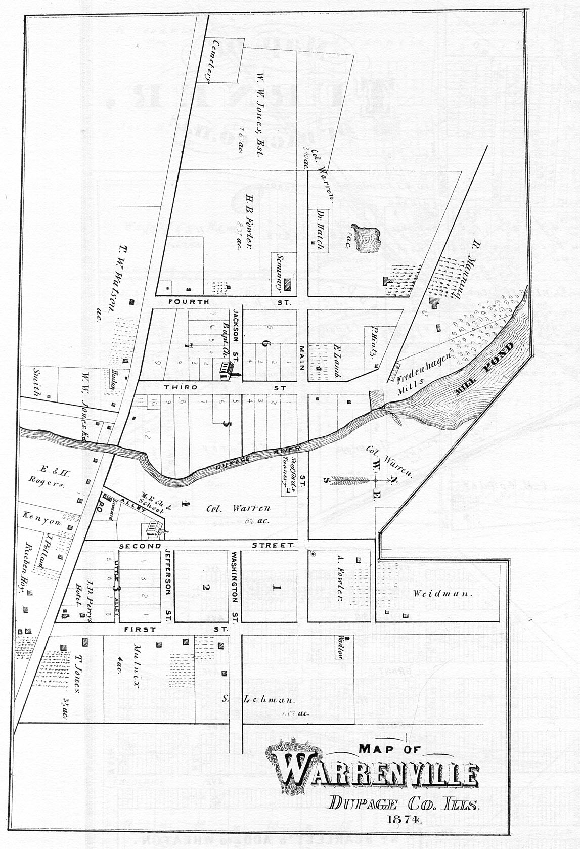
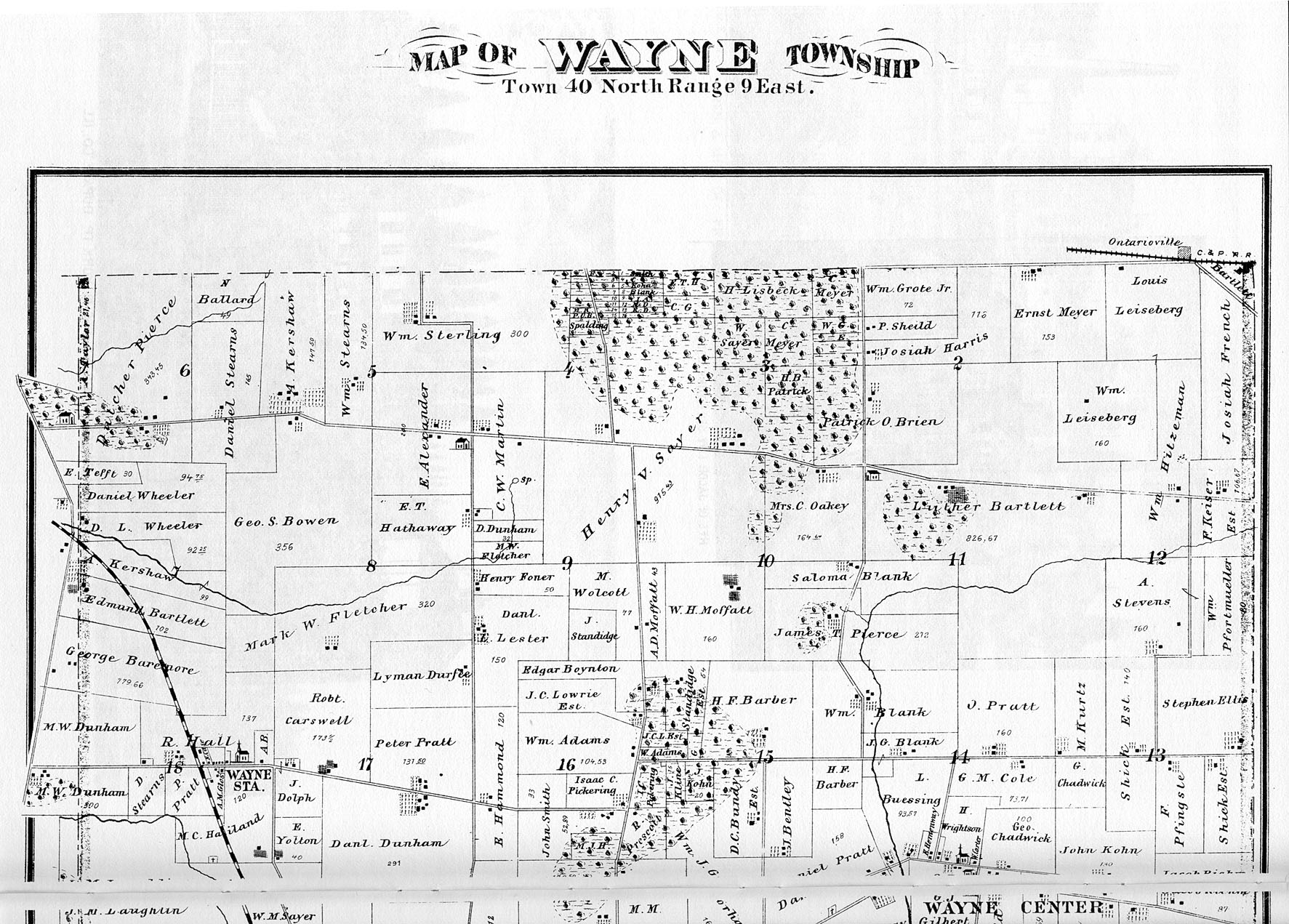
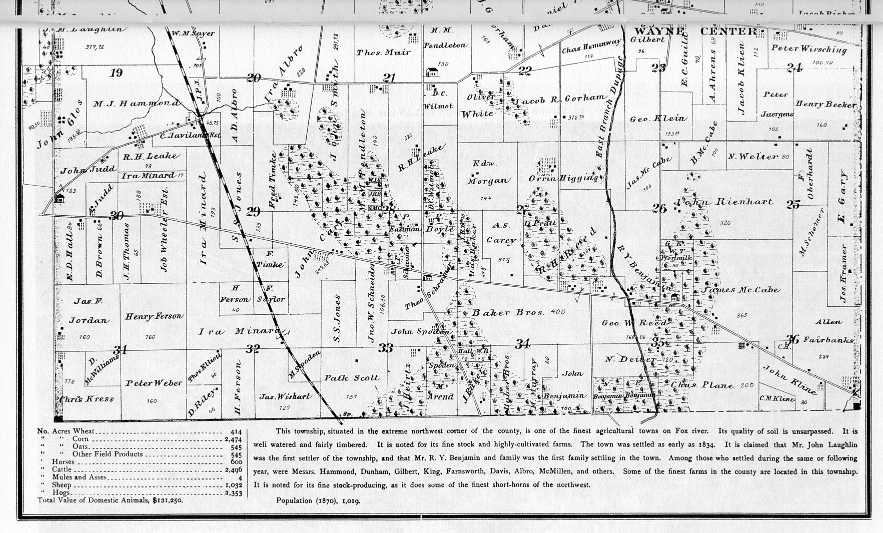
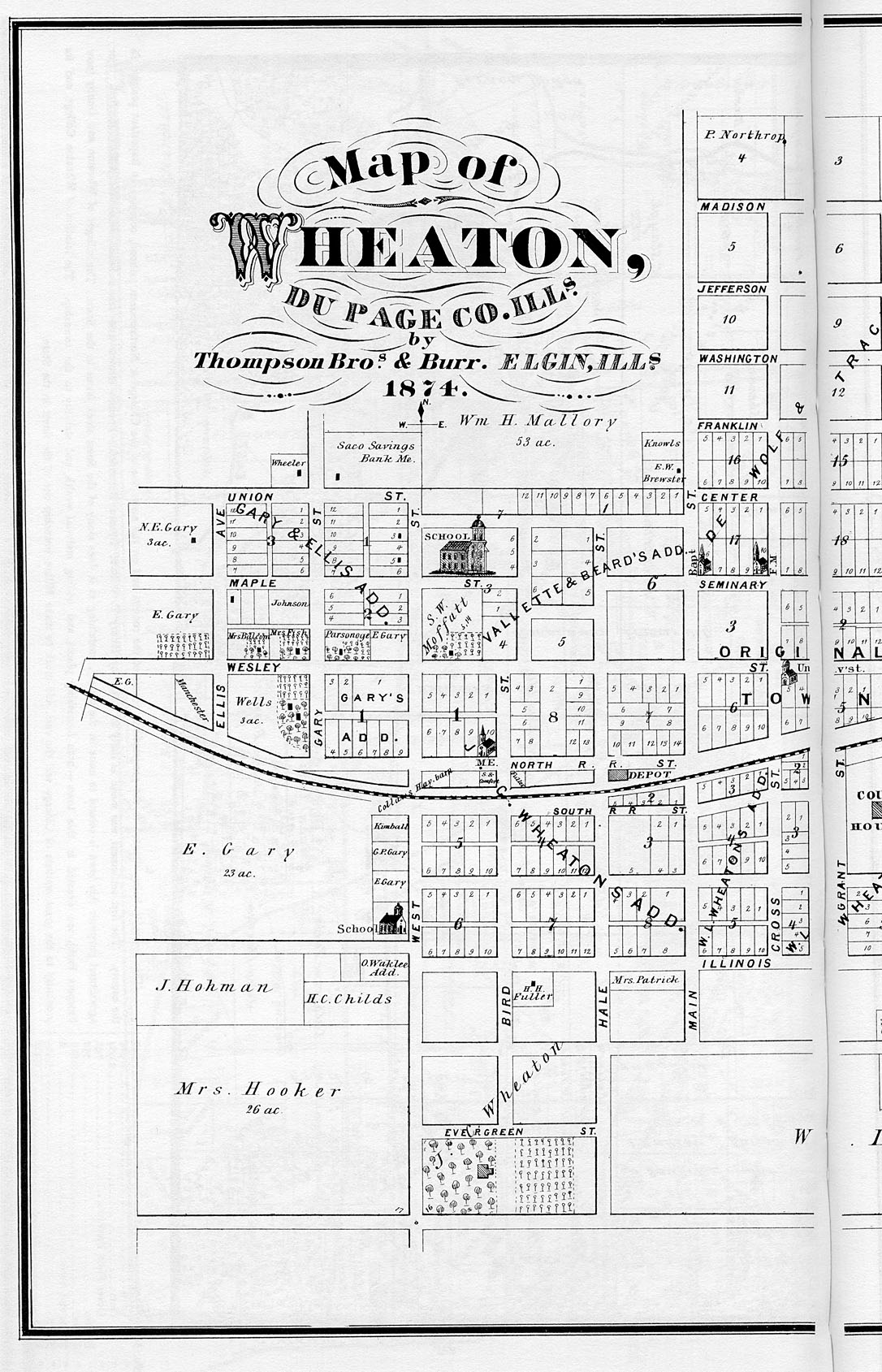
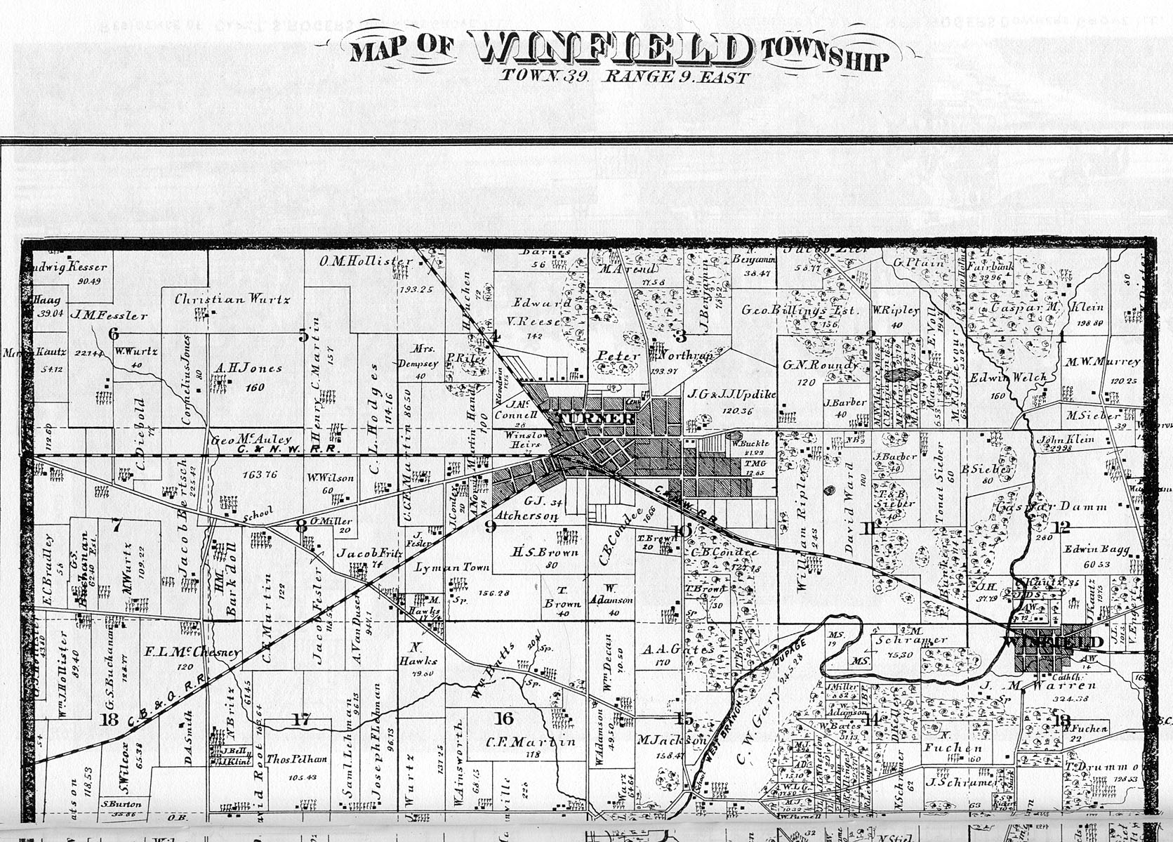
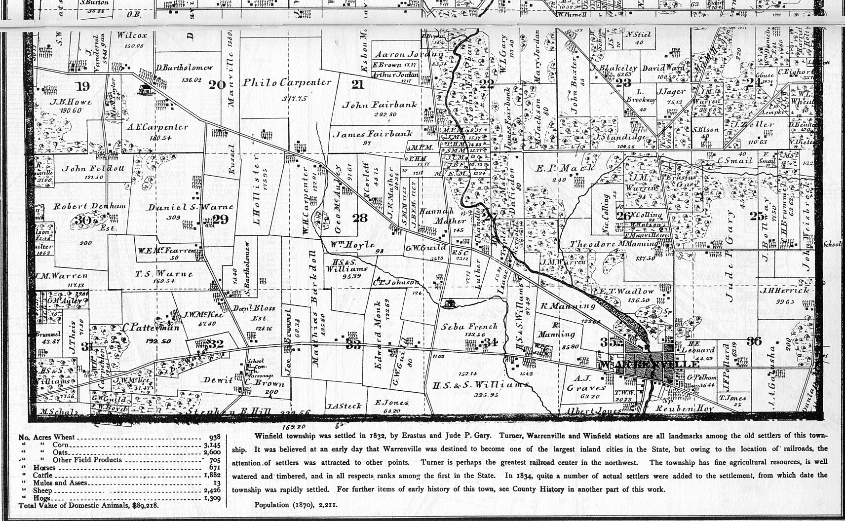
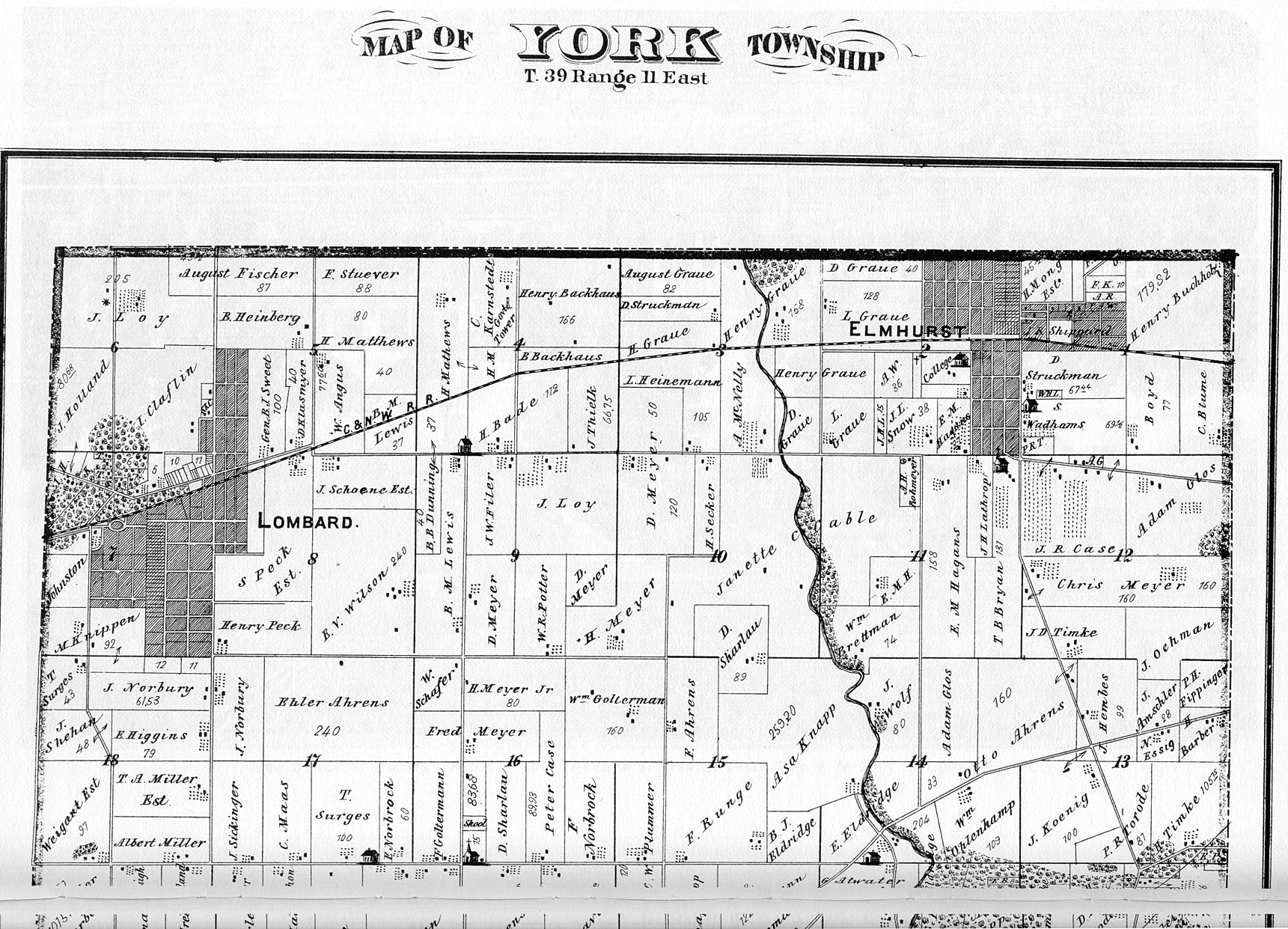
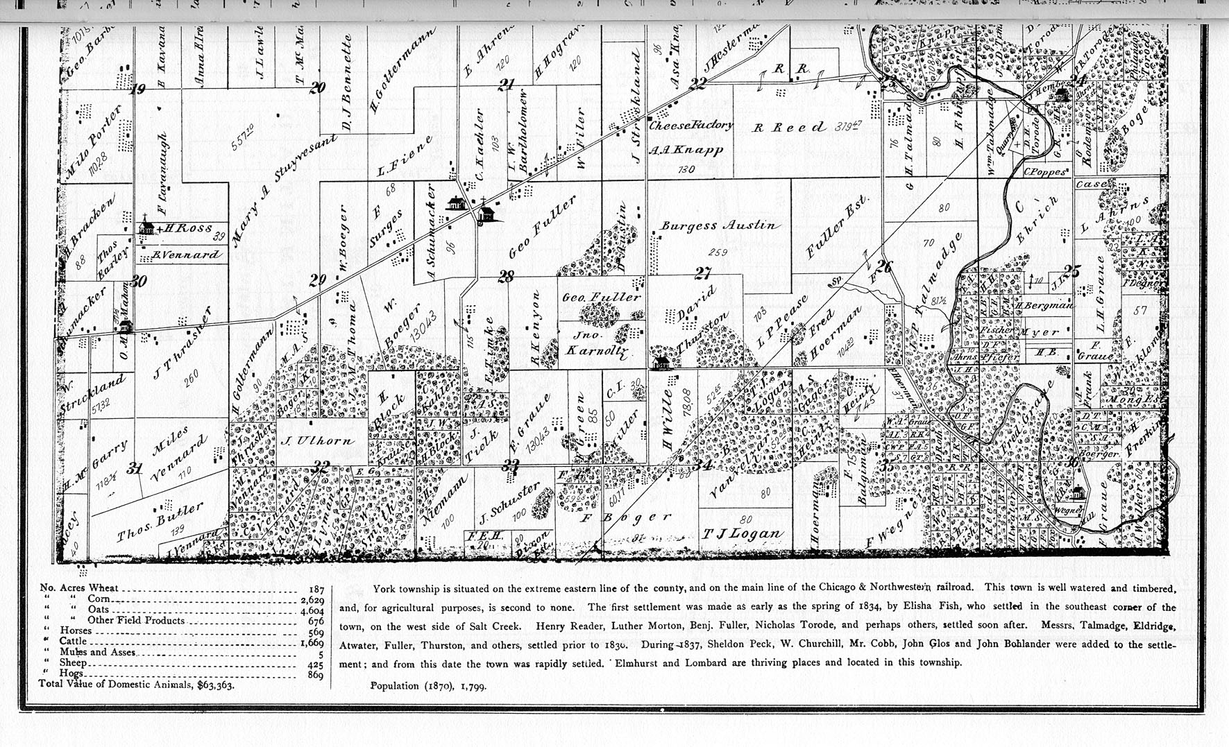
DuPage County Atlas, 1874, by Thompson Bros. & Burr, Elgin, Ill. Submitted by Joy Fisher.
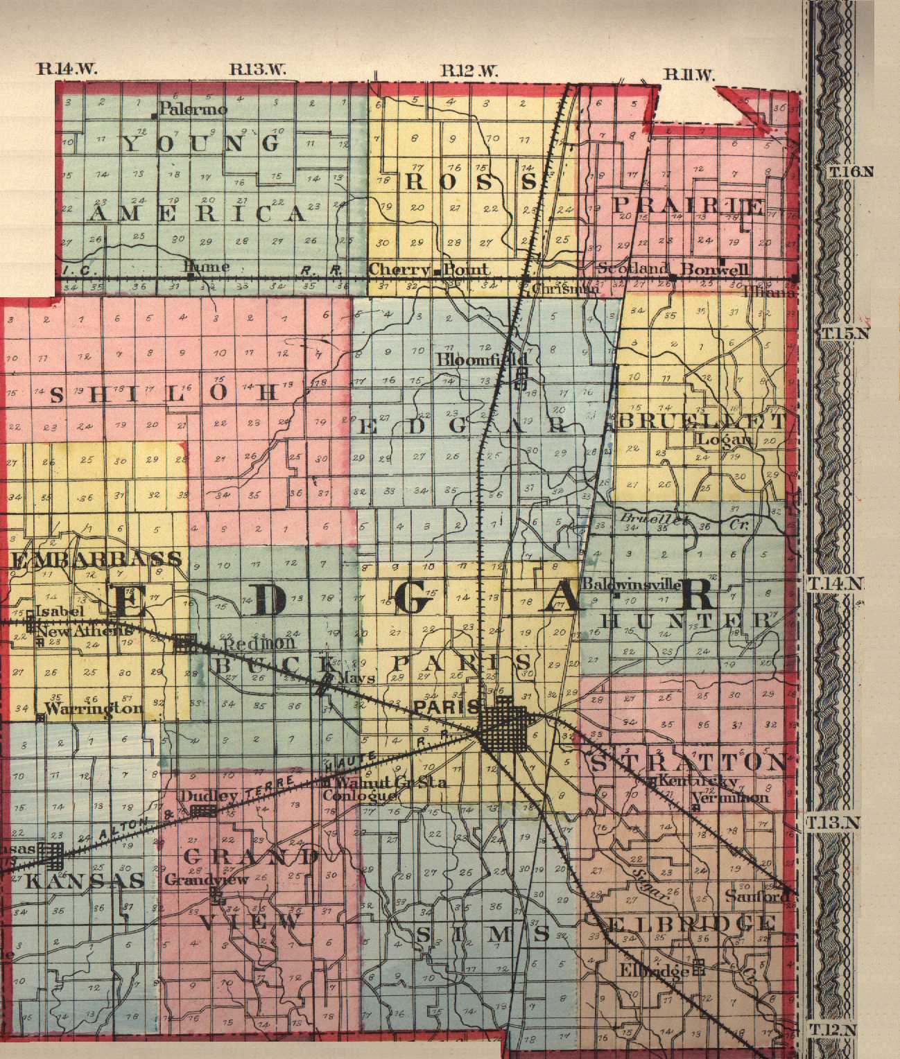
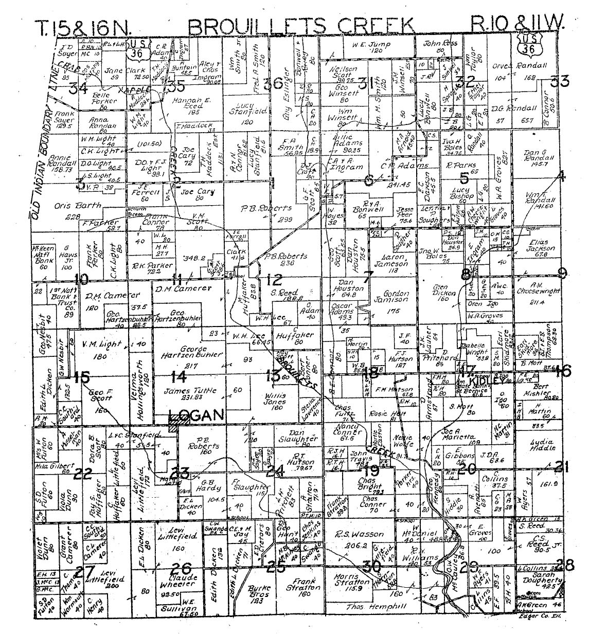
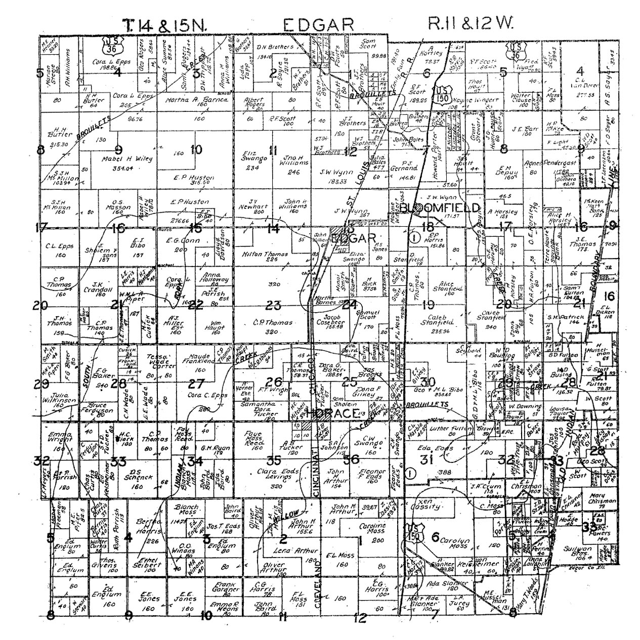
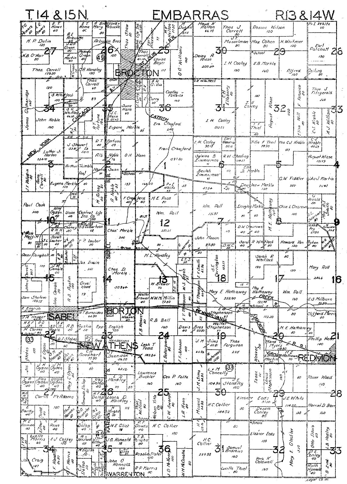
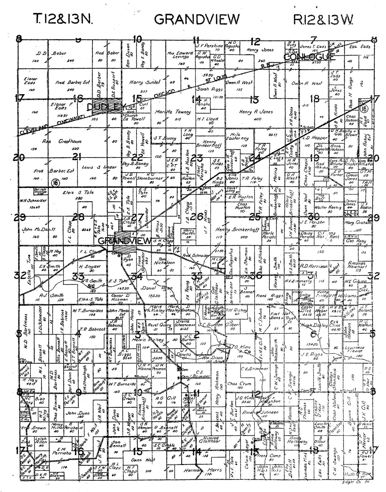
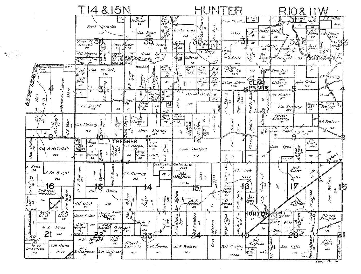
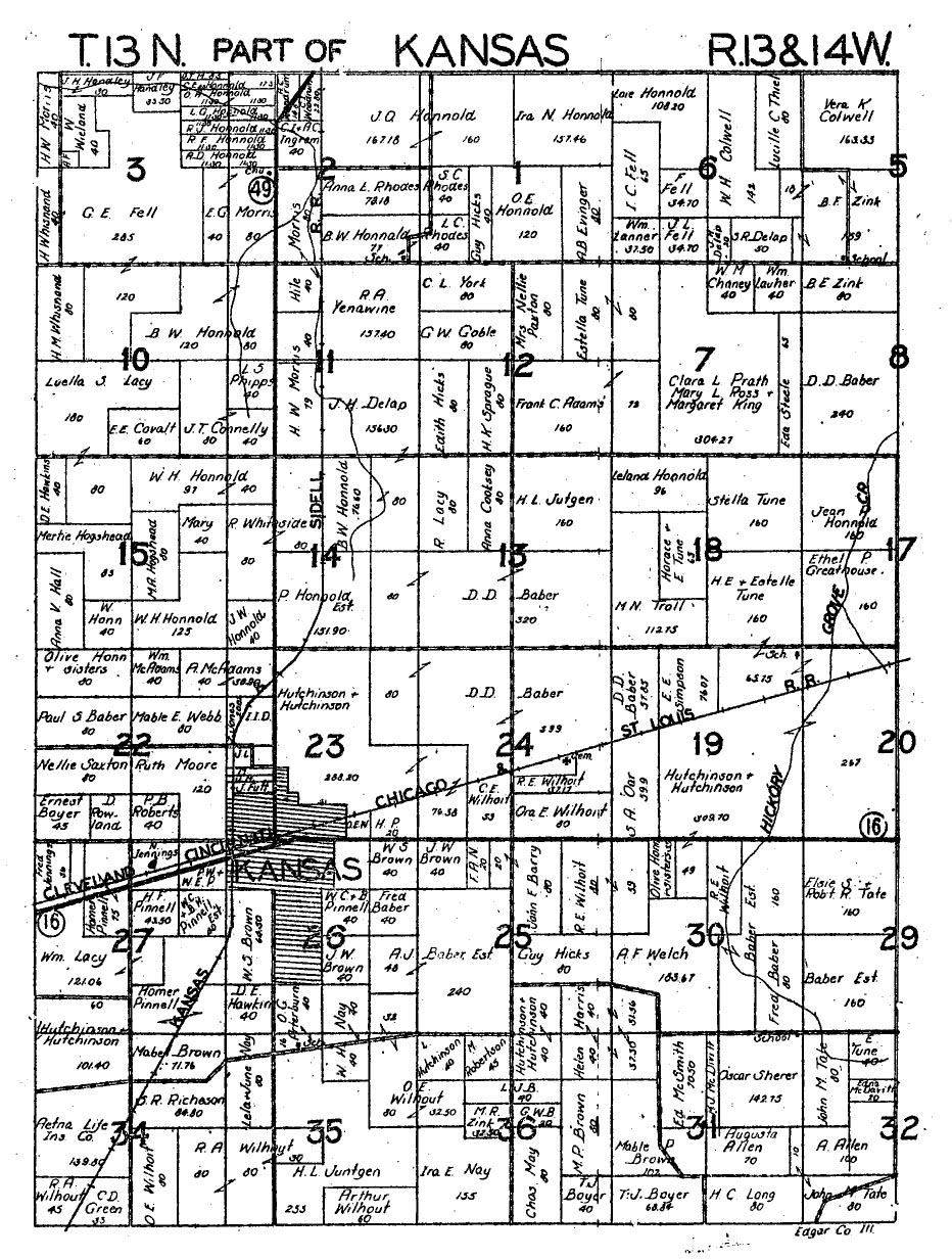
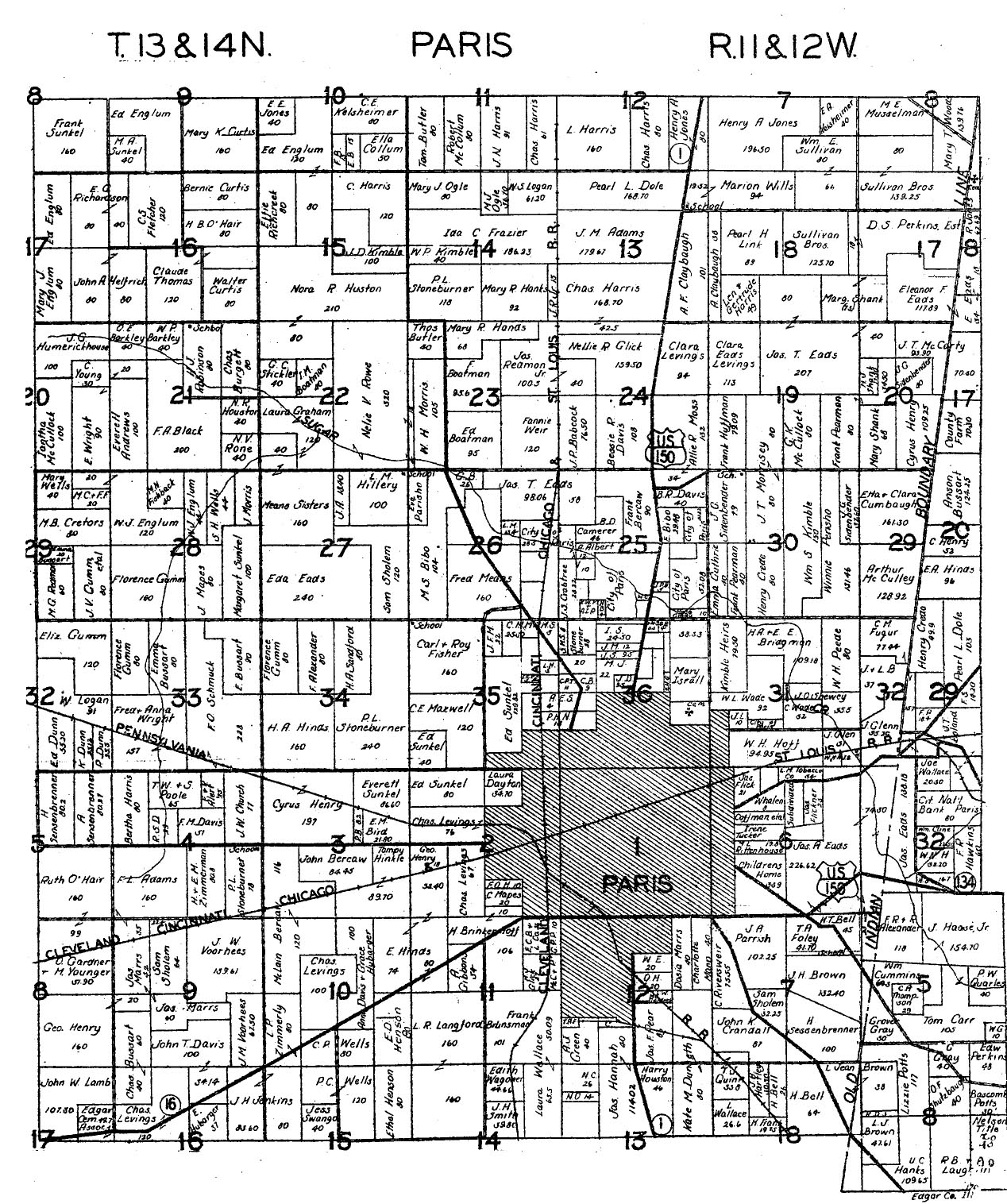
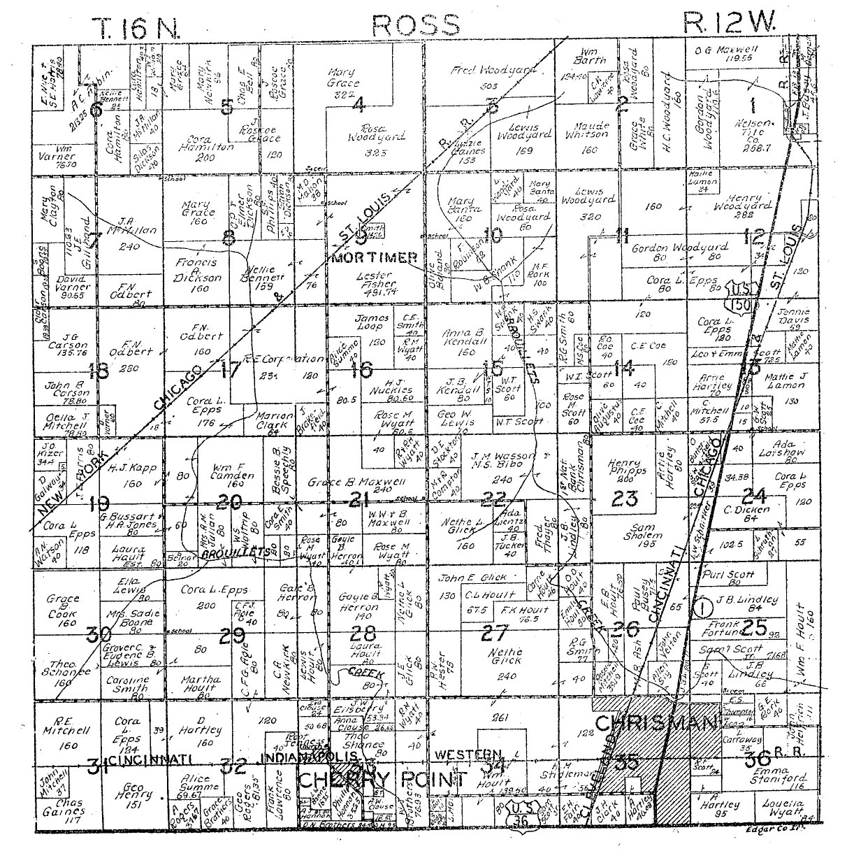
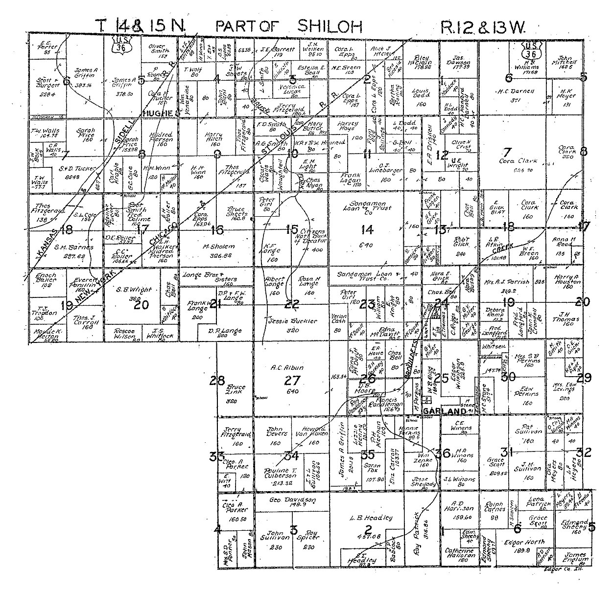
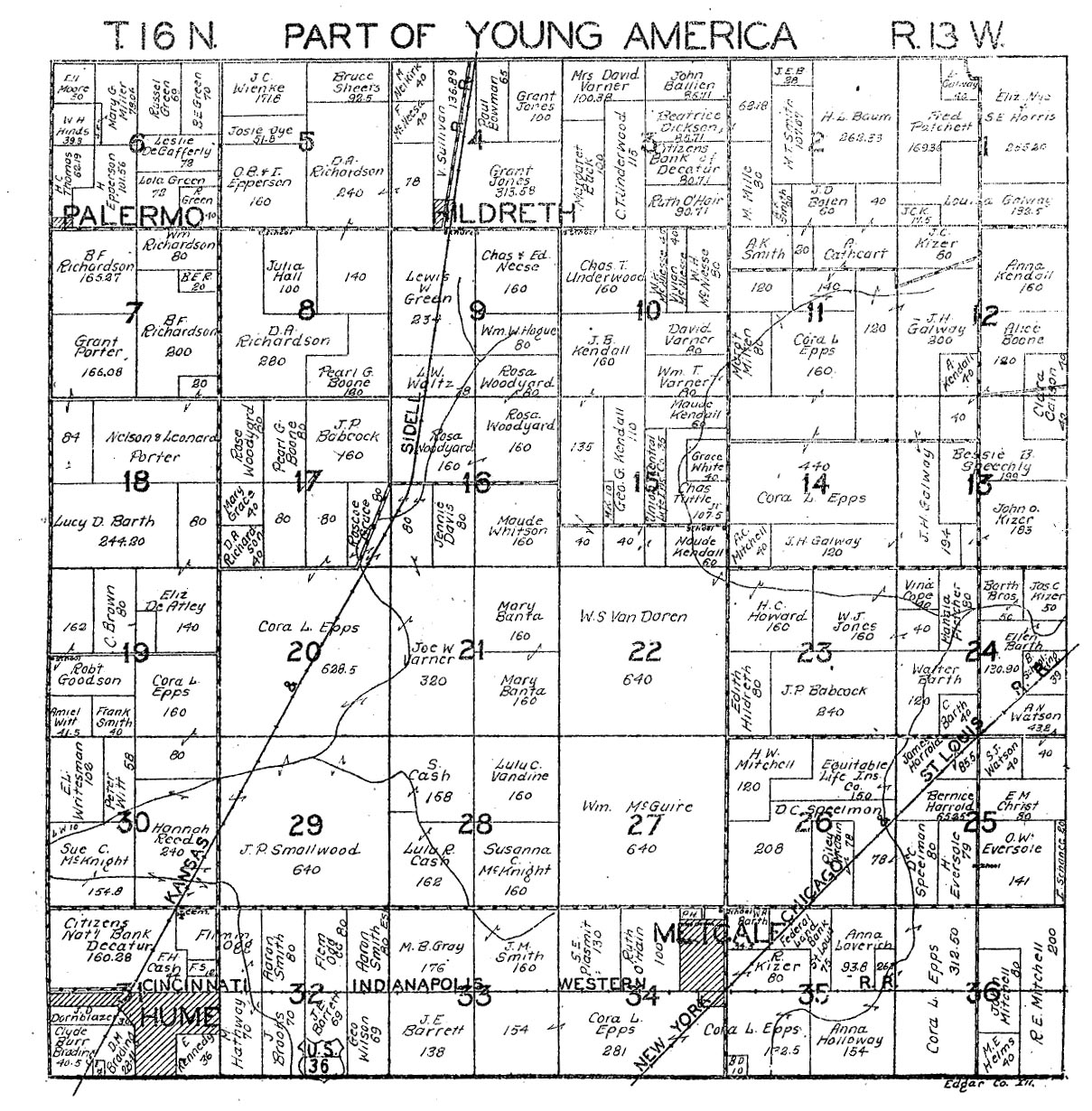
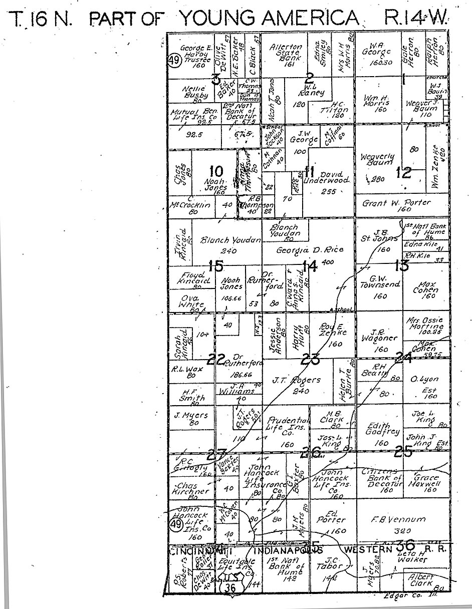
Edgar County Atlas, 1940. Submitted by Joy Fisher.
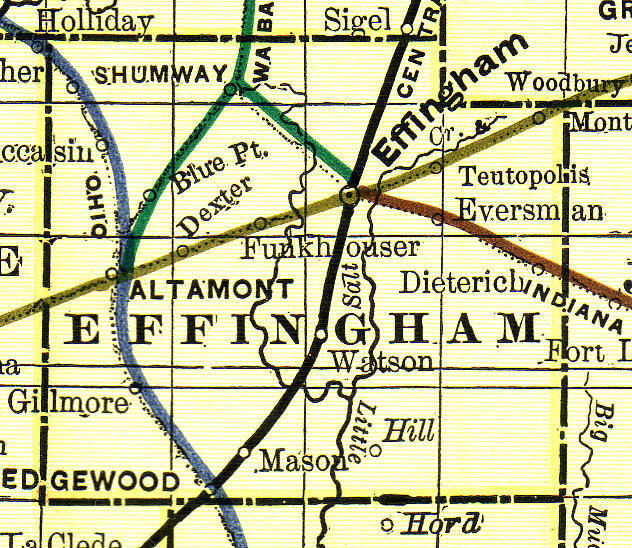
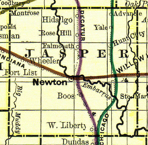
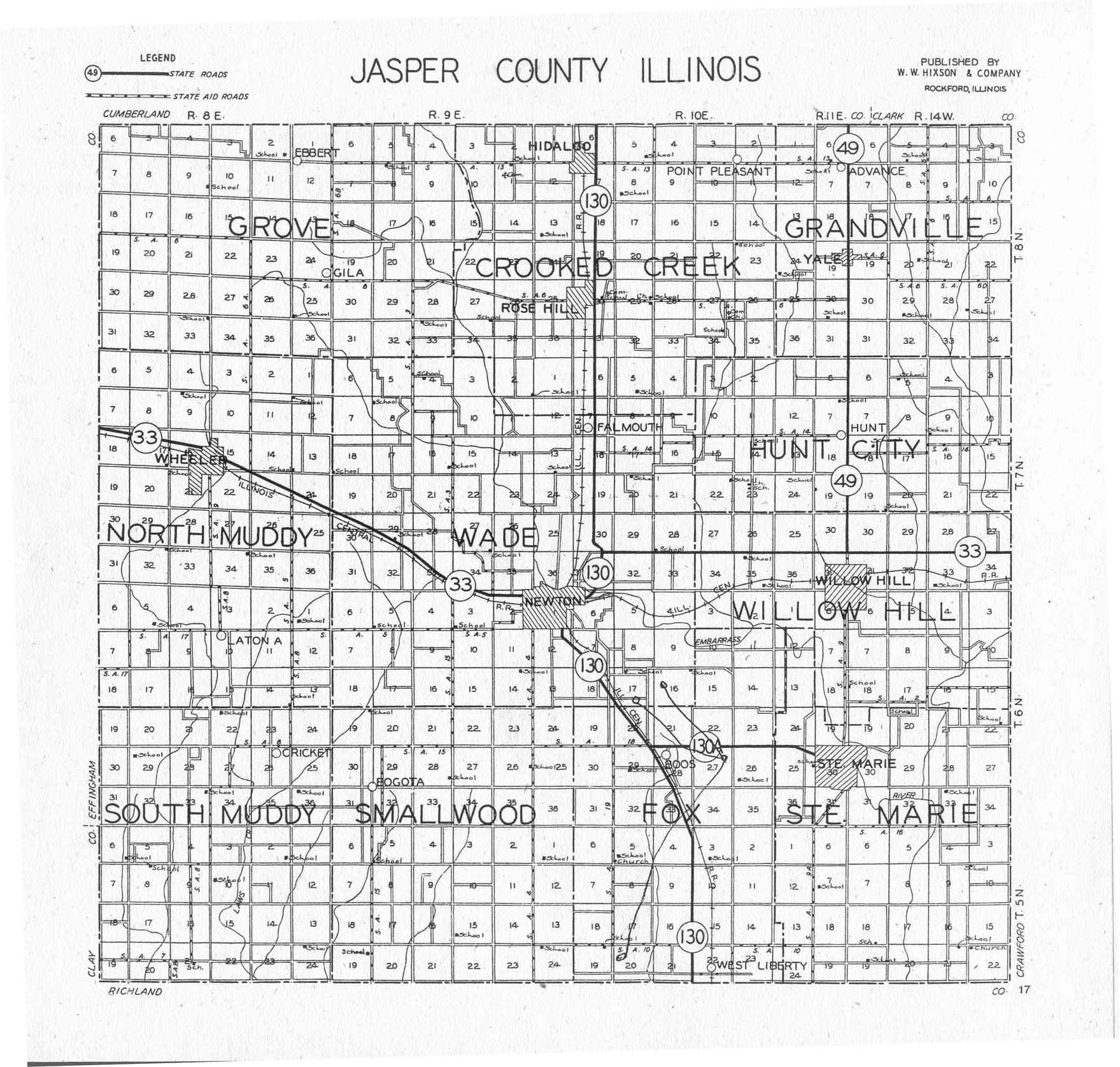
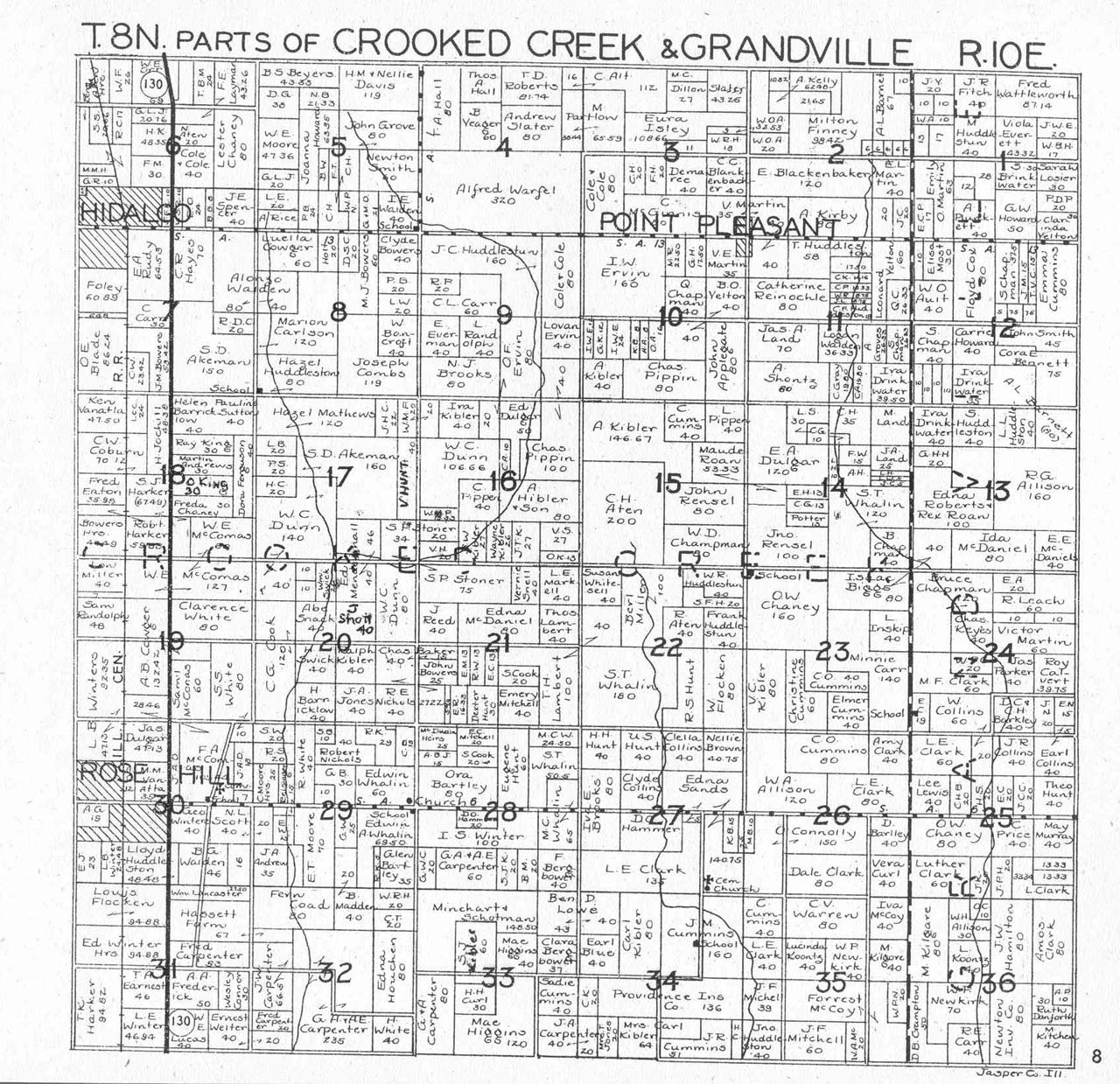
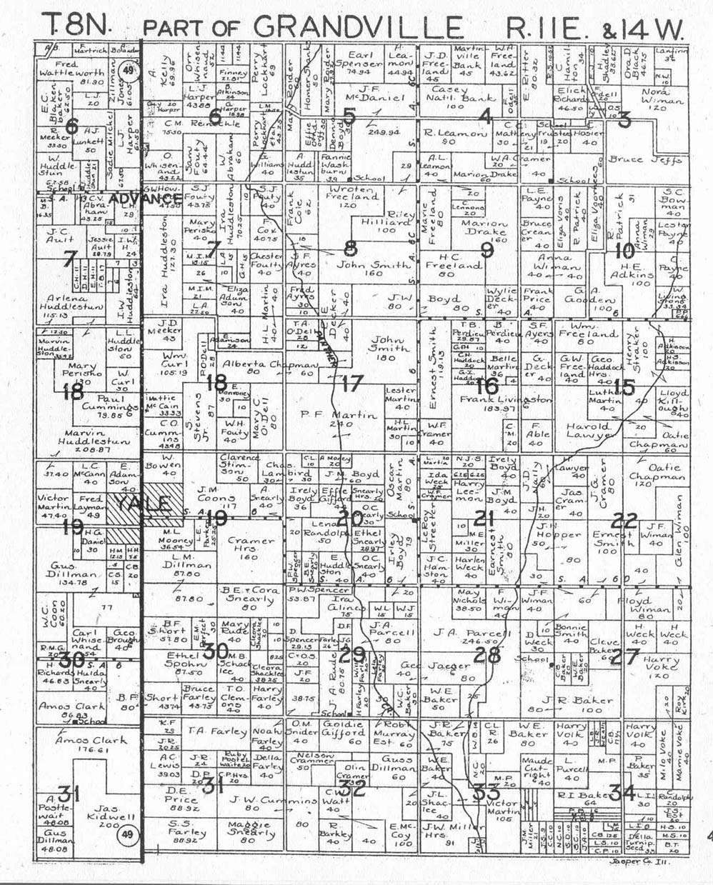
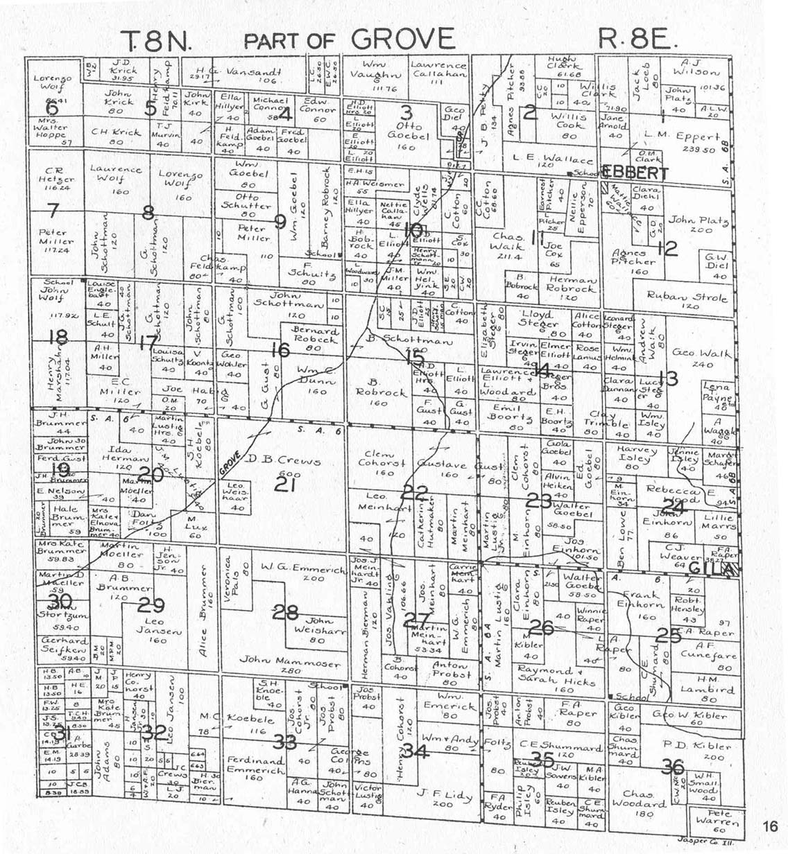
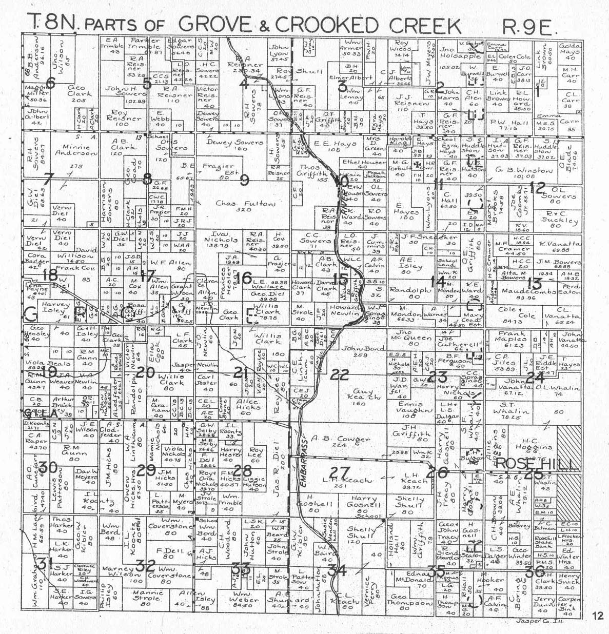
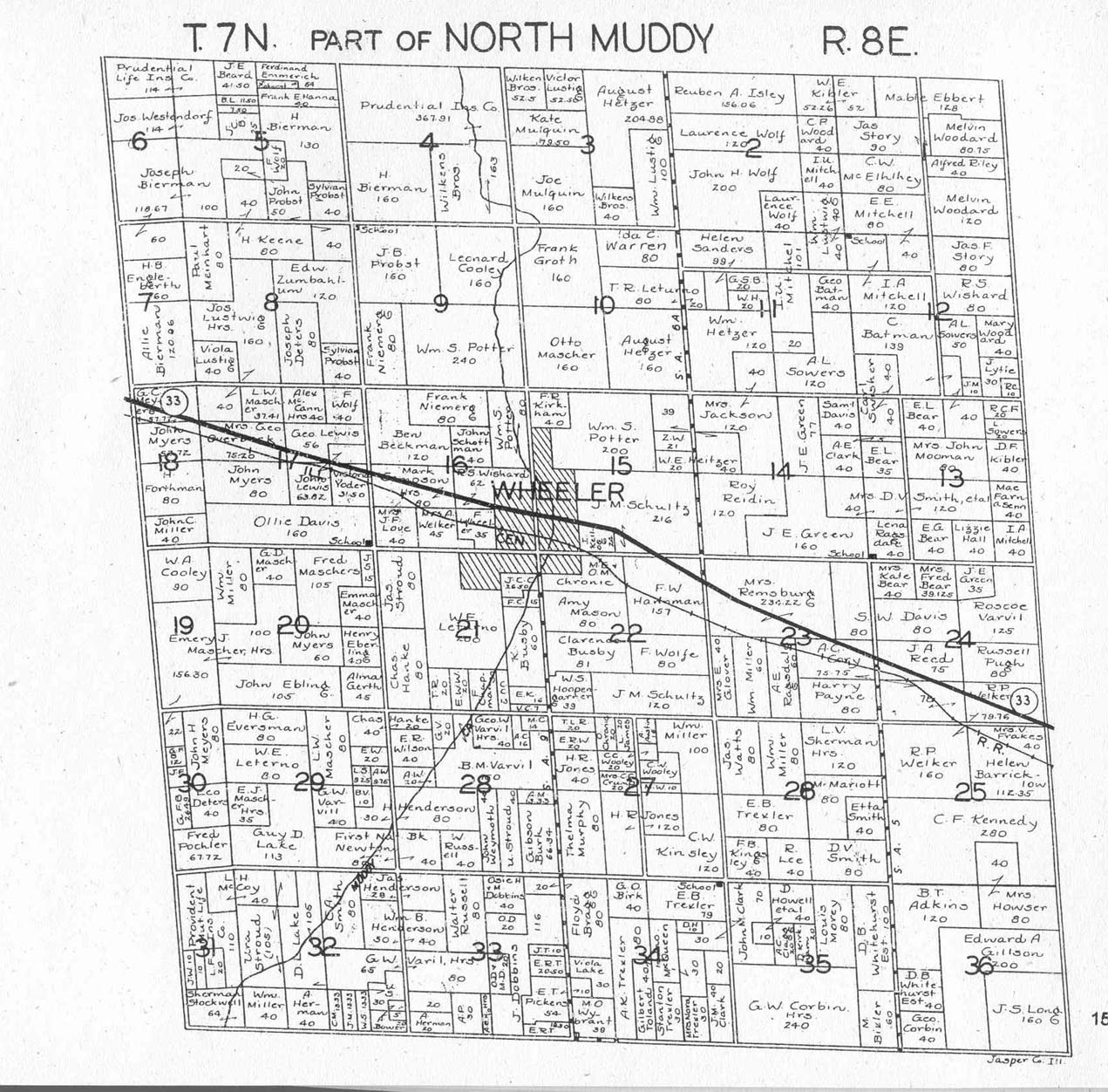
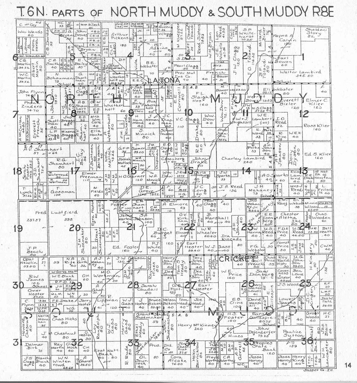
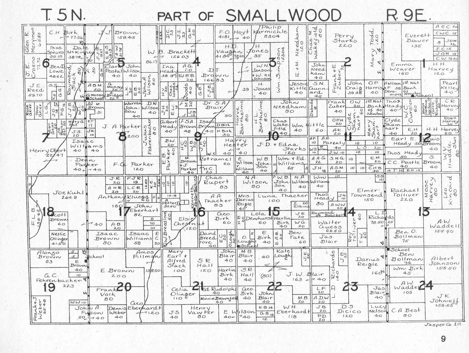
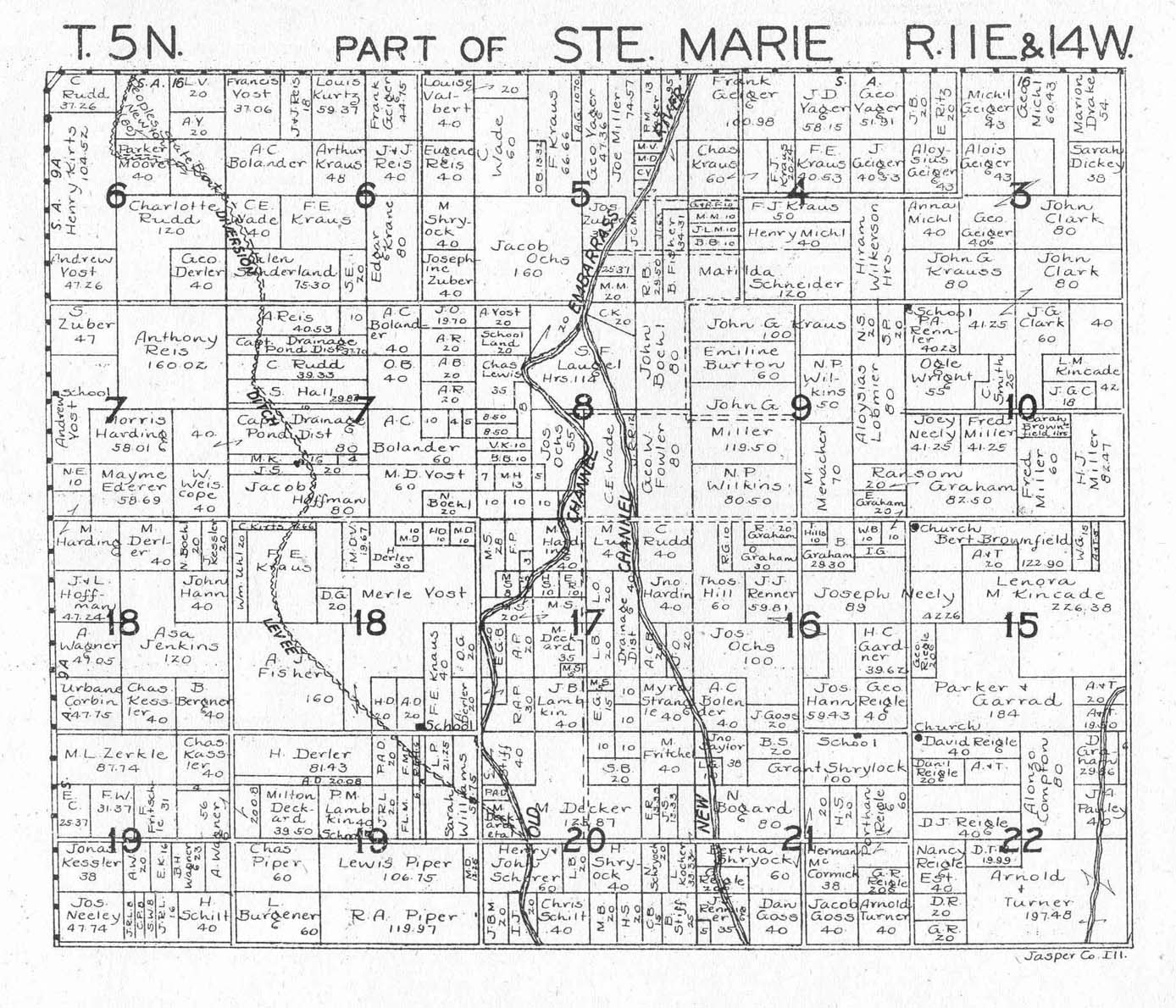
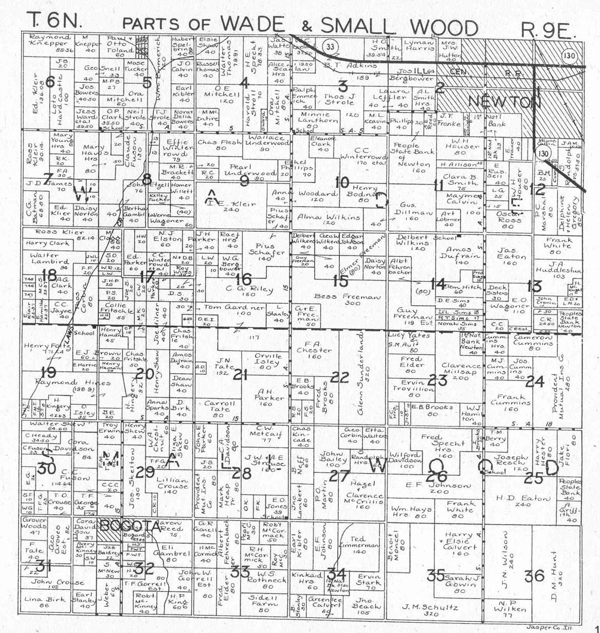
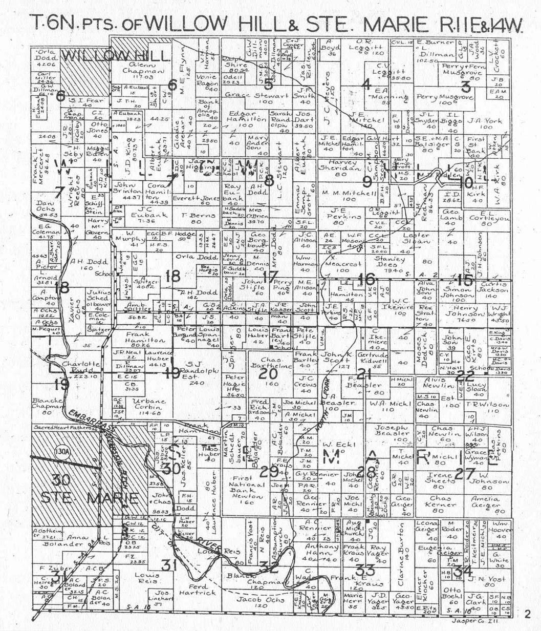
Jasper County Land Ownership Atlas, c. 1925, Published by W. W. Hixson & Co., Rockford IL. Submitted by Joy Fisher. Maps range between 275kb and 450kb.
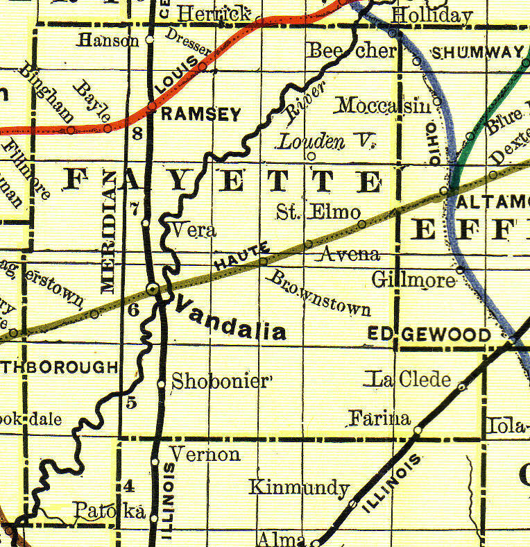
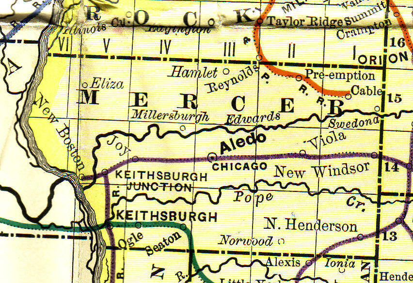
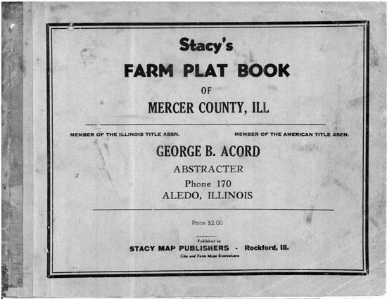
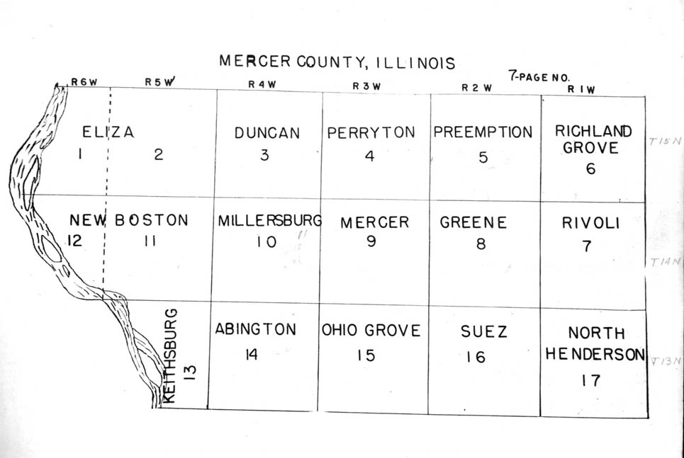
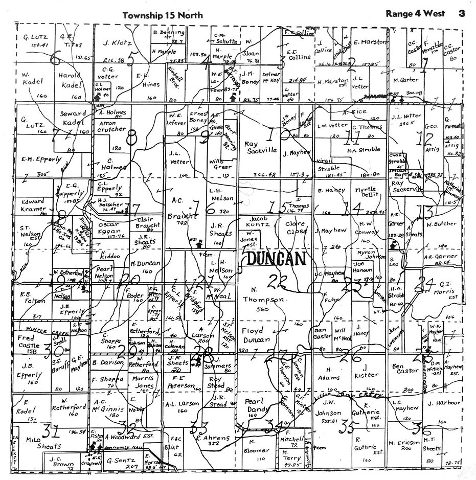
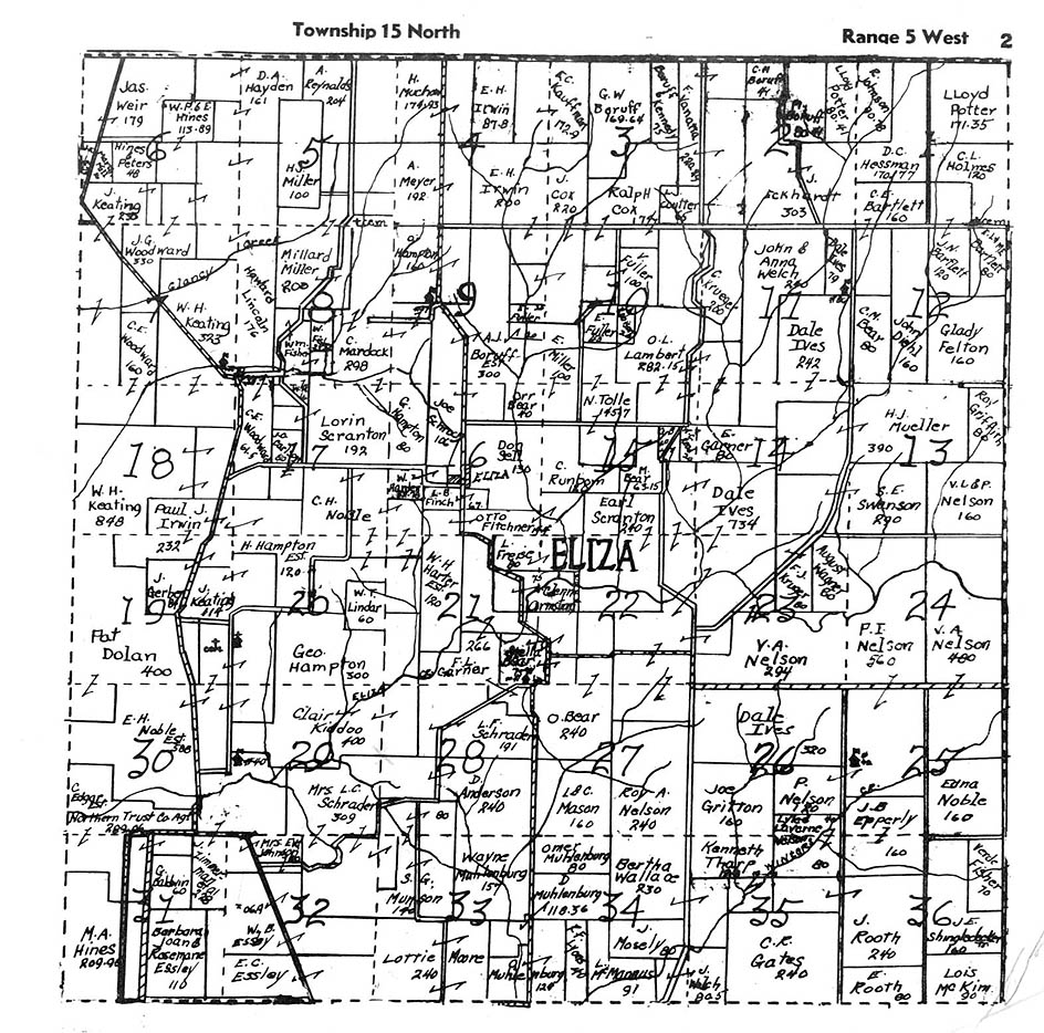
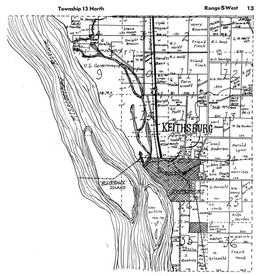
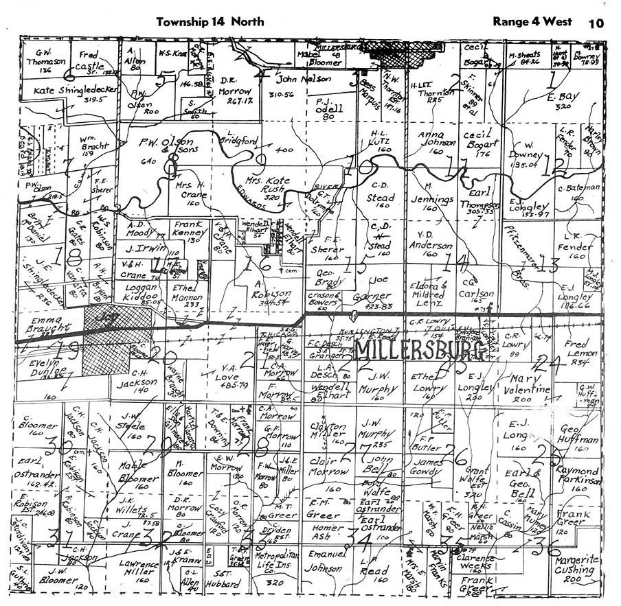
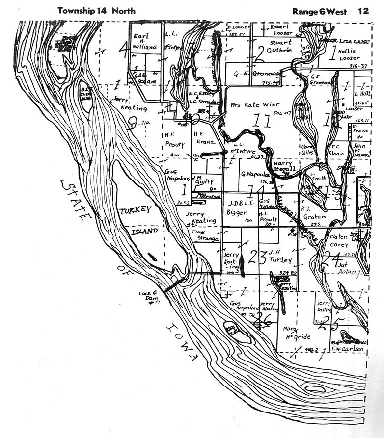
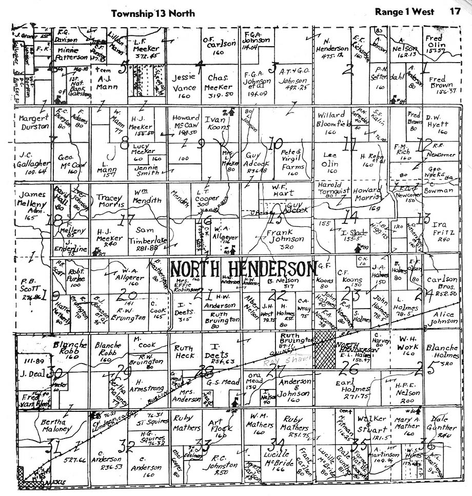
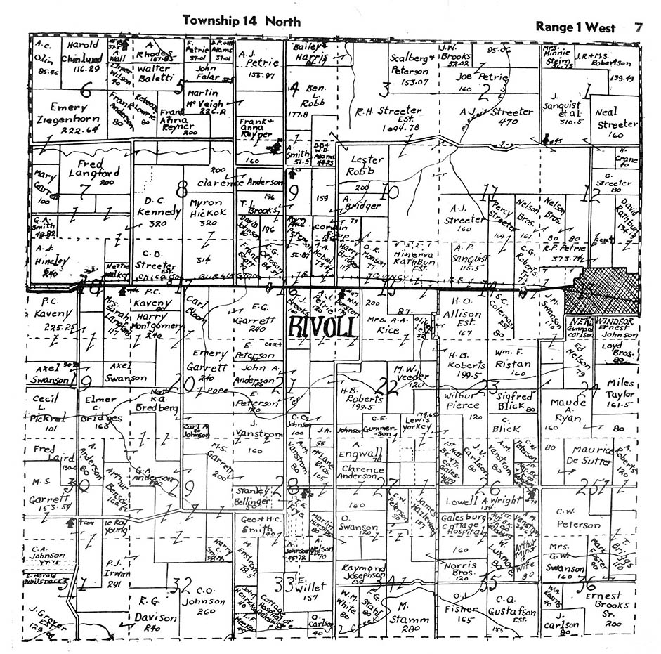
Mercer County Atlas, Stacy Map Publishers, ca 1940s. Submitted by Joy Fisher.
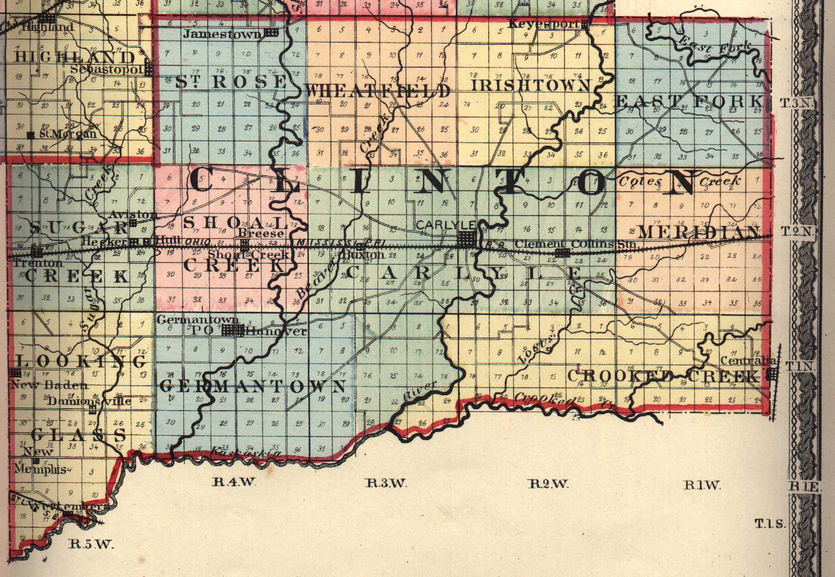
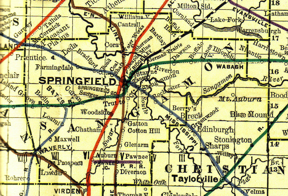
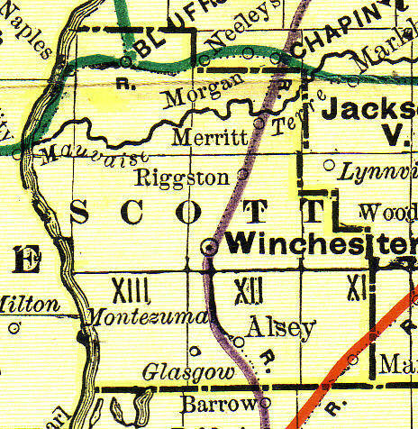
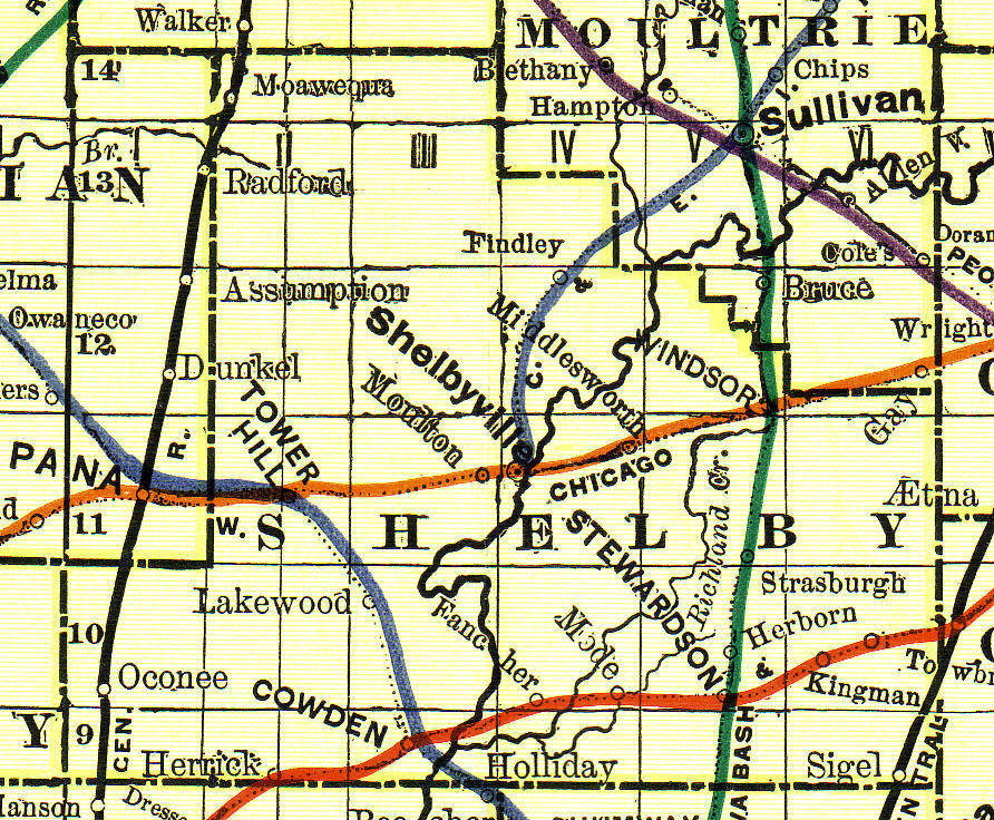
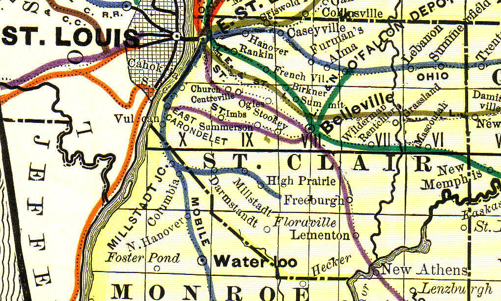
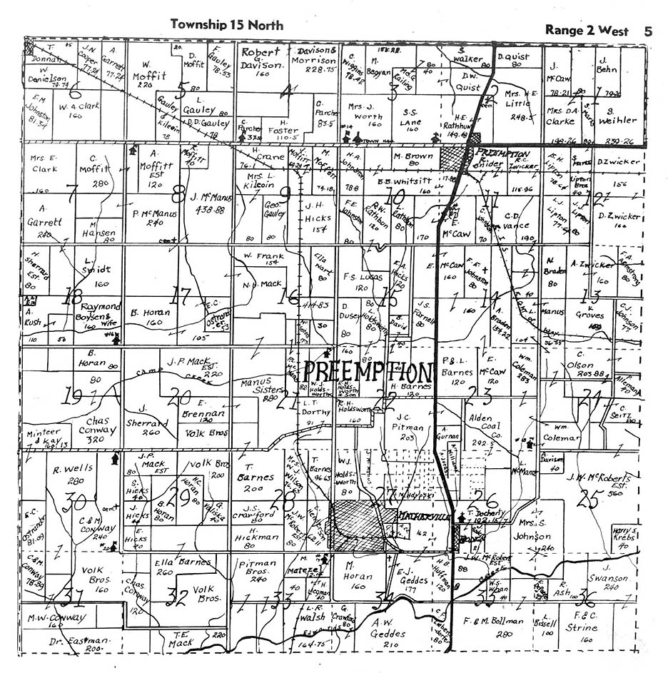
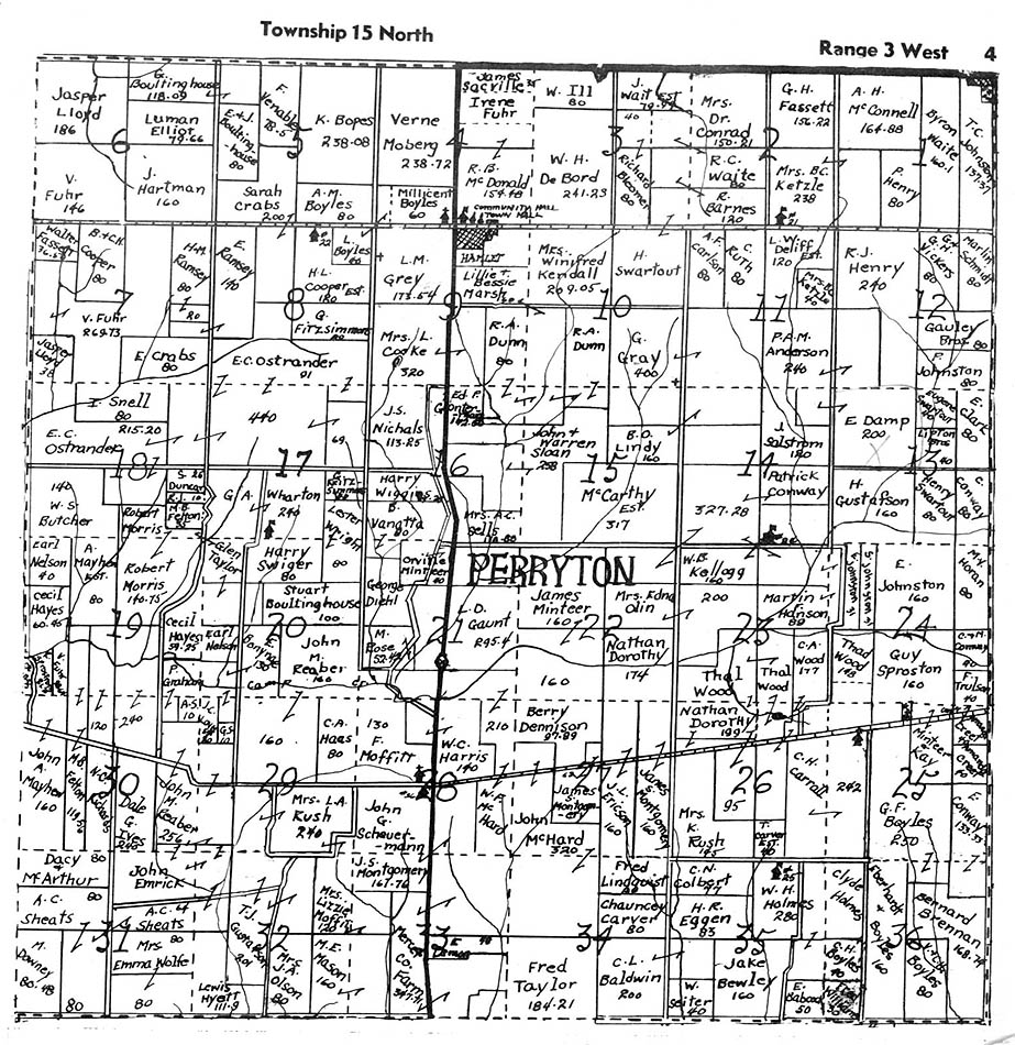
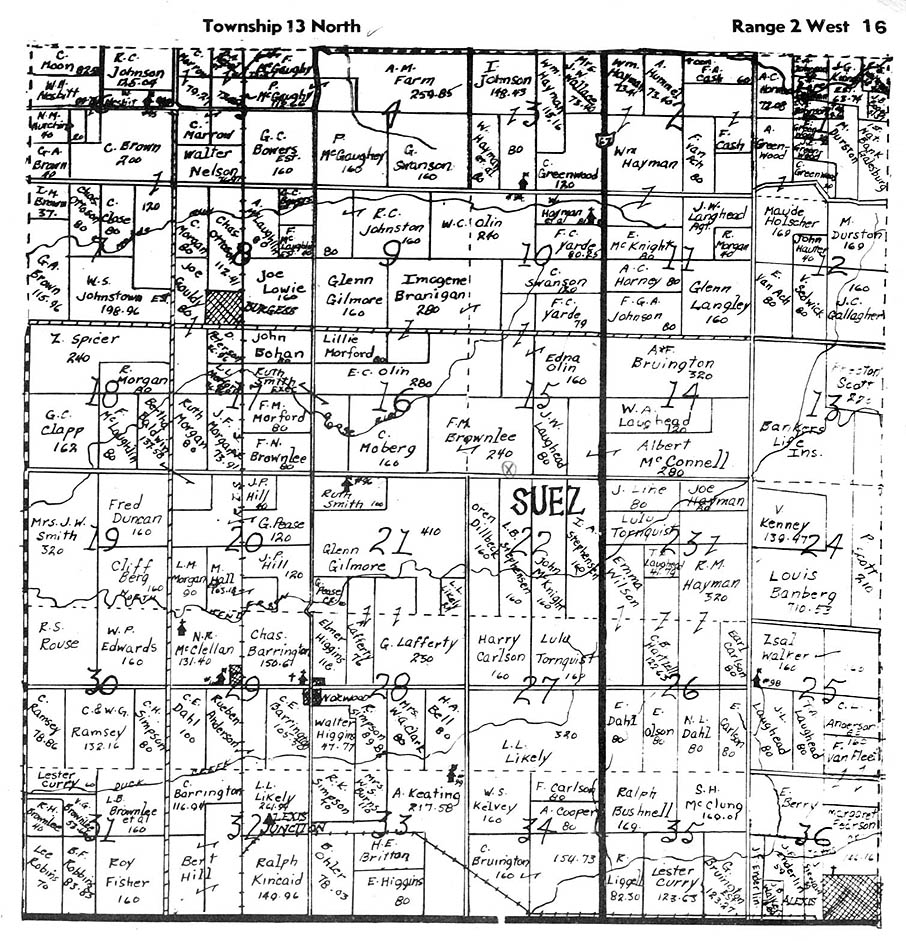
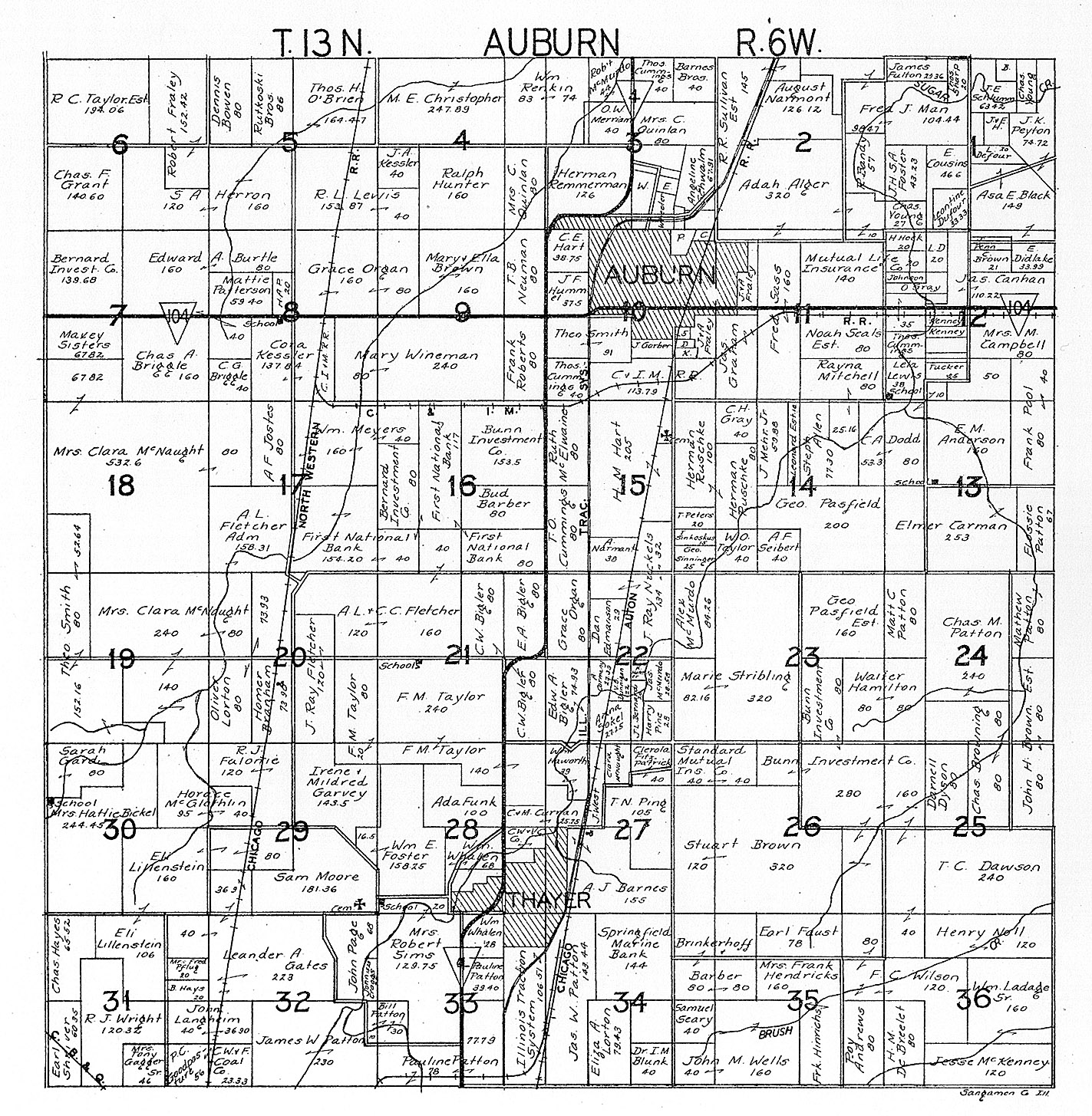
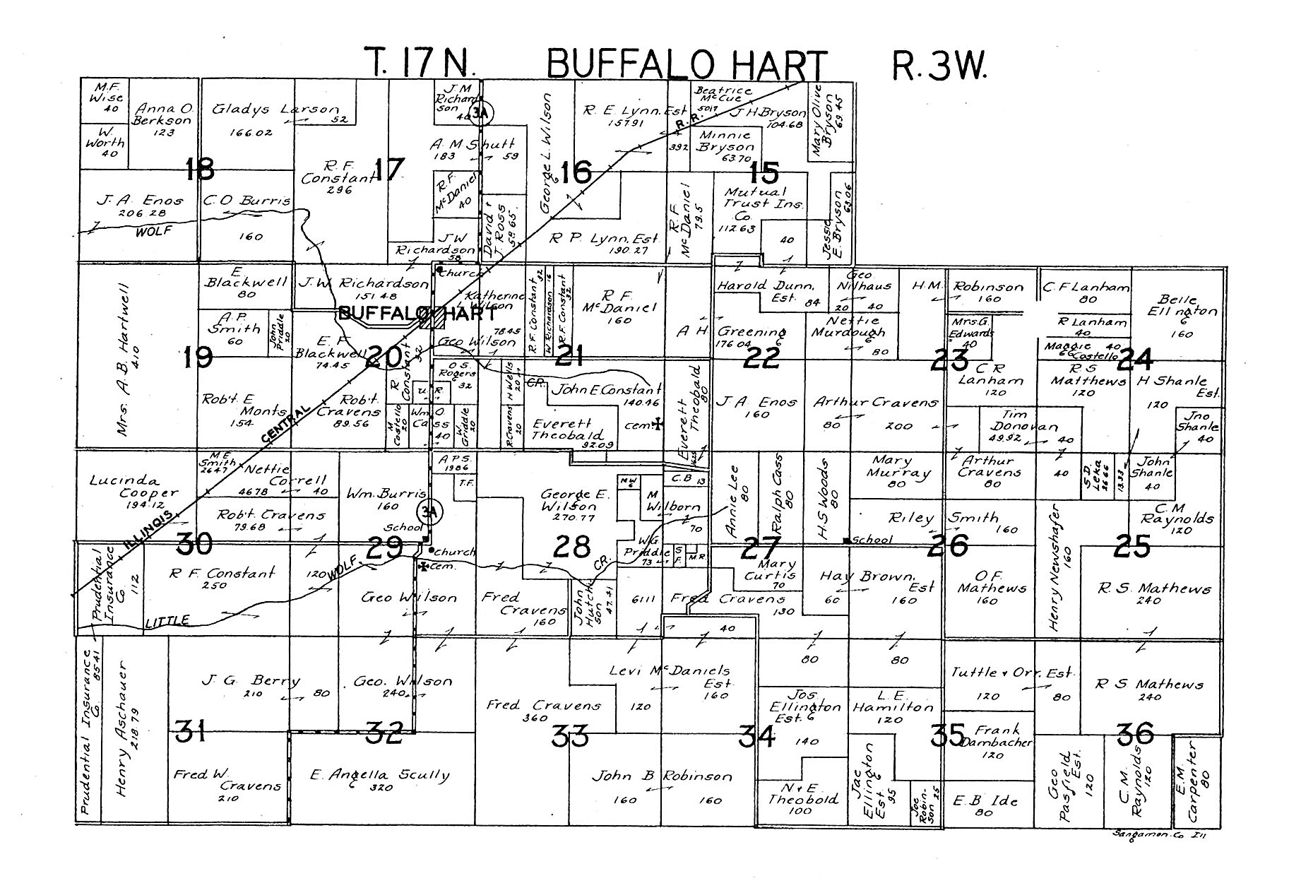
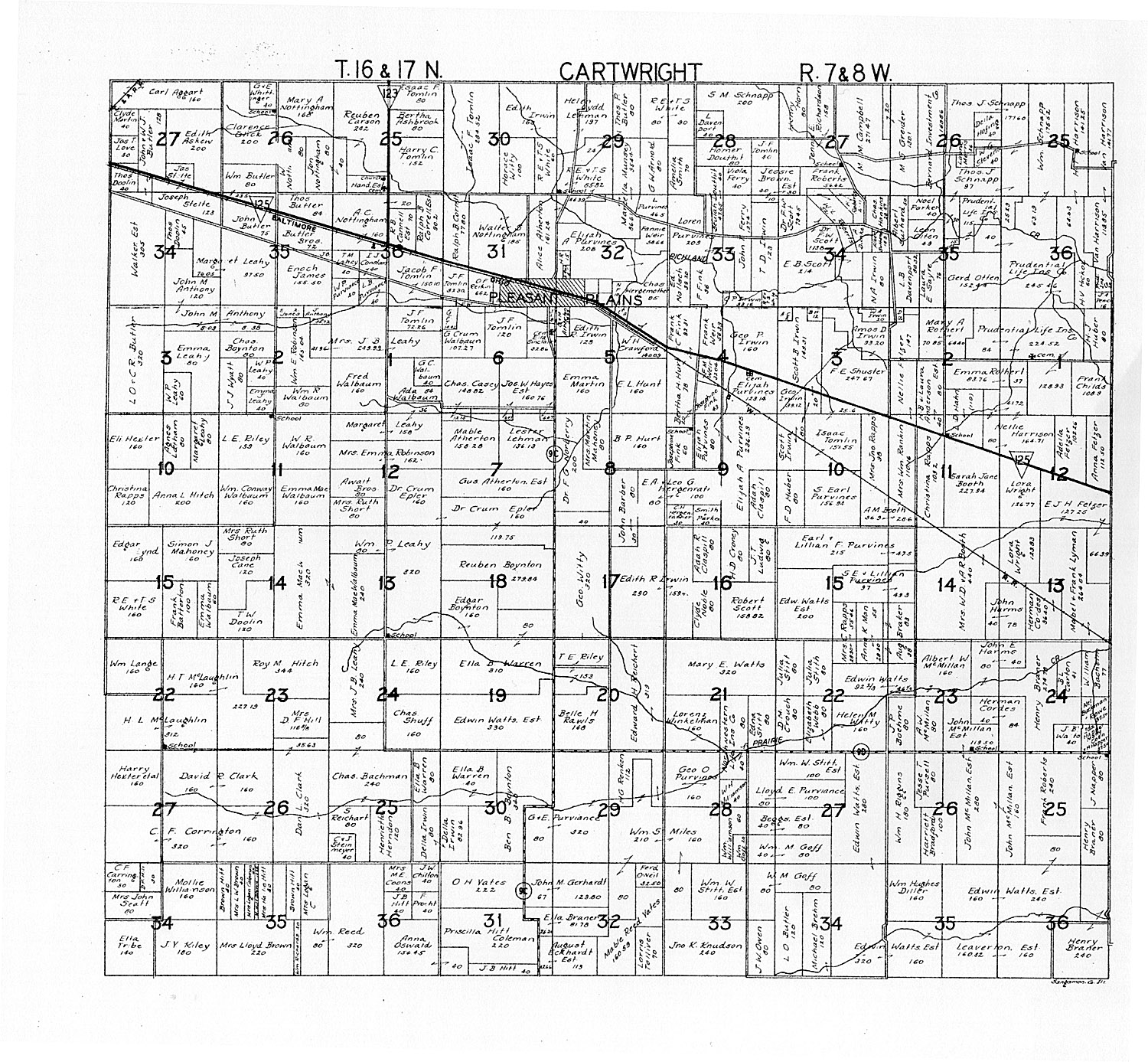
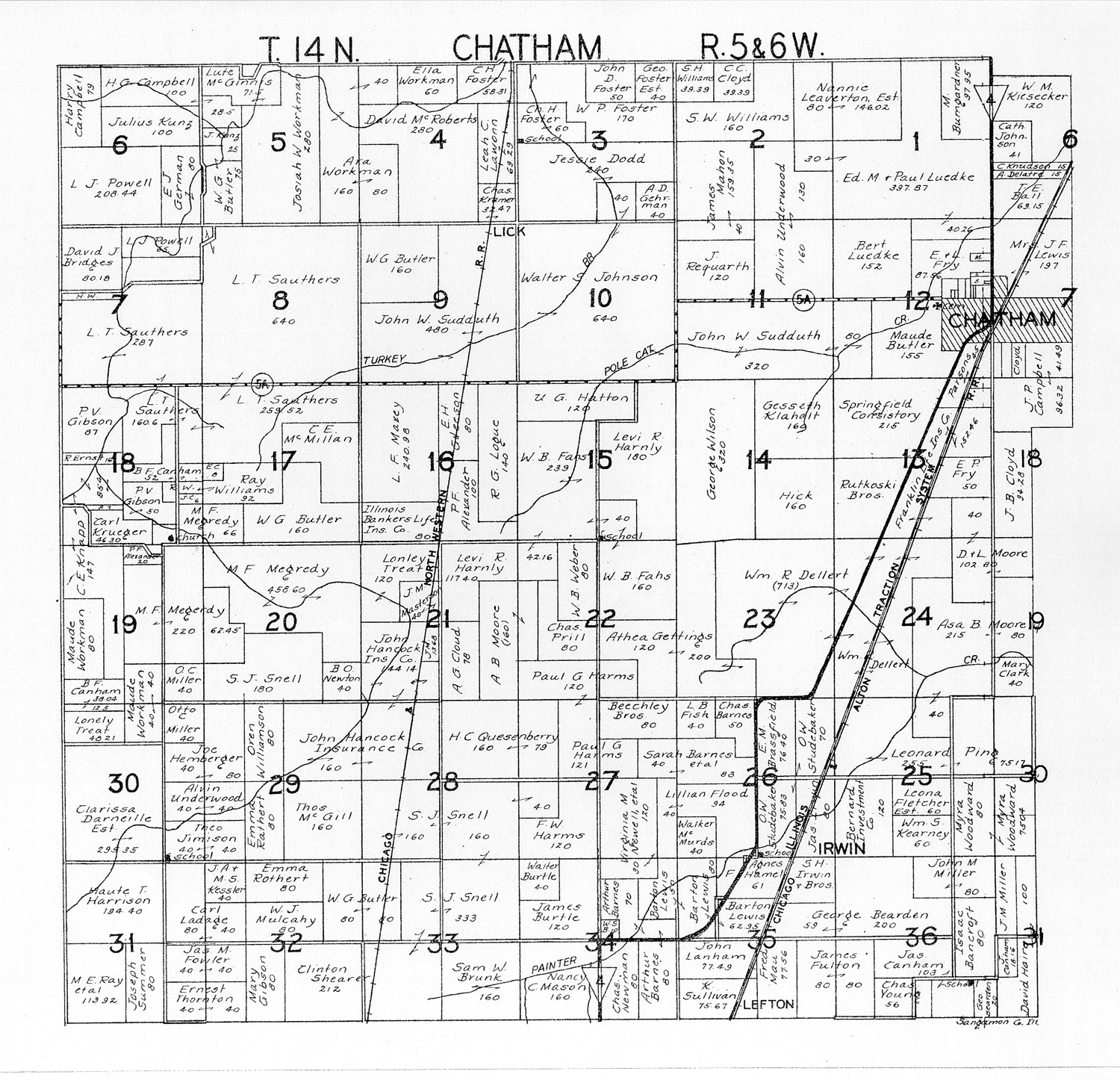
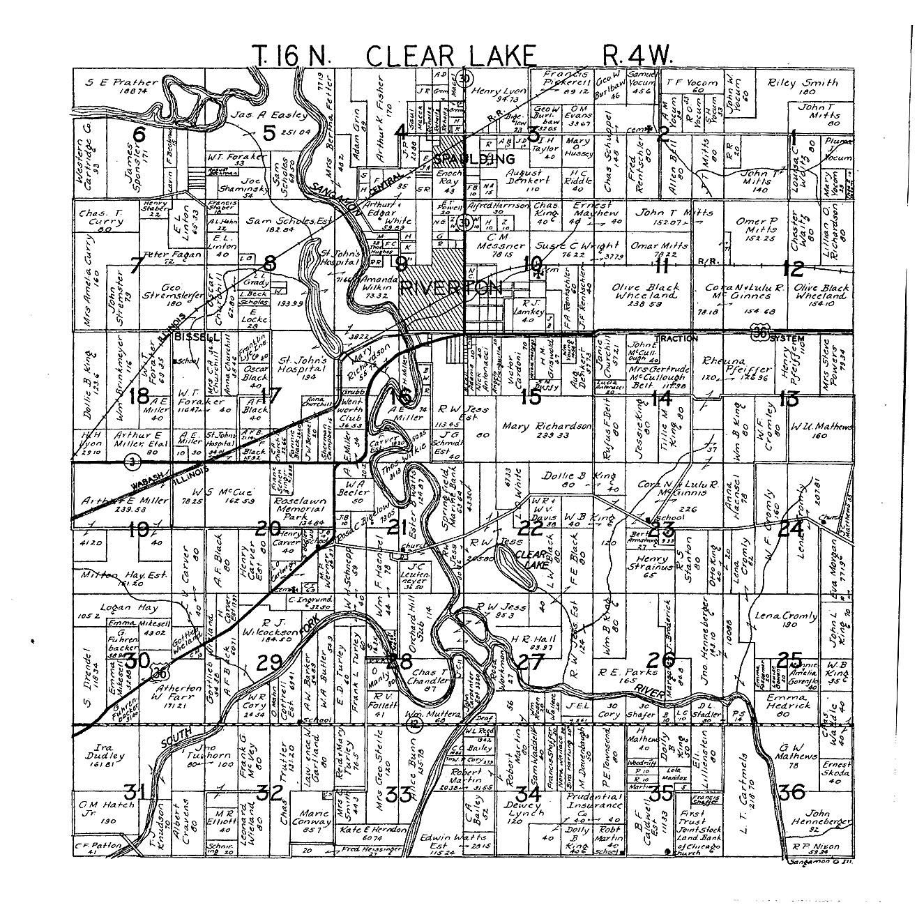
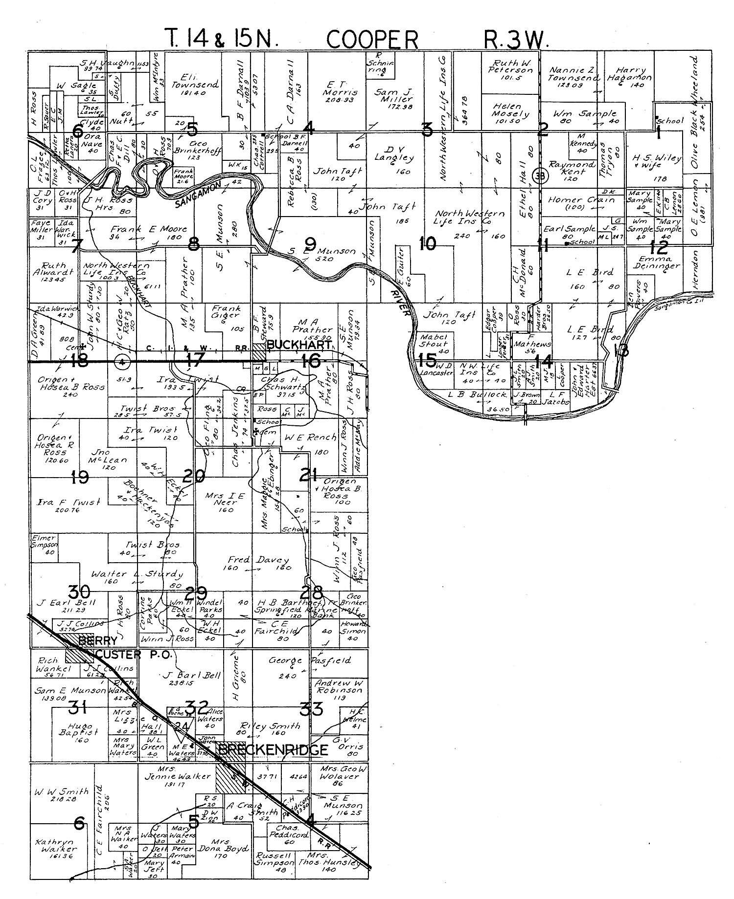
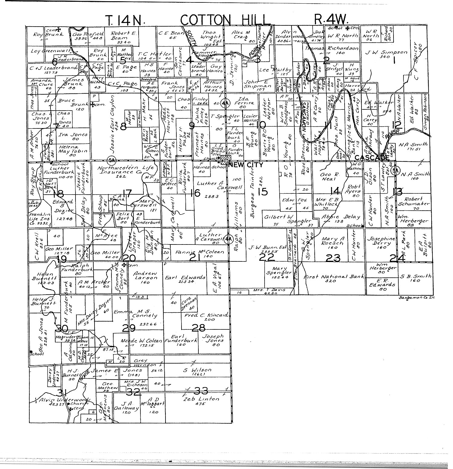
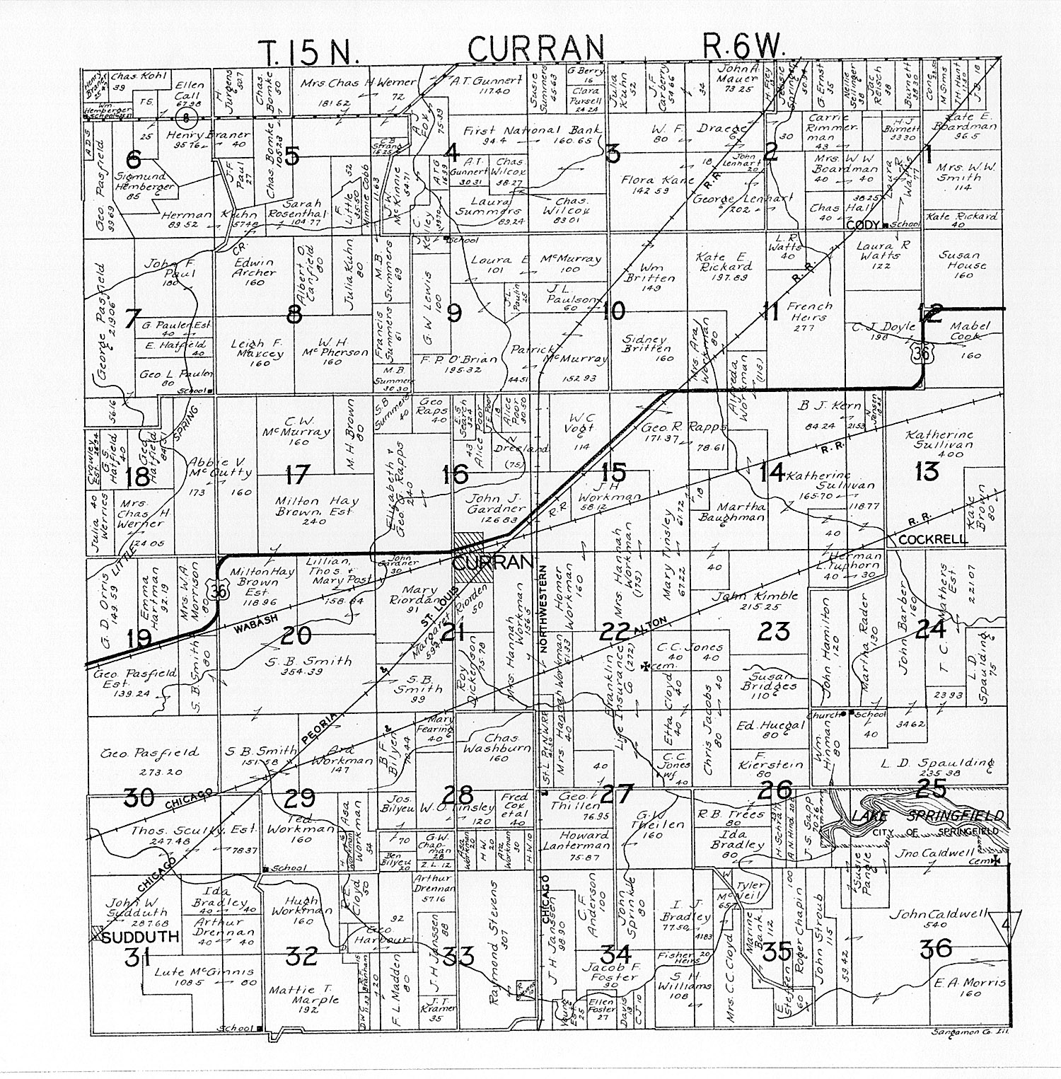
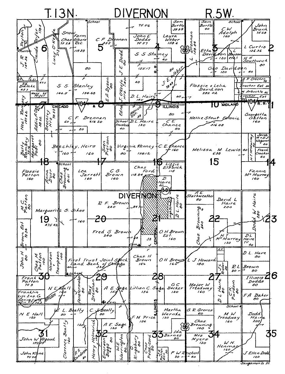
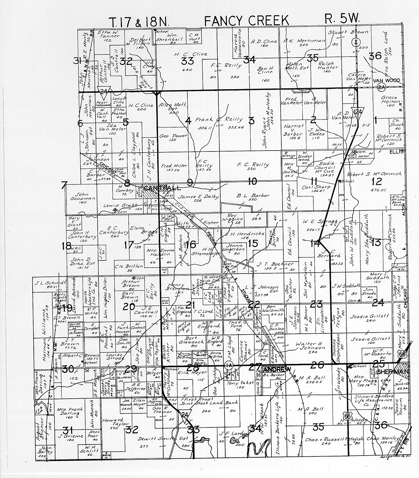
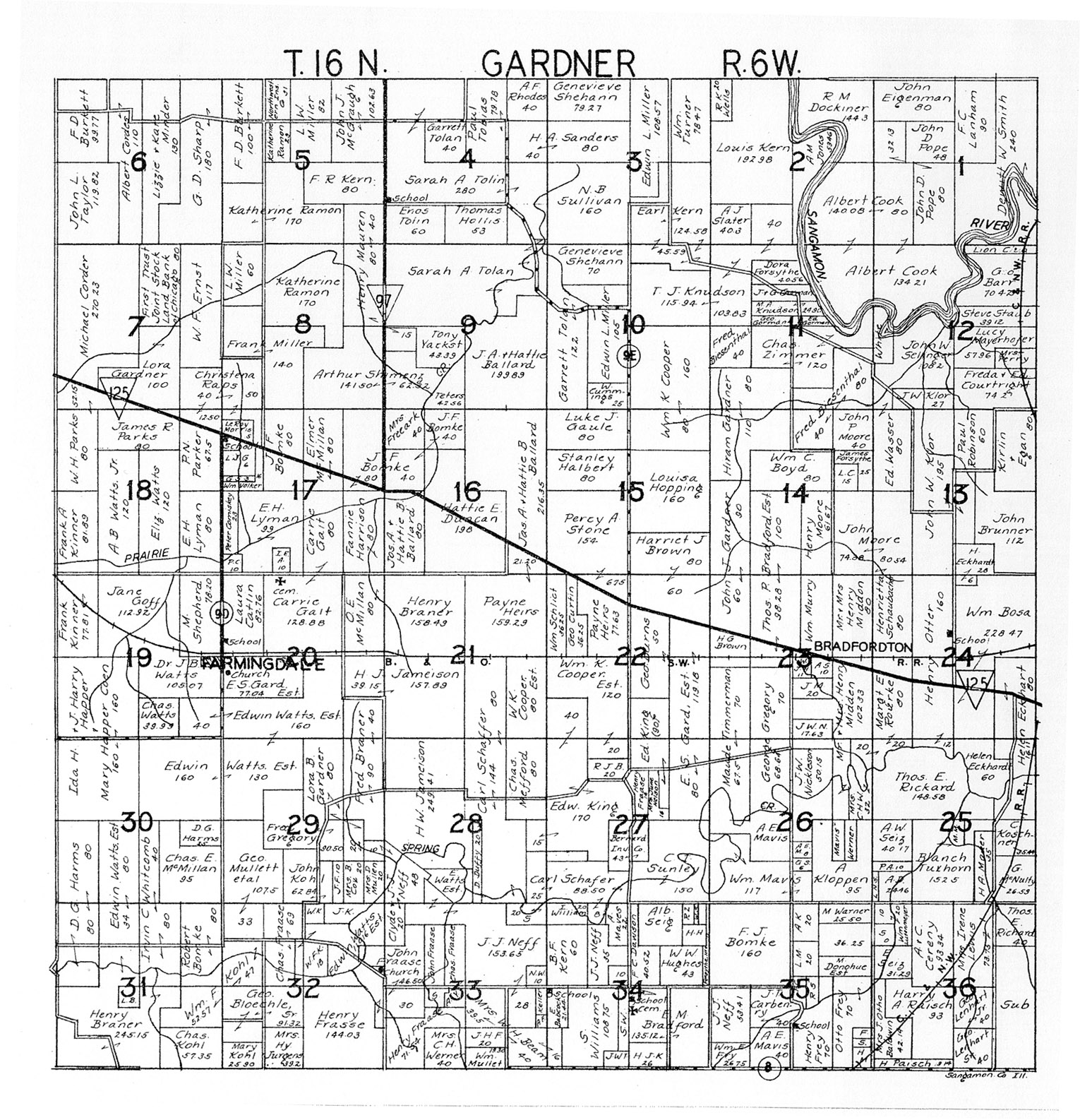
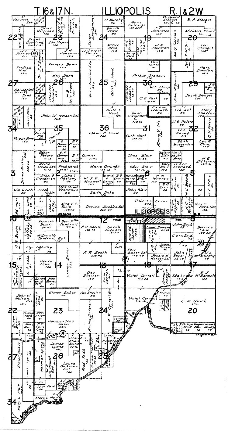
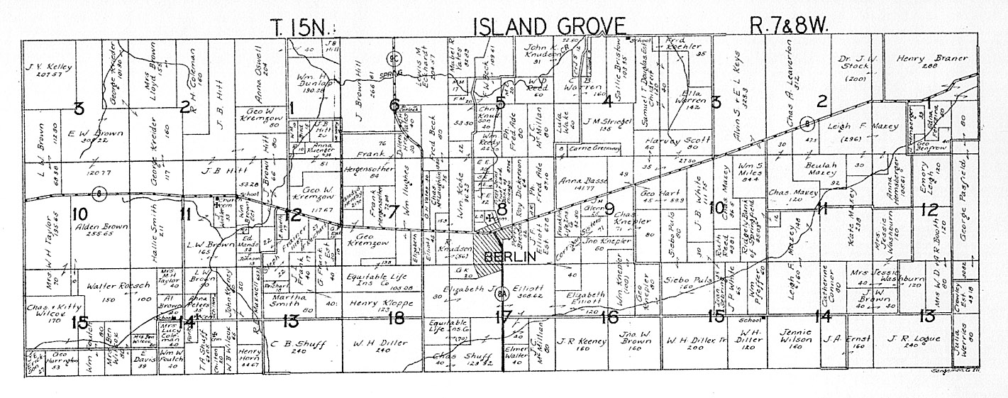
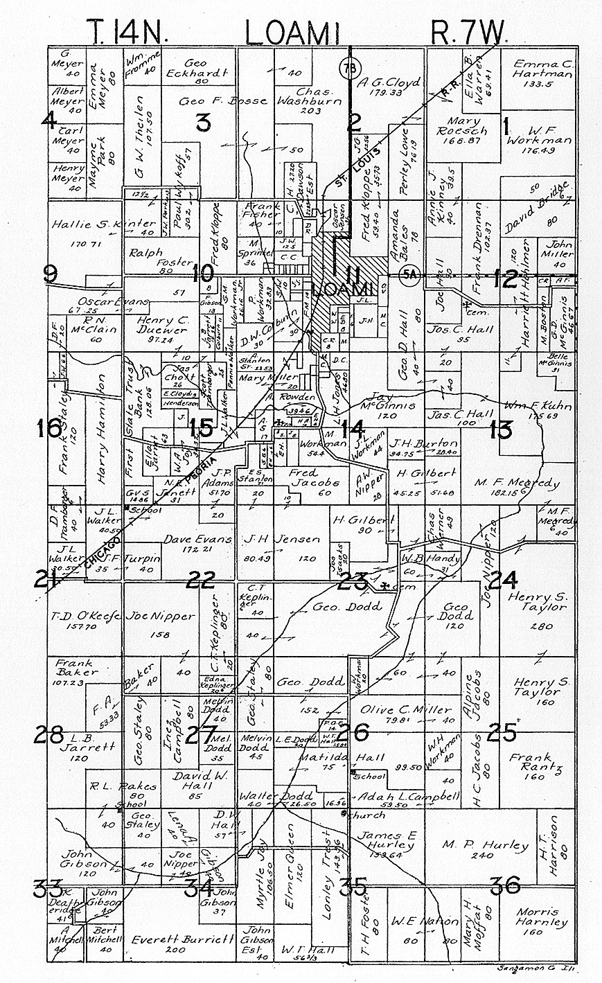
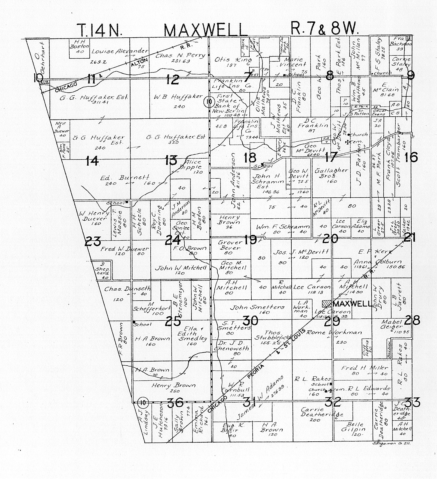
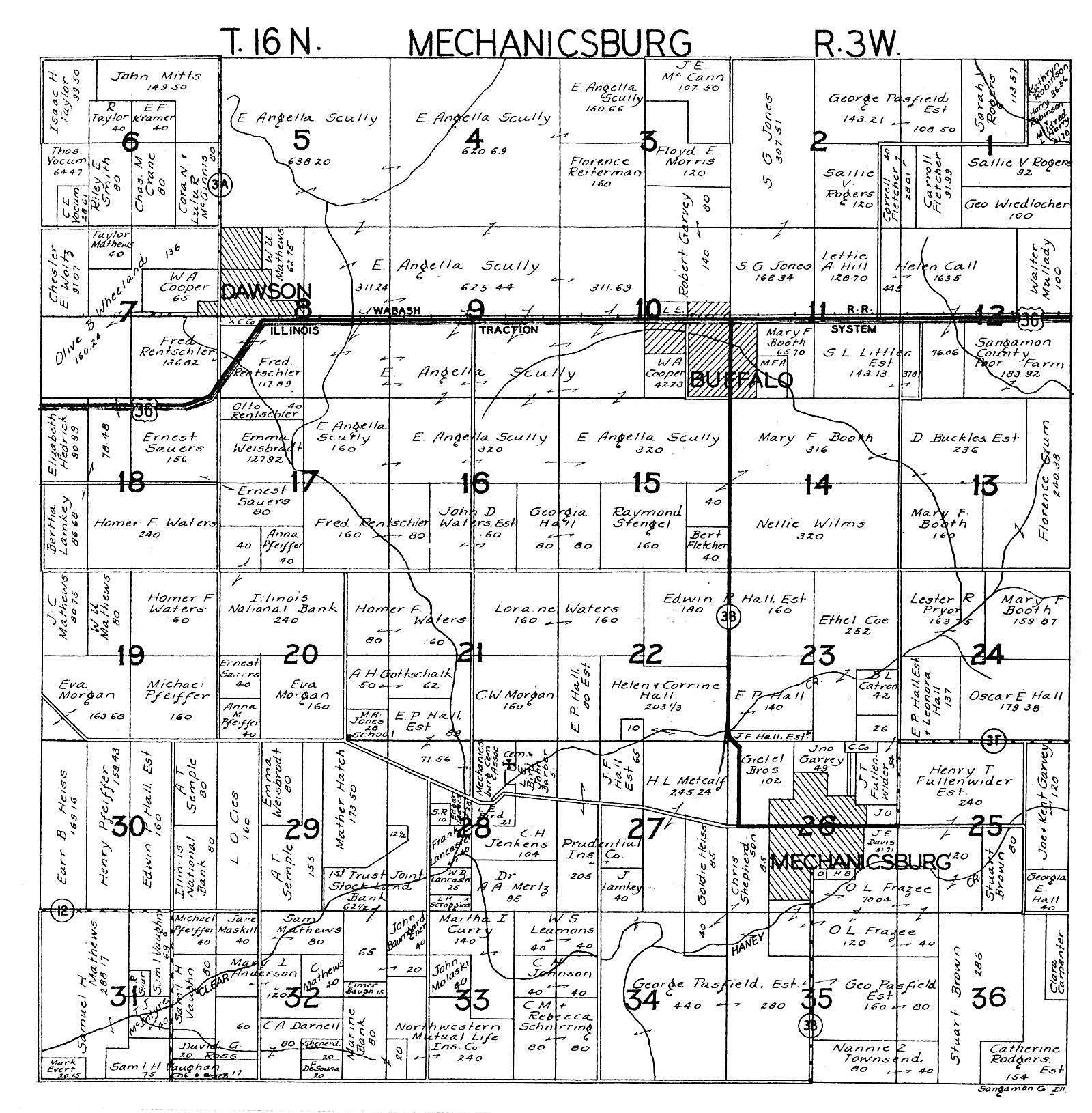
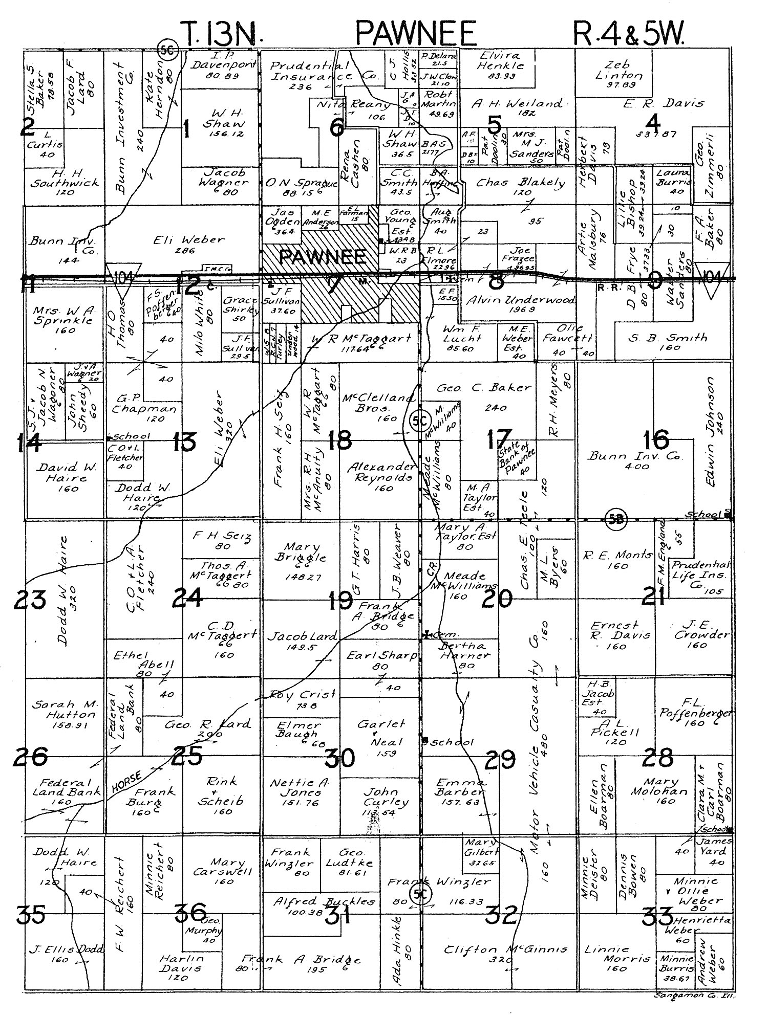
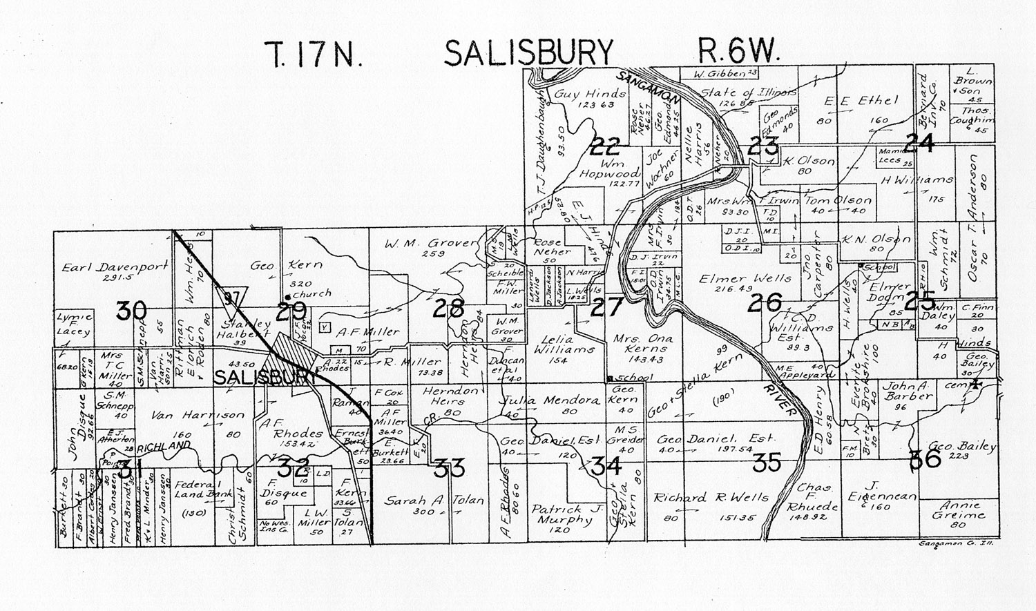
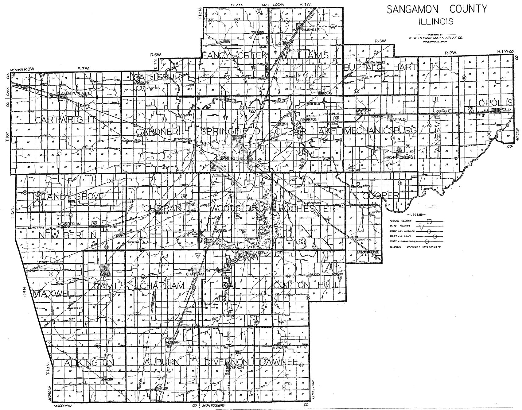
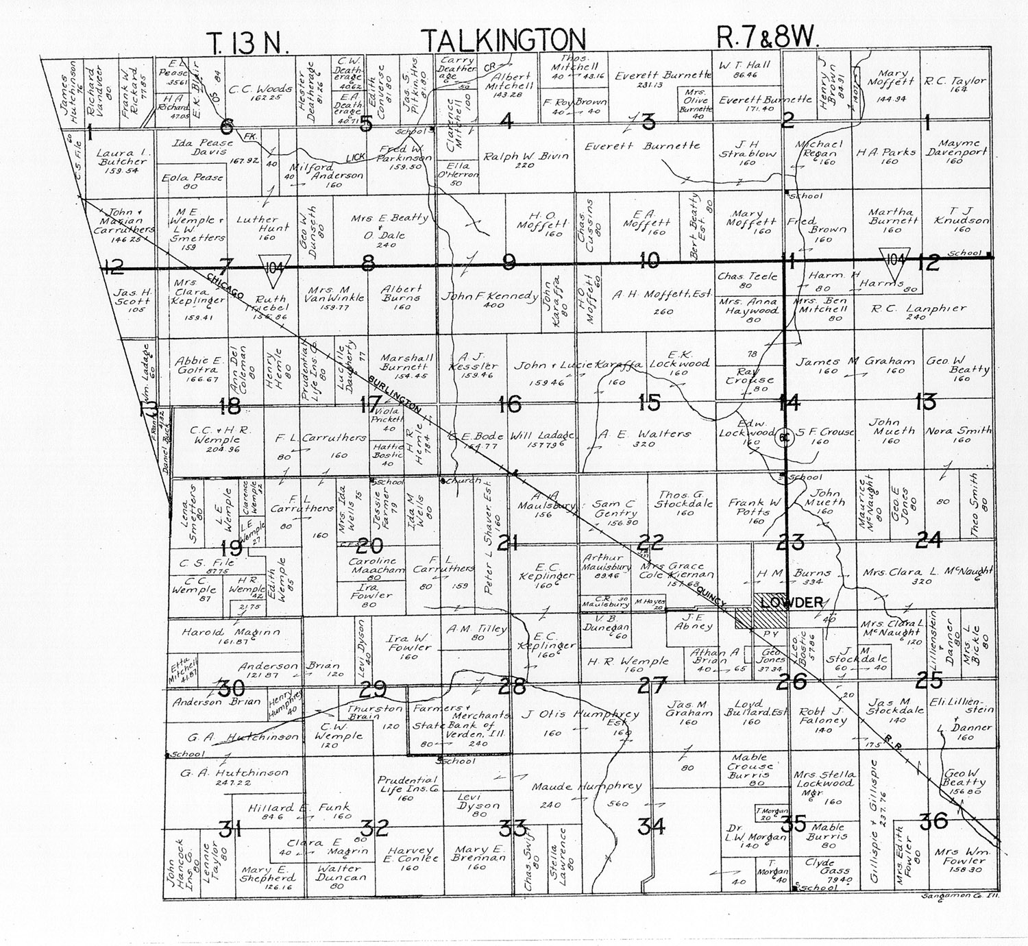
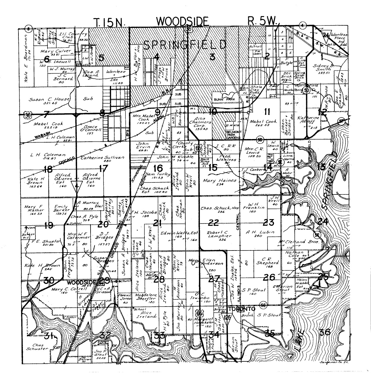
Sangamon County Land Ownership Atlas, c. 1940. Submitted by Joy Fisher. Maps range between 350kb and 800kb.
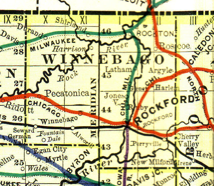
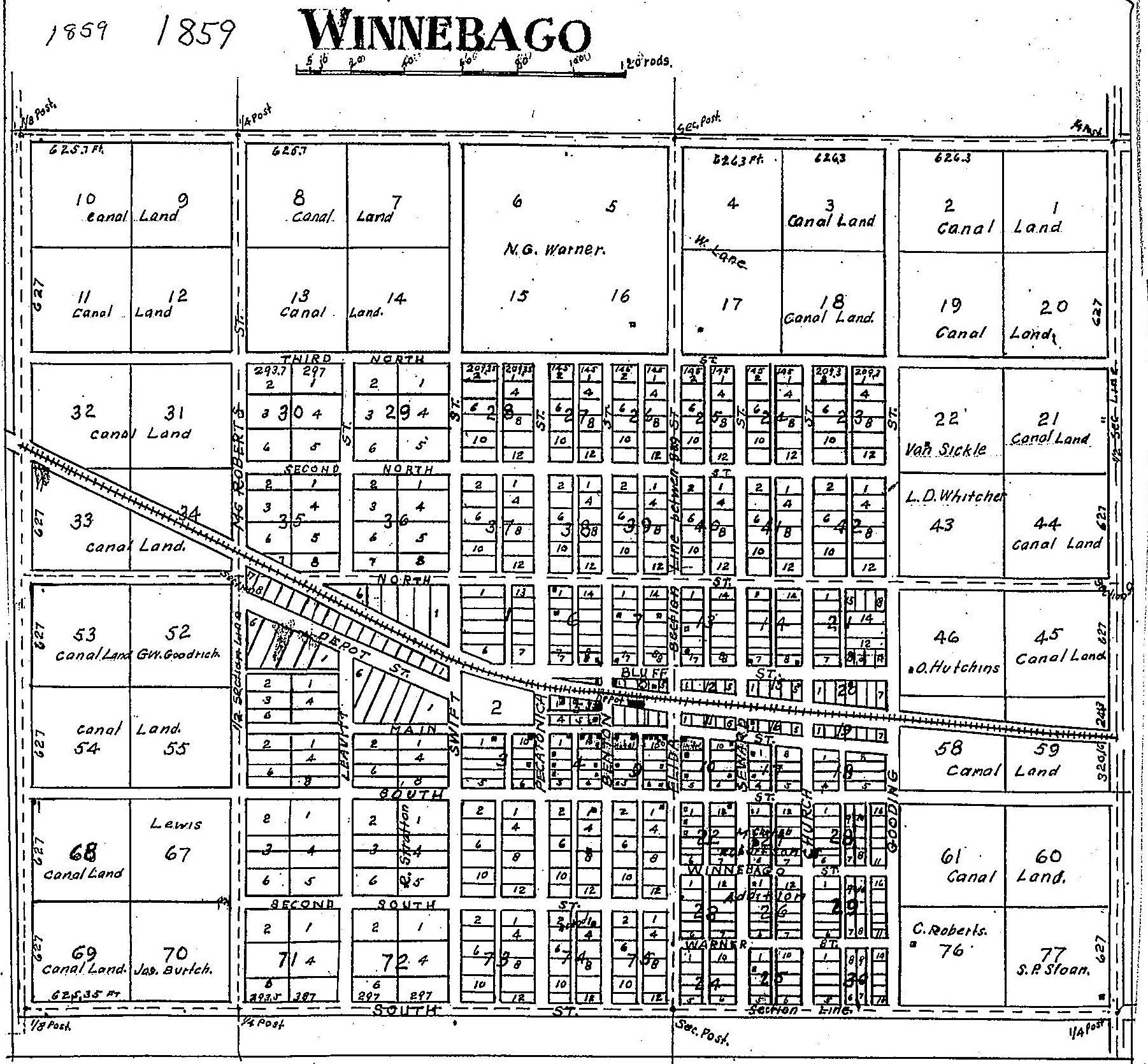
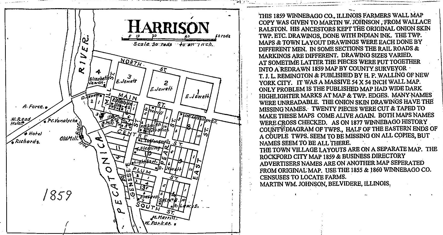
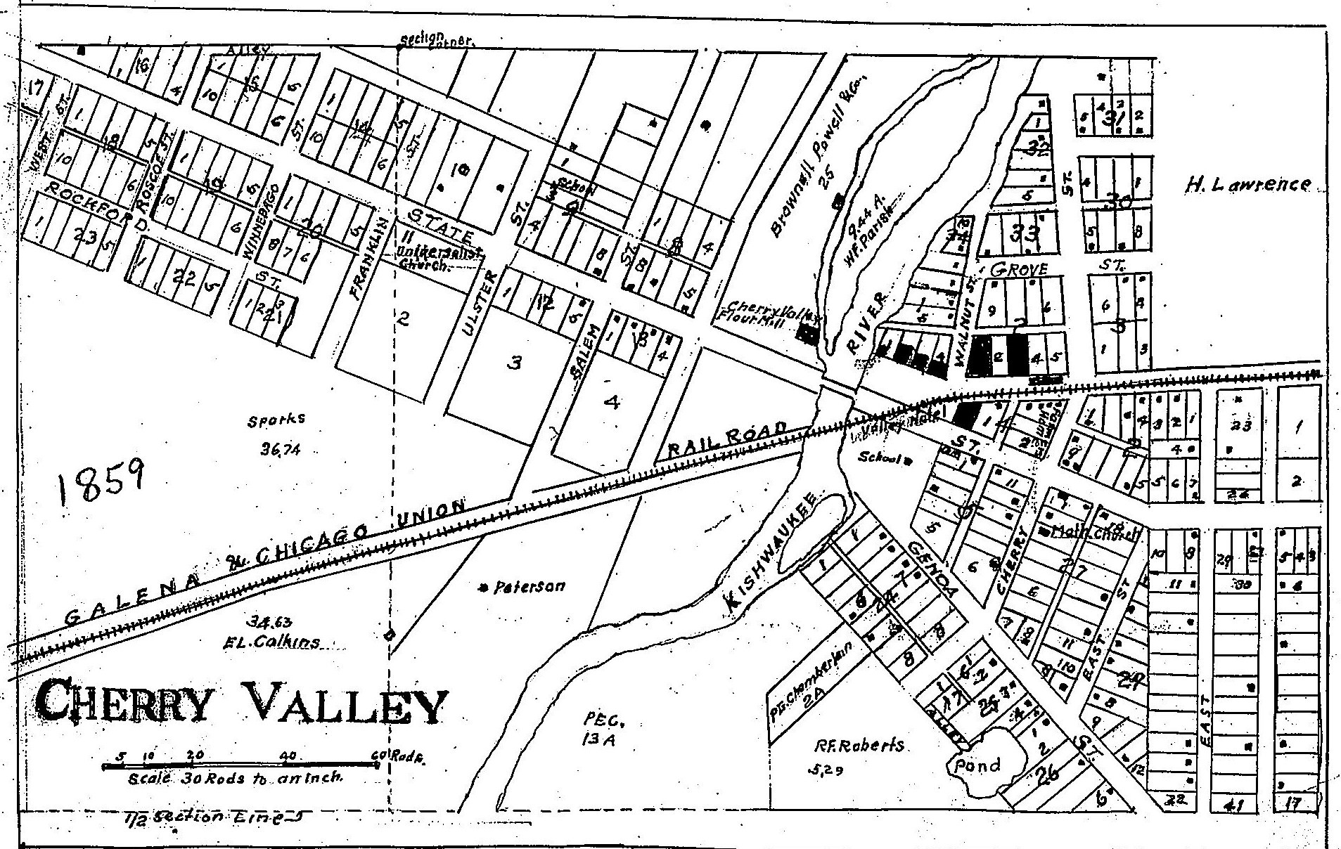
Winnebago County
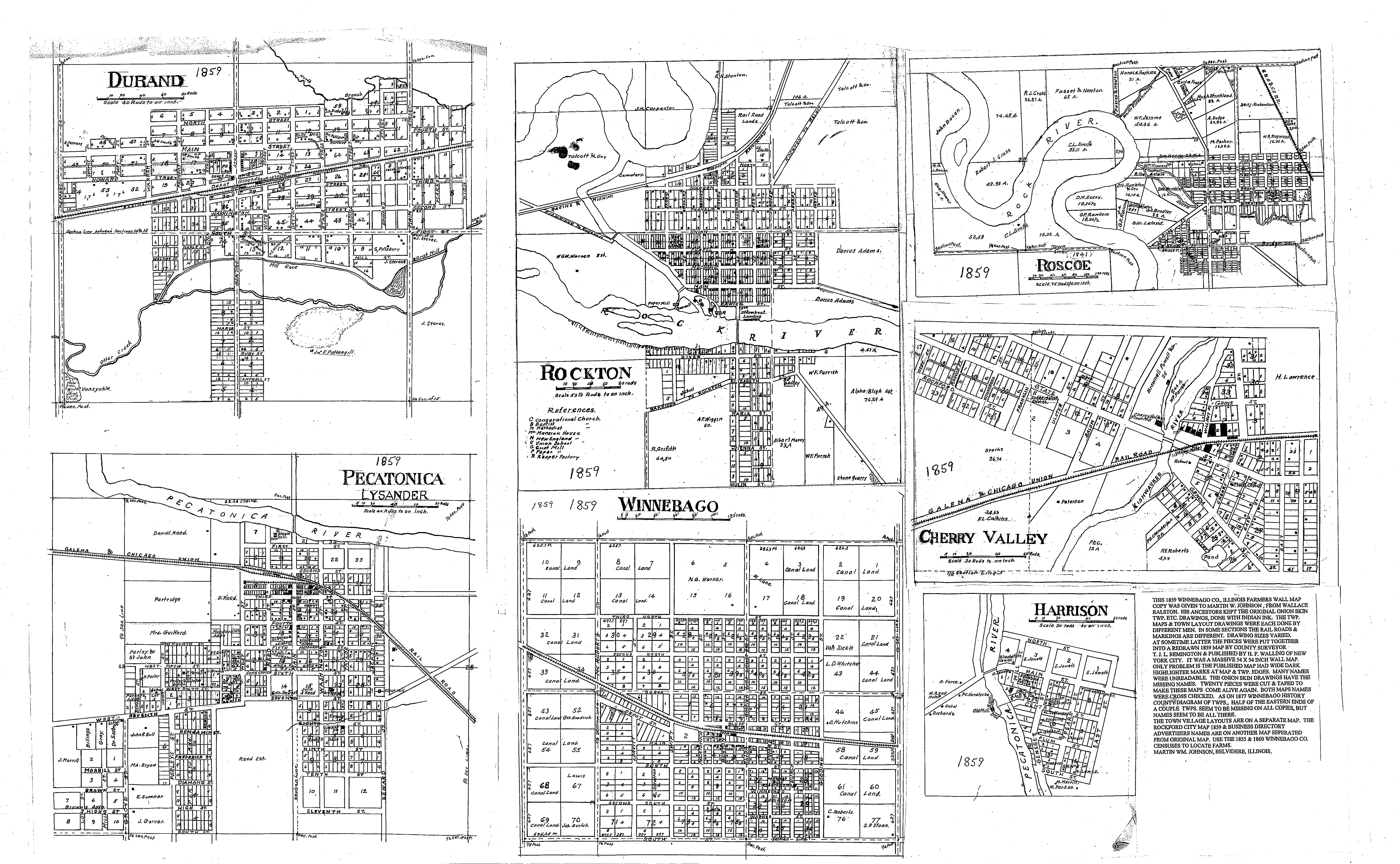
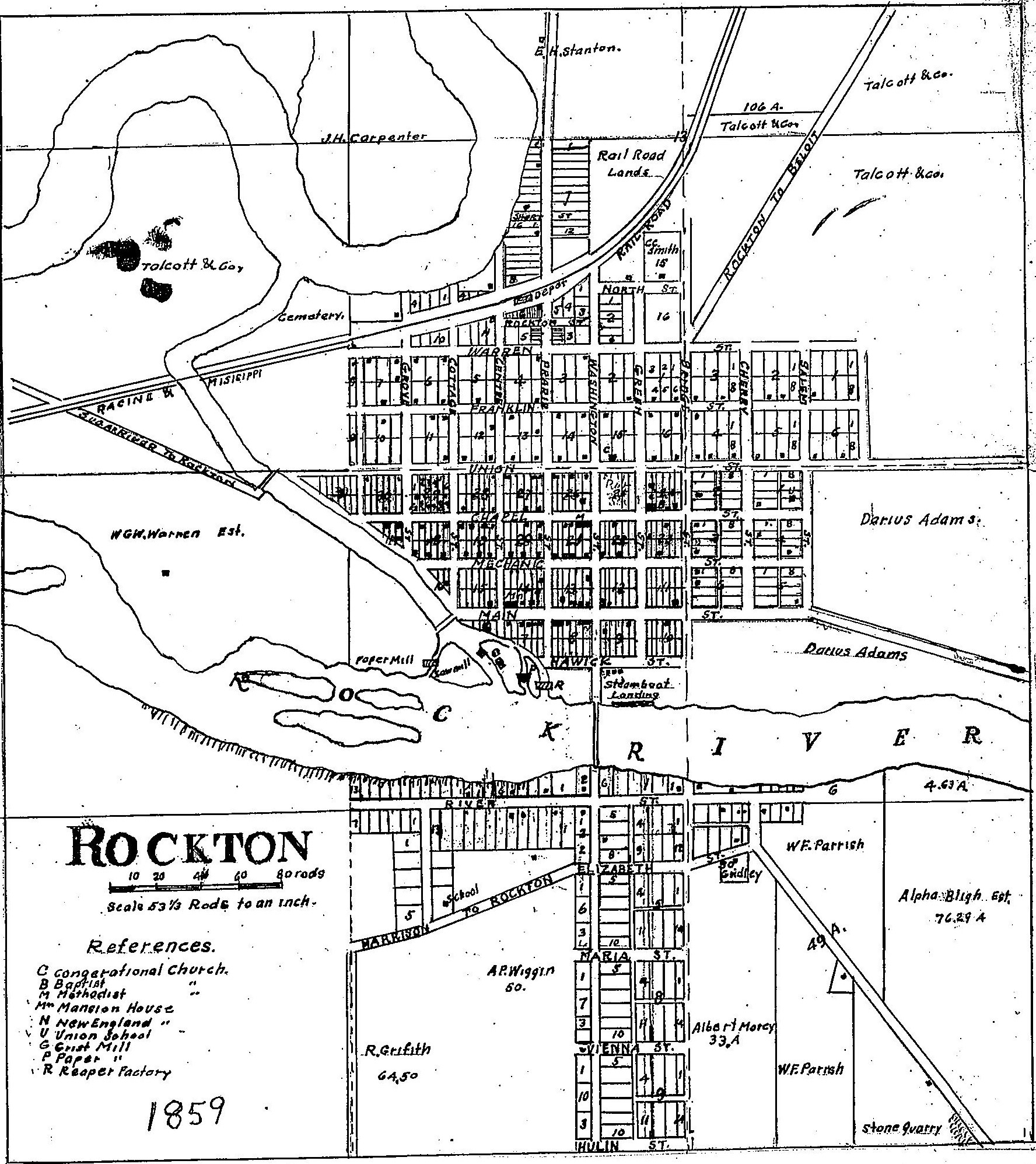
Winnebago County Village Plat, c. 1859. Submitted by Martin Johnson.
This page was last updated Saturday, 06-Nov-2021 03:27:02 EDT
Copyright © 1996- USGenWeb Archives Project. All Rights Reserved.


