

State Map Coordinator
The following maps of Washington, D.C. and the District of Columbia area are online in the United States Digital Map Library, and are available for you to download. If you would like to be part of the Digital Map Library team and/or make contributions, please e-mail me, Rebecca Maloney. Your contributions are both needed and appreciated!
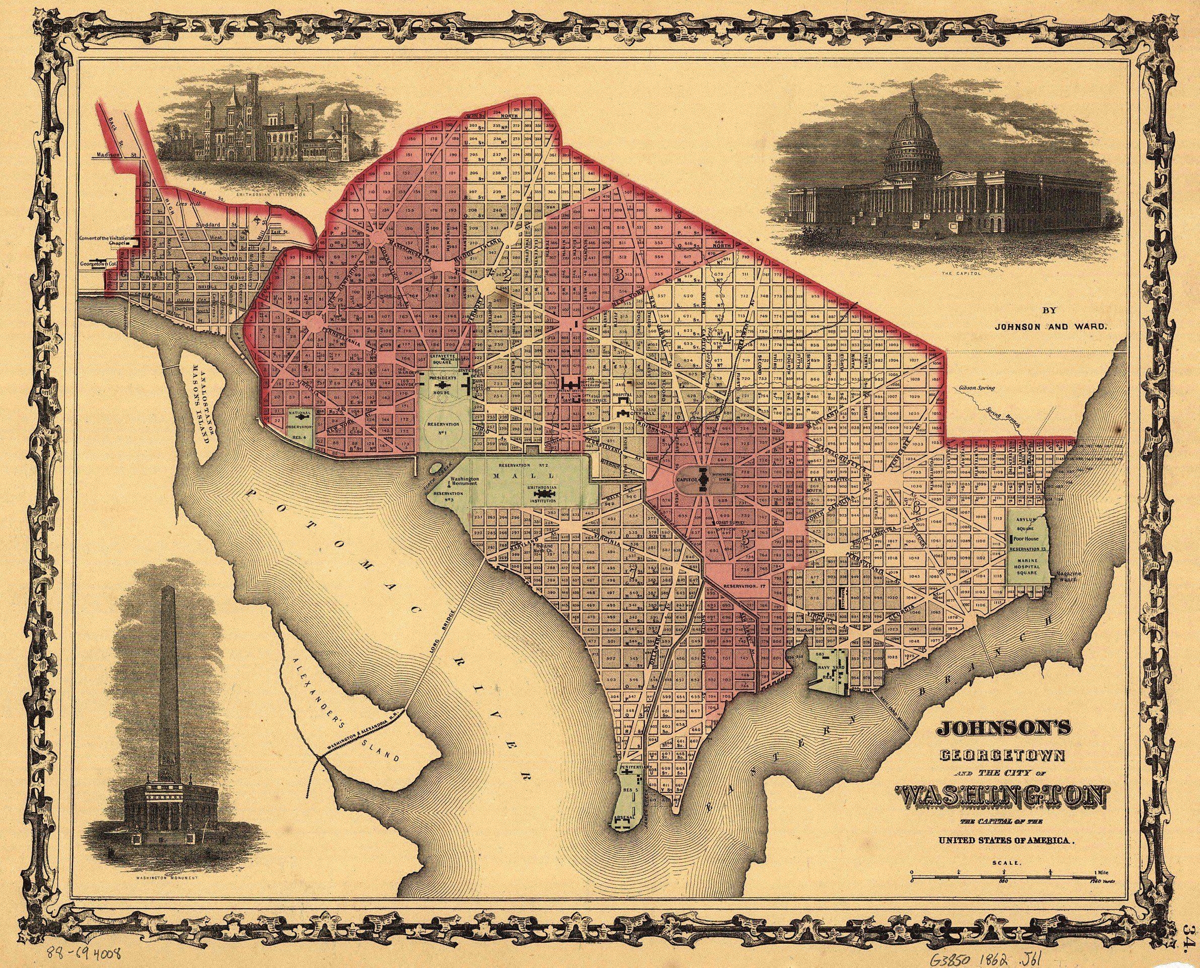 Johnson�s Georgetown and the city of Washington: the capital of the United States of America, by Johnson and Ward. c 1862. Library of Congress Geography and Map Division Washington, D.C. (1.8 mb) |
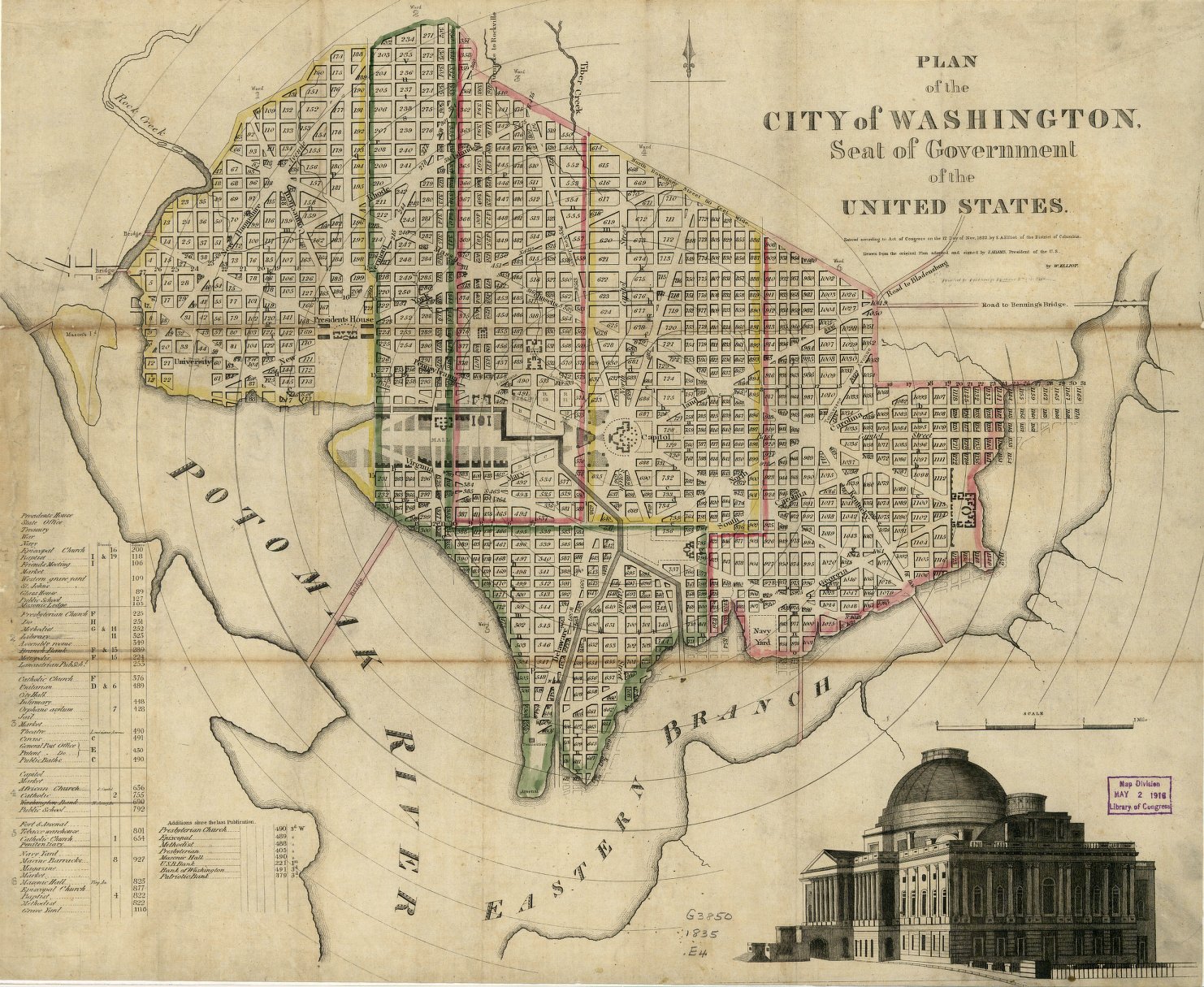 Plan of the city of Washington: seat of government of the United States, drawn from the original plan adopted and signed by J. Adams, president of the U.S., by W. Elliot. c 1833. Library of Congress Geography and Map Division Washington, D.C. (547 kb) |
 Atlas of 15 miles around Washington, including the counties of Fairfax and Alexandria, Virginia/ compiled and published from actual surveys by G.M. Hopkins. Hopkins, Griffith Morgan. Philadelphia: G.M. Hopkins, 1879, c 1878. Library of Congress Geography and Map Division Washington, D.C. (443 kb) |
Joy Fisher
Coordinator
Rebecca Maloney
Special Projects Representative