 |
USGenWeb
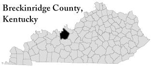
Archives Project Breckinridge County, Kentucky |
 |
 |
 |
|
|
USGenWeb
Archives Project Breckinridge County, Kentucky |
|
|
|
|
THESE ARCHIVES BUILT BY YOUR
CONTRIBUTIONS.
PLEASE CONTRIBUTE TODAY!
New
Easy to use Submission Forms!
This Page Updated Sunday, 06-Mar-2022 10:18:10 EST
| BRECKINRIDGE COUNTY, KENTUCKY MAPS |
Below are maps to present day
towns around Breckinridge County. For the most part, the names
are still the
same as they were 100 years ago. All these images can be found on
GoogleEarth and with a little work, names
of towns can be added by the person. The
links are to pages where the town/city names are already in
place.
In time, cemetery locations will be added
so as to help the researcher out as they are looking for family.
Bear this in mind when viewing these images. All cemeteries in
Breckinridge County are not represented
on these images. I'm trying really hard to go over topographical
maps to make sure that I get as many
cemeteries listed as possible. I can list the major ones, as well
as the smallers ones I've done in
my personal research. But with over 600 cemeteries in varying
sizes dotted all over the county,
I not only will need the topography maps to compare with Google,
but input from Breckinridge
County researchers who know positively of a location and/or the
exact whereabouts. All this
combined will help pinpoint as close as possible where a cemetery
is/could be located,
thus helping anyone who might be trying to locate one of the
cemeteries when visiting the
county while on vacation. The Breckinridge County Archives in
Hardinsburg has shared that
they are in possession of at least one hand held GPS gadget that
when a cemetery is located, it's GPS
coordinates can be locked in and recorded. In doing so, it will
help define the exact "where" of any cemetery
that has been found within the county. Unfortunately it's a
manual keying in, so it's going to take quite
a bit of time gathering all the information.
If you have any information to help locate a cemetery that could
be placed on the maps, please feel
free to email me. Remember, the more specific, the better the
chances of locating it and
positively identifying it for others.
Email: Dana Brown;
File Manager, Breckinridge County USGW KyArchives
| TRANSCRIPTIONS | PICTURES | |||
| GENERAL MAPS | ||||
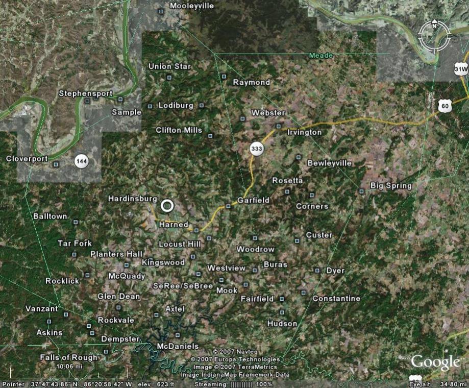
| Towns and Cities in Breckinridge County (entire county) | T | P | ||
| INDIVIDUALIZED
MAPS WITH CEMETERY LISTINGS |
||||
| NORTHERN SECTION OF BRECKINRIDGE COUNTY | ||||
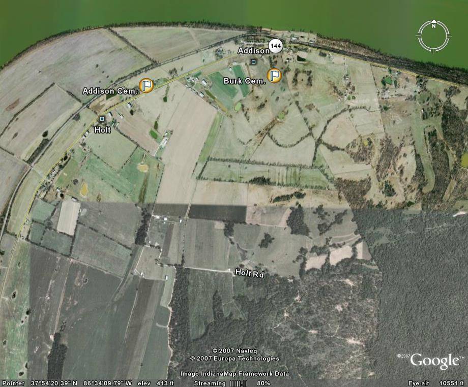
| ~Addison/Holt areas | T | P | ||
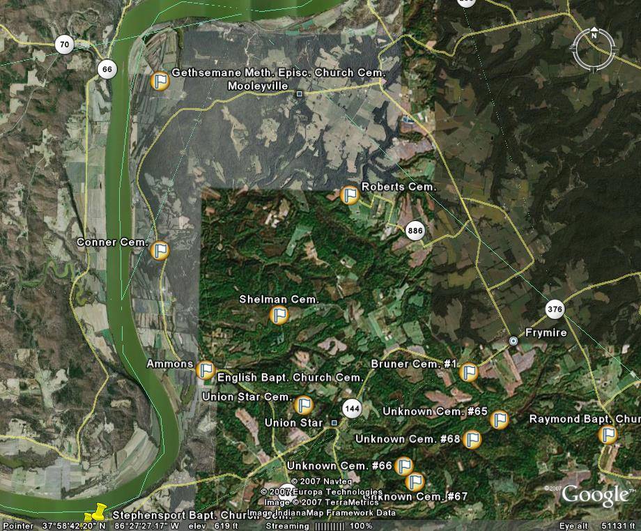
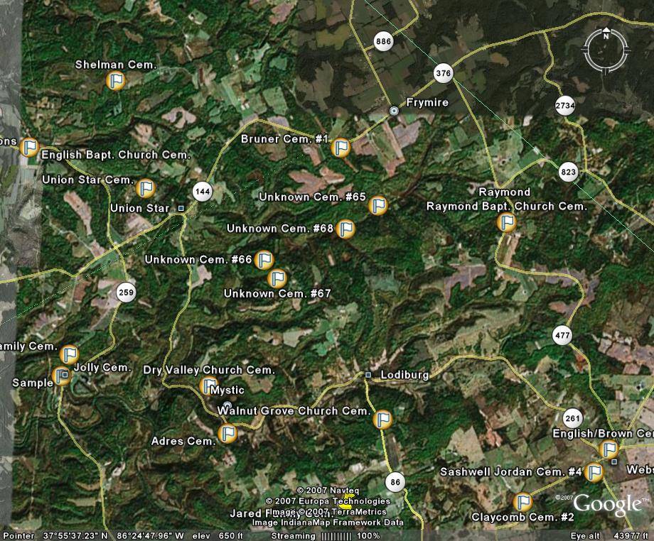
| ~Ammons/Mooleyville/Frymire/Union Star areas | T | P | ||
| ~Frymire/Raymond/Lodiburg areas | T | P | ||
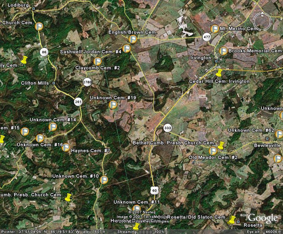
| ~Lodiburg/Clifton Mills/Webster areas | T | P | ||
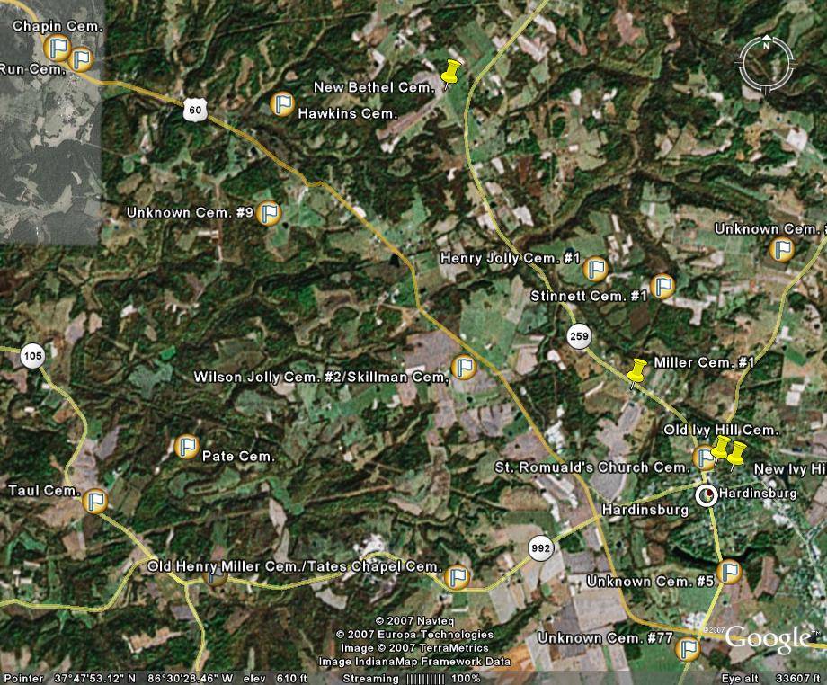
| ~Northwestern Hardinsburg area | T | P | ||
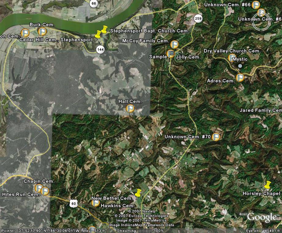
| ~Stephensport/Mystic/Sample areas | T | P | ||
| EASTERN SECTION OF BRECKINRIDGE COUNTY | ||||
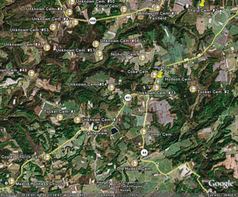
| ~Centerview/Hudson/Fairfield/eastern Madrid areas | T | P | ||
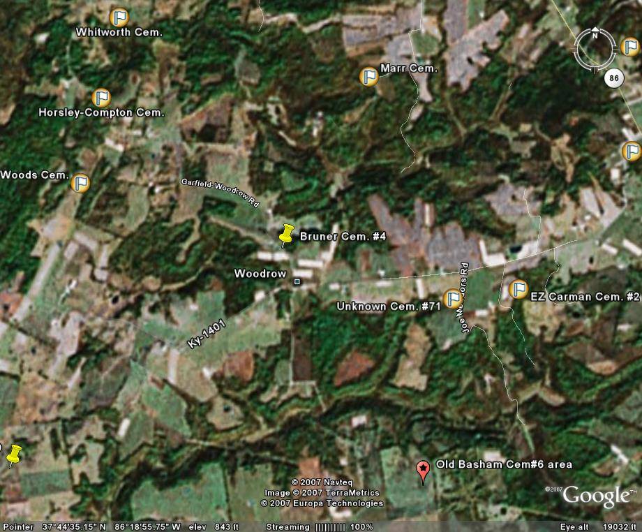
| ~central Woodrow area | T | P | ||
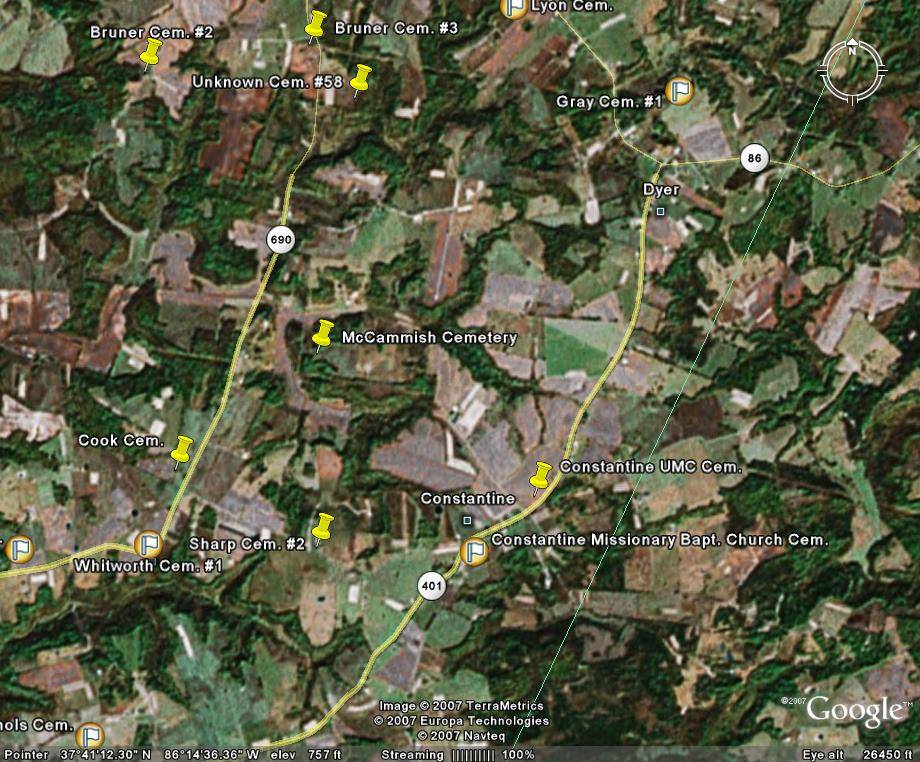
| ~Constantine/Dyer areas | T | P | ||
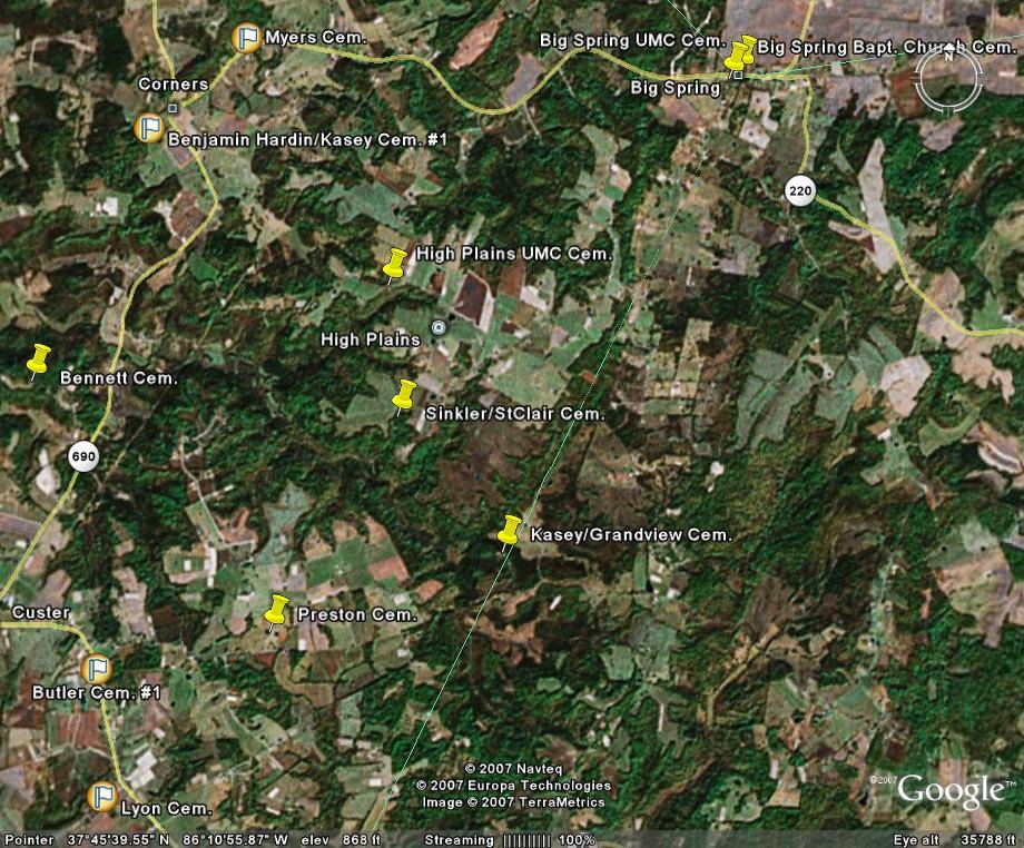
| ~Corners/Big Spring/High Plains/northeastern Custer areas | T | P | ||
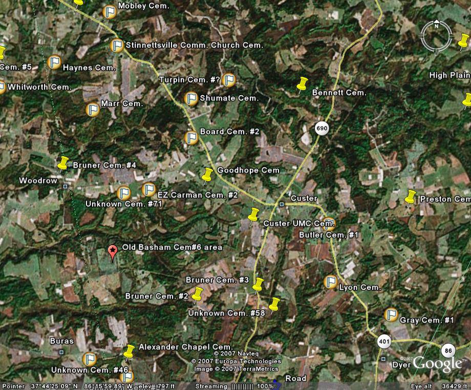
| ~Custer/High
Plains/Dyer/Stinnettsville/Woodrow/Buras area |
T | P | ||
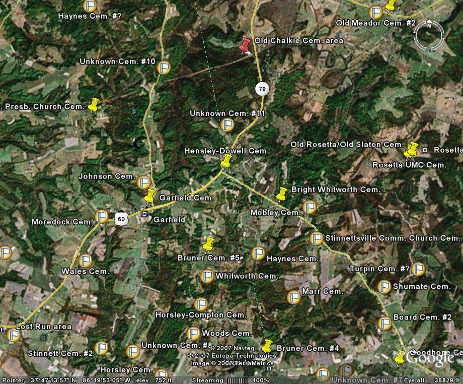
| ~Hensley/Rosetta/Garfield areas | T | P | ||
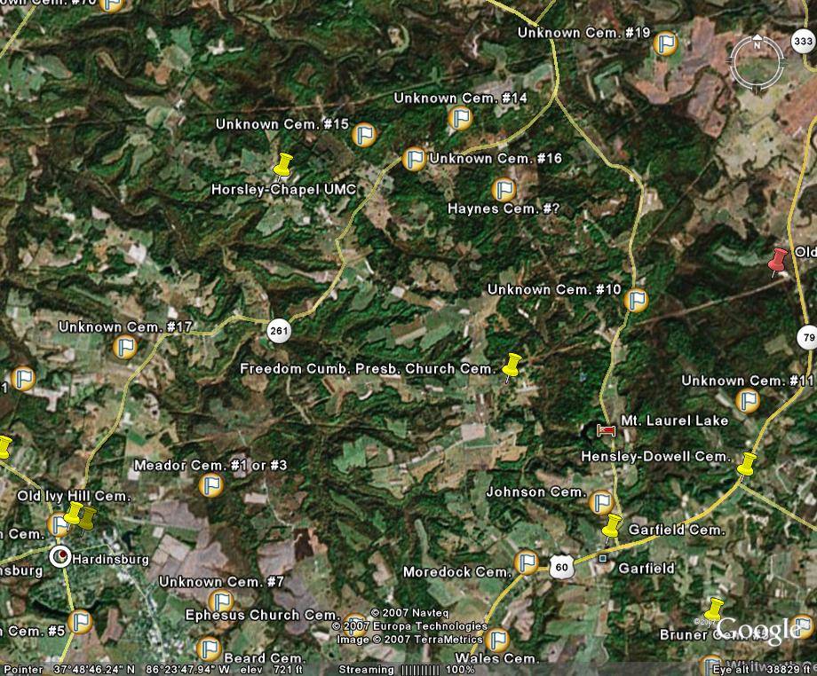
| ~Horsley Chapel/northern Garfield areas | T | P | ||
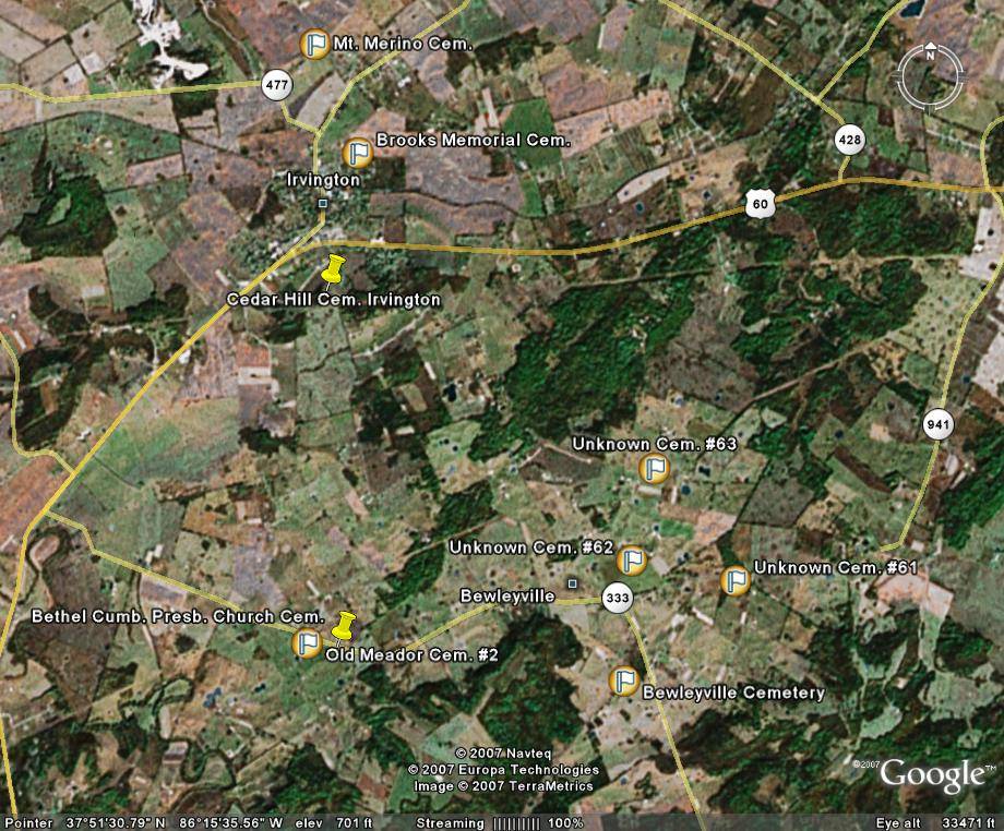
| ~Irvington/Bewleyville areas | T | P | ||
| SOUTHERN SECTION OF BRECKINRIDGE COUNTY | ||||
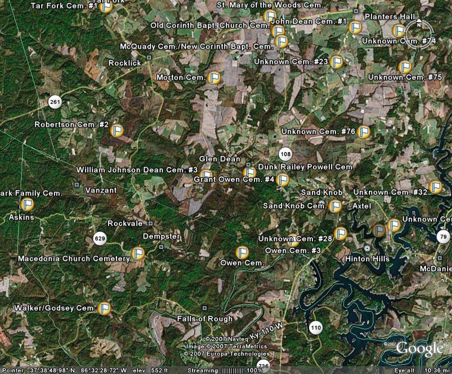
| ~Askins/Vanzant/Falls of Rough areas | T | P | ||
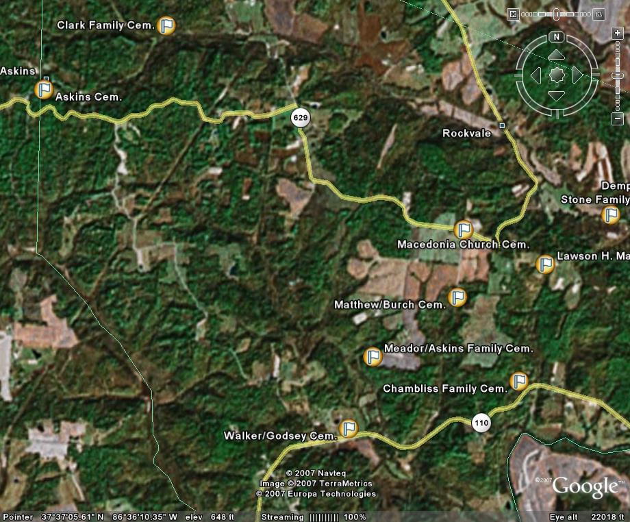
| ~Askins/Rockvale areas (several cem. added) | T | P | ||
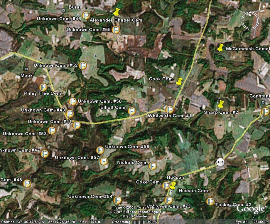
| ~Buras/Mook/Hudson areas | T | P | ||
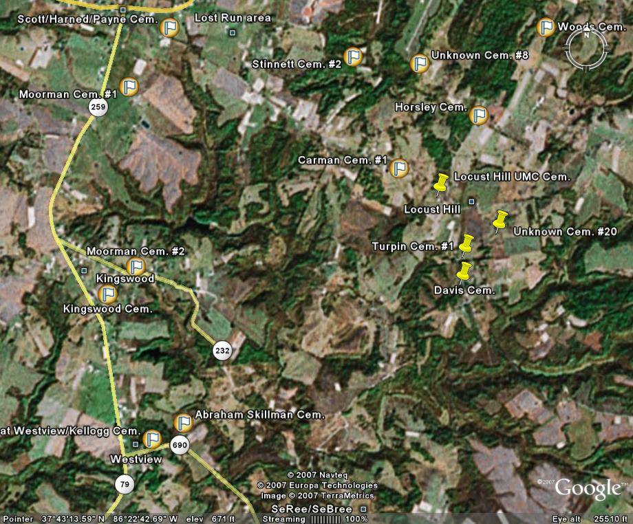
| ~Kingswood/Westview/western Locust Hill/southern Harned areas | T | P | ||
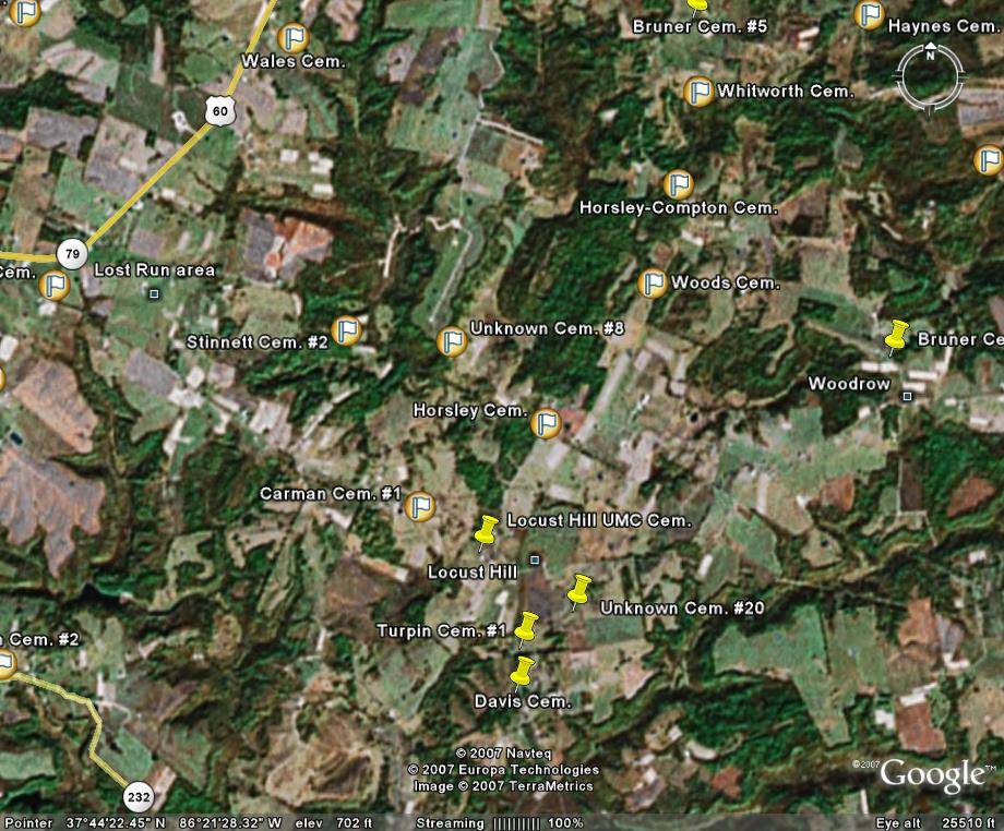
| ~Locust Hill/Lost Run areas | T | P | ||
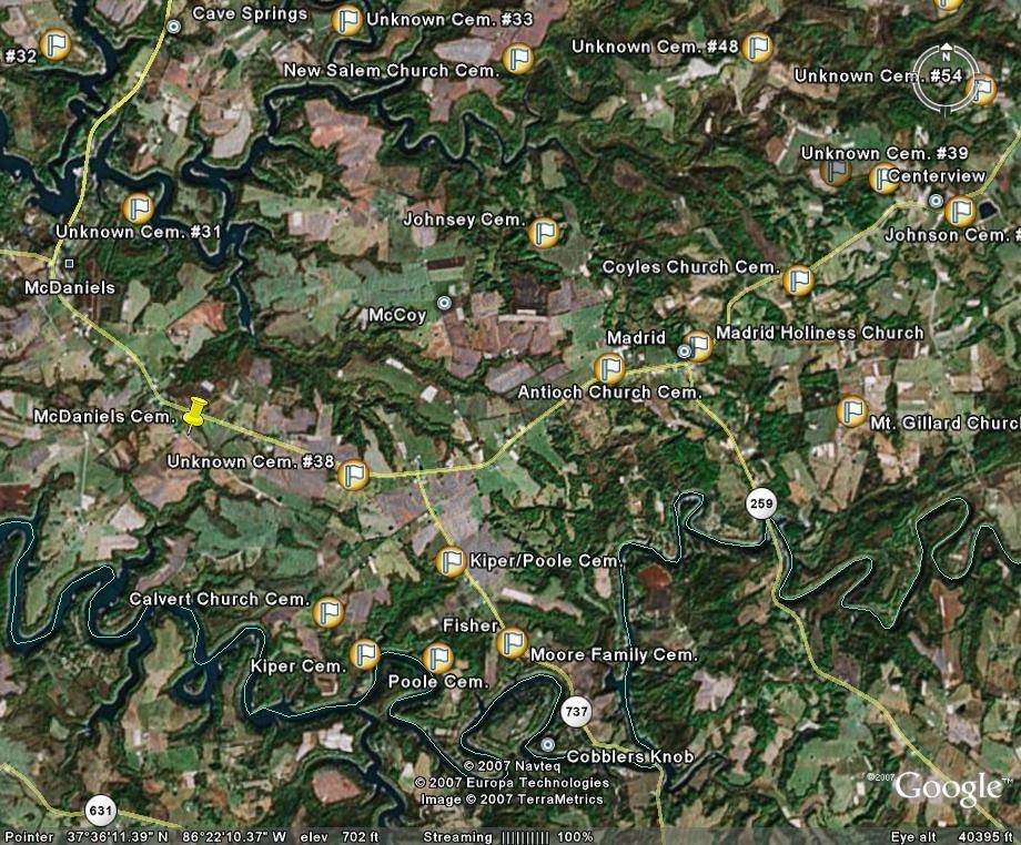
| ~McCoy/Madrid/Fisher/Cobblers Knob areas | T | P | ||
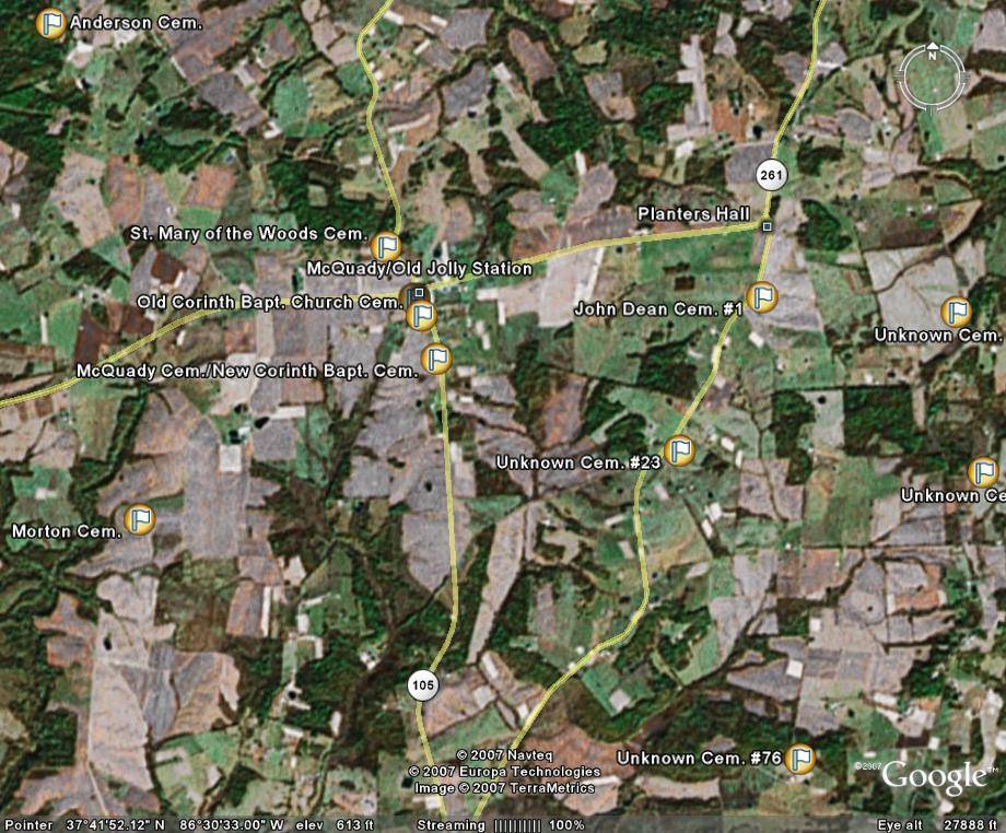
| ~McQuady-old Jolly Station/Rocklick/Planters Hall areas | T | P | ||
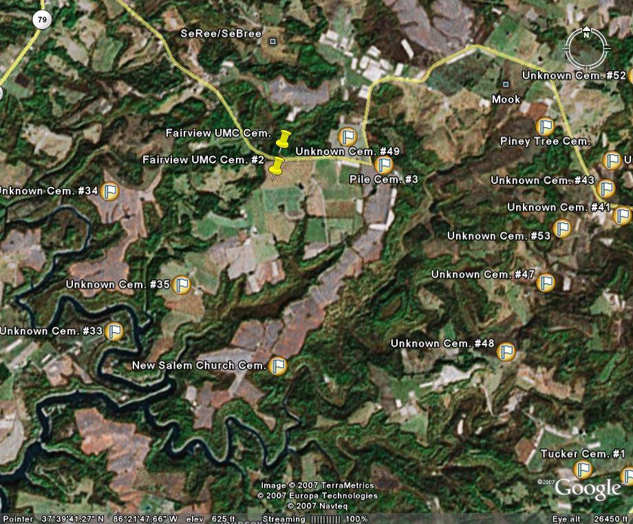
| ~Mook/SeRee areas | T | P | ||
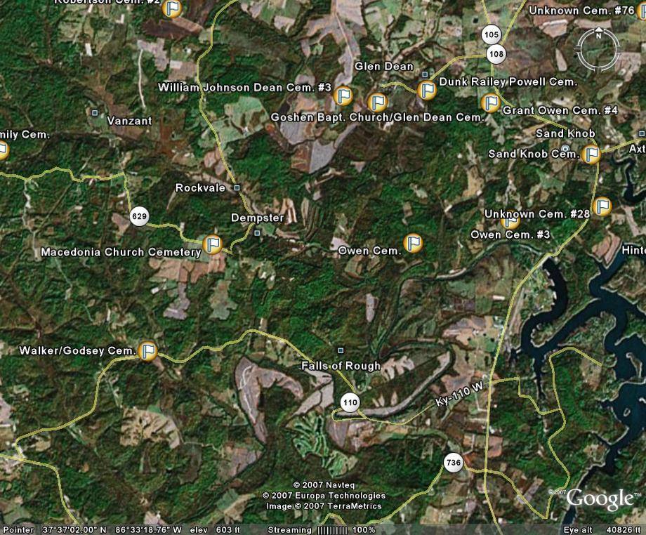
| ~Rockvale/Dempster/Glen Dean/western Axtel/Sand Knob areas | T | P | ||
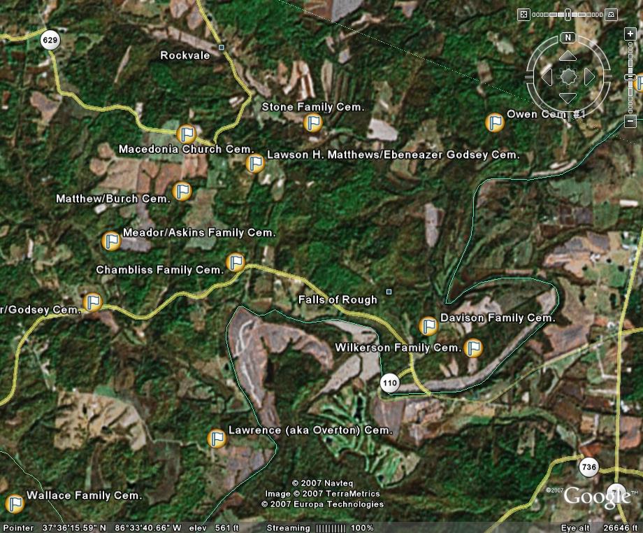
| ~Rockvale/Falls of Rough areas (several cem. added) | T | P | ||
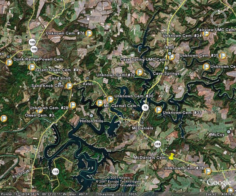
| ~Roff/Hinton Hills/McDaniels/Sand Knob/Axtel areas | T | P | ||
| WESTERN SECTION OF BRECKINRIDGE COUNTY | ||||
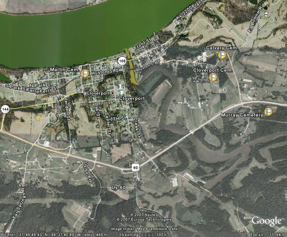
| ~Cloverport area (close up) | T | P | ||
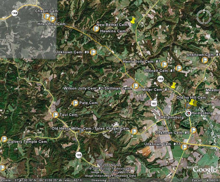
| ~Hites Run/northwestern Hardinsburg/Tates Chapel areas | T | P | ||
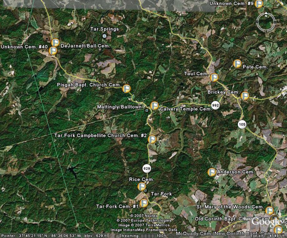
| ~Tar Fork/Mattingly-Balltown/Tar Springs areas | T | P |
 |